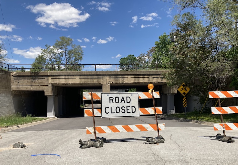
I rounded a familiar corner and promptly found myself navigating the well-known streets of Little Italy. The houses on the narrow, hilly lanes now occupy the area where a magnificent grove formerly stood. They say this elevated, wooded country held great significance to the early Caucasian pioneers of Omaha–a place where little kings and little queens were born, great fortunes were toasted, the elders died and every house held a history and a secret. On this morning, I was trying to track a large house that I had not laid eyes on for years: 1503 Park Wild Avenue.
A few days prior, a letter from a stranger showed up at the office.
It read:
April 25, 2024
My friend Jenny Schima drove me by 1503 Park Wild Avenue a couple of weeks ago as she has a lovely new apartment in the area. There is a beautiful stone (?) very elegant home at this address that is totally out of step with the neighborhood. I was hoping maybe you had explored its history but was unable to find it on the blog. Could you add it to the ever longer list of homes and their history to explore? On the top of a hill and an interesting fence around it, I think it started life as part of a larger estate. We both are interested in architecture and design.
Thank you for considering it.
Carol Lynch
Demonstrating a quick and docile obedience that is characteristic of my personality, (this is a wink from me to you, dear reader), I replied, “Excellent, excellent suggestion, Carol” and tore hell for leather out of the office.
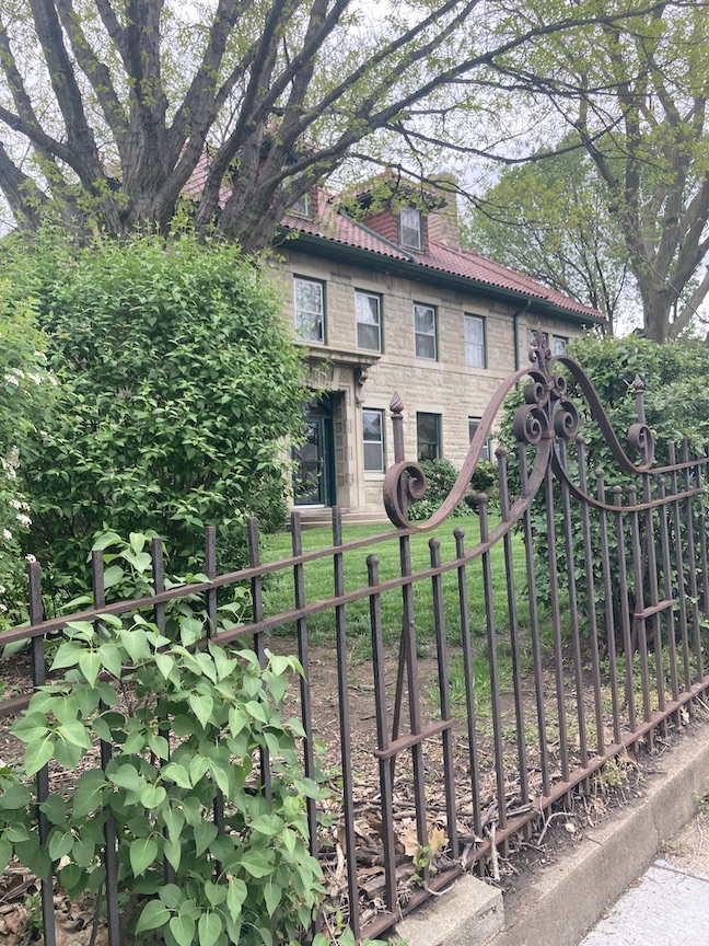
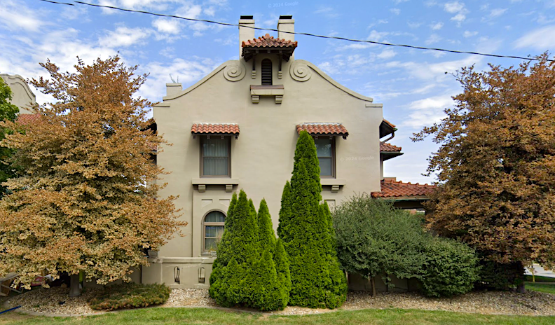
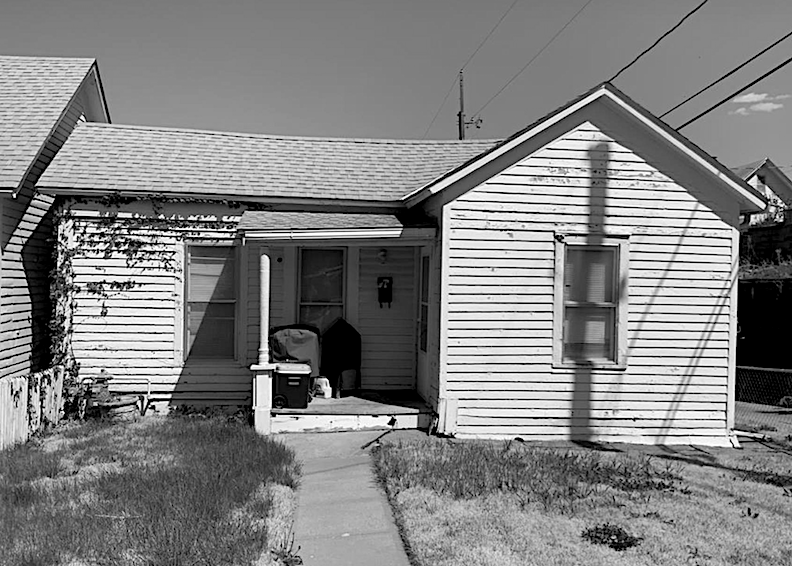
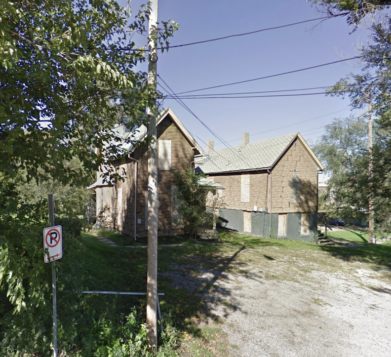
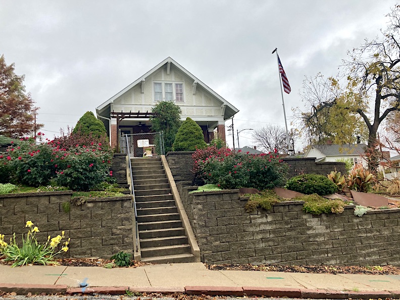
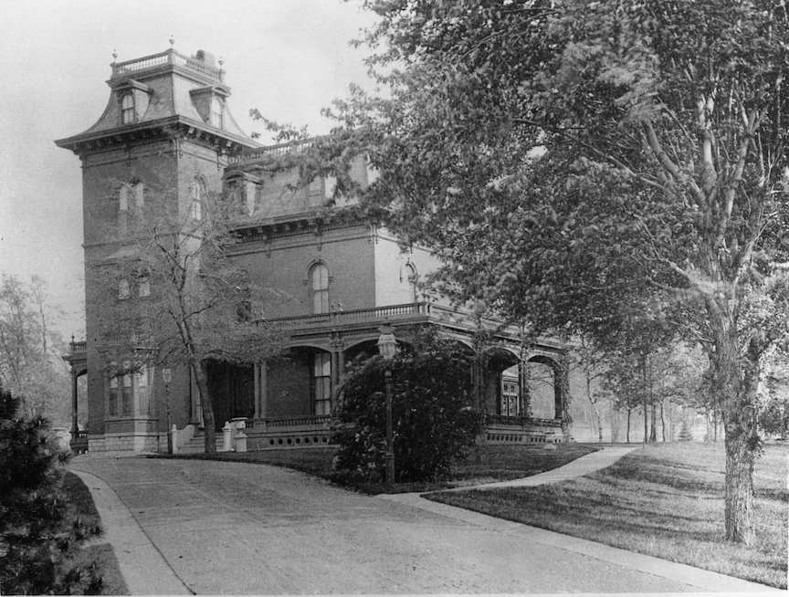
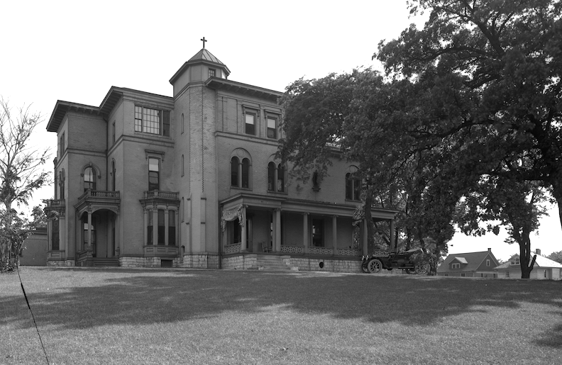
1503 Park Wild Avenue looked familiar. She was even more impressive than I had remembered. 1503 Park Wild Avenue is situated on a hilltop, on the eastern side of the aptly named street. Her backyard and gardens enveloped into an unseen hinterland but presumed to descend to the western boundary of Dahlman Park below. I detected no obscene architectural muddlement to the eye. She displayed her original character and solid bones.
Initial thought on that day: She certainly did look like money. I dreamed a distinguish-aged manservant emerged on a freshly raked pebble driveway to inform of my designated parking location and to invite me into the foyer vestibule, where I could see masculine, brown, oil portraits hung from wires in the distance, a mahogany banister and the most extensive collection of antique umbrella stands existed.
My mind wove ever more intricate webs as I scanned the street for clues. Undoubtedly, the original proprietors possessed the entire plateau at the summit of Park Wild Avenue, and potentially the adjacent acres as well. The 1503 Park Wild residence was distinctly dissimilar to anything else built in around it; those quieter homes came later as the large estate dotted with outbuildings and stables was sold off in parcels after someone’s mother had died. I imagined the stone residence originally had wings and additions and rested on a foundation laced with hidden passageways, tunnels, and concealed chambers with covert openings near Sixth and, conversely, Tenth Streets. The estate’s gardens had bricked pathways that winded off to shell grottoes, greenhouses, gorgeous, mossy, stone benches, and cold caves. The previous owner had raced home to engage his daughter and sons in several rapid sets of tennis in their back court before showering, changing, and joining the Mrs. for cocktails in the library. Nights were spent in Bermuda shorts by an illuminated swimming pool, accompanied by a cigar, Japanese lanterns adorning the trees, and jazz songs emanating from the open study windows.

I could see it all.
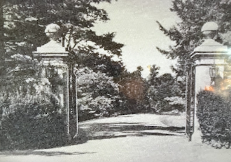
I loitered longingly by the wrought iron gate guarding before the house, but the distinguish-aged manservant never emerged from below stairs. Later I would find that even the mysterious gate had a history.
Down the hill. Back-to-back, Mr. Cassette and I had good friends who lived in these incredible early 20th Century row houses nearby on South Sixth Street–one couple after the next. Many moons ago, we’d walk to that strange nearby park, Dahlman, with our friends and their pup and end up knocking around those Park Wild Avenue and Pine blocks late at night. As a night tourist, I had naively resolved to explore beyond the designated path long ago–seeking an architectural case study, the feelings of a place, or longing for a glimpse of the darkness itself.
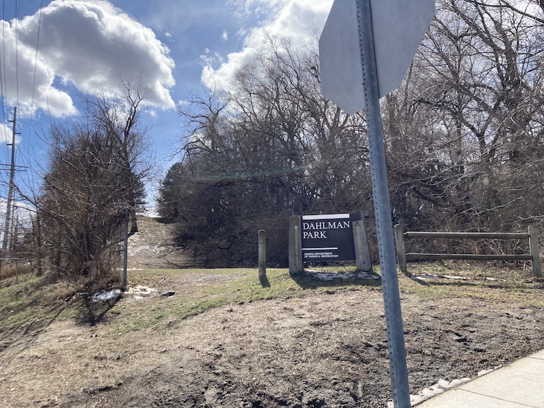
The northern entrance to Dahlman Park is at Sixth and William Street.
Yes! I would be delighted to investigate this 1503 Park Wild Avenue, I mused.
To think, I was a youthful, joyful, and untroubled woman at that time. I was unaware this simple exchange would initiate an over yearlong commitment into the intricate complexities of architectural and historical neurosis. AHN, in some circles.

Bewitching 1503 Park Wild Avenue in August of 2022. Over the years, no doubt several sleuths have purposely arrived here, guided by clues embedded in strange narratives. Whether a tourist, gumshoe or white-collar, a sense of reverence comes upon the gazer caught unawares.
Log Sheet
Early field notes: According to historical records, the kind of befuddled information we spread about year after year, 1503 Park Wild Avenue was constructed in 1915, 1917 and 1918. I would aim to clear that up.
- residence is located within the Little Italy Historic District. Other archives suggest 1503 Park Wild Avenue is within the boundaries of the larger Dahlman Neighborhood.
- legal address: Park Wild Addition. Lot 17. Block 4. ½ Vac alley adjacent and south 45.67 ft Lot 48 Kountze addition and Lots 16 and 17 Blk 4 of Park Wild addition. Interestingly the property comprises parcels in two subdivisions: Park Wild and Kountze.
- the building was at least 2,710 sq ft, probably meaning above ground, which meant it was possibly even larger.
- 2 ½ story. Was the half story, which appeared to be a solid third floor by many people’s standards, for servants’ quarters or a delicious ballroom?
- masonry stone. Marble?
- clay tile, hip roof.
- at least two chimneys visible from curbside.
- The Dahlman Park addition is on the east, as is the actual public Dahlman Park space.
- The Forest Hill addition is on the west.
Zillow listed 1503 Park Wild Avenue having 4 bedrooms, 4 bathrooms, built in 1918.
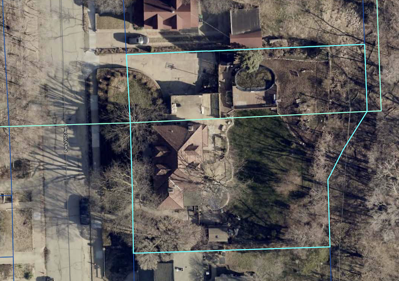
Split parcel as evidenced from the Douglas County Assessor site. Notably the large 1503 Park Wild Avenue property comprises three lots in one parcel in two subdivisions: Park Wild and Kountze. Aerial photo borrowed from the Assessor site.
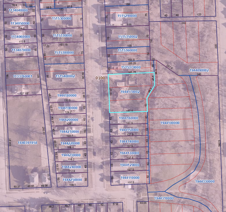
Further inspection found three lots in one parcel at 1503 Park Wild Avenue. Parcel map borrowed from the DOGIS site.
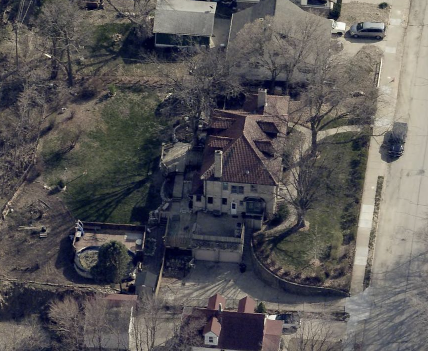
Northern elevation aerial, described below. Photograph borrowed from the DOGIS site.
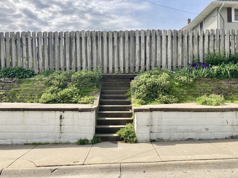
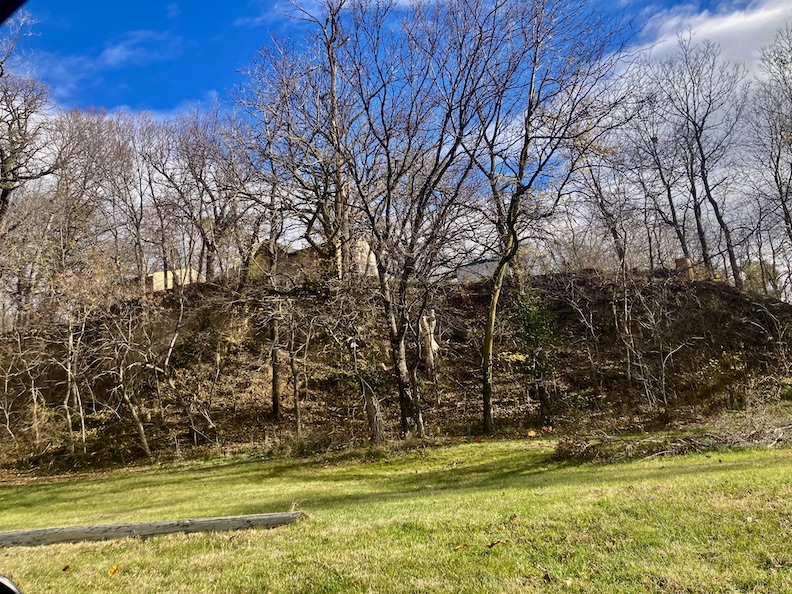
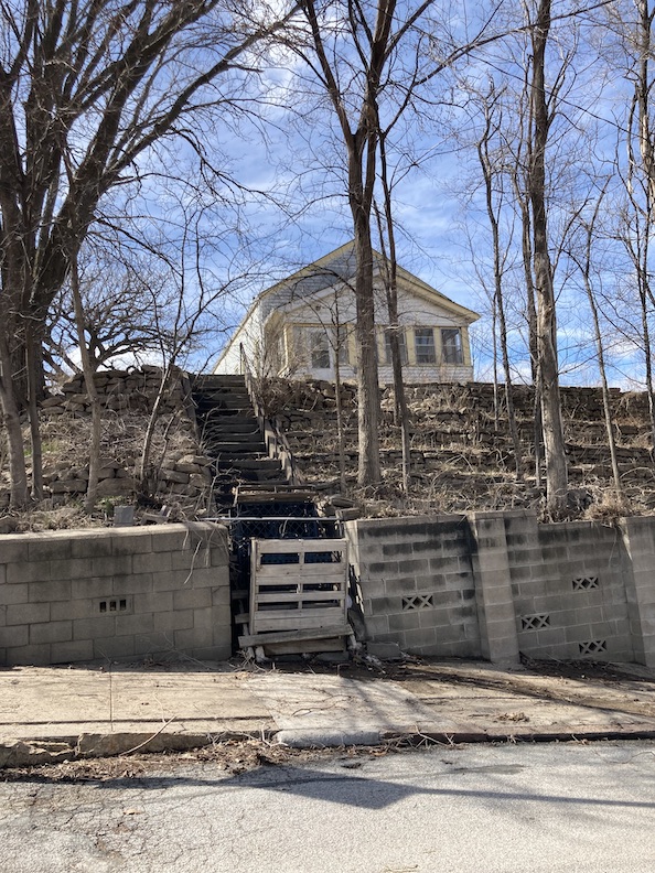
A two-car garage is attached to basement-level on the northern side. Additionally, the property features a private above-ground pool, enclosed by a deck, and encircled by wooden fencing. Upon scrutinizing the property and its surroundings, it will become apparent why excavating an in-ground pool in this area is inadvisable. The eastern boundary of the property is girded by a substantial retaining wall, supporting 1503 Park Wild’s private grounds above Dahlman Park.
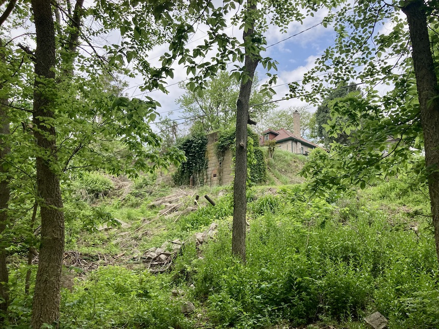
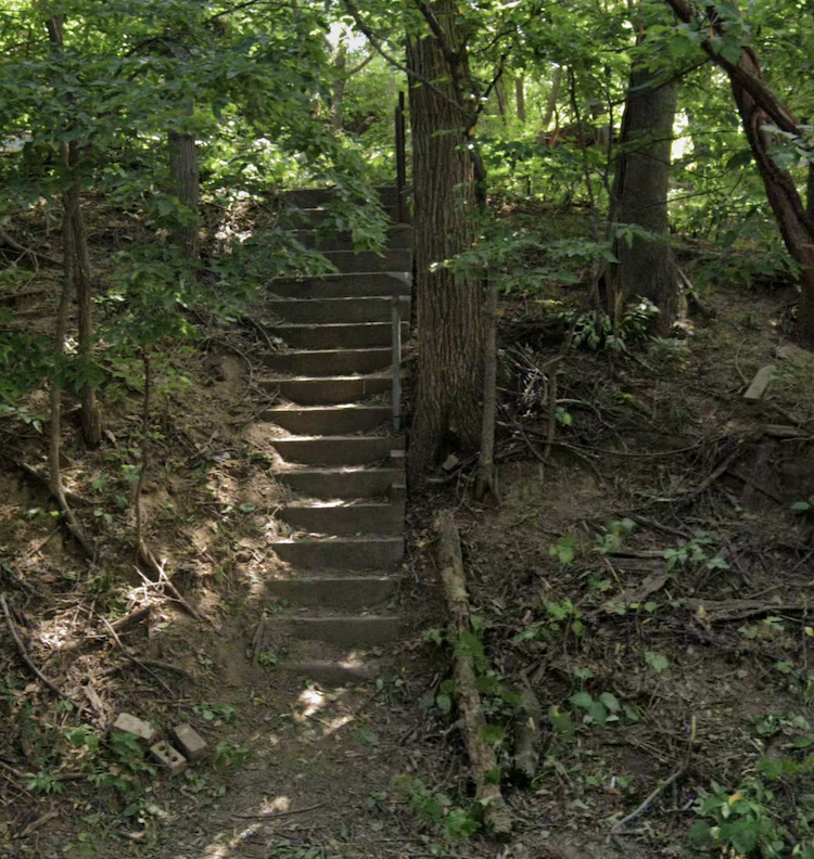
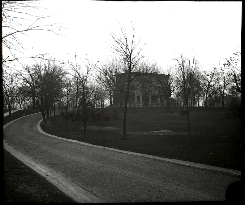
The Park Wild Avenue home in the distance. Loads of mystery. My camera faces west, uphill, from Dahlman Park. My little girl self would have easily shimmied up there to study the remnants of fallen handrails, old cement steps and dug through the rubble of the past. However, that would not be appropriate according to contemporary rules of decorum, would it? Did I spy a door with a window in the retaining wall? Was this whole scene meant to obscure the view or invite the eye? Was this the doorway to the network of underground tunnels connecting other residences on the hillside? I dreamt of my exploration of the tunnel beneath the mansion residence where I discovered a makeshift grave. Impossible. The door or window slats must be some kind of ventilation, I convinced myself. I needed to assess this whole wall.
Notorious
Early in the hunt, I was pleased to find 1503 Park Wild Avenue photographed and listed within the Reconnaissance Survey of Portions of South Central Omaha Nebraska Historic Buildings Survey. Prepared for: City of Omaha and Nebraska State Historical Society; Architectural historians: Mead & Hunt, Inc. July 2006.
Photograph borrowed from this 2006 Reconnaissance Survey of Portions of South Central Omaha Nebraska Historic Buildings Survey publication.
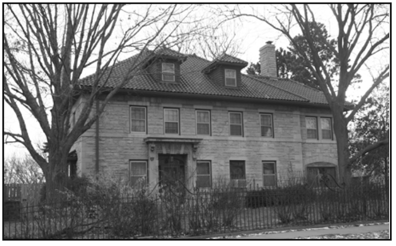
The survey’s text read: “Frank Swoboda House at 1503 Park Wilde Avenue as an example of Renaissance Revival architecture, DO09:0064-006 (reference number).”
Renaissance Revival architecture, characterized by its unique design elements, were inspired by the Italian Renaissance. The classical arrangement of 1503 Park Wild Avenue was readily apparent. Her decorative, carved entry, the strong window surrounds, the formal but asymmetrical balance of the whole composition in addition to the very stones of the structure, allowed even those unfamiliar with architecture to appreciate its imposing appearance.
Despite the abundance of eye pleasing offerings, there was something unusual that I could not put my magnifying glass on. Like many long-ago structures left standing in Omaha, 1503 Park Wild held a certain restraint, as if Midwestern pragmatism constrained the original owner and architect’s ability to embrace Full Exuberance.
I consulted An Inventory of Historic Omaha Buildings. 1980. This book was prepared by Landmarks Inc. under a grant from the City of Omaha and in cooperation with the Landmarks Heritage Preservation Commission. Lucky for me, 1503 Park Wild Avenue was part of the selection. The description read as follows:
Build Date: December 28, 1917
Cost: $9,500
Architecture style: Period Revival
Original owner: Swoboda, F.
Architect: Ballard, D.
Original Builder: unknown
All names, dates, and spellings were precisely recorded as they appeared in the two book surveys. We will address these specifics subsequently.
A Note on Process
The city’s and other well-worn descriptions of historical events found in books, archival newspapers and websites often presented conflicting and varied accounts but all rather interesting, upon further investigation. My initial efforts were repeatedly disrupted because of these errors, but it became a stimulating investigation once I realized this case and this historic land could not possibly be an easy one. These missteps and red herrings only compelled me to remain vigilant, (sustained by a continuous intake of coffee—lending that extra twitch I prefer in my stalking missions). I constructed a timeline of events through archival research of contemporaneous material and interviews with varying narratives, unfolding of mythologies, using in-text citation. I decided to concentrate rather myopically upon 1503 Park Wild Avenue and her surround as a self-contained object. I found in my “limited” investigation a multitude of interconnections derived from this astonishingly ever-expansive, magical, dense domain. I attempted to encapsulate as many of these associations and networks as possible within the allotted space, while including my own insights and interpretations, questioning prior findings.
I hope to add further material about 1503 Park Wild Avenue as it becomes available from individuals like you, who may contribute more precise data and other personal experiences.
I am sharing two insights that I do hope will be received with understanding and sensitivity. Our expedition this evening will intertwine and entangle. I grant myself that right. This inquiry, like all my others, is not intended for continuous reading in a single session. Some individuals present this evening admittedly lack the patience of a saint, or even that of our forefathers and foremothers. We do not judge your restlessness. Kindly consider your predilections. If you are internally needled to proceed directly to the structure at 1503 Park Wild Avenue, continue to the section titled: The Building Permit Clue. You will be scrolling far into the distance. Please spread breadcrumbs if you want to wander back to the group.
Let us embark on this night’s investigation.
Little Italy Poke-About
Omaha City Planning Department’s A Comprehensive Program for Historic Preservation prepared by Omaha Landmarks Heritage Preservation Commission (1980) stated “Little Italy” emerged mostly thanks to the endeavors of two brothers from Sicily. Joseph “Joe” Salerno arrived at Omaha in 1895, followed by his brother, Sebastiano, in 1897. Joseph built a shoe repair shop at the intersection of South Sixth Street and Pierce Street (home at 722 Pierce). The Omaha Awareness Tours detailed these businesses. Joe owned a grocery store and a string of apartments called Salerno Flats on Sixth and Seventh Streets. Salerno’s Groceries was on the northeast corner of Sixth and Pierce where Joe “sold delicious Italian cheeses tied with strings, meats, salami and pepperoni, and vegetables. Braided strings of garlic and red peppers decorated windows and walls. He often gave food to those Italians fresh from the old country until they could stand on their own feet and provide for themselves. A bakery was located behind the main store.” I would discover his brother, Sebastiano called “Yano” or “Art” opened a shoe and clothes store at the junction of South Tenth Street and Pierce Street. Sebastiano later became president of the Italian Society, even opening a bank on 10th Street between Harney and Howard known as the Banca di Sicilia. The two brothers thrived, and in 1904, Sebastiano was designated as an agent for a steamship firm. In this role, he urged family and friends from Sicily to emigrate and proposed to arrange their accommodation and employment in Omaha, particularly at the adjacent Union Pacific shops.
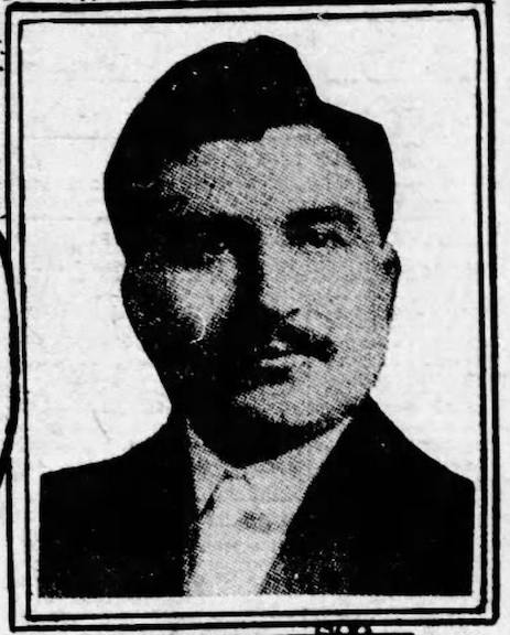
Sebastiano Salerno. Evening World-Herald. 1913.
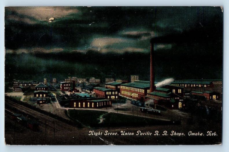
Union Pacific Railroad train shops at night. Wonderful “night scene” postcard of 1912. Sebastiano Salerno urged family and friends from Sicily to emigrate and proposed employment in Omaha, particularly at the adjacent Union Pacific shops seen in this image.
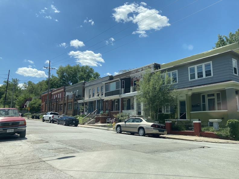
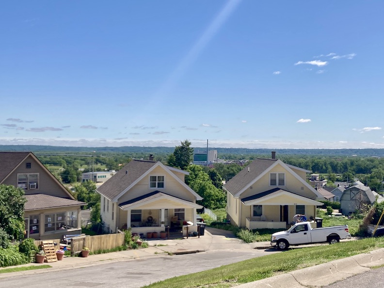
A survey conducted in 1880 indicated that there were merely 62 Italians residing in Omaha. After a decade, the figure had increased to 536. By 1931, the number had reached 11,000. Salvatore “Sam” Salanitro, Omaha mortician in the 1950s, “In those days, the northern part of Little Italy was the main part of the city. Before the influx of Italian immigrants around 1905, the neighborhood was chiefly Bohemian and Irish.” Oral histories in the Near South Neighborhood Omaha Awareness Tours (1979) mirrored the opinion: “Germans, Irish, and Bohemians were the first to settle this area of the city. They first lived along the river which they crossed by ferry. Italians came next.” According to the Federal Writers’ Project (1936) Omaha: A Guide to the City and Environs American Guide Series, in 1905, Sicilian immigrants established residences “along South Sixth Street in the hills south of downtown.” (Why this 1905 date, I wondered. More clues later.) Subsequent waves of Sicilians immigrated between 1912 and 1913, as well as after World War I. The Little Italy neighborhood’s perimeter is delineated by Pacific Street to the north, the Missouri River to the east, Center Street to the south, and South Tenth Street to the west. I outlined roughly in yellow, below. South Sixth Street evolved into a modest commercial area, with a natural extension westward along Pierce Street. This curious area is both south of downtown and south of Omaha’s historic passenger trains: the Burlington Train Station, the Union Station and the Omaha Amtrack Station. What is particularly interesting about portions of the Little Italy region is its steep terrain, a striking contrast to downtown and the Rail and Commerce Historic District. As a young Nancy Drewer, I was astonished to discover that some of the most remarkable views of Iowa and Downtown Omaha are observed from Little Italy’s other equally captivating characteristic—a concealed-in-plain-view, utilitarian network of alleys. Notable features of the neighborhood include a broad array of dwellings, some of the oldest in Omaha, encompassing old money behemoths, row houses, apartment buildings, large four-squares, and workers’ cottages, fascinating industrial structures, brick commercial buildings, massive, sturdy schools, vacant lots, unpaved and brick roads. Other neighborhood standouts for me are the sensory experience of ever-so-close proximity to the Missouri River and the rapid transit of freight adjacent to the river and of course, the passenger trains. The rush! This perception is felt by all who live and spend time in the area. The industrial structures and secondary enterprises related to the Union Pacific Railroad, dotted along the river railway were intriguing to any neighborhood child (back when young ones were encouraged to get out of the house) and urban explorer.
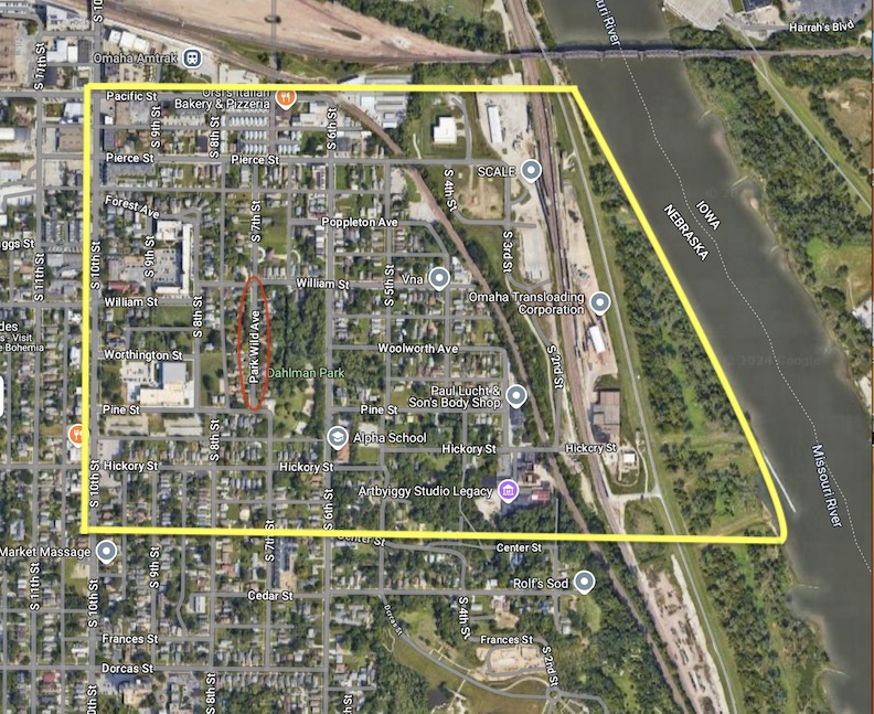
I have (very roughly) outlined Little Italy in yellow, ensuring the street names remain visible. Pacific Street to the north, the Missouri River to the east, Center Street to the south, and South Tenth Street to the west. I circled the short run of Park Wild Avenue in red so you can gather your surroundings.
I dropped a red Google balloon at the site of the original Little Italy for comparative analysis.
The larger Dahlman neighborhood, or Dahlman Park neighborhood, as it appeared to be rebranded in the mid 1960s due to (some) neighbors and the city’s efforts to “upgrade” the area, is delineated to the north by the Pacific, to the east by the Missouri River, to the south by Martha Street, and to the west by Sixteenth. According to data from the 1960s, when the region was being renamed, the boundaries were defined as Pacific, Second Street, Hickory, and Eleventh Streets.
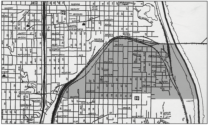
This older map illuminates for the uninitiated the rail lines both encircling the whole of Little Italy, in addition to multiple railways running north and south along its eastern-most border and across the train bridge over the Missouri River to Council Bluffs, Iowa.
Concrete railroad bridge over South Seventh Street, located just north of Pacific Street= Favorite locale of mine. Camera faces north.
Train bridge to Iowa. Camera faces north-east.
Third and Poppleton is my personal “Down on Fascination Street.”
Steps up to the trees where in 1919 an elderly woman resided in the high bluffs of Little Italy.
Mystery Surprise Stairs.
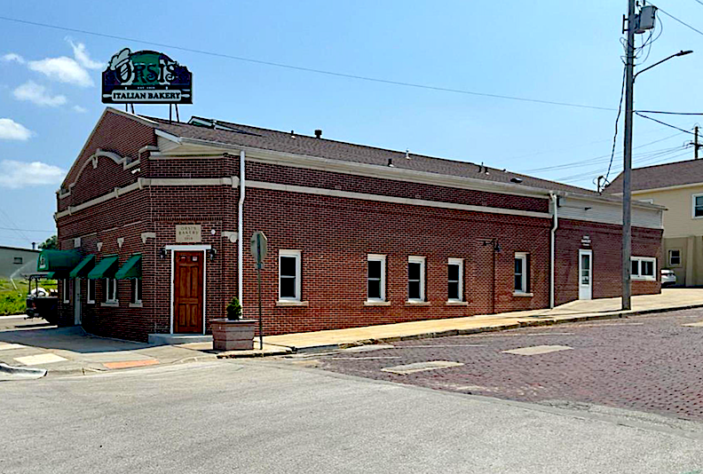
World famous Orsi’s Italian Bakery at Seventh and Pacific. Omaha Awareness Tours (1979): “Prior to becoming a bakery, this building housed the Miller Hotel and Saloon. The front part is the residence of Mr. and Mrs. Claudio Orsi, and the back part is the bakery which turns out an average of 17,000 loaves of bread a week.”
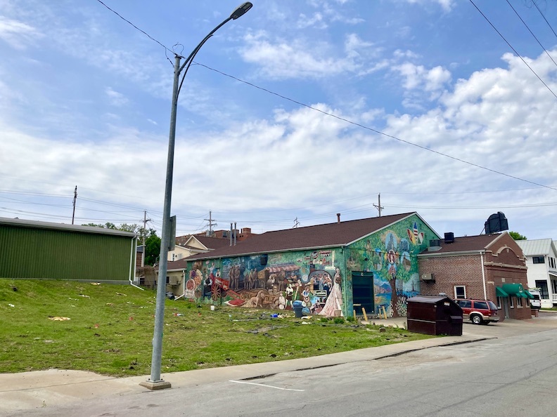
Eastern side of Orsi’s displays a large history of Little Italy themed mural.
My Dream House. 900 Forest Avenue.
Classic Little Italy raised workers’ cottages. Many of the early residences featured this front facing gable.
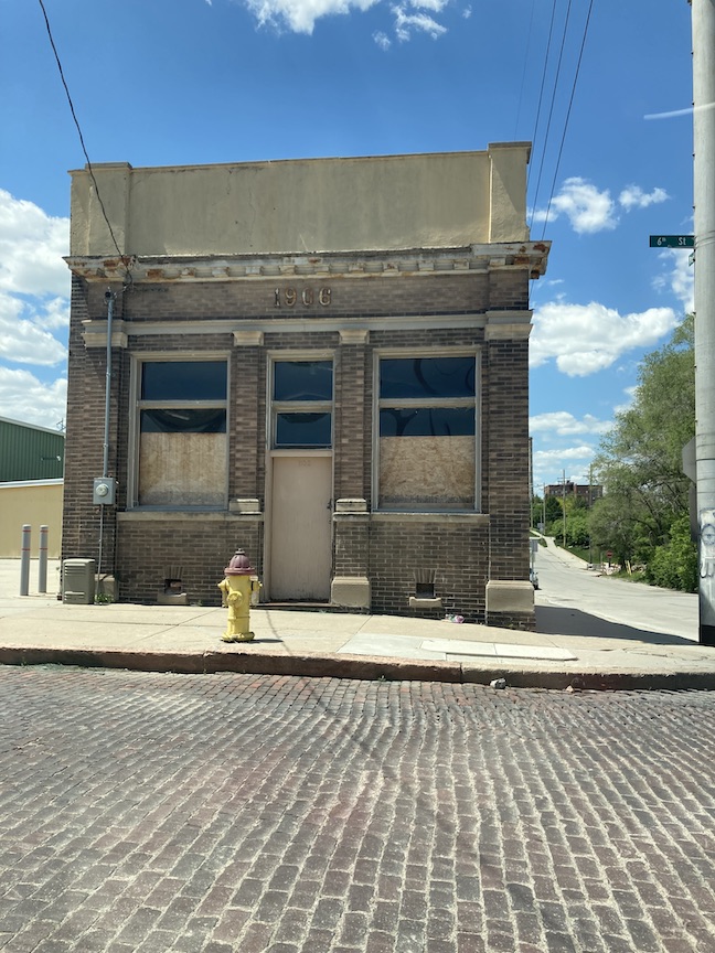
1906 South Sixth Street is one of my all time favorites. I found an early map from 1887 showing the brick Pacific Hotel was situated one door to the west of this great building. Coupled with the brick street, one can still imagine the magic of Sixth and Pacific as it once was.
Dropdead Gorgeous. Spanish influenced St. Francis Cabrini Catholic Church rectory.
Quintessential Little Italy two story duplex next to the Omaha Famous Santa Lucia Hall, originally an 1800’s fire station. Rising alley, headed south, in the distance.
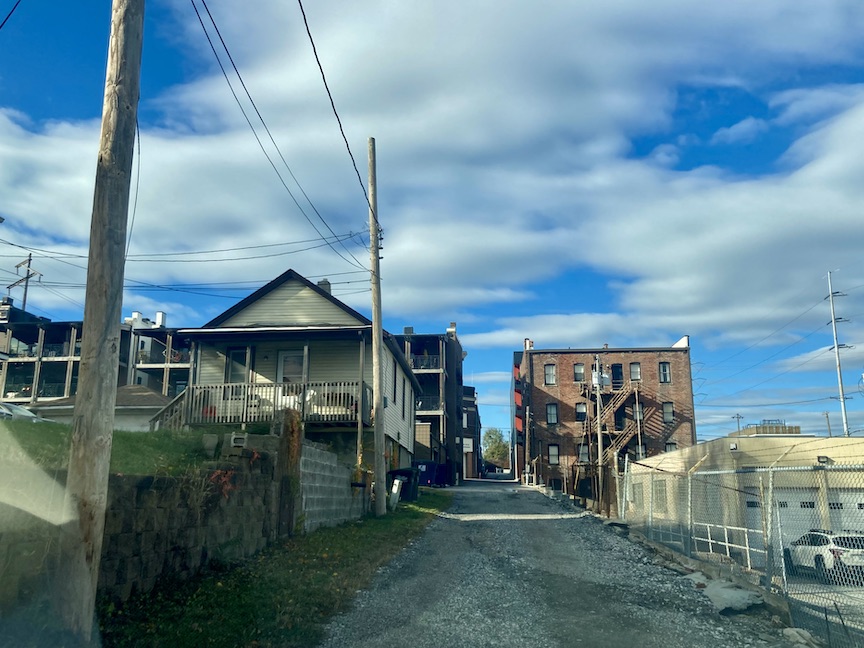
Network of incredible alleys in all directions.
Another perfect, true to type, raised worker’s cottage on a spring day in 2024.
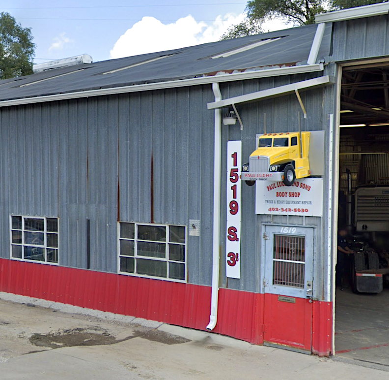
Long Time Man: Paul Lucht and Son’s Body Shop at 1519 South Third Street has been a constant Little Italy business for 75+ years. Their maze of buildings creates an east side empire AND they have the best sign around.
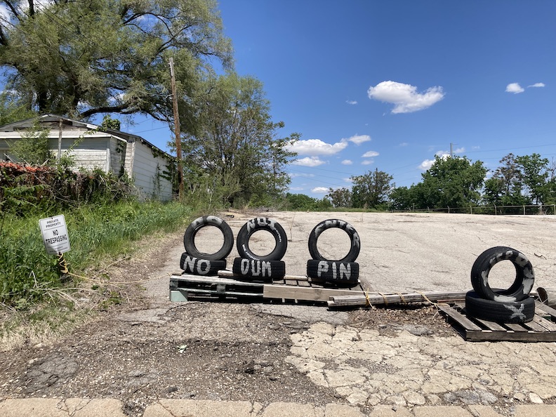
Do Not Enter. No Dumpin. Great views, hand-painted signs and personality found in Little Italy.
Bluestone’s “The Towns at Little Italy” developed in 2006, Airbnb Central, on a rainy day found on Seventh and Lucia Plaza.
824 Worthington Street. A Grande Dame of the Forest Hills area.
Kindly visit Cousin It growing at approximately Third and Hickory at your earliest convenience. Train bridges all around.
And Cousin It’s other cousins at about 2nd and Hickory. Wonderful shapes in the distance. How many can you count? I love things like this.
Endless alleys, my absolute favorite thing! Alleys with access onto rooftops had to have been a 1950’s boyhood joy. These alleys served as historic playground and cut-throughs for the children of Little Italy.
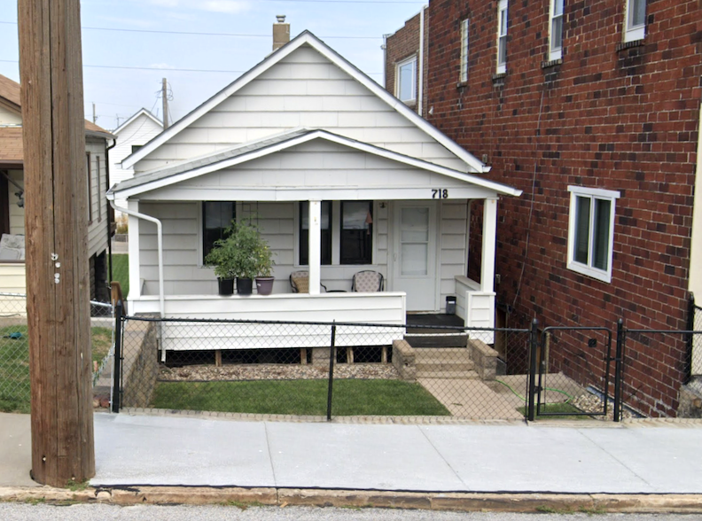
718 Pierce is a favorite and the archetypal Little Italy home.
I spied the Dunsany Flats condo building, 1115 South Tenth Street, originally the Dunsany Apartment House, peeking through a foggy day back in 2014.
Remnants of an exceptional garage and fascinating door….or did it serve another purpose altogether?
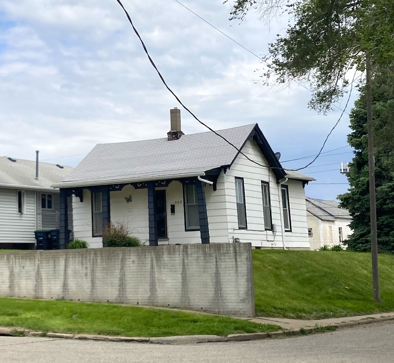
502 Poppleton is exactly the kind of girl that our investigation uncovered. One of the most long lived in Omaha. And here she was all along!
Little Miss 1211 South Ninth Street, on the right, was built in 1888. Her close-up follows.
The hills of Little Italy.
Perched upon this hilltop sits one of Omaha’s oldest homes, if not the oldest.
May I introduce you to 519 Hickory Street? She was built in 1866. Respectus.
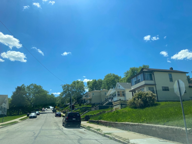
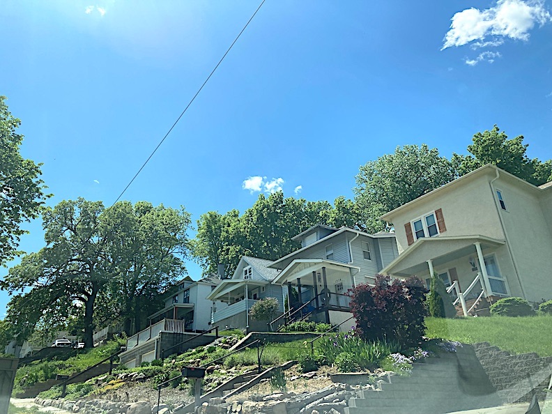
The early workers’ cottages and frame homes found up in the hills between South Sixth and Center to Hickory and all the way down to Second Street feel like The True Old Omaha, the very ends of the earth or Omaha’s endearing Laurel Canyon. I love wandering up and down around in here. This is very special ground, and the views are outstanding.
The Forest Avenue Loop-de-loo Twins with Council Bluffs casino seen in the distance.
There are many private back drives and dirt roads found.
This gravel backroad no longer exists and neither do these gem cottages from the 1800s. Unfortunately lost to the development of Nove Lofts. 2017.
Peekaboo. Numerous residents undoubtedly possess the finest views in all of Omaha.
1323 South Eighth Street was winking at me. What a flirt. Love this home.
“Danger! Closed!” the sign read. Many mystery buildings and some houses with an array of window arrangements waiting to be loved once more. I wish I could buy and move into each one.
Lovely Craftsman with Omaha Famous lineage.
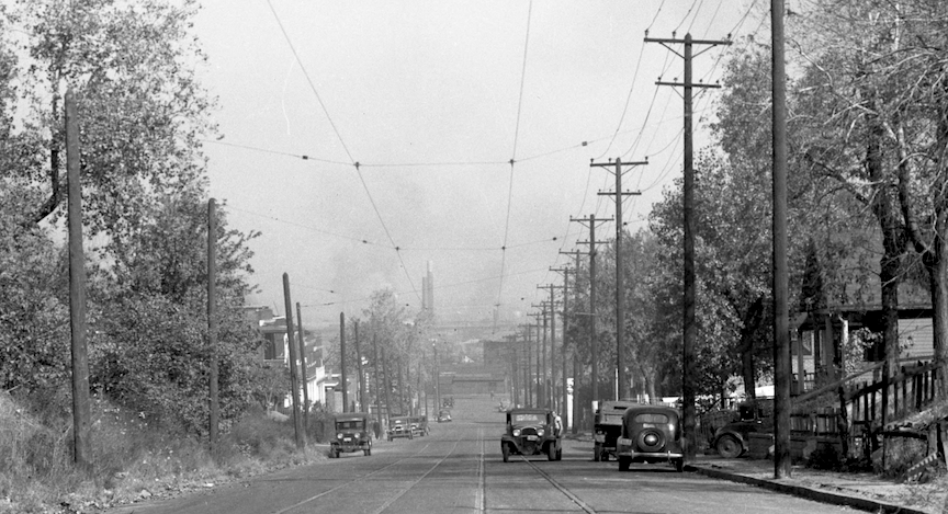
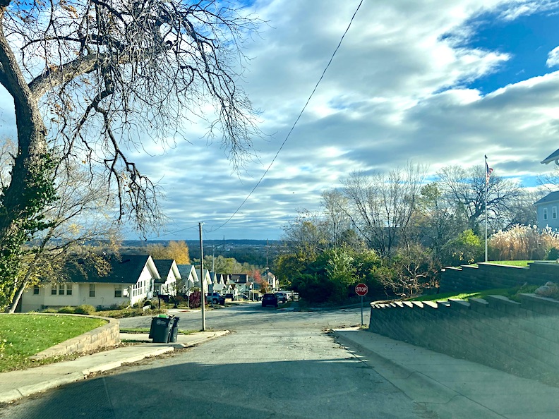
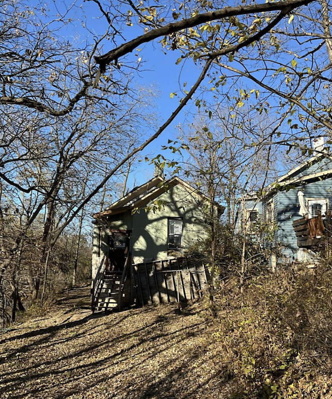
Looking south, up the steep hillside of mysterious Park Wild Avenue. The glory!
The First Little Italy
In 1895, I discovered a reference to “’Little Italy’ a settlement of Italian laborers, located near Twentieth and Poppleton streets.” The Omaha Italians were hired as street sweepers in early Omaha, and when employment opportunities diminished, many relocated to Kansas City. Leona Parra’s sidewalk fruit stand at Sixteenth and Cass Street, renowned in Omaha during that era, served as her secondary residence, located near her primary home also in the Twentieth Street and “Union Pacific tracks” vicinity. This Twentieth and Union Pacific tracks area held in into the early 1900s.
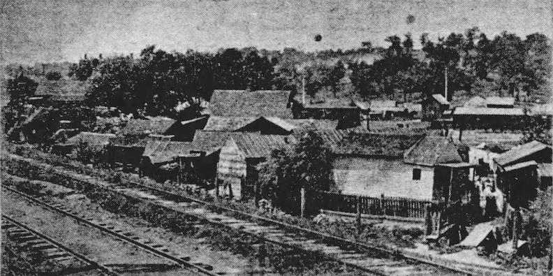
Twentieth and Poppleton Avenue in 1901. Note the train tracks. Photograph by F. B. Millar. “Covering a small section of ground abutting upon the east side of Twentieth street and extending south to the railroad tracks and east to about Eighteenth street, is a motley collection of shanties which openly defy all the laws of gravity and cohesiveness. To a casual observer they seem in the last stages of decay and absolutely unfit for dog kennels, yet these houses have been in this same condition for several years and have been and are inhabited by Italians of a certain class.” The news pieces seemed to engage with Little Italy and its residents as a source of amusement and derision, often using cruel phrasing by today’s standards. I would find this phrasing present even into the 1950s.
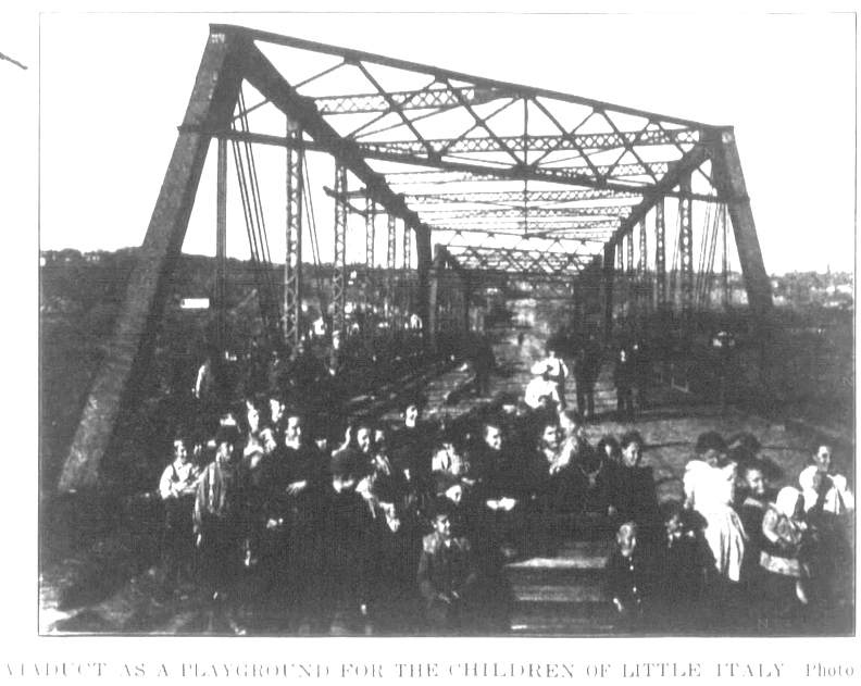
1901. Omaha Illustrated Bee. “Viaduct as a playground for the children of Little Italy.”
Omaha’s Italian quarter from the 1860s until 1905, was located within the district bounded by Eighteenth and Twentieth streets, Pierce and the Union Pacific tracks. In 1890, this area accommodated several hundred sons and daughters from Southern Europe, but by the early 1900s, the dilapidated shanties were either collapsing or being demolished. (And being written about in a disparaging way.) In September of 1905 only seventeen of the “ramshackle domiciles” remained. Building Inspector Withnell and his staff determined that just three of the seventeen structures could be salvaged; the remainder must be demolished. The ultimate demolition of the first Little Italy was instigated by the resolve of Herman Kountze, one of the wealthiest men of early Omaha, to clear the land belonging to the Elizabeth Kountze estate, making way for the building of the Chicago Great Western railroad. I believe this estate pertained to his first wife, Elizabeth Davis Kountze, who passed away at the age of 44 in 1890. (The Kountze family will be interspersed throughout this investigation.) The Calabrians, thought to be the pioneers of the Italian migration to Omaha, had worked in manual labor on the streets and on the paving gangs. These were the founders of the first Little Italy and, following its demolition in 1905, the Calabrians commenced buying more conventional residences with their savings. The Sicilians were fruit sellers “and do all of the street business except that done by the Greeks.” During the year 1907, Sicilians were also purchasing “Americanized” homes as well in and around what we now consider the Little Italy Historic District. About 100 Piedmontese rented and lived in a colony at Seventh and Pierce Streets, near the Burlington freight house where the men were employed.
1905. September. The Omaha Evening Bee.
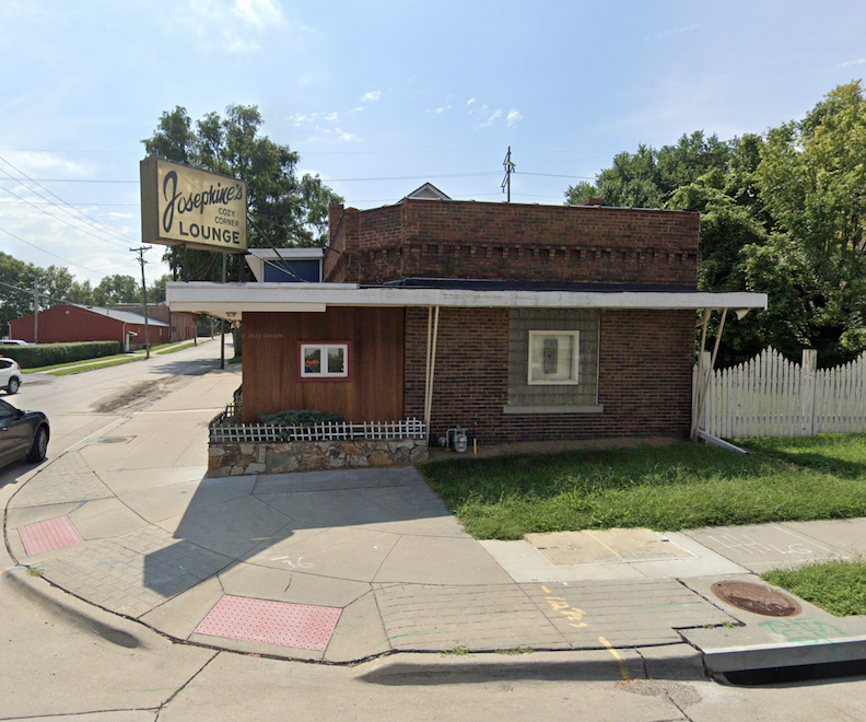
My buddy Frank’s bar, Josephine’s Cozy Corner Lounge at 2201 Pierce St and my girlfriend Christina’s once residence, formerly a barbershop and Rotella’s Italian Bakery, are among the vestiges of the Old Little Italy. This remarkable area contains numerous clues.
Park Wild Avenue Clue
A distinguishing factor of the whole investigation is that our home of inquiry is located on Park Wild Avenue. If you didn’t grow up in this neighborhood, chances are you’ve never heard of this street. Flanked by William Street on the north and Pine Street on the south, interestingly Park Wild is called South Seventh Street leading up to both bookends. Park Wild Avenue is positioned on a bluff. The Streets of Omaha: Their Origins and Changes, compiled by H. Ben Brick in 1997, provided information about Park Wild Avenue: “It derived its name from the claim staked off by Alfred D. Jones before Omaha was surveyed, which he named Park Wilde. It was later called Parkwild. Its name changed from Seventh Avenue.”
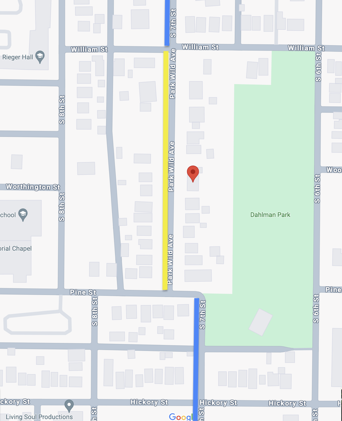
The 1503 Park Wild Avenue home has a red Google marker on it. The yellow line denotes the Park Wild Avenue stretch. The blue lines show you the slight jog in the road and the continuation of South Seventh Street.
The rise and hilltop of Park Wild Avenue, on the south end, is so significant that I have experienced butterflies when driving upward in the southern direction. A Mr. Lozowy lost control of his car on that very hill due to brake failure in the 1950s and I am sure he is not the only one through the decades. The alarming things you read about during an investigation–just a part of the thrill.
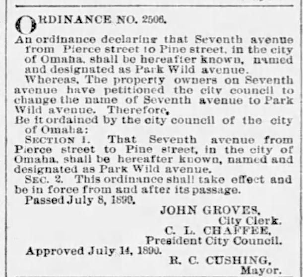
July 24, 1890. Omaha Daily World-Herald.
Is it accurate to say that the brief-run Park Wild Avenue is equivalent to Seventh Street? Yes and no. In the remainder of current Omaha, Park Wild Avenue aligns with Seventh Street. However, I did find evidence that it was also referred to as Seventh Avenue for a time. Interestingly in 1886, the Omaha Evening Bee reported that the city council had enacted an ordinance to completely overhaul the street naming system. “According to the present method the thoroughfares of Omaha are named so badly that sometimes one street, running through various parts of the city will bear three or four different names (…) Park Wild Avenue becomes Seventh Avenue.” In keeping with our peculiar customs, Seventh Avenue had then seemingly transformed into the Seventh Street it is known as today. Seventh Street extends southward to Bancroft Street.
H. Ben Brick’s mention of the Park Wilde-Parkwild claim staked off by one Alfred D. Jones was not lost on me. A. D. Jones was a name I repeatedly bumped into during this investigation and others, and one that you are possibly familiar with too. I scribbled his name down.
Arrival at Park Wild
A 1902 piece from the Omaha Daily Bee was quite interesting. I included every single word for your survey:
“The grass-covered prairies lying beyond the morass along the Missouri River west of that stream had an attraction for many of the residents of western Iowa, and from time to time at various points along the river they made unsuccessful attempts to establish homes, but they were foredoomed to failure, as the title to the land was in the Indian tribes and until the Indian title could be extinguished by treaty the government looked with jealous eye upon the white squatters, who were regarded as interlopers by the aborigines, the Indians making loud clamors for their removal. In 1853 a number of residents of Council Bluffs determined to brave not only the danger of trouble with the Indians, but the displeasure of the government and to settle themselves as squatters upon the Indian lands within what is now the borders of the city of Omaha. The three men to make the first attempt at locating land upon the present site of the city were A. D. Jones and two brothers by the name of Brown. In November of 1853, they paddled in a dilapidated canoe across the river, landing near the foot of Davenport Street and made a rapid survey of the land. Mr. Jones shortly after this, ‘squatted’ upon a tract of 160 acres of land, the eastern border of which included the well-known Willow Springs, the land in Forest Hill addition, being part of that tract. This claim he called Park Wild, by which it was known until it passed into other hands and was platted as additions to the city. One piece of the tract he designated as ‘Purgatory’ a name by which it was known for many years. The reason for this name, as told by Mr. Jones, was that while running the first survey of the land he found himself in the bottom of a rather deep ravine, clothed with a heavy growth of trees, so that the only direction in which he could look was upward. With thoughts of Indians ever in his mind, a danger from ambush not being impossible, he said that between that place and purgatory there would be little choice.”
![]()
The earliest proof of Alfred D. Jones in Omaha, was this announcement of Friday, September 15, 1854 from The Omaha Arrow.
In 1854, the Omaha Town Company was founded, and under the direction of the board of directors, Mr. Jones executed the preliminary survey of the city. The 1902 article stated that the survey’s baseline was established at present-day Davenport Street, and that Jones placed one of the cornerstones at or near the existing Union Pacific headquarters.
I was interested to find “The first white man who remained at Omaha for any length of time is said to have been T. B. Roye, or Royce,” a fur trader, who set up a trading post on the block now bounded by Capitol Avenue, Dodge, Ninth and Tenth streets in 1825. I wondered who remained to tell of the Mr. Roye-Royce history to the paddling pioneers of 1854?
Mr. A. D. Jones
Alfred D. Jones was born on January 30, 1814, in Philadelphia, Pennsylvania. From Omaha: The Gate City and Douglas County Nebraska, “In the early ’40s he went to Jackson County, Missouri, where in September 1847, he married Miss Sophronia Reeves.” Local papers let on the Jones couple had no biological offspring, but a foster child, Mrs. Mackey, existed. (Mrs. Mackey moved back into their home as an adult and after Mr. Jones had died, she remained with Mrs. Jones.) While investigating her identity, I discovered the U.S. Census of 1860, which indicates that Mrs. Mackey may have been the 11-year-old girl residing in the Jones’ household, identified as Elizabeth Jones. Miss Elizabeth Jones was born in Missouri in 1849. From that census, I discovered that the couple potentially had another child, recorded as a one-year-old boy, Alfred D. Jones, Jr. The good people at Find a Grave have recorded Junior’s death occurring later in the same year.
The A. D. Jones lore was as thick and tangled as the Omaha land he “squatted in.”
Apparently removing from Missouri, “a year or so later he went to Iowa as a surveyor and while working in the western part of that state, his attention was directed to the possibilities on the west side of the Missouri”. Mr. Jones served as Mayor of Council Bluffs, during which he and others established that town’s layout. As we have found with so many early settlers, Mr. Jones wore many professional hats. I marveled as he was said to be a school teacher, an attorney, a bricklayer, a plasterer and surveyor, in addition to postmaster. To further complicate research matters, the previously mentioned 1860 U. S. Census noted A. D. Jones’ occupation as “druggist.” After Jones conducted the surveys in Council Bluffs, it is said he “negotiated with the Omaha Indians for the sale of their lands in this region,” crossed the Missouri River, and staked the initial claim in the state of Nebraska on November 15, 1853, six months prior to the enactment of the legislation establishing Nebraska Territory. The land in question encompassed 300 acres situated south of Pierce Street. His marked claim was named ‘Park Wild,’ now known as the Forest Hill addition. This area was described “where a beautiful grove of timber stood.”
This previously shared Omaha: The Gate City and Douglas County Nebraska exposé was not nearly as colorful as what the Omaha Daily Bee revealed. Is the truth somewhere within all of these chronicles?
As we have already discovered, the size of Jones’ land varied with different narrations of the story. I would find curious specifications of 160, 300 and 320 acres.
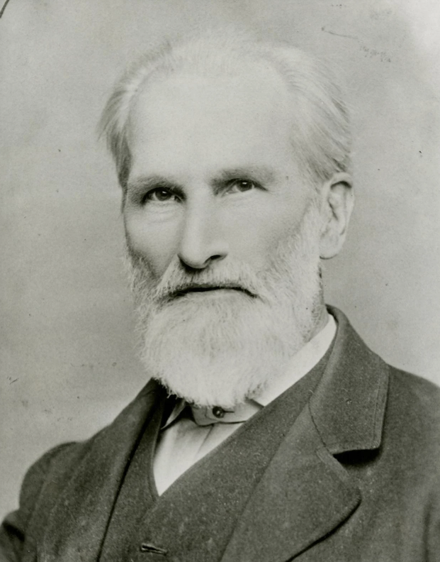
Portrait of the Ambitious Alfred D. Jones, Omaha’s first postmaster from May 5, 1854 to January 12, 1855. Bostwick, Louis (1868-1943) and Frohardt, Homer (1885-1972). The Durham Museum. 1854. I would like to correct that Mr. Jones was significantly younger in 1854. This fine photograph must have been captured toward the end of his life.
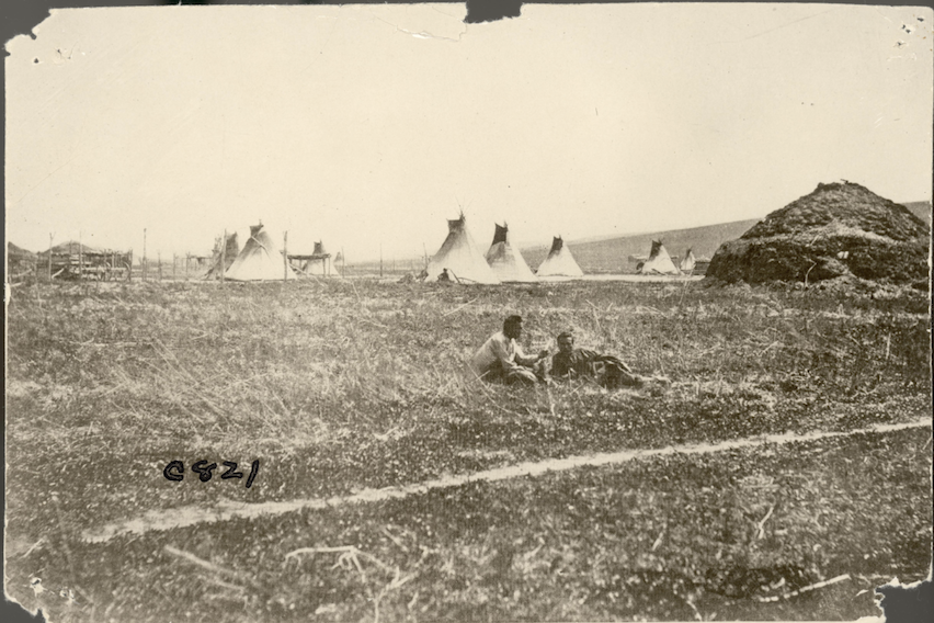
Native People
I was very interested to learn about Native populations residing in Omaha and where exactly they lived. Most records referencing the Omaha tribe concentrated on Jones’ negotiations with and/or efforts to circumvent them. From History at a Glance compiled by the Douglas County Historical Society in 2007, I read with intrigue about potential of a far earlier settlement:
“On July 27, 1804, William Clark and Reuben Fields (of the Lewis and Clark-members of the Corps of Discovery fame) came ashore on the west bank of the Missouri River to investigate mysterious earthen mounds close to where Eighth and Douglas Streets and Heartland of America Park are today. The mounds may have been of natural origin or the remains of an Otoe Indian village. It has never been determined with any certainty what the mounds were.” 8th and Douglas is not very far from the area of our focus today.
Directly from Clark and Fields’ journal entry, I read further of “a low piece of land and a pond, is a tract of about two hundred acres in extent, which is covered with mounds of different heights, shapes and sizes; some of sand, and some of both earth and sand; the position of the ancient village of the Ottoes, before they retired to the protection of the Pawnees.”
History of Omaha: From the Pioneer Days to the Present Time written by Alfred Rasmus Sorenson in 1889, shared a vivid narrative: “The curious collection of graves or mounds, and the tract of two hundred acres covered with mounds of different heights, shapes and sizes were undoubtedly included in that portion of the city bounded on the south by Farnam Street, west by Eleventh Street and on the north and east by the river bottoms. At different periods in the history of the city, while excavating cellars or grading streets in this vicinity, Indian graves have been discovered, and bones and trinkets and relics have been exhumed. Numerous mounds, which have long ago disappeared, were found here in the early days. In 1873 while lower Douglas Street was being graded, an Indian’s skeleton was unearthed at the southeast corner of Eleventh and Douglas streets. While workmen were engaged in 1876 in excavating for the foundation of the Third Ward school house, at the southeast corner of Dodge and Eleventh, they dug up two Indian skeletons, with a lot of relics, among which were numerous scalp rings, to which the hair still clung. Sorenson’s rendition explained why Omaha: A Guide to the City and Environs written and compiled by the Federal Writers’ Project of the WPA between 1935-1939 shared the eyebrow raising news: “The opinion is held by many that the city was built on an ancient burial ground of the Indians.”
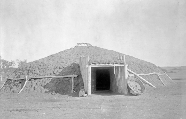
Exhibit 13: Earth lodge dwellings of the Plains tribes. As much as I want all of Downtown Omaha to be a collection of graves, and I am no expert, but could these discovered earthen mounds have been Earth Lodges? Photograph by Edward Sheriff Curtis c 1908.
Toward the very end of his life, Mr. Jones was quoted in the Omaha Daily Bee. “He recalls very distinctly that about all of the population that Omaha had when he came here was the Indians. They were of the Omaha tribe, principally, and made their headquarters on the bottoms below where South Omaha now stands.”
The Omaha Evening Bee of 1885 ran an article called The Great Omaha Indian Tribe and Its Destruction. This history is contingent upon the accuracy of the Bee’s investigation and evaluation, supposedly based on the Omaha tribe’s oral tradition. The Omahas, Otoes, Iowas, and Poncas were thought to have arrived in Omaha 300 years before the writing in 1885. They originated from the southeast, beyond Ohio, and journeyed collectively, traversing the Mississippi around St. Louis or St. Charles. They journeyed via various stages on the eastern and northern banks of the Missouri River. They descended together, with the Otoes and Iowas leading and the Omahas and Poncas following. Seemingly the author intended to convey that the indigenous people of the region had also emigrated to Omaha and were not truly “native.” The current Omaha tribe recognizes portions of this oral history, particularly of a migration “to the Great Plains from the east.” Archaeological evidence typically indicates that “the Ohio River Valley region” is a likely location of genesis. Colonial European records indicated that the Omaha tribe inhabited southwestern Minnesota and northwestern Iowa by the 1670s. They reached the Missouri River by 1714.
Directly from that 1885 Omaha Evening Bee article: “As stated in a former letter, the Omahas were once a great and warlike* people, but after the deadful ravages of the small-pox, they dwindled down in numbers and strength till they became a small and feeble tribe. When Nebraska was opened for settlement in 1855, the Omahas were located in what is now Sarpy County, a little west of Bellevue, but they were soon afterwards removed to their present locality on the Omaha reservation. The Presbyterian mission to the Omahas, which had been located at Bellevue since 1847, was now removed to Blackbird, on the reservation, for which spacious buildings were erected.” The opinion piece stated that the Omaha tribe was more advantaged residing on the reservation. “The only white persons the writer found in Nebraska in 1854, were the Reverend William Hamiton, Presbyterian missionary to the Omaha Indians, then located at Bellevue, in charge of the mission established there under the auspices of the Presbyterian board, Peter A. Sarpy, Indian trader and his associate, Commodore Stephen Decatur.” The men had established a trading post there, which later became the Bellevue Depot.
* I am no expert, but I had not heard of the Omahas described as a warlike people.
This article asserts that Colonel Manypenny, (Caucasian) commissioner of Indian affairs, reached an agreement with the Omahas and Otoes in Bellevue in 1853 for the purchase of Nebraska, leading to a treaty that was ratified the following spring, resulting in the enactment of the Nebraska and Kansas bill. In 1856, Mr. Hamilton established the new mission at Blackbird on the reservation. “The influence of Mr. Hamilton as a missionary, adviser and friend of the Indian, is seen in the present prosperous, civilized and Christianized condition of the Omahas.” The Christianization and Americanization of the Native Americans is now viewed as a calculated dispossession.
Through Vladimir Kucera and Alfred Novacek’s Czech Contributions to the Progress of Nebraska. (1976), I found this information: “Though the first bill for the creation of the Territory of Nebraska (five times as large as the present-day State of Nebraska) was introduced in Congress in December 1844, it was not until 1854 that a bill was passed. One difficulty was that the government had moved certain Indian tribes west of the Mississippi. To open the Nebraska Territory for white settlers would bring the Indians south and other white people would not want many Indians on their frontiers.”
The Omahas of Early Omaha
David J. Wishart’s book, An Unspeakable Sadness: the Dispossession of the Nebraska Indians, the eHRAF World Cultures site, with Omaha tribe research by Mark Awakuni-Swetland, and The Omaha Tribe Volumes I and II by Alice C. Fletcher and Francis La Flesche gave essential clues. Fletcher (non-Native fieldworker) and her “adopted son,” La Flesche (Native, member of the Omaha tribe, also of French descent)’s work is particularly important because the team lived with and recorded, as ethnographers, the direct words and history of the Omaha people over the course of 29 years. The Omaha Tribe was not published until 1911.
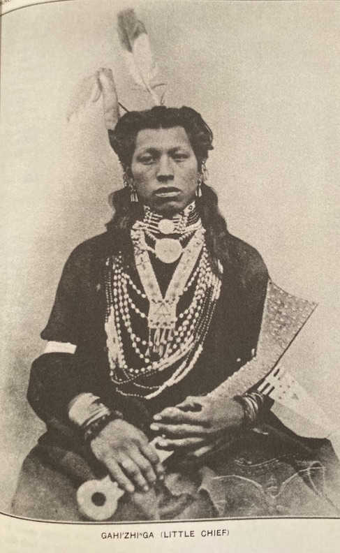
“Gahi’zhi Ga (Little Chief)” photograph borrowed from The Omaha Tribe Vol. I and II.
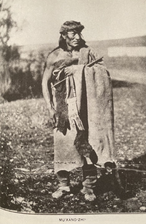
“Mu’xano Zhi” photograph borrowed from The Omaha Tribe Vol. I and II.
Before A. D. Jones or the Presbyterian missionaries arrived, pre-1800 records indicate an Omaha tribe population exceeding two thousand. A smallpox epidemic from 1800 to 1801 diminished that number by over fifty percent; nonetheless, a high birth rate and effective subsistence methods facilitated a resurgence to the previous figure by the 1820s. The Omaha endured years of displacement and famine, resulting in their population declining to fewer than eight hundred by the 1850s.
The 1854 treaty established the present-day reservation while eliminating all other territories. In June 1855, the Omaha, “according to treaty stipulations, removed to their present reservation to receive their first annuity in money.” The northern sections of the reservation were sold to the Winnebago between 1865 and 1874. The Omaha were promptly subjected to American colonial enforcement of assimilation on the reservation, which intruded into all facets of their culture and life. “The Omaha were the first tribe in the United States to participate in land allotment.” They endured territorial displacement, boarding schools, and Christianization. Pre-reservation Omaha were primarily hunter-gatherers and actively engaged in the fur trade until its widespread decline at the close of the nineteenth century.
In January of 1856 The Nebraska Democrat was warning of heavy and severe penalty attached to selling local Indians liquor. Violation of the law was met with extreme penalty of the law. Eight months later, news of the reservation was being publicized.
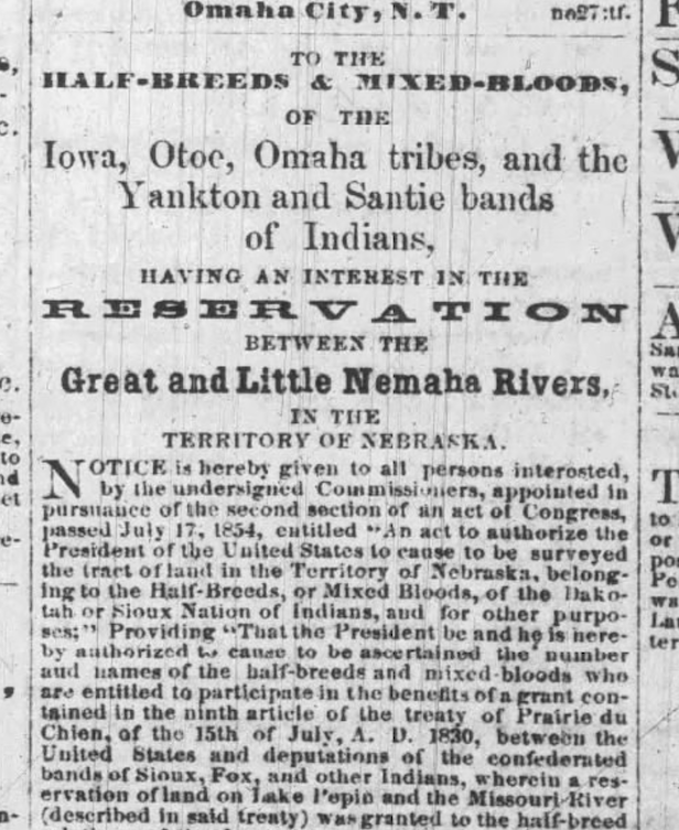
I did discover an advertisement in The Nebraskian August 27, 1856, attempting to interest Native Americans to relocate the reservation “between the Great and Little Nemaha Rivers” in Nebraska.
From Fletcher and La Flesche’s tome: “In 1882 Congress passed an act under which every Omaha man, woman and child received a certain number of acres of the land which the tribe selected as their reservation in 1854 when they ceded to the United States their extensive hunting grounds (…) by the act of 1882, they were placed under the laws, civil and criminal, of the State of Nebraska (…) In June of 1884, the Omaha tribe numbered 1,179.”
Numerous clues converged, some of which conflicted, inside a dynamic chronology. It was hard to gauge if the old-time newsmen were covering the news or shaping the history. I found the work of Alice C. Fletcher and Francis La Flesche utterly captivating and began off-course efforts to enhance my understanding. One thing I must know more about: The U. S. Government employed Omaha chief, Logan Fontenelle, as an interpreter; it is said that he kept that position until 1848, “when the U. S. was about to purchase the Omaha lands.” Was this the government pressure that A. D. Jones spoke of competing with? Ultimately, I left this investigation to be picked up at a later date, because I was losing sight of Park Wild.
Photograph of Logan Fontenelle borrowed from The Omaha Tribe Vol. I: “Logan Fontenelle, a prominent half breed of the Omaha tribe, while hunting alone was killed by the Oglala Sioux in the summer of 1855.”
Photograph of the Omaha Reservation. Photographer: Jackson, William Henry. Photograph borrowed from History Nebraska. Date: 1869.
Omaha City
From the Historic Towns of the Western States book (1901), there is an interesting chapter called, Omaha: the Transcontinental Gateway by Victor Rosewater, a Nebraska politician and son of Edward Rosewater, the founder of The Omaha Bee, whom he would emulate in the field of journalism. Victor Rosewater’s summary suggested that Alfred D. Jones wasn’t just looky-looing over in Omaha– the Ferry Company sent him with explicit directions.“As an adjunct to the ferry, the company staked out a claim adjacent to its west landing directly opposite Council Bluffs, and employed Alfred D. Jones, a young civil engineer, to lay out a town site which on pretentious paper was invested, without particular thought or design, with the name Omaha, from the tribe of Indians that was wont to camp upon the creek brushing its north boundary. The survey was conducted in June and July of 1854, and the adoption of the name was doubtless suggested by the fact that a month or more before the representative in Congress for the State of Iowa had prevailed upon the Post-Office Department to issue a commission to Mr. Jones as postmaster at Omaha City, which at that time must have existed solely in his prolific imagination.”In these retellings of the story, the Brown Brothers, who paddled across the Missouri River with Mr. Jones, had fallen from the narrative arc.The last year of his life, in speaking of his survey of the new town, Mr. A. D. Jones stated, “I drew up the papers for William Brown when he established the ferry across the Missouri river. The ferry was located at a point near where the Terminal Bridge now stands.” This clarified for me that the occasionally absent Brown Brothers, or at least one of them, were involved in the ferry company.
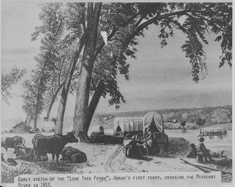
Photograph of early drawing of Lone Tree Ferry; Omaha’s first ferry crossing the Missouri River carrying covered wagons. Bostwick, Louis (1868-1943) and Frohardt, Homer (1885-1972). The Durham Museum.
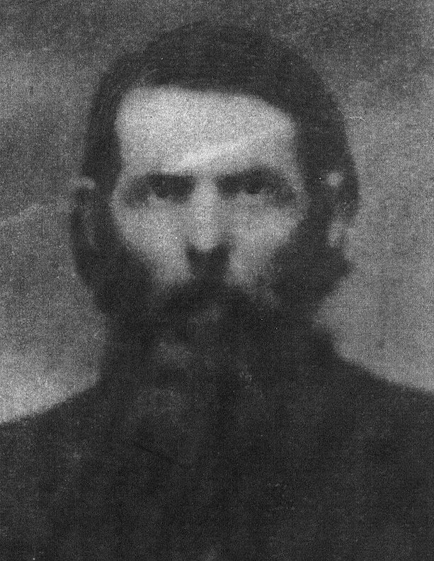
William Davis Brown. Photo borrowed from Prospect Hill Cemetery. This may or may not be a frightening photograph by historical standards but it is certainly metal by today’s yardstick.
Further digging revealed other books with additional storylines. Anecdotes of Omaha by M. B. Newton from 1891 described William D. Brown as a youthful and vigorous individual who, upon arriving in Kanesville (now known as Council Bluffs), recognized the potential for profit in operating a ferry to transport passengers eager to traverse the “Big Muddy.” The ferry was described as a flat-bottomed vessel, rowed with oars, departing from Kanesville hourly and arriving at a solitary tree, near the current foot of Douglas Street at river’s edge in Omaha. From this landing place it was called the “Lone Tree Ferry.” “It is a well-known fact that large cities are usually located on the west bank of rivers and these men soon became convinced that there would be someday be a city here.” Following a prosperous year, the Council Bluffs and Nebraska Ferry Company was organized, replacing the Lone Tree Ferry. Alfred Rasmus Sorenson’s Omaha Illustrated: A History of The Pioneer Period and The Omaha of Today (1888) reported that it was Dr. Enos Lowe who established the Council Bluffs and Nebraska Ferry Company. The organization, in conjunction with other members of the ferry firm, aimed to acquire the town site promptly upon Nebraska’s admission as a territory. This occurred on May 23, 1854, when Congress enacted the Kansas-Nebraska bill. Mr. Jones is quoted in the Anecdotes of Omaha book and in Alfred Rasmus Sorenson’s 1889 book History of Omaha: From the Pioneer Days to the Present Time that Jones decided to “make a strike” on the Nebraska side of the river with the help of Thomas and William Allen. The Allens were allegedly subcontractors for the grading work of the Council Bluffs and Nebraska Ferry Company. The trio acquired a scow from W. D. Brown. Jones clearly articulated his staking over his claim of Park Wilde. It was said “the Indian owners of the land complained to their agent and the agent ordered Mr. Jones to vacate the land he had named Park Wilde. By the time the Indians were ready to trade, Mr. Jones had an application in Washington for a post office to be located here.”
In May of 1854, Mr. Jones was appointed postmaster and he was the lone postal courier for about a year. Apparently, A. D. Jones was “elected” as a judge of the Omaha Claim Club upon its establishment in July 1854, and in December 1854, he was one of four individuals elected to represent Douglas County in the upper chamber of the Territorial Legislature. This prompted me to question the identity and quantity of his supporters? Where did these townspeople come from? The Omaha Daily Bee shed more light. “Following the survey of the town site, immigrants began to arrive from eastern states, leading to significant disputes regarding the conflicting claims of individuals attempting to settle on the same parcels of property. All occupants were ‘squatters’ lacking enforceable rights, and there was no court with adequate jurisdiction to determine their cases.” Of course, Mr. Jones was made judge– a clerk and sheriff were also selected. In other documents I discovered Mr. Jones’ brother-in-law, Joseph Cameron Reeves, was the first sheriff of Douglas County. All In the Family was not considered a problem of Nepotism back then.
Mr. Jones was admitted to the bar in June 1855, however, seemingly never engaged in practice. In the years to follow he became known as Honorary Jones. Mr. Jones served on Omaha’s inaugural City Council in 1857, where he proposed the first ordinance; he was a member of the initial school board in 1859; he held the position of speaker of the House in the Legislature of 1861 and was actively involved in numerous initiatives aimed at advancing the city’s and its residents’ interests.
“Panoramic view of Omaha from ‘Forest Hill’ on North 11th Street, South of Pierce. Second Territorial Capitol is seen on ‘Capitol Hill’ on the left; later site of Omaha High School and 1967’s Central High School (which dates from early in the 20 Century). 11th Street in center of right plate long before the 11th Street hill was graded down. At right of right plate is Herndon House/International Hotel begun 1857. This image could have been taken by E.A. or E.L. Eaton, Omaha’s pioneer photographer, or by ‘Hamilton’.” The Durham Museum. 1860-1870.
Aartje Potts’ 1931 thesis at the University of Nebraska at Lincoln entitled, The Street Names of Nebraska, described the naming of Jones Street. Potts drew the conclusion that street name honored our man A. D. Jones. “In 1880 this street had situated upon it residences large and small, from the Missouri River to Sixteenth Street.” Mr. Potts’ thesis noted another man, named Mr. Todd. Mr. Todd was known to have the first case of delirium tremens in Omaha (quite the honor). Todd ultimately became the first to perish as “a dipsomaniac” in Omaha, with a pioneering magazine characterizing him in poem. “’Twas the intoxicating cup that caused him to turn his toes up.” Another news article from The Nebraska Republican stated Mr. Todd’s demise was “the first death of an adult” in Omaha, undoubtedly of a Caucasian adult. But my interest lies in the fact that Mr. Todd was interred adjacent to the crossroads of Jones and 13th Streets. We are compiling the locations of these early unmarked burial sites.
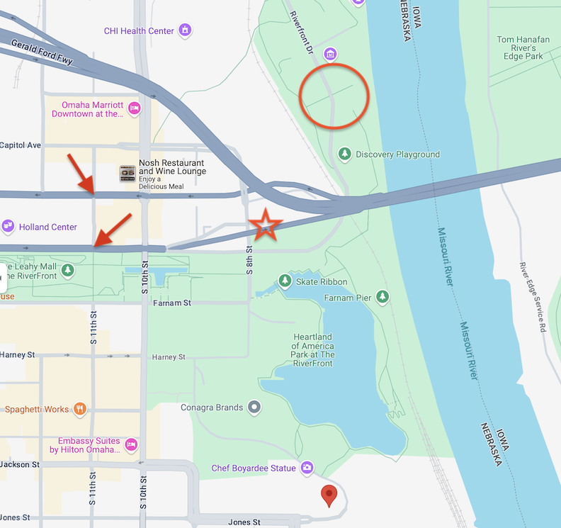
Google Map of east downtown. The red Google marker is settled on the initiation site of Jones Street. In 1880 Jones Street apparently met the river. Jones Street presently commences in the vicinity of the Conagra cluster of buildings, strikingly at 666 Jones Street, where it diverges from the northbound Conagra Drive. Jones realigns itself and integrates into the city grid, proceeding westward from that point. The red star is situated in the vicinity of the discovered earthen mounds near the intersection of Eighth and Douglas Streets. (The mounds may have originated naturally or could be the remains of an Otoe Indian village.) Red arrows point to both Eleventh and Douglas and Eleventh and Dodge where Indian skeletons were found. I placed the red circle at the approximate location of Mr. Jones and the Brown Brothers landing in November 1853. Mr. Jones executed the preliminary survey of the city. The 1902 article stated that the survey’s baseline was established at present-day Davenport Street, and that Jones placed one of the cornerstones at or near the existing Union Pacific headquarters.
Omaha: A Guide to the City and Environs written and compiled between 1935-1939 by the Federal Writers’ Project Works Progress Administration noted topographical details of early Omaha. “The most characteristic feature of Omaha’s natural setting is the rugged contour of hills and bluffs bordering the river.” Innovative realtors developed residential additions on the northern, southern (site of Park Wild), and western hills. In the 1920s and 1930s, significant alterations were made to the original topography of the land. Hills were graded and ravines and lowlands were filled. Some streets in downtown were filled in as much as forty-five feet. A creek formerly flowed along what is now Nicholas Street, while another creek ran along Jones Street, both of which are now covered over.
The Mystery House
The Omaha Evening Bee reported the Ferry Company (the Browns of Council Bluffs) put up a building, which was known as the Claim House, yet the log house built by Mr. Jones on the 28th of May, just two days before the Territorial Act as passed, was “the first (White) settler dwelling built in Omaha.” They say a photograph of the log house Mr. A. D. Jones constructed on this claim, the inaugural residence in Omaha, proudly adorned his sitting room for decades. I sure would like to see that photo.
Where exactly was this home (featured above) that downtown Omaha swallowed up? The Durham Museum offered up this clue: “A house with large buildings to the left and behind. It has a fence around it. Birthplace of Lake and Deuel. Abandoned by the Lakes in November of 1876. Daughter Mary was born here, and she later married Deuel.” I have written about Charles Duel (one of the United States National Bank founders) and son, Lake Duel, in the past. For our purposes here today, the Durham site noted that the Omaha World-Herald (at some point) labeled this “the home of A.D. Jones, city’s first Postmaster in 1854.” Bostwick, Louis and Frohardt, Homer. The Durham Museum. 1906.
I questioned at what point the Jones family could have lived in this home featured on the Durham’s site. I would later discover in an article from 1888 that A. D. Jones’s early residence was on Sixteenth Street, between Farnam and Harney. The description seems to align seamlessly with the photograph of Durham. Is it possible that this residence is the fancied-up early home of Mr. Jones? By 1891 the Joneses were abandoning their original log cabin and building their dream home at 2018 Wirt Street, reputed to be an elegant structure in the Kountze Place addition in North Omaha. Alfred, his wife Sophronia Reeves Jones, his mother-in-law Mrs. Elizabeth Reeves, and his mother Mrs. Elizabeth Jones all lived there together. This later home is the one that daughter, Mrs. Mackey, would return to.
The Squatter’s Claim
Mr. Jones’ fame was not without scandal. With the establishment of the Omaha town site corporation, it was later argued that Mr. Jones possessed “an excessive amount of land,” leading him to relinquish half of it. Is that why some accounts said he founded 320 acres and others described 160 acres? Please advise.
According to the Omaha World-Herald in 1855, Mr. A. D. Jones “occupied Park Wild” and sold a “squatter claim” to 320 acres of the land which surrounded it for $1,000. The sale caused a great sensation in this then cluster of log and cottonwood shanties.
An 1886 Omaha Evening Bee article reported that Franklin Robinson of California was suing Alfred D. Jones, Sophronia J. Jones, Jonathan Merritt, Isaac Brown (one of the Brown Brothers of Council Bluffs or just another Mr. Brown?) and Horace Metcalf, requesting a split of the property purportedly acquired through fraudulent means by A. D. Jones. The plaintiff asserted that in 1849, Jones obtained a bounty warrant belonging to Robinson, as an ex-soldier of the Mexican War, granting him 160 acres from any of the U. S. government public lands. “He alleges that Jones failed to notify him of the receipt of the warrant.” Furthermore that Mr. Jones deceitfully assigned it to himself and entered the land in Pottawattamie County, Iowa, close to “the transfer.” This land was purportedly sold– 80 acres to a Mr. Davis and a Mr. Fleming and Mr. Jones sold another 80 acres to the Union Pacific Railway in 1854, with the proceeds reinvested in Omaha, currently possessed by the defendants, and valued at “many thousands of dollars.” I would hammer down the actual ill-gotten property, at least some of it to: one-quarter of a block located at the southwest corner of Twelfth and Dodge, the former site of the Olympic Theatre; the Joneses’ current residence at Sixteenth Street, situated between Farnam and Harney; and the parcel at the southwest corner of Twelfth and Jackson streets. By 1888 the case had worked its way through the courts and the newspapers and the estimated $150,000 owed to Mr. Robinson was being debated. At that point, I aborted the mission.
Years later, Alfred Sorenson would dish of another land dispute involving Mr. Jones. This is a narrative I had caught wind of from an alternative source as well during this investigation. In 1854, a Frenchman named Veunaseau (or maybe Veneau) forcibly seized Jones’ Park Wild area, defying Jones and all other claimants. Jones was said to have sent word down to Missouri and summoned renowned fighter, Cam Reeves (another Reeves relative?) Accompanied by Jones and friends, Cam Reeves crossed the river from the Iowa bank and bound up the hill toward the Frenchman’s shack. “Scores of citizens fell in line, for the reputation of Cam Reeves was known in Omaha.” The Fighter told the Frenchman to “get out” and a fist fight ensued. A violent confrontation was depicted in meticulous detail—the outcome was A. D. Jones acquiring “peaceable possession” of the initial parcel of Omaha property.
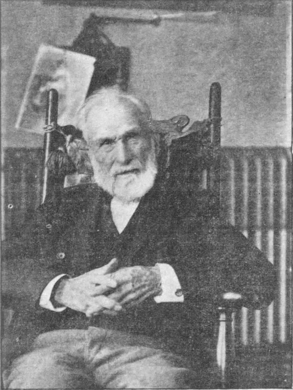
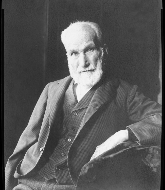
1901 photograph of A. D. Jones from the Omaha Daily Bee archives. Incredible image–we rarely see a person captured in a casual posture from this time period. Furthermore, kindly retrieve your magnifying lens and inspect the intricately carved chair of the gods.
The final years of Mr. Jones’ life were devoted to relaxation and managing his large property interests. Mr. Jones passed away on August 30, 1902, due to pulmonary congestion, after an injury sustained from a fall at his 2018 Wirt Street residence in July, resulting in a broken shoulder blade. Daughter Mrs. Mackey would stay on with her mother.
Park Wild
If we review, only a year after paddling over to Omaha, A. D. Jones had named and occupied his Park Wild and sold a “squatter claim” to 320 acres of the Park Wild land which surrounded it for $1,000. The sale caused a great sensation in the cluster of log and cottonwood shanties. “After the survey of the town site, immigrants began to arrive from the eastern states,” presumably building these shanties.
“The bluffs, ravines and ridges, were described as heavily wooded. Fine groves of elm, oak, ash, box-elder, black walnut, and cottonwood were interspersed with open areas of prairie. Sumac, wild berries, and willows covered the bottomlands and islands of the river. Most of the native timber was cut and used by the settlers to construct buildings.”
Our city never adopted the name Park Wild, however this designation persisted in the area named by Mr. Jones. Park Wild, the area, remained as the city grew around it and subsequently became a now little-known addition in the city. I discovered variations in the spelling. From the mid-1800s to the 1950s, Parke Wilde, Park Wilde and Parkwild were superficially favored. (Were these merely spelling errors?) At that time, Park Wild denoted the area, not the street and not yet the formal subdivision.
Affording an excellent view of the river and the surrounding country, the hilly wood of Park Wild hosted several firsts. The inaugural post office in Omaha was established in Park Wild on May 28, 1854. The first Caucasian settler born in Omaha occurred in Park Wild on October 3, 1854. His name was William Nebraska Reeves, son of Mr. and Mrs. Jesse Reeves, no doubt, more of A. D. Jones’ in-laws.
In 1857, a remarkable procession comprising of several thousand individuals paraded to Park Wild, a picturesque grove located at the southern outskirts of the city where they partook in a feast, offered rounds of toasts, and listened to speeches by local orators “amid the roar of cannon, and the popping of corks and firecrackers.”
By 1860, Park Wild was being broken up into lots, which were available for purchase, but it had not yet been formally platted as a subdivision. Park Wild Avenue, the existing thoroughfare, seems to have been created no later than 1875.
A generous “Map of Omaha City” was included in Their Man in Omaha- The Barker Letters: Volume I 1860 to 1868. The map reads “Entered according to Act of Congress in the year 1866 by Oscar F. Davis I the clerk’s office of the District Court. Published by Oscar F. Davis Surveyor and Real Estate Agent.”
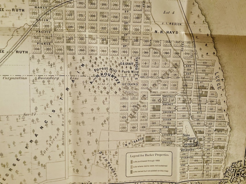
If you follow the east-west streets from north to south, Mason, Pacific, Pierce…the boundary line of the Forest Hill and Park Wild areas appeared to be Poppleton Avenue on the north. Did this area extend to Eighth Street or Tenth Street? I also couldn’t help but notice George Francis Train owned 400+ acres directly to the south, including his residence abutting, or perhaps within, Park Wild. We will examine the illustrious Mr. Train and my attempts to nail down his property in a short while.
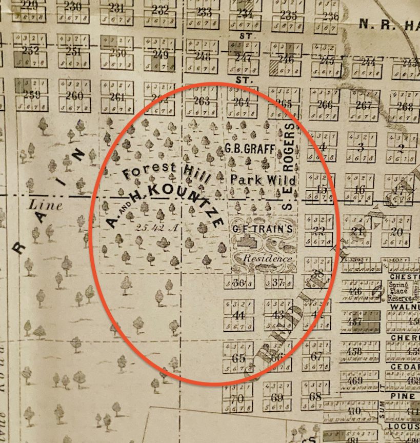
Allow me to enlarge. Surveyor Oscar F. Davis I’s 1866 map shows so much. Map borrowed from Their Man in Omaha- The Barker Letters: Volume I 1860 to 1868. This Park Wild-Forest Hill area was filled densely with trees and sat at a higher elevation. Note the large Kountze, G. F. Train, and G. B. Graff properties, to be discussed later. The 1862 Tri-Weekly Nebraska Republican reported A “Mrs. S. Draper, midwife and female physician, has residence at Park Wild, formerly the country seat of S. E. Rogers.” S. E. Rogers’ large home site is viewed on this map, although his name runs vertically.
Union Pacific Railroad
In 1863, President Lincoln appointed Omaha as the eastern terminus of the Union Pacific Railroad, the eastern segment of the nation’s inaugural transcontinental railroad. The railroad construction in Omaha commenced in 1865, with the Union Pacific advancing westward and connecting with the Central Pacific at Promontory Point, Utah, in 1869. The UP was the inaugural railroad west of the Missouri River and the first transcontinental railroad, operating as the principal railway for the west coast. Omaha housed the corporate headquarters and primary repair facilities of the UP, significantly enhancing the city’s overall development. Our narrative tonight is profoundly influenced by the Union Pacific.
The Park Wild Set
The 1867 Omaha World-Herald announced: “In the south part of the city, Park Wild, Augustus Kountze is starting the work on his new house. J. N. H. Patrick and Dr. George B. Graff will soon start theirs.” Let us address each name individually.
Augustus Kountze built and lived in what would become the Kountze Mansion. The Kountze estate, coined Forest Hill, with an official postal address at 1207 South 10th Street would later become brother Herman Kountze’s possession. The Forest Hill estate grounds were extensive, resulting in several ambiguous addresses based on the entry utilized. Eighth and Forest Avenue was one location, and Ninth and Forest Avenue was another. Later still, the Forest Hill addition was platted from this family estate. Photographs and many more delicious details to come. I was interested to learn that Forest Hill was also the namesake of John D. Rockefeller’s wooded, 235-acre summer home in Cleveland, originally designed as a sanitarium.
According to Their Man in Omaha- The Barker Letters: Volume I 1860 to 1868, the J. N. H. Patrick family had constructed an early large, brick home at about Seventeenth and Davenport by 1857. By the 1867 World-Herald story, the Patricks were constructing once more in the Park Wild region. Their little son, Robert Patrick, was given two deer, which he kept confined within “the family’s private park.” The deer were subsequently entrusted to Dr. Graff, who possessed the land that would eventually become the Park Wild addition, providing him with the capacity to retain the deer for many years.
Dr. George B. Graff was born in Maryland in 1816 and was said to be an “ex Indian agent” of the Omahas. An Indian agent was a government officer who represented the U.S. federal government to Native American tribes, particularly on reservations. Graff received an appointment under President Buchanan as an Indian agent, which necessitated his move to Omaha in about 1857. Dr. Graff practiced medicine in Omaha and also participated in investments, including mining, before founding oil wells in Colorado and Wyoming. His residence was located at 1324 Park Wilde Avenue (1312 in some references). The Graffs constructed a two-story brick barn in the 1860s, a structure more opulent than many residences of that era. The 1866 Omaha City Directory showed G. B. Graff, physician, residing on the corner of Seventh and Pearce [sic], which, considering all of the confusion with Park Wild and Seventh Street/Avenue, could very well be the exact same address as listed above.
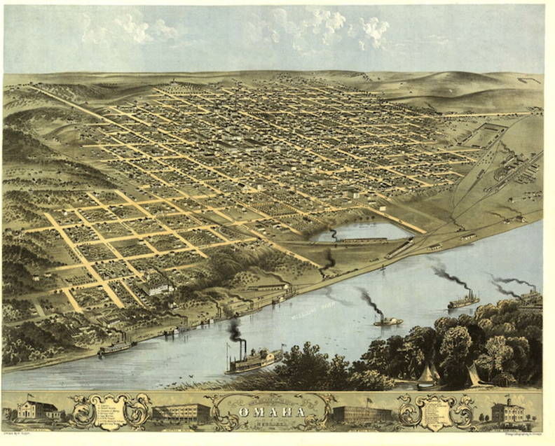
1868 “Bird’s Eye View of the City of Omaha” map drawn by A. Kuger.
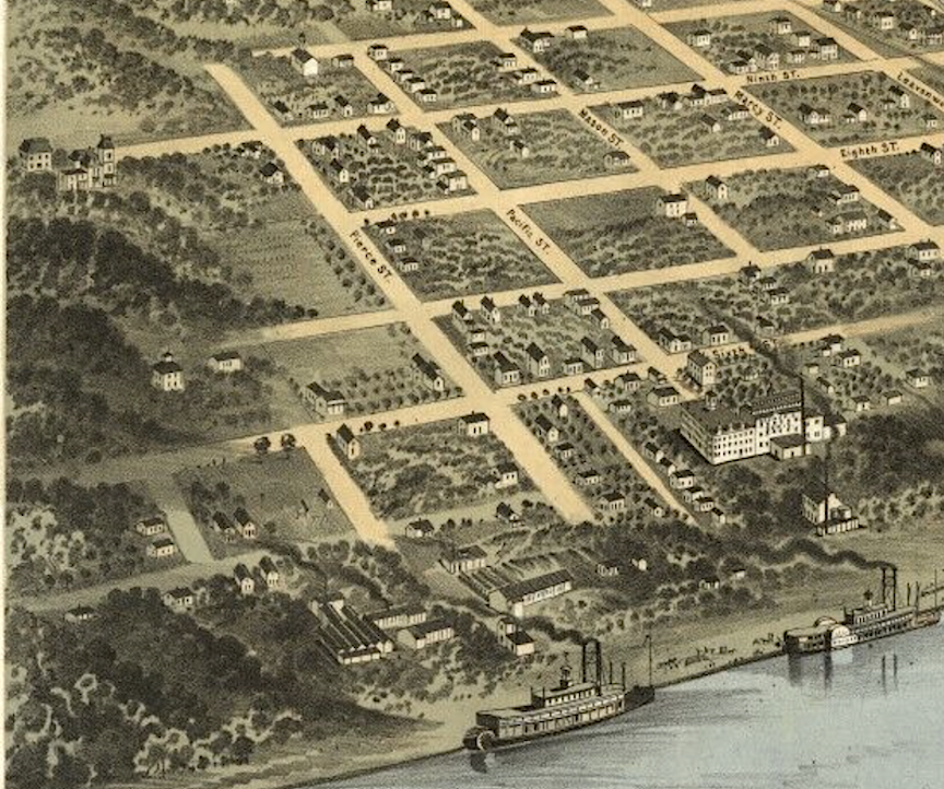
1868 “Bird’s Eye View of the City of Omaha” map drawn by A. Kuger enlarged. One can easily observe the artist’s capturing of the forested, elevated area south of Pierce Street. Note the large houses on the hill–one is the Augustus Kountze mansion, Forest Hill.
1876 photograph. View of Omaha from Herman Kountze’s Forest Hill estate (Eighth and Forest Avenue)- “One of a panorama of three plates possibly more; made by E.L. Eaton in 1876 from Herman Kountze house. Street at W. Church at its head is Eighth Street. Underpass at extreme right marks Seventh and Pacific’; trains crossing through the middle of the photo.” Bostwick, Louis (1868-1943) and Frohardt, Homer (1885-1972). The Durham Museum. 1876.
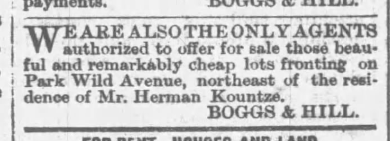
November 1878. Omaha Evening Bee. Advertisement for Park Wild. Boggs & Hill would offer “25 elegant residence lots just south of the Depot, on Pierce Street and also fronting on Park Wild Avenue, near residence of Messrs Kimball, Stebbins, Graff, Long, Carrier and others.” This depot reference pertains to the Union Depot. It should be noted that Boggs & Hill also had their own addition.
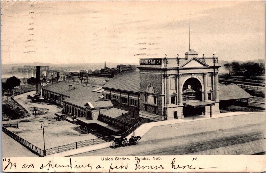
The Union Station or Union Depot at 801 South Tenth Street. This is the original building, later torn down. The present structure was completed in 1931 and was later bought by the Western Heritage Museum, now called the Durham Museum. Park Wild is seen to far right (south). The Union Pacific bridge is seen to the left hand side (east).
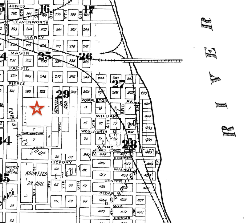
1890 Sanborn Map of the Little Italy district lent by Trina Westman and Shelley McCafferty of the City Planning Department. I placed a red star where the large Herman Kountze’s Forest Hill estate was located with private drives off Tenth, Ninth and Eighth Streets. Our Park Wild Avenue is labeled as Seventh Avenue back in 1890.
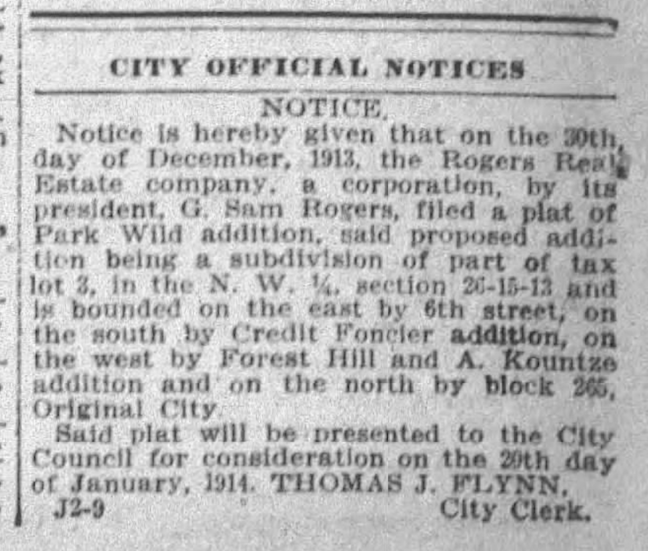
January 2, 1914. The Omaha Evening Bee.
The mythology of Park Wild and the mystique of its very name persisted but I was surprised to discover that the addition was not officially platted until 1913. I will elaborate on this in detail shortly. The Rogers Real Estate Company, directed by President G. Sam Rogers, submitted the plat. I would later learn that this was the only child of S. E. Rogers, who owned the substantial residence and estate depicted on the earlier 1866 map of Park Wild. (Additionally, it is noteworthy, though not yet confirmed, that Dr. George B. Graff owned the entirety of what is now known as the Park Wild Addition, also shown in the earlier 1866 map.
The 1866 Omaha City Directory recorded S. E. Rogers as a “farmer,” residing “south of the railroad.” Indeed, we know that was accurate. However, there was significantly more. Samuel Evans Rogers was born in Kentucky, and his wife, Martha Brown Rogers, was born in Ohio, 24 years his junior. By the 1870 United States Census, Mr. Rogers was identified as a “speculator;” I had not heard this term and found it to mean an individual who “invests in stocks, property, or other ventures in the hope of making a profit.” Curiously the 1880 United States Census registered S. E. Rogers’ profession as a banker. I consulted the Omaha: The Gate City and Douglas County Nebraska : A Record of Settlement, Organization, Progress and Achievement, Volume II by Arthur Cooper Wakeley (1917), which I have jokingly referred to as My Omaha Bible in the past. Wakeley made plain Mr. Rogers arrived on the banks of Omaha in October of 1854 with an education, a plan, and a load of money, “contributing much to its early development through the erection of between eighty and one hundred houses.” His real estate dealings were extensive, and he emerged as a banking leader by establishing a financial organization under his own name and participating in two others. The Rogers couple had one child, a son named Godlove Samuel, who shrewdly went by “G. Sam” Rogers in his adult years, later overseeing the Rogers Real Estate Company established by his father.
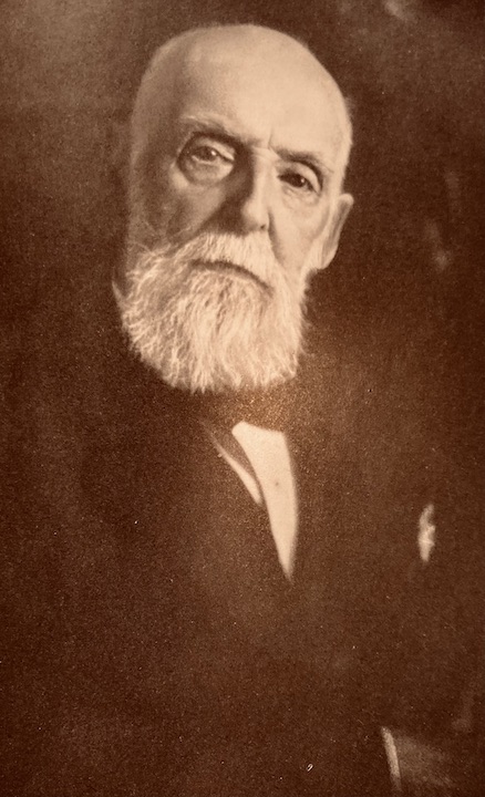
Samuel Evan Rogers as seen in the Omaha: The Gate City and Douglas County Nebraska: A Record of Settlement, Organization, Progress and Achievement, Volume II by Arthur Cooper Wakeley (1917). If only they had shown the Rogers’ house. Mr. and Mrs. resided with two or occasionally three servants, which, in conjunction with the preceding map, suggested that his residence may have been noteworthy.
The Glories on the Hill
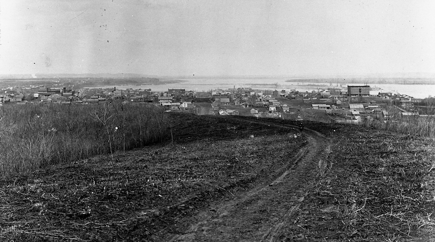
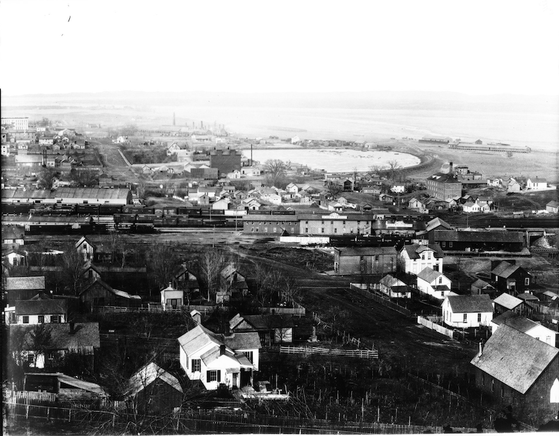
One of my favorite Omaha writers, Margaret Patricia Killian, wrote in Born Rich: “It was only natural that the wealthy owners of these businesses should seek to build their home in wooded areas with views of the river and bluffs, and not too far distant from their factories and businesses. Businessmen at the time felt that the natural residential growth of Omaha would be to the north and to the south, up and down the great river. To the south of the business area and the hub of the railroads were picturesque hills along the river as far south as Child’s Point (in Bellevue). Some mansions already had been constructed on what was rapidly becoming the fringe of downtown and commercial areas. The hills along 8th and 10th Streets from Mason Street to what is now Riverview Park and Henry Doorly Zoo became the first concentrated ‘Gold Coast’ of Omaha in the 1880’s.”
The homes in the Park Wild and Forest Hill area were at a distance and an elevated, visual reminder for the workers of downtown Omaha. The grand homes on the hill marked the pinnacle of Omaha social ascension. The following photograph illustrates early Omaha finding its footing with simple wood frame buildings.
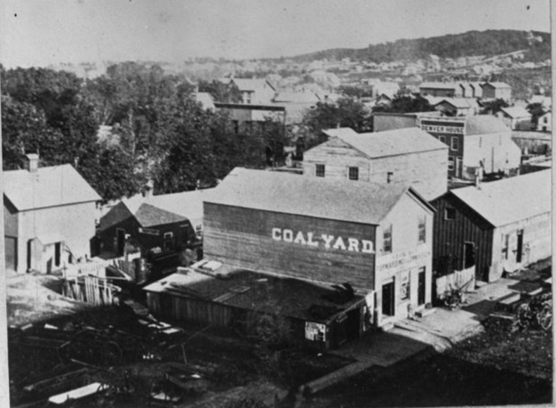
The camera faces southeast angle. A “Coalyard” building and the “Denver House” stands southeast from Thirteenth and Farnam. The Herman Kountze residence, Forest Hill, is on the extreme right, on the hill. Bostwick, Louis (1868-1943) and Frohardt, Homer (1885-1972). The Durham Museum. No date.
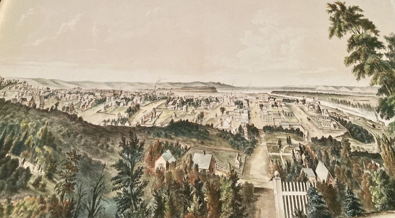
This beautiful, dreamy, watery painting by H. Lambach in 1867 depicts Omaha as viewed “Looking North from Forest Hill.” The Missouri River is seen on the right.
The Herman Kountze mansion at located at 1207 South Tenth Street. Some sites read “Eighth and Forest Avenue” and “Ninth and Forest.” Bostwick, Louis (1868-1943) and Frohardt, Homer (1885-1972).
From Omaha, Illustrated: A History of the Pioneer Period and the Omaha of Today by A. R. Sorenson, 1888. “The name of Kountze Brothers, bankers, in Omaha, Denver and New York, is well known throughout the country. There are four brothers living—Augustus, Herman, Luther and Charles B.” These four were the renowned sons of Christian Kountze, who emigrated from Saxony, a German province. There were ten children all together. The eldest son, Augustus, departed from the family residence in Ohio in 1854. Upon entering the real estate sector, he relocated here upon learning that Omaha was “a coming city.” Augustus executed several investments. In 1856, Herman partnered with his brother in Omaha to engage in the acquisition and sale of real estate nationwide. In 1857, Augustus and Herman established the family banking enterprise known as the Kountze Brothers. By 1872, the Kountze Bank in New York was thriving, prompting Augustus to take up residence in that state. It was at that time that Forest Hill become Herman Kountze’s home.
The Herman Kountze residence, located at 1207 South Tenth Street, can be seen from a distance in this lantern slide. The large brick house is partially obscured from view by the many trees with bare branches on the lawn. A road leading up to the house is visible in the foreground. Photographer William Wallace. Digital Publisher: Omaha Public Library. Date: 1880-1890.
SIDENOTE OBSESSION: In September of 1906 the Herman Kountze mansion was abruptly “closed” and all servants were mysteriously dismissed. Mrs. Kountze left for Glen, New York in a hush-hush manner, purportedly to holiday where Mr. Kountze had been all summer. It was disclosed within months that Herman Kountze had passed away having sought quiet treatment in Watkins, New York for rheumatism. He was 73 years old. Herman Kountze was a pioneering banker along with his brothers, and president of the First National Bank of Omaha, established by his family.
1880. Omaha Daily Bee. The Kountze Bros Bank transitioned to First National Bank in 1868.
Herman Kountze was reputed to be Omaha’s wealthiest man, a multimillionaire at the time of his 1906 death. By 1907 I found the old Kountze Forest Hill grounds had been subdivided and streets paved. In 1911 St. Catherine’s Hospital opened in the former Augustus-turned-Herman Kountze mansion. We shall examine this in further detail in the coming chapters of this extensive examination.
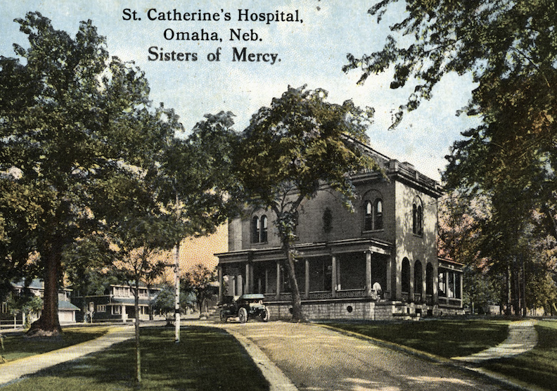
Postcard view of St. Catherine’s Hospital, 811 Forest Avenue. Publisher: Omaha Public Library. Contributed by Darlean M. Danielson.
The Catholic hospital evidently placed a cross atop the Kountze Mansion tower and, no doubt, called it good. The former Herman Kountze mansion at Eighth and Forest Avenue was then being used as St. Catherine’s Hospital. Bostwick, Louis (1868-1943) and Frohardt, Homer (1885-1972). The Durham Museum. 1913.
The former Herman Kountze mansion at Eighth and Forest Avenue with addition as St. Catherine’s Hospital. Bostwick, Louis (1868-1943) and Frohardt, Homer (1885-1972). The Durham Museum. 1916. Another view of the Kountze mansion turned St. Catherine’s Hospital. Oddly this addition seemed charming. I wish we could see more of this type of architectural planning in Omaha. We will pick up this Kountze mansion-St. Catherine’s Hospital hobbyhorse later in our case.
I present the peculiar and marvelous domicile of Thomas Lord Kimball and Mary Rogers Kimball located at 1231 Park Wild Avenue/1231 South Seventh Street. I was delighted to see this photograph, nearly inconceivable that it was authentic. Mr. Kimball was one of the builders of early Omaha. Kimball would ascend to the position of Assistant General Manager of the Union Pacific Railroad from his previous role as a passenger agent. Kimball served as the general passenger and ticket agent, then becoming the general traffic manager, and eventually Union Pacific Railroad Vice President and President of the Union Depot Company. In 1879, he became an incorporator of the Omaha Electric Company and subsequently served as president of the Omaha Thomson-Houston Electric Light Company. Then he became the President of the Union National Bank. He graciously received insider trading tips from Jay Gould (yes, that Jay Gould) and although he did not strictly adhere to Gould’s recommendations (culminating in the dissolution of their relationship), upon Kimball’s sudden death in 1899, he left a comfortable fortune to his family. Mary Rogers Kimball, his wife, was recognized for her philanthropy, serving as President of the Omaha Charity Association, and founding the Creche Home. Photographer: Bostwick, Louis (1868-1943) and Frohardt, Homer (1885-1972). Durham Museum.
The reason for my questioning this photograph being the Kimball home is simply due to my prolonged hunt for this proof. Discovering it is stunning. I had read so much that I envisioned a larger home, although this image is deceiving. The Kimball home was said to have twelve formal rooms. The 1880 United States Federal Census revealed thirteen Kimball family members living in the home and three live-in servants. In 1891 the Kimball residence was characterized as “very large and roomy, reminiscent of the country houses in the south, which were located all over that fair land before the war came and destroyed them.” It was encircled by mature trees and located on one of the “prettiest streets in the city,” everything tending to the making of an ideal home. Chinese lanterns illuminated the grounds, while the trees appeared particularly gorgeous, with lights intermittently nestled among the greenery. As to the home itself, they depicted a rear parlor, a library, dining room, and music room where an orchestra was positioned. The Kimballs’ long residence in Omaha and the prominence they maintained resulted in a true who’s who guest list at these fetes. The T. L. Kimball mansion and estate was squarely situated on the A. D. Jones claim of Park Wild.
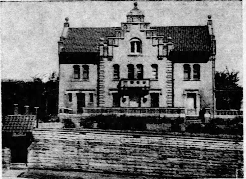
SIDENOTE OBSESSION: Their son, Thomas Rogers Kimball, one of my favorite Omaha architects and artist crushes has made appearances in many of my investigations. Architect Kimball designed the gorgeous 2236 St. Mary’s Avenue mansion for his mother, Mary Rogers Kimball and his sister, Arabel Kimball, after the death of his father. 2236 St. Mary’s Avenue was being built in 1905 and completed in 1906. This is An Obsession Home. Photo borrowed from the Omaha World-Herald archive.
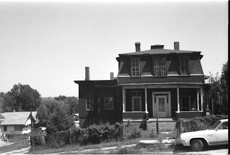
The Thomas Lord Kimball’s Park Wild home, having fallen on hard times by 1964. Following senior’s death, Mary Rogers Kimball converted their Park Wild residence into a dormitory for transient women in need, referred to as a “industrial institution.” This institution was to be equipped with sewing machines and implements to enhance the women’s earning capacity. In 1913, thirty children from the Creche Home were relocated from their residence at 1824 Harney to the Kimball residence of 1231 Park Wild Avenue. Photographer: Martin Weil. 1964. Durham Museum.
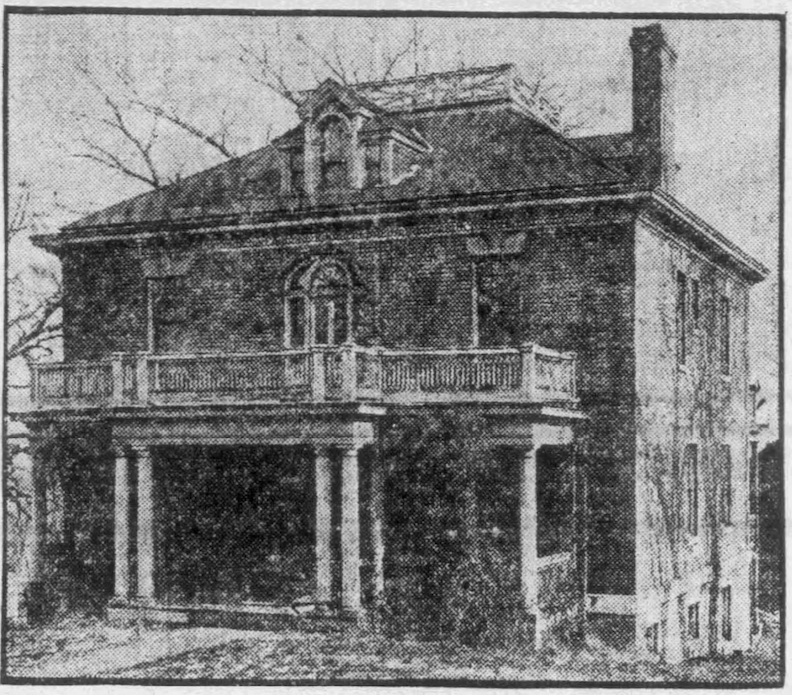
Richard Rogers Kimball, yet another son, donated his home to the Creche in 1914. The children moved from “the old T. L. Kimball home at 1231 Park Wild Avenue” to the R. R. Kimball home “just north of it.” Supposedly this glorious home carried the address of 1235 Park Wild Avenue/1235 South Seventh Street, in addition to other lots purchased by the Creche. Photograph borrowed from the Omaha World-Herald. 1914.
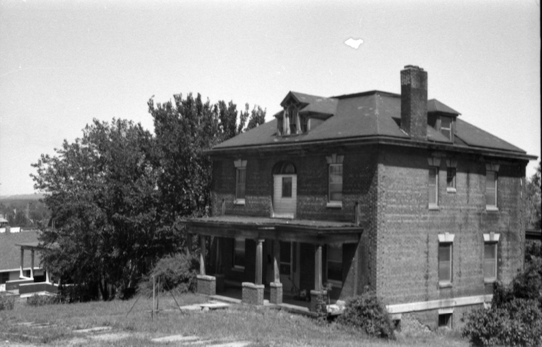
I do believe this photograph found on the Durham Museum site is the original Richard Rogers Kimball home shown previously. More hard times by 1964. Photograph by Martin Weil. 1964. Durham Museum.
Addendum of March 30, 2026***This just in. A fabulous map of 1883.
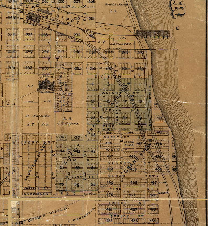
Fantastic Map of the City of Omaha, 1883. Published by George P. Bemis’ real estate agency, compiled under direction of Andrew Rosewater, City Engineer. Drawn by Jacob Hauck, Borrowed from Omaha Public Library. Depicts the whole Park Wild area with addition of Park Wild Avenue subdivided in proximity to the Kountze home and the S. E. Rogers estate. Top of map is north.
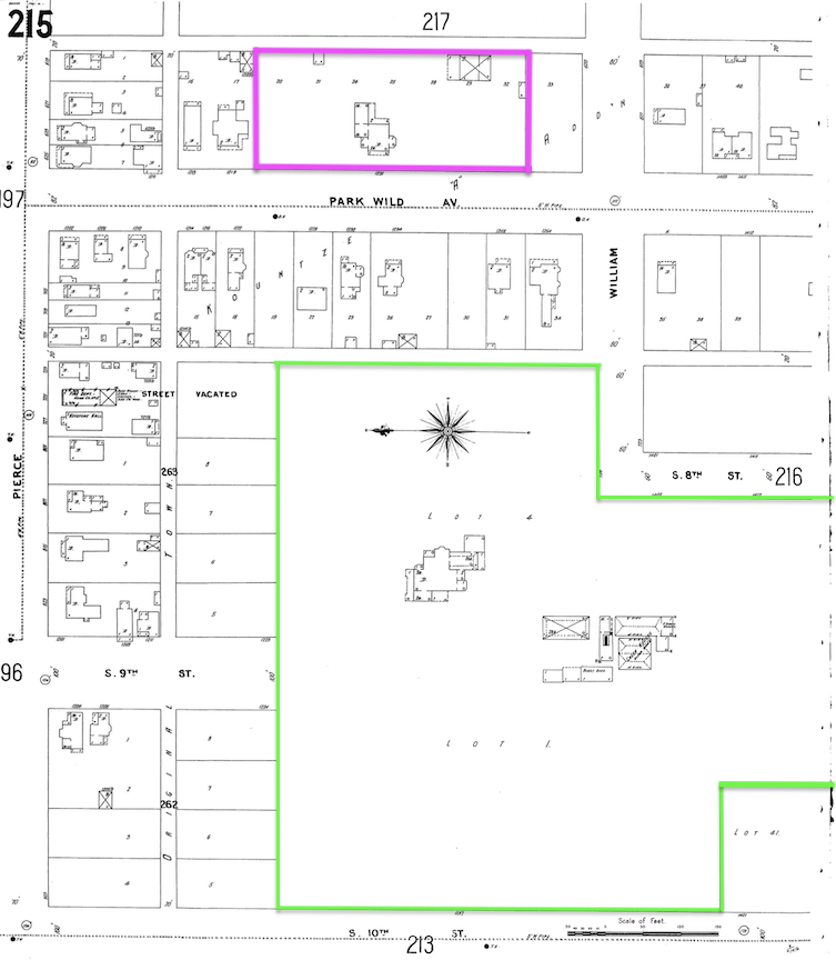
This 1901 Sanborn Map shows the proximity of the Herman Kountze estate, outlined in green, to the Thomas Lord Kimball estate, outlined in purple. If you enlarge, you can review the details of the outbuildings and the homes. This view also allows one to see the large footprint of the original homes along Park Wild Avenue. The Richard Kimball home was built just north of his father’s home, no doubt on the same parcel of family land. This large swath of Herman Kountze land merely represented his home estate. Previously Mr. Kountze had bestowed land along Tenth Street to Brownell Hall, a seminary for young women. Brownell Hall had commenced operations in Florence in 1863. The 1515 South Tenth Street school was constructed in 1886 and 1887. Following the relocation of the school to Happy Hollow Boulevard and its rebranding as Brownell-Talbot, the former structure was repurposed as a dormitory for single working women, designated as Stuntz Hall. Later still it became the Grace College of the Bible. More details to follow. 1901 Sanborn map lent by Trina Westman and Shelley McCafferty of the City Planning Department.
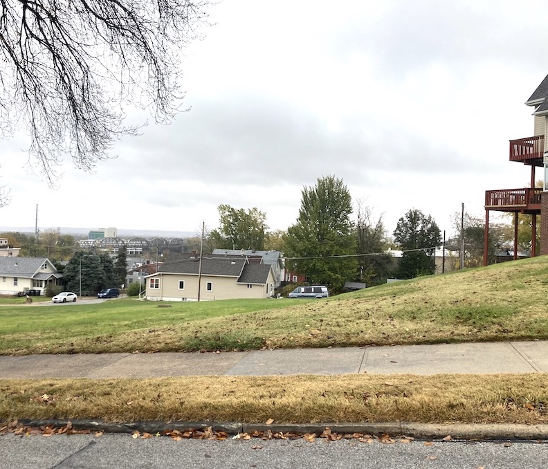
A large empty lot is all that remains of 1231 and 1235 Park Wild Avenue.
The original Gold Coast in Omaha, referenced by Margaret Patricia Killian, has largely vanished, with just the remaining mansions along Tenth Street still standing. These exquisite homes are outside our current subject of focus, so I did not include them today, despite their beauty. Numerous historical glories are found in the Forest Hills neighborhood, and the following are a selection of them.
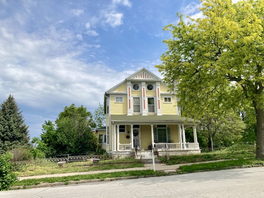
Pretty, pretty…810 Worthington Street in the Forest Hill addition, Lot 4 was built in 1892. This is a very upright Victorian home. In keeping, this was once “the Violet Lady’s house.” Worthington Street, sometimes Worthington Place in honor of Bishop Worthington (information forthcoming) was designated in 1886 and paved months later. It is in the historic registry as the R. S. Deems house of Forest Hill. More on this glorious house later.
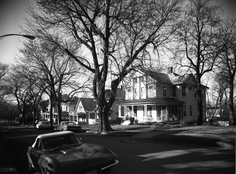
I was very pleased to find this historic image of the 810 Worthington Street home, from another angle. Some will be eyeing the Chevy Corvette parked at the curb. The string of smart homes to the west are now gone. Bostwick, Louis (1868-1943) and Frohardt, Homer (1885-1972). The Durham Museum. 1967.
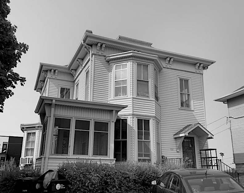
900 Forest Avenue, said to have been built 1886. A favorite! Wilhelm Segelke, a German immigrant, and his family lived at 900 Forest Avenue. Segelke was president of the Omaha Bottling Company, formerly Pomy & Segelke Mineral Water. They were a mineral water manufactory turned soda company on Tenth and Pierce.

Another one of the oldest, to-die-for homes in the area is a hop onto the next block at 1425 South Eighth Street in the Forest Hill addition. Built in 1911.
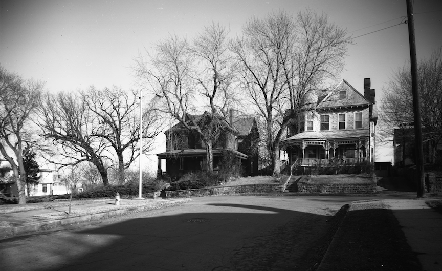
I was very happy to find a historic photograph of the 1425 South Eighth Street home from 1967. This is her on the left in a much darker shade. Sadly, the house to the right (south) is long gone. Houses at 1425 and 1427 South 8th Street. Bostwick, Louis (1868-1943) and Frohardt, Homer (1885-1972). The Durham Museum. 1967.
Amidst the beautiful architecture on the hills, were the ungraded and partially graded hills themselves. In the 1880s and again at the turn of the century, the construction of Sixth Street through the Park Wild bluffs incurred a cost of $150,000, resulting in significant property disfigurement; yet it was deemed necessary for the establishment of this essential route.
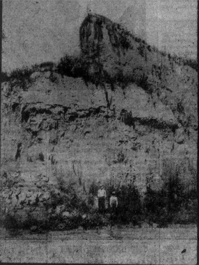
One such Park Wild bluff was designated as “Mount Blanc” by the locals, which I quite enjoyed– a fifty-foot bluff near Sixth and Hickory Streets. Omaha Daily News archive. 1902.
The Strange Case of Mr. George Francis Train
There is one Park Wild character that I have not yet delved into. The more I read about him, the further I fell into the past of this wonderful part of town. George Francis Train was already a prosperous man upon his arrival to Omaha in 1863. At that time, he resided in New York and, like many aspiring real estate investors in our burgeoning city, there is evidence that Train was attracted by the structure of the early Union Pacific Railroad. In his colorful history Train was known as a well to do merchant, having amassed wealth in shipping and real estate, an eccentric–an exceedingly talented writer, lecturer, adventurer, outspoken advocate of women’s rights, politician, world traveler, investor, who would become an international speaker and promotor of the Union Pacific Railroad and an 1872 Presidential candidate. Numerous colorful anecdotes remained unverified, like the claim that Mr. Train had promoted and displayed advertisements for Omaha, Nebraska on the Great Pyramids of Egypt. Train is known internationally as the real-life basis for Jules Verne’s character Phineas Fogg in Around the World in Eighty Days, having completed a similar journey in just 67 days, two years prior to the publication of the novel.
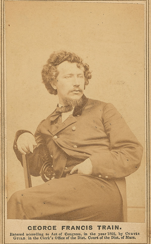
Three matters to address before we proceed: The intriguing likeliness of Mr. Train being drawn to engage in the railroad industry further substantiates our file on Those Influenced by Nominative Determinism. Mr. Train liked trains. Additionally, I picked up our Mr. Train was an Ideas Man–an innovator, a talker, and a big dreamer. We have previously covered the Specific Electrical Wiring of this personality type. The ideas come in like tornadoes and often the incredible plan has not been executed before five more brilliant ideas have begun spinning into the cyclone. Thirdly George Francis Train was known to have a beautiful, full head of hair, magnetic good looks, and piercing eyes. Combined with his verbal skills, incredible mind and supposed prosperity, I think he might have easily entranced people.
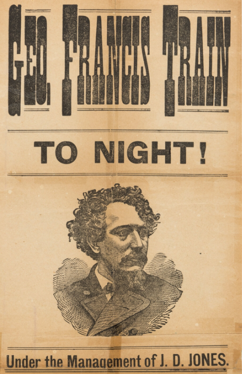
In George Francis Train’s own words, he was “orphaned in New Orleans in 1833” and moved north to live with a grandmother in Massachusetts, where he “supported self since babyhood.” Mr. Train wed Wilhelmina “Willie” Wilkinson Davis in 1851; the couple had four children, one of whom died before reaching the age of one. Train was already established in Boston’s mercantile sector, but I soon discovered that he would proceed to develop numerous other firms, creating the requisite organizational and financial frameworks for their operation many times over. Train and Willie landed in Melbourne, Australia in 1853 where Train assumed the role of local agent for the White Diamond Line. In collaboration with fellow American, former mariner Captain Ebenezer Caldwell, they imported apparel, construction supplies, firearms, flour, proprietary medicines, mining equipment, coaches, and carts. Caldwell, Train & Co. constructed warehouses at both terminals of the newly established railway lines. Willie returned to Boston to deliver their daughter, Susan Minerva Train (Gulager), born in 1855. Train departed from Australia in November 1855 to join his wife and infant, traversing through the Orient and the Middle East.
In 1863, President Lincoln appointed Omaha as the eastern terminus of the Union Pacific Railroad, the eastern segment of the nation’s inaugural transcontinental railroad. This is also the very year that Willie Train first came to Omaha with her husband, according to The Excelsior‘s reporting in 1906. She “spent a portion of her time as a resident of Omaha in the old home of Rev. Mr. Kuhns, being her place of residence.” (Rev. Mr. Henry W. Kuhns was the first reverend of what would become the Kountze Memorial Church.) In 1865 George F. Train acquired 500 acres of property in Omaha–between the river and Twentieth Street from Herman Kountze and Samuel E. Rogers under a mutually acceptable payment arrangement. He visited Omaha off and on, “making investments.” At that time, Train was at the pinnacle of his career, among other things, known as a financier for the Union Pacific Railroad, regarded as a prominent figure in Omaha and the West. I became obsessed with tracking his whereabouts.
I was surprised to find Credit Foncier of America was a financial and real estate firm established in Omaha during the late 19th century by George Francis Train. The business was established mainly to develop townsites adjacent to the Union Pacific Railroad and was founded under a special act of the Nebraska Legislature in 1866. Although associated with George Francis Train’s other enterprise, Crédit Mobilier, the Credit Foncier firm was not implicated in the controversies that dismantled Crédit Mobilier. It turns out that in 1864, Train facilitated the establishment of the shadow financing entity for Union Pacific Railroad, The Credit Mobilier of America, whose primary executives were identical to those of Union Pacific, despite its appearance as a distinct, autonomous firm contracted by Union Pacific. Train and others established a framework that enabled them to achieve substantial profits throughout the railroad’s development. The narrative regarding this fraud and legislative corruption was unveiled in 1872 by The Sun, a New York newspaper that opposed the re-election of Ulysses S. Grant for the presidency. The scandals ultimately led to legislative and executive government investigations that implicated several legislators, including James Garfield. Somehow George Francis Train walked away unscathed.
“Nebraska, Cottages and Train,” was a slogan Mr. Train adopted early in 1866 as he acquired titles and began building in Omaha. It is worth mentioning, he was also known to call himself Citizen Train which only endeared him to me. Citizen Train, our George Francis Train’s self-named alter ego predates Orson Welles’ 1941 movie, Citizen Kane about character, Charles Foster Kane. Certain biographies of Welles suggest that he served as an inspiration for the role, but I posit that Citizen Train was partial shadow influence for Citizen Kane.
1878.
As president of the Credit Foncier, Train was said to have “organized to ‘profitably dispose’ of the Union Pacific’s land grant acreage. The company owned almost 5,000 lots in Omaha.” During this time, Train built a hotel in Omaha in the summer of 1867 and immediately leased to Mr. Cozzens of Cozzens Hotels, New York. Upon more investigation, I discovered that Mr. Train constructed several hotels in Omaha during this time frame. He also developed a plot along the southern periphery of Omaha, initially designated “Train Town” in honor of himself but shortly after, called the Credit Foncier Addition. The Credit Foncier Plat is one of the earliest plats filed in Omaha, if not the earliest, platted in 1867. This addition remains in the city records. Irrespective of names, this culminated in Train obtaining a small fortune from the selling of his buildings and unoccupied parcels to new settlers. My contact at the Douglas County Assessor’s office believes that George Francis Train’s railroad workers’ cottage dwellings remain dispersed around tonight’s investigation and surely represent some of the oldest residences in Omaha, although we cannot substantiate this claim. One residence believed to be of Train’s original Train Town is among those the county has recorded as constructed in 1866, located at 519 Hickory Street. (Previously displayed in my photo collection Poke-About.) It is suspected that many of the smaller houses in that area were built at this same period, however the county’s records indicate they were erroneously erected in the 1880s.
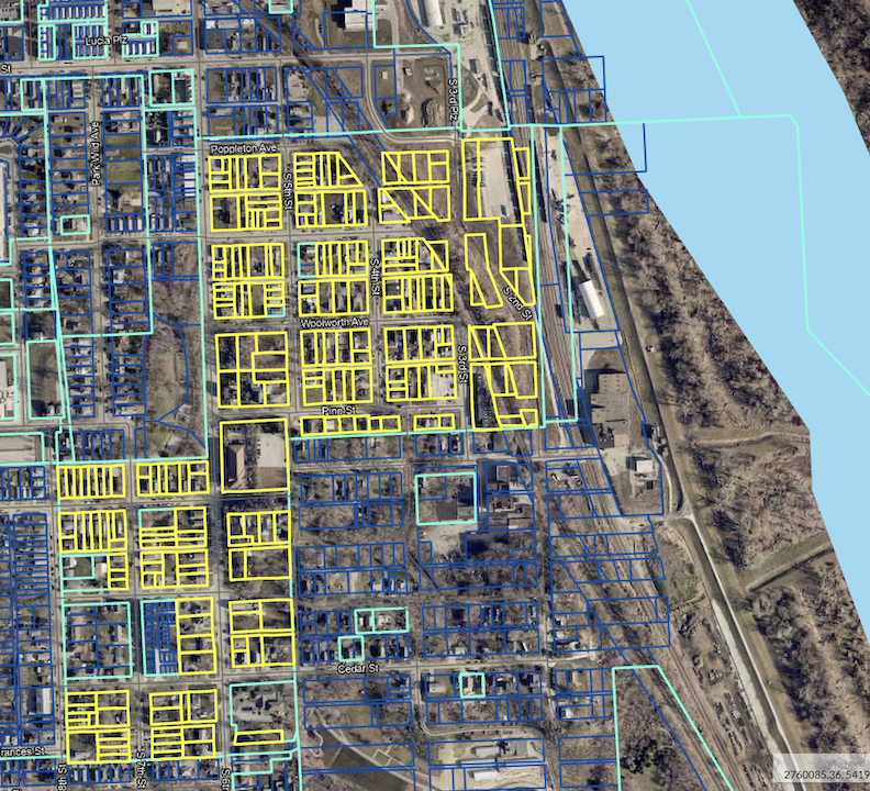
Credit Foncier Addition as seen on the Douglas County Assessor site. Credit Foncier Addition—8th Street to Frances Street to 5th Street to the train tracks/river, to Poppleton to 6th Street. The Credit Foncier Addition is all that is left of the Train Town dream, 20 blocks by 20 blocks. According to record, Mr. Train later sold his lots in Credit Foncier addition to the City of Omaha.
Regardless of its veracity, whether fact, fiction, or myth, I discovered that further details regarding the notoriety of George F. Train were disclosed in Their Man in Omaha: The Barker Letters, Volume I, 1860 to 1868. These were correspondences exchanged between the Barker and Martin families. From May of 1966: “There are a number of good private residences and an increase of smaller neat pine ones. I see quite a number of smaller ones going up around. Also, two or three that are to be large handsome bricks, George F. Train is here and said to be connected with Durant the head of the railroad and he has got up a scheme or Company for building on some land got from Rogers and Kountze to build 100 neat pine cottages of 4 to 6 rooms.” In other passages it is explained that Train had formed a Cottage and Land Company in Omaha. “Train is Durant’s great friend—and seems to be a partner with him—Durant is Head of the Rail Road here—Train has also bought 300 acres of Lands all round South Omaha on the west and back of Kountze and Rogers. (…) he is trying to be one of our Senators if Nebraska becomes a state. He is a great man here. There are 60 acres in his Cottage Company [the Credit Foncier] and 200 shareholders. He has sold all of the shares—they are $1000 each with 15 per cent paid on them. He has got some of the best of Eastern Capitalists into it and he is the sole agent and manager. He is trying to identify himself with the Pacific Railroad idea.”
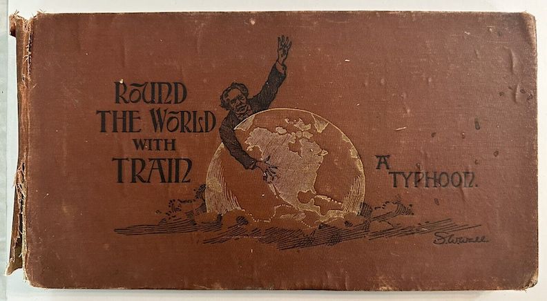
Round the World with Train. A Typhoon. 1891. An account of the round the world trip of George Francis Train, written and photographed by his private secretary, Samuel W. Wall.
Five years after the acquisition of 500 acres from Herman Kountze and Samuel E. Rogers, with only $38,000 remitted by Train, Mr. Train and his secretary, Mr. George P. Bemis (who was later revealed to be a nephew), seemingly traversed Europe extensively. Is it accurate that Mr. Train was imprisoned in Dublin prior to his departure for France? Affirmative. It is reported that Train experienced approximately 17 incarcerations throughout his life, prompting me to question whether these were psychiatric hospitalizations? During his 1870 European travels, the fabulous Mr. Train is said to have met the emperor of Russia and purportedly convinced the Queen of Spain to support the construction of a railway in the remote areas of Pennsylvania. Her assistance facilitated financing for the Atlantic and Great Western Railroad. He advocated for and constructed tramways in Britain. It was exhausting and exhilarating just thinking of it. But it was during this time that Kountze and Rogers seized the Omaha land and from it sold a number of valuable parcels, on mortgage foreclosure proceedings. Attorneys in New York and Omaha were retained and the land in dispute were outlined roughly as Second Street and Poppleton Avenue, to Seventh Street, excepting the residence and ground around Mr. Kountze, south to Center, to Twentieth, to the south-west corner of Rogers’ plat. The Omaha property was foreclosed on by Kountze and Rogers while George Francis Train was incarcerated in the Tombs Prison in New York in the winter of 1872-1873.
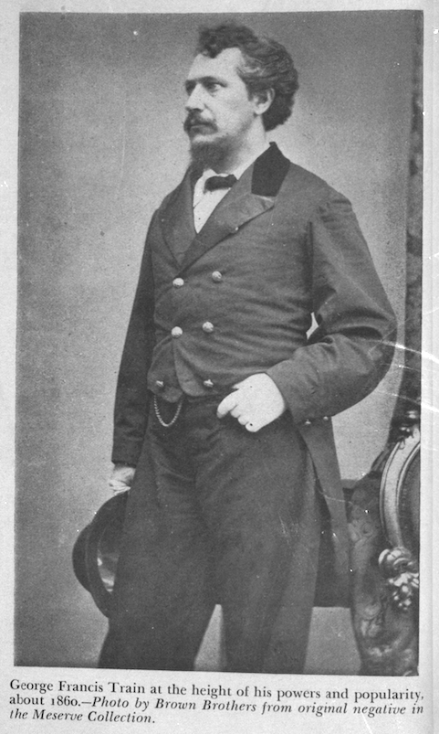
What with all of his travels and adventure, they say Mr. Train did not actually move to Omaha until 1871 and soon after launched the first Omaha Horse Railway. I question the late date. Other histories report the streetcar transportation commenced in 1868, when the Omaha Horse and Railway Company initiated horse-drawn streetcar service. South Sixth Street and South Thirteenth Street were among the initial horse-drawn car lines.
I could not find Mr. Train’s home. “Train built a home overlooking the river at Seventh and Pine Streets, the current location of Dahlman Park.” Was that true? Another local historian in town believed George Francis Train’s house was built on the site where Dahlman Park is now…but no more details. An article of 1891 referred to the old George Francis Train house then being occupied by a Mrs. George B. DeForest. I could not find his property within the historic Sanborn Maps, but his home was featured in the “Map of Omaha City” included in Their Man in Omaha- The Barker Letters: Volume I 1860 to 1868 where I would see a depiction of his large landholdings and his estate. An orange arrow points to the substantial footprint of his residence, depicted in Surveyor Oscar F. Davis I’s 1866 map shown below.
The 1870 United States Census recorded (Mystery) Train living in Omaha with his nephew George P. Bemis. Unfortunately census takers did not enter addresses in those days, although this official did document, perhaps, a dynamic discussion in real time. Mr. Train was listed as a “Statesman;” interestingly, that profession was crossed out and “Lecturer” was penned over it. While Mr. Bemis had initially been logged as “Private Serv of G. F. Train,” that too was crossed out with “Clerk” written over it. Absent from the Nebraska census was Wife Willie Davis Train, daughter Susan Minerva Train Gulager or sons George Francis Train and Elsy Mchenry Train.
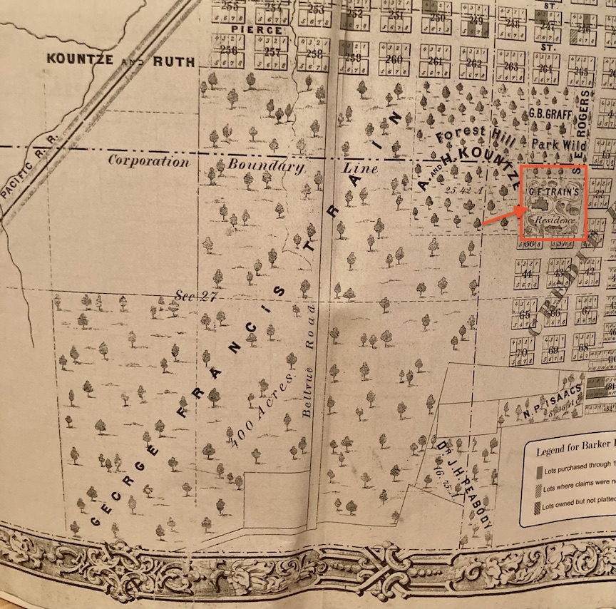
G. F. Train’s private residence of 1866, outlined in orange. Directly beneath that rectangle is the beginning of the words “Credit Foncier addition,” which cut on a diagonal to the east of the map. Also directly to the southwest of Train’s personal property is the large, treed, “400 acres” labeled George Francis Train. “1866 Map of Omaha City” was included in Their Man in Omaha- The Barker Letters: Volume I 1860 to 1868.
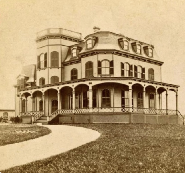
I was happy to find this photograph. Apparently in 1869, Train constructed his summer residence in Newport, Rhode Island, referred to as Train Villa. If this was his idea of a summer home, what might his Omaha getaway have looked like?
The last years of her Willie Davis Train’s life were spent at home of her father in New York where she died in 1879 at the age of 46. I found next to nothing about George Francis Train in her obituaries except their early life together and their children. Was I correct in assuming they were separated by Victorian standards?
George F. Train’s final visit to Omaha was in October 1893, during which he delivered speeches at Boyd’s Theatre for a week.
It is rumored, and documented, that as Citizen Train aged, he became increasingly eccentric, initiating and adhering to several peculiar fancies. Now one of these was quirks was vegetarianism, so take these peculiarities with a grain of salt. The story is that in his final years, Mr. Train sat in Central Park, New York, distributing dimes and conversing solely with children and animals. On January 5, 1904, Train succumbed to heart failure in New York. At the time of his demise, he resided in a “cheap lodging house” called the Mills Hotel, where his rent was 30 cents a day. He wrote incessantly. George Francis Train, formerly a prolific creator of great wealth for himself and others, passed away in destitution. Friends of the family said, “the once vast estate is nil and that his only valuable asset is his claim against the City of Omaha for the land upon which it stands.” Train’s heirs would launch a federal suit to obtain possession of then 500 acres of “valuable city property in Omaha covered by streets, homes and buildings of various kinds.” The property was estimated at $30,000,000 by 1904 money and was bounded by the Union Pacific tracks, Twentieth street, Vinton Street, and the Missouri River. Train’s heirs stated he “was declared a lunatic by the New York courts and no provision made for the protection of his property rights.” Mr. Train’s youngest son, Elsey McHenry Train, explained that they did not want to cause their father distress or embarrass him by the national publicity, had they begun proceedings while he was still alive.
I discovered a book he dictated in this timeframe, “breaking my silence (…) in my little corner in the Mills Hotel,” called My Life in Many States and in Foreign Lands. I couldn’t help but conjure Charles Bukowski holing up, as he was fond of saying. Train’s was an Intriguing Book. “Omaha… owes its prosperity directly to the Union Pacific Railway.” Despite Omaha’s brief mentions in the book, I found no descriptions of a Train residence in the city.
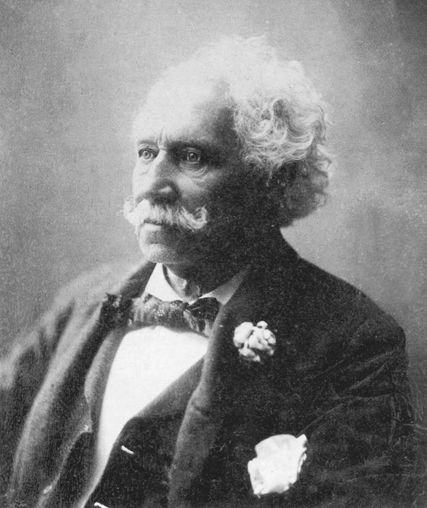
Mr. Citizen.
Train Elementary School
While Mr. George Francis Train was still alive, the 1893 Omaha Schools’ officials agreed that “the new Hickory School being built should be called the Train School.” Opened in May 1894 at the intersection of Sixth and Hickory, this gorgeous, symmetrical, two-story, brick school was later given her 1615 South Sixth Street address. Fortunately, this resilient beauty still stands.
I took this in the fall of 2024. This portion of the school is the original structure.

The Train School once had gorgeous cast iron grillwork above its entry. As we can observe the entry recessed into an alcove with glass doors and glass windows to the sides and above. Lovely elaborations. I wonder what happened to it? Photo by Savage, John. The Durham Museum. 1943.
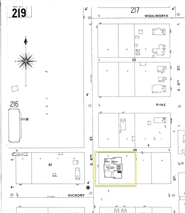
1901 map displays the Train School footprint outlined in yellow. The front elevation of the stately building faces west on South Sixth Street. 1901 Sanborn map lent by Trina Westman and Shelley McCafferty of the City Planning Department.
The original George Francis Train School was encircled by some of the incredible, rugged, steep bluffs of Park Wild described earlier in our investigation. (These are not clouds viewed in the background—retrieve your magnifying glass and marvel!) The George Francis Train school classrooms quickly filled up with 55 students per room, leading to the Board of Education’s acquisition of adjacent deeds to the north in 1901. The Board of Education must have recognized what they were up against in purchasing the northern lots for school expansion, as the mound exceeded forty feet above grade—a great expense for the school district to grade.
The 1902 photograph, viewed above, reveals the once massive ungraded bluff to the north of the school. Omaha Daily News archive. 1902.
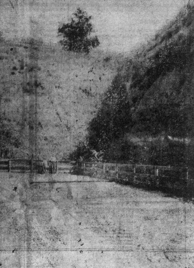
Notably Train school had previously scooped into one of the mounds in creation of their playground, described as a forty-foot scoop-out into the hillside in the back. This photo was described as the “playgrounds of the Train School.” Omaha Daily News archive. 1902.
When George Francis Train died in 1904, the children of the Train School displayed their flag at half-mast.
Movable, frame annexes were constructed until the grading and a proper expansion was made to the northern side of the structure years later. Children were taught in “a row of wooden houses before the school system tore them down” and completed the expansive brick addition to that north end. Train Elementary was the quintessential neighborhood school of the past, catering to the expanding Little Italy district and adjacent blocks due to its strategic but tucked-in location. Although the building had served 90 strong years, with the ability to educate 560 students, it was decided that Train Elementary School would cease operations at the conclusion of the 1983-84 academic year. “Decreasing enrollment” in Omaha schools overall and a significant restructure of district schools in the mid-1980s (and possibly shadowy motives—such as targeting older Omaha neighborhoods, catering to West Omaha expansion and “new” buildings), were cited as causes. In the Fall of 1984, the Omaha School District transferred ownership of the building to the Santa Lucia Festival Committee for the purpose of establishing a clubhouse and a local community center. By the summer of 1985, the Alpha School initiated on the second floor and was prepping to launch their program. Alpha School was a state-run (although now I believe privately funded) day treatment center for students with behavioral and emotional conditions and learning disabilities.
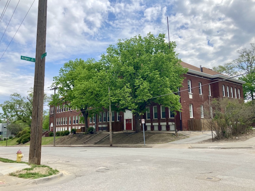
I took this in the spring of 2024; camera angles northeast, showing the addition to the north end.
Side Note on Sixth and Pine and the Wild Bluffs
Through the 1890 Evening World Herald, I discovered a strange plan. The Missouri Pacific Railway was contemplating relocating its St. Louis headquarters to Omaha. When the Missouri Pacific was anticipated to forfeit its office lease in St. Louis’ Equitable Building, the company commenced exploring a potential building site at Sixth and Pine Streets in Omaha. (!!!) In my assessment of this corner, this incredible vicinity, and particularly its jarring elevation, was shrouded challenge, and dare I say, mystery. Perhaps due to its incompatibility with conventional city planning. This Sixth and Pine plan did not materialize, evidently, although Jay Gould’s Missouri Pacific Railroad was connected to the Omaha Belt Line, which transported passengers and freight. We have seen the Omaha Belt Railway in our other cases.
The strangeness of Sixth and Pine would resurface. It is weaved through this investigation as we continue to look at what is now called Dahlman Park. In 1889 and 1890 the city began to lower the grade of the streets or to carve out a new street. (Sixth?) I was unclear. Andrew Flood owned a property (lots 3 and 4 in block 38) to the east of Sixth and Pine, which, due to the recent grading, was left with a home “perched on an eminence of sixty feet above the road.” Because the city had initiated this street project but then abandoned the proposal, the result was this substantial earth mound around forty-five feet high adjacent to property owned by Flood. Andrew Flood brought a $7,000 damage suit compelling the city to grade down the bluff and lodged a complaint against the city for maintaining an additional strip of dirt measuring 132 by 20 feet adjacent to his property. As of 1895, Flood was wanting to cart the jurors up into the hills of Credit Foncier. Ultimately Mr. Flood was awarded $350.16. “The city refused to lower a strip it owned, and which surrounded his land.” Of note, Mr. Flood again brought a case against the city after being struck and thrown from his wagon by the city line. He failed to hear the approaching car due to his winter apparel/earmuffs. He lived to tell, bring suit and continue giving the city hell.
The next time you are able, drive down to Sixth and Center Street. First, wave “hello” to the fine people of Traco Painting and Wallpaper, then proceed north along Sixth Street. Experience the differing elevations on either side of the street, especially just north of Sixth and Hickory (my favorite) and contemplate the effort, time and money required to literally carve out this early thoroughfare. It is asserted that between the 1850s and 1890s, Omaha expended an exorbitant sum to grade these city streets. In the early 1900s, there was suspicion that Omaha could have conserved significant resources had A. D. Jones not been determined to adhere to a certain city grid, rather than following the natural topography.
This incredible photograph is not from our area of case study, but it highlights in a strong, narrative way Omaha’s once rough and rugged terrain and the determination and strangeness of its early settlers. “Washington Hall, with a public dance hall on the top floor, stands at 410 South 18th Street. A man in the center of the intersection at Seventeenth and Harney adjusts carbons in an arc light.” Photographer: Bostwick, Louis (1868-1943) and Frohardt, Homer (1885-1972). Publisher: The Durham Museum. Date: 1898.
Another illustration of the remarkable topography in this area was the distillery story. Willow Springs Distillery, dating back to 1866, at Fourth and Pierce Streets, had asked the city to fill and grade the intersection so that wagons could drive up to their establishment. A daunting delivery before this plea. The large factory would later be taken over by Metz Brewery. Reestablished as Fontenelle Brewing Company in 1933 following the repeal of prohibition. Subsequently, it was reestablished as Metz Brewing from 1938 to 1961.
Mystery, Lot Number Three
Esteemed Readers and Colleagues in Investigation,
We have undoubtedly hiked Park Wild front and back and all around, and now…now, I’d like to show you something peculiar. Something that will draw us all up another hill towards the construction of 1503 Park Wild Avenue.
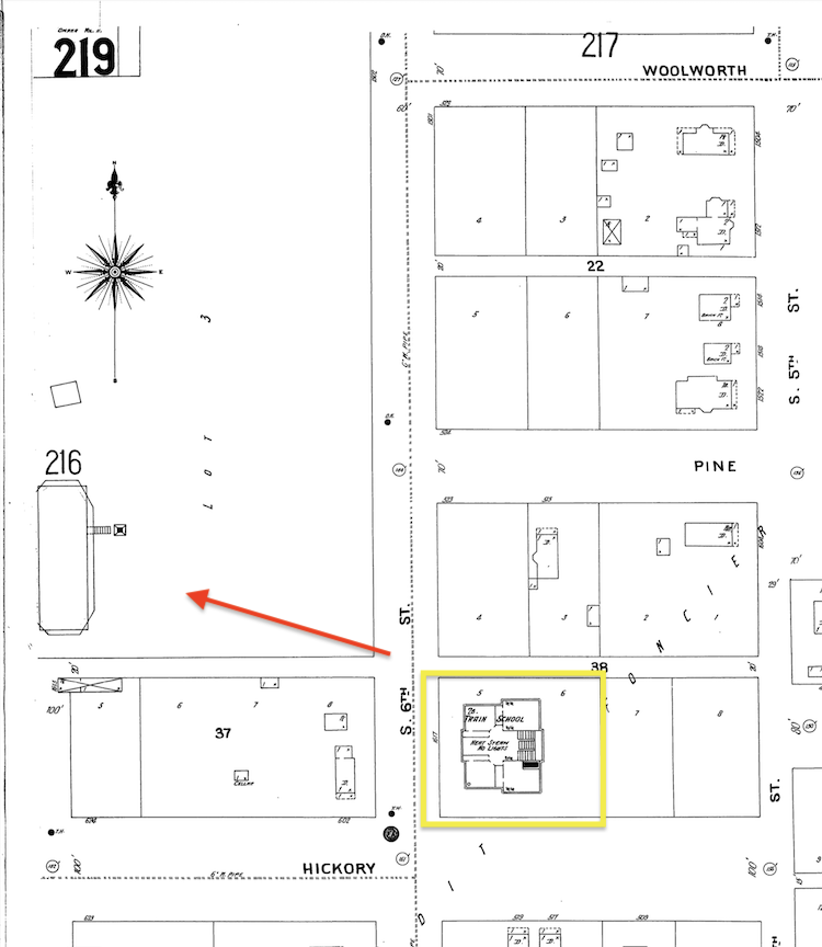
Note the compass rose. Some of you sly sleuths already caught this. If we magnify the 1901 Map again, find our bearing at the yellow outlined Train Elementary School and gaze up the hill to the west (red arrow is there to guide you) at what is now the Dahlman Park area, we will see a large footprint of a building. This large lot is not yet Dahlman Park, for those who wonder. Little steps (?) are shown descending the building. There is an adjacent building and the words “Lot 3” on the whole of the parcel. 1901 Sanborn map lent by Trina Westman and Shelley McCafferty of the City Planning Department.
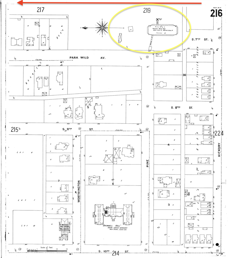
Orientation of the map has changed. Here is a companion 1901 map, another view. I placed the red arrow pointing north, where Sixth Street ran alongside to the east. However, there was a large portion of this land between what is depicted in this map and where Sixth Street bordered. Dahlman Park is now located there. I put a yellow hoop around the building which is across the street from Train Elementary shown on the previous map. This once large building, long razed, is depicted with steps or some form of passageway from north-south running Park Wild Avenue. At first, I was excited to think this might have been the home of George Francis Train. When I used my magnifying glass, I could read that this was a brick yard house, enlarged below. There also appears a Mystery 3 on the property, within the yellow hoop, near street side. 1901 Sanborn map lent by Trina Westman and Shelley McCafferty of the City Planning Department.
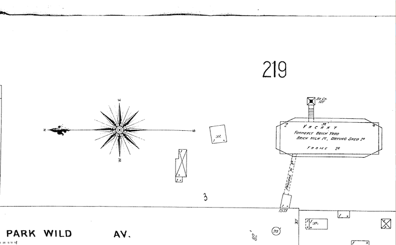
Magnified. Note the compass rose. The fine print read: “VACANT Formerly brick yard/ brick kiln 1st, drying shed 2ndframe building.” Also—“3.” The 3 is connected to the previously view Lot 3 designation. When I enlarged more, I could read that the brick kiln, building #1 was directly off of Park Wild Avenue with a connection to the drying shed, building #2. There were also two outbuildings. Why was a brick yard right in the middle of a neighborhood? Vacant. How long had it been sitting empty?
I learned early on that due to Omaha’s absence of strong, solid trees for frame construction and the expense of transporting large and heavy building material restricting the availability of specific woods, one of the initial commercial endeavors was a brick yard. Bricks were produced rapidly in Omaha, leading to the emergence of numerous brick yards. Benjamin Winchester established his brick yard factory as early as July of 1854. Many more followed.
H. Seymoure & Co. built their brickyard in 1857, on “the most eligibly situated of any that we have ever seen.” The clay was dug and shoveled immediately into the temperers, and then “into the machinery for moulding. The water is carried in pipes along the foot of the bluffs and so arranged with spouting and stop cocks as to be turned on or off at pleasure. They have a large area for the yard machinery capable of moulding thirty thousand and upwards per day.” Nebraskian, May of 1857.
I would explore Patrick & Graff’s steam brick yard from 1867 as a possibility. Given that this business was the surnames of both families previously investigated (J. N. H. Patrick and Dr. George B. Graff) from the Park Wild region, I was certain this may be the abandoned brickyard illustrated on the map. Patrick & Graff’s brick yard, at the foot of Pierce Street, on the railroad, “the yawning hill whence the clay is taken, the spacious house and complicated machinery that mix the clay so fine, descriptions of the kilns. In this case a “yawning hill” is a metaphorical term for a hill characterized by a broad, open slope, resembling a vast “yawn,” suggesting a “steep drop” or a notable shift in elevation that appears striking. If one has set foot in the strange Dahlman Park, I cannot conceive of a more apt description. However, the reference to Pierce Street as being “on the railroad” seems incongruous.
Mr. Guion’s brickyard business, reportedly nearby, was a rival enterprise to Patrick & Graff’s. This vacated brick yard may have been his formerly prosperous business. Ultimately, I could not comprehend why a business would construct a brick house in such proximity to Omaha’s first Gold Coast area. Another perplexing aspect was that George Francis Train’s enigmatic residence was allegedly situated in this same region.
Another clue and question about this large empty swath of land is taken from significant anecdotal evidence that suggests that Dahlman Park, then unnamed, located at Sixth and William Streets, served as both a recreational hub and a meeting place for the early inhabitants and the Little Italy community. The park at the southernmost extremity extends between Pine and Hickory. Was the area utilized solely on the northern edge when it functioned as a meeting place? This would require additional examination. Please put a pin in your field notes’ map.
The 1419 and 1421 Park Wild Connection
If we persist in our side hobbyhorse of the brickyard building for a minute or two longer, we must orient ourselves and examine neighboring homes for context. 1503 Park Wild Avenue, the (eventual) focal point of this investigation has not yet been built. But below I show the map of the soon to be home site and its surrounding area to display several oddities.
The most evident conclusion was that 1503 Park Wild Avenue was not the original historic residence in this location, as I had initially presumed. Despite being a historic residence, 1503 Park Wild Avenue did not embody the manor house of my aspirations. She had been built right within a functional, stable neighborhood.
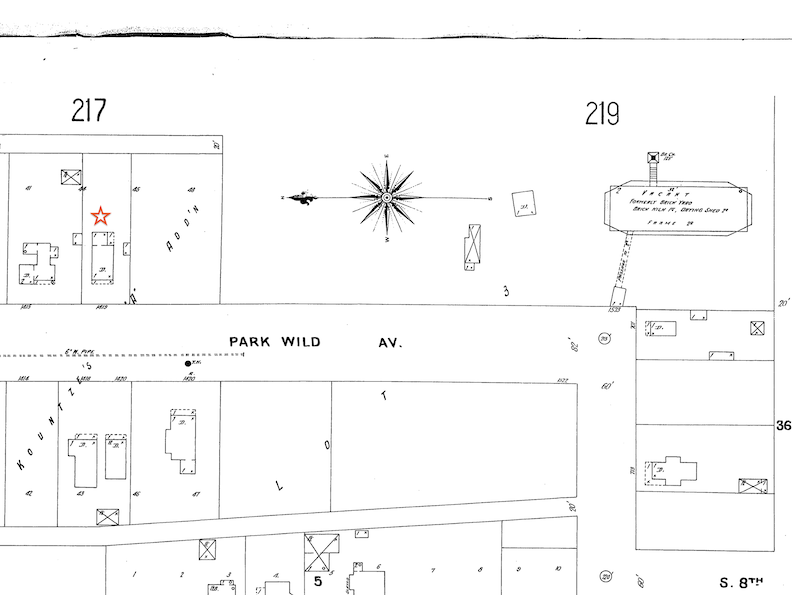
Red star on the 1901 map shows 1419 Park Wild Avenue, the oldest, closest property to 1503 Park Wild Avenue, according to this drawing. However, the city has on record that 1421 Park Wild Avenue (not shown on the Sanborn Map) was built in 1893. The parcels and residential footprints shown on the map are part of the A. Kountze Addition, sometimes late called Kountze’s “A” Addition. It was confusing to me as I had thought this real estate development was named for Augustus Kountze. What are not yet developed and therefore not depicted are the Park Wild parcels. These lots were said to be “covered with fine, large trees.” This must have been gorgeous atop the southern Park Wild Avenue strip. 1901 Sanborn map lent by Trina Westman and Shelley McCafferty of the City Planning Department.
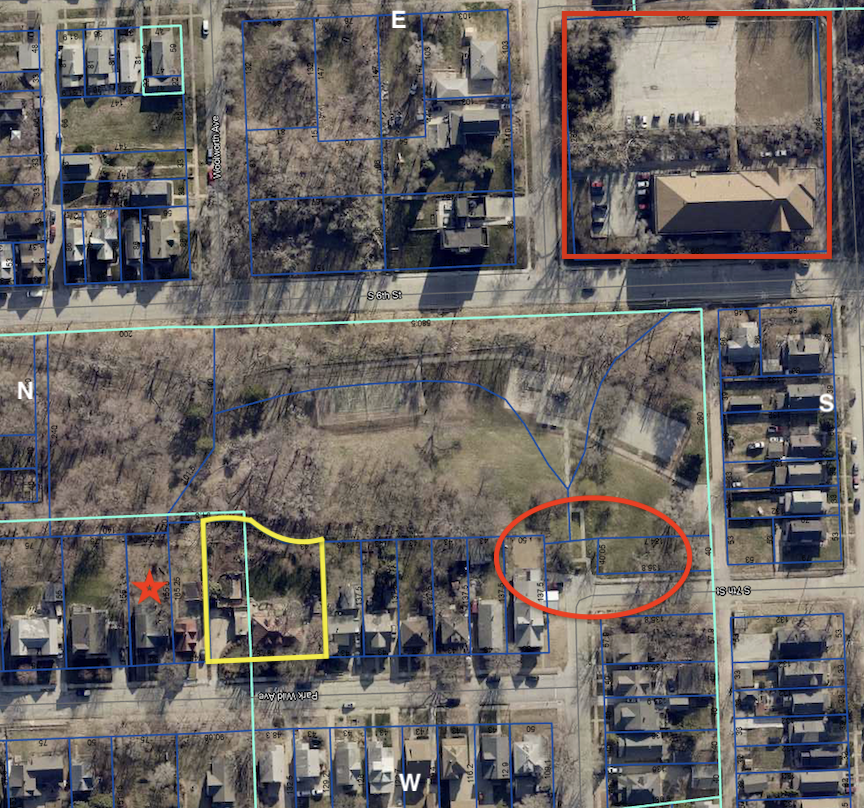
2024 aerial photograph. Cardinal directions denoted by white initials. The Mystery Lot 3 is viewed as Dahlman Park. Sixth Street to the east of the park, runs between the park and Train School, outlined in red. 1503 Park Wild Avenue is outlined in yellow. An odd-shaped parcel– as you might remember it is made up of three lots from two different additions. I placed a red star on the 1901 map (previous) to show a property to the north with a postal address of 1419 Park Wild Avenue; likewise, here it is in the 2024 aerial map. 1421 Park Wild currently stationed between our 1503 and 1419 was not yet built at the time of the 1901 map and it appear that a portion of its parcel, which was large, was used for our 1503 property. I put a red oval around where the brickyard building vaguely was located in 1901–my best estimate. This view also reveals, for the uninitiated, that East-West running Pine Street, a bookend to Park Wild Avenue, connects a slight jog in the road and the continuation of South Seventh Street. All rather strange…and wonderful. 2024 aerial courtesy of the Douglas County Assessor’s Office.
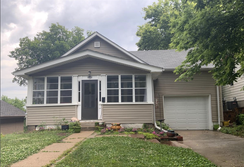
1419 Park Wild Avenue is our Red Star Queen. The city attributes her origins to the 1883. Kountze’s A Addition, Lot 45 Block 0. Obviously, she has been altered, as evidenced by the garage and its roofline. In 1884, the G. G. White family referred to their residence as a “large cottage” featuring a “farm-sized kitchen.” Two doors to the north of 1503 Park Wild Avenue. Photo courtesy of the Douglas County Assessor’s Office.
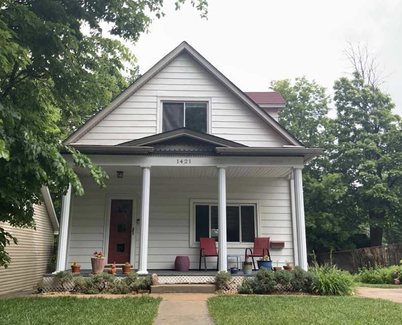
1421 Park Wild Avenue, one door to the north of 1503 Park Wild Avenue, was built in 1893, according to city records. (However, the History Properties and Surveys report stated this home was built in 1905.) Kountze Addition, Lot 48 to be specific. Perfection. I love this house. Lot 48 of the Kountze’s A Addition was split in two. Oddly 1503 Park Wild is made up of a portion of parcel 48. We have seen this before, not to worry, although it did complicate things.
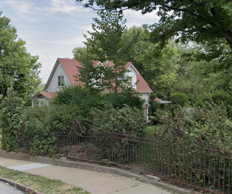
Another wonderful angle as it reveals her great dormer windows on the southern side. 1421 Park Wild Avenue observed descending the steep hill. The wrought iron gate of 1503 Park Wild roughly adjoins the 1421 property, separated only by the intervening driveway, resulting in an intriguing juxtaposition. What was the reason for their shared lot?
Charles B. Kountze owned the southern half of lot 45—our little Miss Red Star (1419 Park Wild Avenue) and lot 48 (1421 Park Wild Avenue), a portion of which would later become 1503 Park Wild Avenue. Charles B. Kountze was then president of the Colorado National bank and member of the famous Kountze family of bankers. This Kountze A Addition/A. Kountze Addition property was developed by brother, Augustus Kountze. It is highly possible that Charles was managing the Kountze real estate holdings of Omaha while living in Denver. When Charles Kountze died in Denver in 1911, he was categorized as “one of the richest men in the west.”
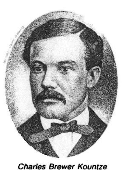
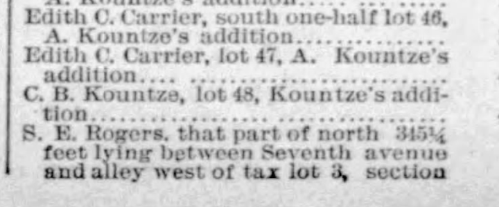
April 16, 1891. Evening World-Herald. This article listed the lot owners of Park Wild Avenue from William to Pine in 1891.
After seeing this listing of “S. E. Rogers,” I would tiptoe after Samuel E. Rogers and his ties to the mysterious Tax Lot 3, lying east of Park Wild Avenue and Tax Lot 3, lying east of the intersection of Park Wild Avenue and Pine Street.
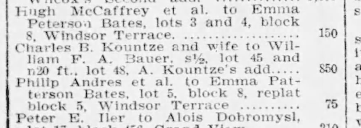
Charles and Mary Kountze sold the southern half of lot 45 and northern portion of lot 48 to William F. A. Bauer. March 30, 1907. Evening World-Herald.
I tracked the Bauer couple. In 1886 William F. A. Bauer and Annie Meyer were married. Both were born in Germany, met, and married in Omaha. He was a carpenter with the Union Pacific Railroad and the couple lived at 139 Center Street. Was this an investment for the Bauers? I did not find that they ever moved to Park Wild Avenue.
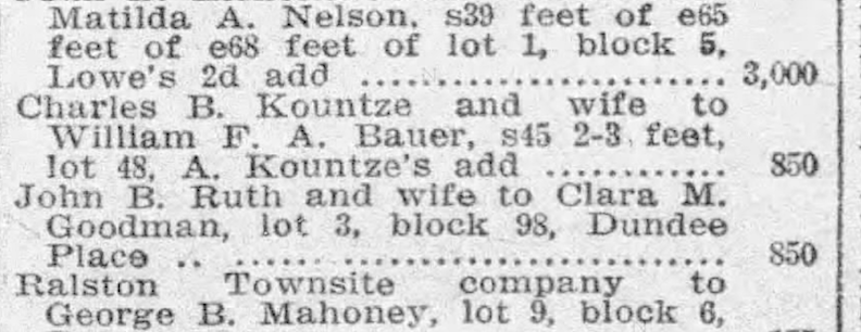
Three years later Charles and Mary Kountze sold more of the land to the same couple, the William F. A. Bauers. March 1, 1910 Evening World-Herald.
Park Wild Addition
Brick sidewalks were installed on Park Wild Avenue in 1909 and in May 1913, the Water Board of the City of Omaha announced plans to install a pipe down Park Wild Avenue, extending south from William Street to Pine Street, and subsequently west along Pine to the main line at Eighth and Pine. Modernization was traveling up hill. As stated earlier, the Rogers Real Estate Company, directed by President G. Sam Rogers, submitted the Park Wild plat in 1913. I would later learn that G. Sam Rogers was the only child of S. E. Rogers, who owned the substantial residence and estate depicted on the earlier 1866 map of Park Wild. I also noted the connection of Lot 3 and the adjacent S. E. Rogers’ property while tracing the Charles Brewer Kountze breadcrumbs.
January 2, 1914. The Omaha Evening Bee.
The new Park Wild Addition was to be bound on the east by Sixth Street, on the south by Credit Foncier Addition, on the west by Forest Hill and A. Kountze Addition, and on the north by Block 236 of the “Original City.” Interestingly the plat was submitted to the City Council on January 20, 1914, but was rejected. The concept allocated park space on the west side of 6th Street, about 580 feet south of Woolworth Avenue. Furthermore, the proposed park area was situated sixty feet above the graded Sixth Street and, in the city council’s view, was not suitable for park functions. An alternative plan was subsequently authorized.
November 30, 1913. Omaha World-Herald. Hastings & Heyden assumed the role of selling agency for the Park Wild Addition and commenced the construction of residences within the development. “Several old houses will be moved and will be replaced by new ones, which will change the appearance in that particular locality.”
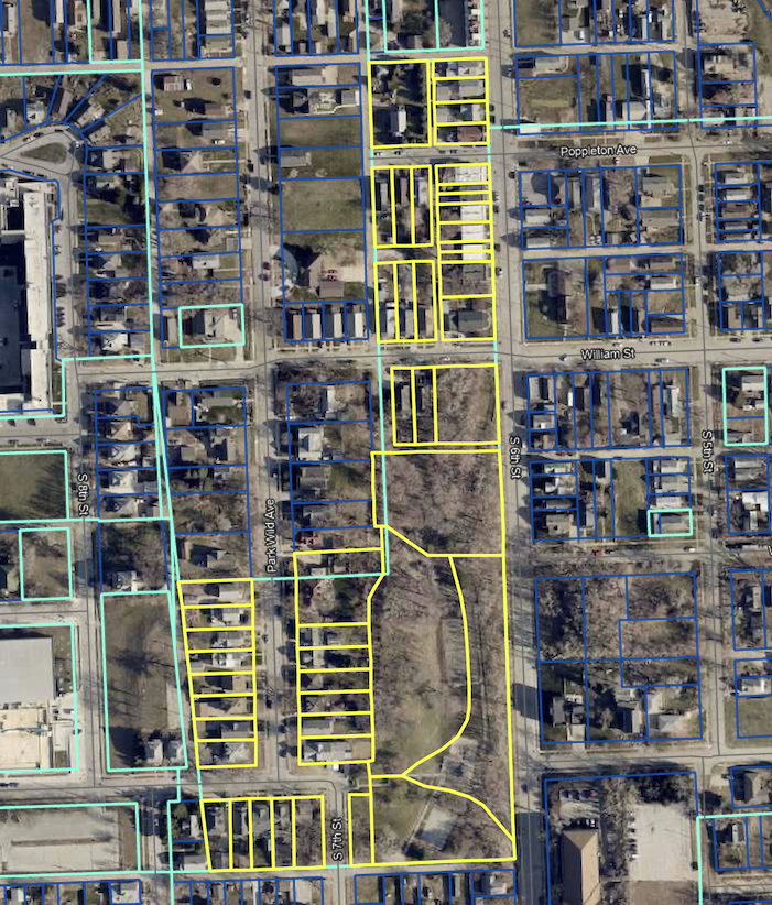
The Park Wild Addition parcels as they appear today. The lots are outlined in yellow. Strikingly only a wedge of the Park Wild Addition endcap Park Wild Avenue; the bulk of the land borders the west side of South Sixth Street. The addition extends to the alley behind Pierce on the north, and the alley between Pine and Hickory on the south–for a total of 47 parcels. Dahlman Park is also included within the addition, broken up into six curious lots. Image borrowed from the Douglas County site.
The City Council’s concern with the excessive elevation of the proposed Park Wild Addition Park area would be confronted later, following Rogers Real Estate’s efforts to market residential lots on the summit. Further details will be provided subsequently. For the time being, I present to you the intriguing announcement below. Kountze and Rogers seized George Train’s Omaha land and sold several valuable parcels through mortgage foreclosure procedures. Does this suggest that Train’s mansion may have been located near or within what would later become Dahlman Park? Still no definitive clue.
June 1916. The Omaha Daily News.
The Building Permit Clue
Friends, I cannot tell you the extent of my trials and tribulations in finding the notification for the 1503 Park Wild Avenue building permit. I will spare you the details and teeth gnashing. The problem was that the owner’s name was spelled wrong, and the address was incorrect.
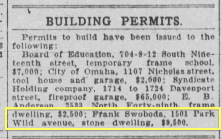
December 30, 1917. Omaha Daily Bee. A building permit application was filed and issued to Frank Swoboda for 1501 Park Wild Avenue. A stone dwelling to the tune of $9,500. A residence valued at approximately $200,000 in current currency; however, it is evident that marble or stone would incur significantly higher costs today.
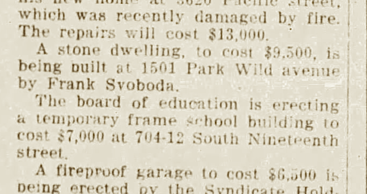
January 6, 1918. The Omaha Daily News. A week later The Daily News accurately identified Mr. Svoboda’s name, but the address remains incorrect. It is likely that the postal address has not yet been established, as Park Wild property lots were still being sold.
I consulted An Inventory of Historic Omaha Buildings. 1980. This book was prepared by Landmarks Inc. under a grant from the City of Omaha and in cooperation with the Landmarks Heritage Preservation Commission. 1503 Park Wild Avenue was part of the survey selection.
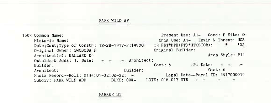
To further confuse 1503 Park Wild Avenue matters, the inventory included the Build Date as December 28, 1917; Original owner as Swoboda, F; Architect as Ballard, D. All three were ultimately erroneous, as we will examine shortly. Due to the little inaccuracies in this text, which has long been regarded as authoritative, the strange history was perpetuated.
Part of the historic confusion arose from the initial owner of our house, Frank Svoboda, being recorded as Frank Swoboda. Both are prevalent surnames of Czech origin. I would learn Swoboda is a variant of Svoboda, predominantly favored among West Slavic nations. During this time period, there were a gazillion Czech Omahans named Swoboda and Svoboda and numerous of those in Nebraska were named Frank. We very nearly had a storyline involving the renowned Swoboda Bakery building at 1422 William Street, which I was equally excited about. This building was constructed in 1889 and is on the historic registry. The Omaha Famous Czech bakery functioned in one of the lower-level bays of this fantastic structure for forty-six years before its closure in 1945. A later renovation converted the entire structure into residential flats. But this bakery narrative was not to be for this was not a Swoboda story. However, I include the Swoboda Bakery building photo below because I became obsessed with it.
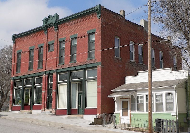
Swoboda Bakery at 1422 William Street, built in 1889. Great photo borrowed from Ammodramus. March of 2012. Everything about the building next to it including its mailbox, gate and collection of fences is storybook worthy. Someday!
Before we continue to the gorgeous 1503 Park Wild Avenue, allow me to introduce Mr. and Mrs. Svoboda. I believe this meeting will elucidate how the couple constructed a large stone house on the hill during World War I.
The Svoboda Family
Vojtech Albert Svoboda and Marie “Mary” Veskrna Svoboda were born in Okres České Budějovice, Czechoslovakia. The couple emigrated to Omaha as did their sons Frank, Albert, and Jerry. (There is evidence of other offspring who died in infancy. Some accounts indicate that Father Albert was a music teacher who passed away in Czechoslovakia.) České Budějovice is the capital of the Southern Bohemia region in the Czech Republic. An image search will display a gorgeous, idyllic, well-constructed Czech city featuring a proper plaza. The Svoboda children would later indicate on U.S. Censuses that their parents originated from Austria. This discrepancy may be attributed to boundary alterations or other political factors. Their eldest son, Frantisek F. “Frank” Svoboda, was born in September 1878 (some records indicate 1866) in Jelmo, Okres Ceske Budejovice, with an immigration year of 1905 (some places report 1906–more later). Various logs indicate the family arrived in the United States in different intervals from one another. Additional reports, such as Frank Svoboda’s Nebraska marriage license, note “Moravin” as his birthplace. Moravia is a historical region situated in the eastern section of the Czech Republic and is one of the three historical Czech territories, alongside Bohemia and Czech Silesia. After the dissolution of the Austro-Hungarian Empire in 1918, Moravia was incorporated into Czechoslovakia. This event may also explain the parents’ homeland inconsistency as well.
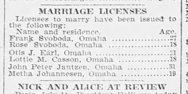
July 1906. Omaha World-Herald.
I discovered the Nebraska marriage license for Son Frank Svoboda and a Miss Rose Svoboda. The pair wed in July of 1906. Frank was listed as 27 years old. Rose Svoboda was 18 years of age, amusingly possessing the same maiden name as her married surname. A Nebraska girl from Wahoo, Rose’s parents were Frantisek Svoboda (same name as her husband) and Petronila “Nellie” Bilak Svoboda.
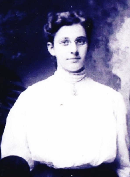
Beautiful Rose Mary Svoboda Svoboda. Frank’s wife. Photograph uploaded by W. B. Svoboda.
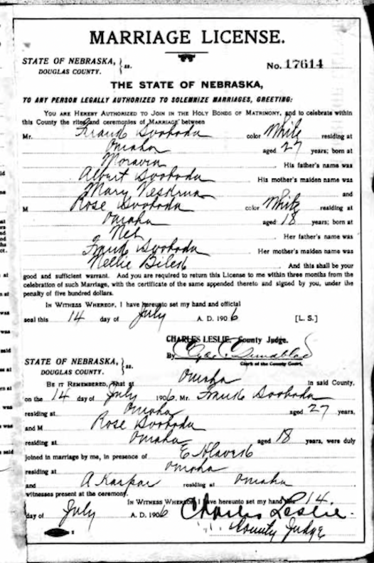
1906, July 14. The State of Nebraska Marriage Record for Douglas County.
At the time of the 1910 United States Census, Frank and Rose Svoboda lived at 1417 South Eleventh Street in Omaha. This is a great frame house, more spacious than some on this nice block. Unfortunately, this large mixed space building rose behind it in recent years, changing the view, certainly. I’d love to criticize this contemporary structure seen behind, although my several visits have revealed its excellence.
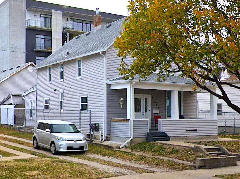
Great looking frame house at 1417 South Eleventh Street. The Svoboda’s early home is in the Forest Hills Addition and literally a hop and skip from the home they would soon build on Park Wild. I traced this home to John Reagan’s construction back in 1904. Reagan lived in the home until selling to Frank and Rose Svoboda in July of 1906. The couple knew the area well, as did all Czech Omahans. Frank’s occupation was that of stone cutter, marble worker. Frank was then 30, Rose was 21. Little daughter Sylvia was 2 and their baby son, George, just born.
Praha
Melissa Dirr Gengler found in her research for the National Register of Historic Places Registration Form for Omaha’s Little Bohemia District, that by 1900 Czechs were the third largest foreign-born group in Nebraska behind Germans and Swedes. Although enacted in 1862, the planned Homestead Acts of 1852, 1854, and 1859 attracted Czech farmers to Nebraska, which ultimately became the state with the highest population of foreign-born Czech farmers in the Union. Urban establishments such as taverns, grocery stores, butcher shops, and restaurants were created to cater to fellow immigrants in the Little Bohemia district of Omaha. Upon their arrival in Omaha, the Czechs founded the Bohemian National Cemetery, Sokol Hall, and various enterprises, so creating a self-sustaining community that flourished by preserving their culture and language. For example, Frank Svoboda, our character of focus, was featured in about a million Czech newspaper articles in Omaha, none of which I was able to read. All this to say that the Czech community thoroughly supported their various newspapers. The Little Bohemia area, historically known as “Praha,” was situated along South 13th Street at its intersection with William Street, the core of the Czech commercial district in Omaha by the early 1900s. The neighborhood emerged spanning from South Tenth to South Sixteenth Streets and from Pierce to Martha Streets, at its peak population from the 1880s to the 1920s. Currently, the most concentrated region of commercial structures is situated on the west side of South Thirteenth Street, whilst the east side predominantly features smaller buildings, with clusters of shops intermingled with residential properties or vacant lots. Dirr Gengler noted that many of the original residential lots have two houses on one lot, typical of the Czech immigrant building tradition.
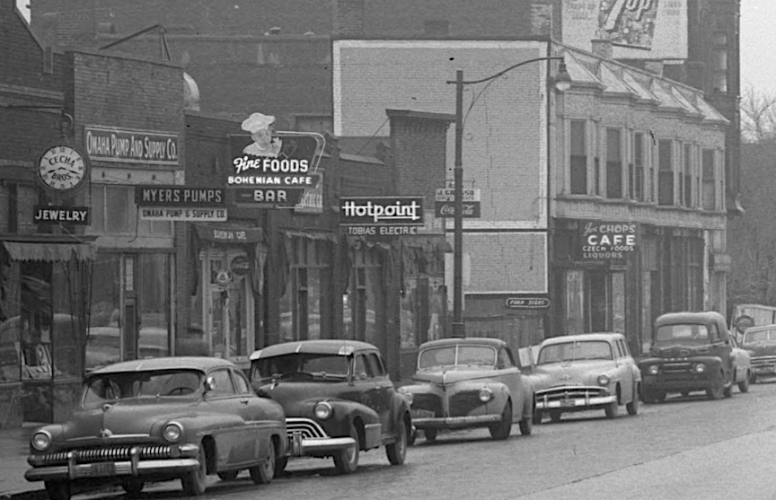
Although this photograph was taken much later in the timeline, Omaha’s Little Bohemia was still in full swing. Looking north on South Thirteenth Street from William Street. Cecha Brothers Jewelry, Myers Pumps/Omaha Pump and Supply Company, Bohemian Cafe, Hotpoint Tobias Electric, and Joe’s Chops Cafe Czech Foods. Bostwick, Louis (1868-1943) and Frohardt, Homer (1885-1972). The Durham Museum. 1953.
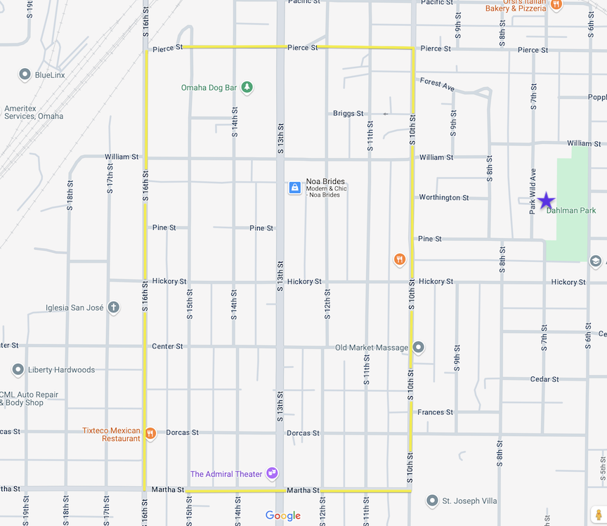
The Nebraska State Historical Society indicates that the official boundaries of old Bohemia Town or Praha, at its peak population from the 1880s through the 1920s, were defined by Pierce Street to the north, South Tenth Street to the east, Martha Street to the south, and South Sixteenth Street to the west. Image borrowed from Google Maps. I outlined Omaha’s Bohemia Town in yellow. Purple star approximately at the site of our 1503 Park Wild Avenue to the east.
Vladimir Kucera and his spouse, Delores, played a significant role in documenting and safeguarding the history of Czech immigrant life in Nebraska. Mr. Kucera arrived in the United States post-World War II, having been imprisoned by both the Nazi and Communist regimes. He contributed to the establishment of the renowned Nebraska Czech festivals, served on the Board of Nebraska Czechs, Incorporated, and authored several important books and pamphlets on Czech life in Nebraska. Vladimir Kucera’s Czech Contributions to the Progress of Nebraska (1976) was essential in my tracking of the first Czechs to Omaha. The following information is from Kucera’s book.
Libor Alois Slesinger is often regarded as the first Czech settler in Omaha, or Nebraska, while the name of a famous Indian trader, Manuel Lisa, suggests a potential Czech lineage. Slesinger, a participant in the 1848 Prague rebellion, was also a member of the Czech Diet and faced persecution after the events of 1848. The intolerable circumstances in the Czech lands resulting from Bach Absolutism ultimately compelled Slesinger to emigrate to America in January 1857, where he established residence in Cedar Rapids, Iowa, and later relocated to Omaha on April 15, 1857, after a brief period. He ultimately was known as a frontier Czech farmer of the Plains. The second known Czech in Omaha was Joseph Horsky, who arrived in America in 1857 from Borovnice, near Kostelec above Orlice. The third Omaha Czech was Edward Rosewater (Rosenwassr), a Czech Jew, who immigrated to America in 1854 at the age of 13 with his father. After residing in Cleveland, Ohio, Rosewater became a field telegraph operator in Omaha in 1863. Mr. Rosewater would go on to launch the infamous Omaha Bee, an English daily newspaper, on July 19, 1871, and the Czech weekly paper, Pokrok Zapadu (Progress of the West) about a week and half after. Another well-known, early Omaha Czech was John Rosicky, via his brochure Jak Je v Americe (How Things Are in America), Mr. Rosicky assisted potential immigrants in choosing a state for residence. After selling the newspaper, Rosicky published several Omaha Czech papers including Obzor, Americke Kvety, and Osveta. Mr. Rosicky and his popular papers would weave their way into this investigation over and over again.
The Monument Man
Mr. Frank Svoboda was characterized within the Omaha Czech community as a hardworking entrepreneur, with exceptional professional skill acquired through years of study; he was resourceful, highly energized, a significant social benefactor with a remarkable success. During this time, Mr. Svoboda was chairman of the local committee of the Bohemian Free Thought Society, a national group. The Bohemian Freethinkers were a Czech fraternal organization based in community, cultural programs, debate, and exchange of ideas; the Freethinkers focused on public education about freedom of thought, science, critical thinking skills and advocated for the separation of religion and government. Although I assumed Svoboda attained a level of fame that we local detectives fondly call, Omaha Famous, it was revealed later, Mr. Svoboda had a national reach I had not anticipated.
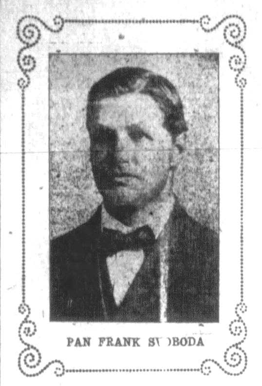
Presenting Mr. Frank Svoboda.
The year 1910 was my initial discovery of Omaha references to Svoboda Monuments, however, subsequent advertisements indicated a commencement of about 1897 and 1907. It was only later I came across Frank Svoboda having worked in stone and marble in his native land, possibly starting in 1897. Frank Svoboda garnered significant press; nevertheless, I was hindered in my investigation because of the language barrier presented by the multitude of Czech newspapers. I finally got the idea to use a translation program, which required typing every word from the newspaper archives. Sleuths, it was daunting but rewarding. Pokrok Zapadu of October 1917 illuminated Svoboda’s connection to a deeper Omaha architectural history I never would have found otherwise. The following information is from this fascinating article.
Frank Svoboda was born on September 17, 1878, in Jelmo in Moravia. He attended general school as a young student and spent four years studying at an additional “real estate” school at Teleci in Morave (Teleci is a village in Czech Republic’s Pardubice Region, not considered Moravia currently). —I believe this was lost to translation but perhaps this was a high school or vocational building school. After completing this preliminary study, Frank Svoboda then entered the sculpture academy in Horicy in Cech (town of Hořice in Czech Republic), “which is one of the leading vocational schools of its kind in Europe. He worked for a short time in Berlin, and he was employed on works for the Austrian government in the Carpathians, where tunnels, railway stations, were being built.” In about 1905 he came to the United States, namely to Baltimore, where he worked for a year and a half. After that, Mr. Svoboda arrived in Omaha, “where he is permanently active, because he saw great business opportunities here. He primarily did sculptural work on various large constructions, especially the YMCA building, and the Brandeis building. In a short time, he set up for himself, and one of his first works was the construction of the Burkett Hospital for retired soldiers and sailors at Grand Island, Neb., which building was built entirely of Colorado lava.” I was stunned.
A Deeper Look
Were these the sculptural works that Svoboda contributed to Omaha’s YMCA? I do believe his words. Dapper Omahans walking on the front steps of the old YMCA building at Seventeenth and Harney Street, no longer standing. Photographer Homer O. Frohardt. The Durham Museum. 1910.
Detail of the facade of the Old YMCA building (Seventeenth and Harney Street) is shown with two world weary “Atlas” statues holding their hands above their heads. Note the baskets and ornate floral designs cut in stone. Gorgeous. Savage, John (1903-1989). The Durham Museum. 1951.
Y. M. C. A. at Seventeenth and Harney Street postcard. The image I have always seen of the old “Y” does not lend the incredible understanding that the previous photos reveal. These are the buildings that we tear down in this town.
A lovely interior of the Y at Seventeenth and Harney Street from 1910. Is it possible that our man Svoboda worked on this gorgeous interior as well?
Exterior view of Brandeis Theatre Building at Seventeenth and Douglas Streets; Bostwick, Louis (1868-1943) and Frohardt, Homer (1885-1972). The Durham Museum. 1914.
Magnified detail of the Brandeis building. Please enlarge even further to see this intricate stonework. Did Svoboda have a hand in this glory?
Another article from 1913 reported: “Mr. Svoboda spent eight years in the study of sculpture in Bohemia, his native land, under the personal direction of some of the best sculptors and teachers of that country and his ability in the art of modeling, while little known in Omaha, is recognized in Baltimore and the east coast, where he lived and practiced his profession before engaging in the monument business in Omaha.” It might be difficult as modern-day Americans to grasp what Frank Svoboda’s education and experience brought to little ol’ Omaha. Czech stone masons are esteemed for their intricate carvings, ornamental elements, and exacting stone cutting processes, seen in the elaborate sculptures and architectural details of numerous buildings. The artistry and craftsmanship of Czech stone masons were regarded as an essential component of Czech cultural heritage, enhancing the distinctive architectural identity of the nation. Mr. Svoboda’s contributions and influence in Omaha would have been viewed as an extension of the Czech community’s historical legacy, of which they were proud.
The investigation into Svoboda’s initial monument training uncovered a fascinating historical detail. Frank Svoboda asserted that he was a neighbor of Adolf Hitler and that they worked “across the alley from each other” in Olomouc, Moravia, in 1904. Hitler was a 16-year-old painter, and Svoboda, a monument plant worker. Of Hitler, Svoboda stated in 1939, “He was a bluffer when I knew him and a queer sort of fellow. He never seemed quite like a normal boy. He often had trouble with the men working with him.”
Frank Svoboda’s Business
Further Czech newspaper translations indicated that Frank’s wife, Rose Svoboda Svoboda was the daughter of a renowned early pioneer in Omaha, Mr. Svoboda, the hatter, who served not only as son in law Frank Svoboda’s devoted assistant in the monument business but also as his advisor, significantly contributing to his remarkable success. I would find later evidence that Rose’s parents, Frantisek and Nellie Svoboda, lived with Frank and Rose’s growing family.
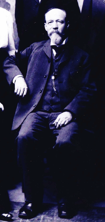
Mr. František Svoboda, Rose’s father. Photograph uploaded by W. B. Svoboda.
In 1911 the Svoboda Monument Factory or Svoboda Company of Omaha would move operation to their well-known South Thirteenth Street location. The Syracuse Democrat reported in August of 1911, Svoboda bought “the property occupied by the Democrat and Townsends harness shop and will do considerable needed repairings to the building.” I did not find the following photo of the business until very recently. What a delight.
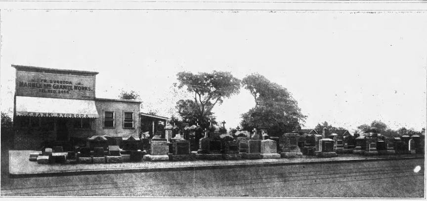
Frank Svoboda Monument business. I believe this was the southeast corner of Thirteenth and Pierce. The salesroom was purported to be at 1215 South Thirteenth Street. The ever-expanding enterprise would continue to reach south on Thirteenth Street in the classic Czech neighborhood–absorbing addresses. Mr. Svoboda was renting these lots from the Kountze family. His business extended from 1215 to 1231 South Thirteenth Street over the years.
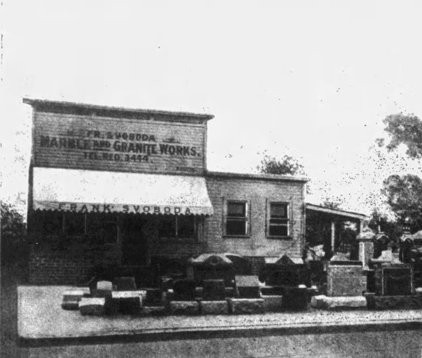
Enlarged. How the Frank Svoboda Monument business looked in 1913. Not hard to envision an old harness shop. “Marble and Granite Works.”
Unfortunately, the original Frank Svoboda buildings were torn down and these twin structures were constructed in 1988. There is a large parking lot between these twins. Next time you drive by this area, imagine it filled with cemetery memorials and headstones.
1215 South Thirteenth Street. Southeast corner of Thirteenth and Pierce.
1217 South Thirteenth Street.
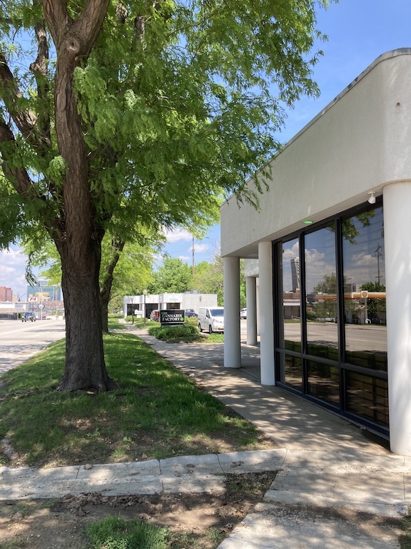
1217 South Thirteenth Street looking north to the twin building with parking lot between.
This cool building, a door to the south, at 1227 South Thirteenth Street was constructed in 1900. In time, the Svobodas absorbed this charmer into their operation. I believe there was a southern door that carried the 1229 South Thirteenth Street address or perhaps another building to the south was torn down.
The Svoboda empire continued down the block. Frank and Rose built this house on the southern edge of their business. 1231 South Thirteenth is a hardworking, front gabled frame, allowing Mr. Svodoba view of and proximity to his business. The mystery is the twin set of stairs directly to the south. I am sure there must have been another home… RIP Mr. France.
Frank and Rose Svoboda grew their family in this time period. Sylvia (1908) and George (1910) were joined by siblings Helen (1913) and Irwin (1914).
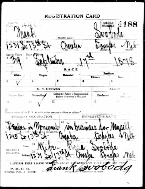
1917-1918 World War I draft registration card shows the 1231 South Thirteenth Street address. Love his signature.
The Czech newspapers let on that Frank Svoboda’s Omaha “marble cutter” business was just one of a larger chain he owned, allowing him to fulfill a huge number of orders. In addition to his Omaha plant, there were “branch houses” in Clarkson, Nebraska, and others in Denison, Iowa (I later found opened in 1913), and Council Bluffs, Iowa. There were quarries in St. Cloud, Minnesota and Aberdeen, South Dakota, where black ore was mined. I was surprised to find Svoboda was also owner of the Frank Svoboda Construction Company, the president of the Black Hills Granite Corporation and a shareholder in many other institutions. “In the Omaha plant, the number of employees is around thirty, sometimes much more when cutting.” This factory carries out the most prominent stone and sculpting work.” The Omaha location had more than one hundred thousand dollars’ worth of ready-made monuments in stock and was said to be the largest display of finished monuments in the United States.
Frank Svoboda’s offerings ranged from pure white cement grave markers with inscriptions to massive artistic monuments and high-grade statuary. By 1913 Mr. Svoboda had been making monuments in Omaha for eight years; he had built up a business that reached to all parts of the U.S. and Canada. Svoboda was fond of mentioning his Salida granite creations. I discovered the Salida Granite Company was out of Colorado, specifically Chaffee County, once considered the granite center of the world. Ed Bowen, a local prospector, incorporated his granite company in 1901 and popularized the Rose Pink granite mined from the Great Salida Mineral Belt.
![]()
“Svoboda Memorials from quarry to consumer.”
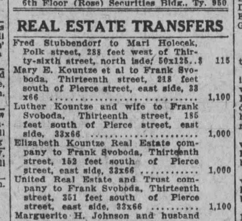
In January of 1918, Frank Svoboda bought up four lots on Thirteenth Street, all south of Pierce. I believe these lots were the precise location of his business, if not the surrounding parcels. Interesting to see that he purchased these varying plots from Mary, Luther and Elizabeth Kountze, in addition to the United Real Estate and Trust. And this wasn’t the only real estate Frank Svoboda was acquiring during these years. He appeared to be expending substantial amounts of money and investing in real estate.
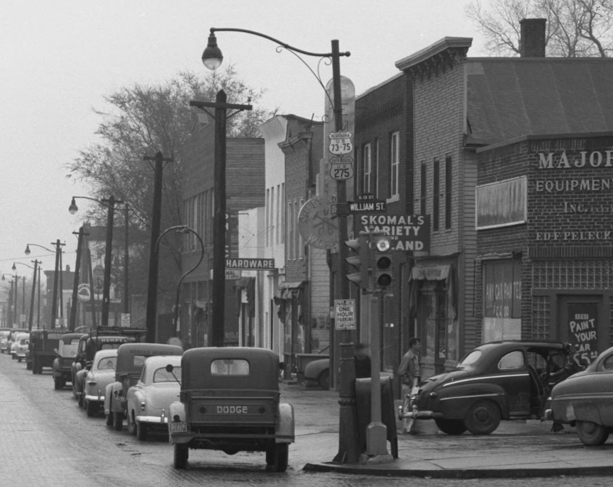
On that note, I am leaving these two images here, for anyone who might remember these days. Little Bohemia of the 1950s. Looking north on South Thirteenth Street from William Street. Major Equipment Inc. by Ed F. Pelecky, Skomal’s Variety, Hempel Sheet Metal Works (still going strong), and a hardware store whose sign is not visible. A lot of these great little stores are missing. Do you see the Svoboda Monument sign down the street (to the north) where they were located ? Bostwick, Louis (1868-1943) and Frohardt, Homer (1885-1972). The Durham Museum. 1953.
There it is through the foggy haze. A circular sign with a tombstone on it. Detail of the photo by Bostwick, Louis (1868-1943) and Frohardt, Homer (1885-1972). The Durham Museum. 1953.
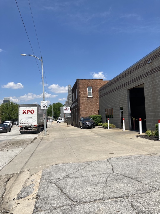
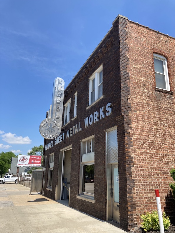
And here we have photos from a walk down Thirteenth from William Street. Hempel Sheet Metal Works going strong.
Great door. Arrow to Office This-a-way.
The Svoboda Designs
Svoboda’s designs were characterized by their massive scale and artistic manner. In those days a craftsman stood with hammer and chisel behind headstones pounding names and dates into rock. An artist used the same tools but as Michelangelo articulated the process, he saw the form within the stone and subsequently eliminated any extraneous material. Through this perspective, we can assume Mr. Svoboda unveiled his monuments and figures by sculpting away the surrounding stone block. Contemporary grave monuments of this magnitude are rarely observed due to their cost. A visit to Omaha’s Bohemian National Cemetery, a cherished haunt, holds fresh significance now that I am aware of Mr. Svoboda. Please visit when you can. Frank Svoboda’s cemetery monuments and sculptures exhibited remarkable craftsmanship; he also designed large-scale architectural estate monuments including columns and Neoclassical elements, including headstones, mausoleums, and memorials. Here are just a few of the incredible advertisements and photos that I found.
On October 22, 1911, The Omaha Daily News documented that the Catholic Ladies’ Cemetery Association in Vail, Iowa entered into an agreement with Frank Svoboda to construct Jesus on the cross, Blessed Virgin, and St. Joseph statues for their cemetery. The Welch and McGuire families donated the Carrara marble to the immense project. “It only required four months for Mr. Svoboda to complete this work in every detail.” If this was not effective marketing for Svoboda Monuments, I am uncertain what would qualify as one.
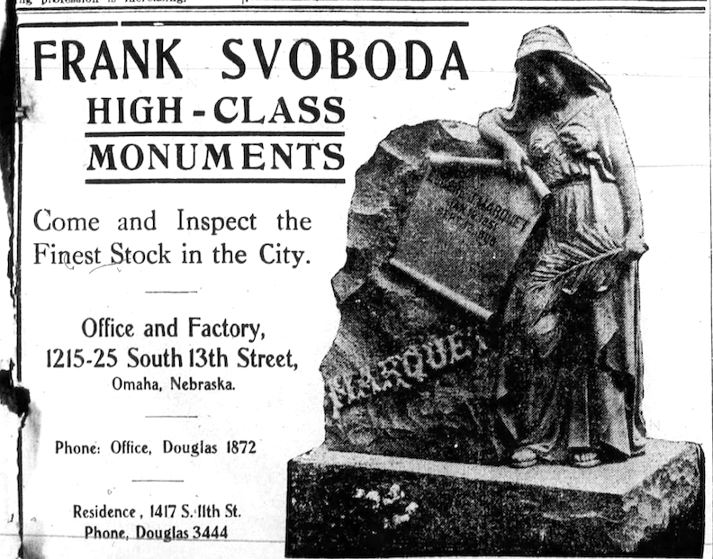
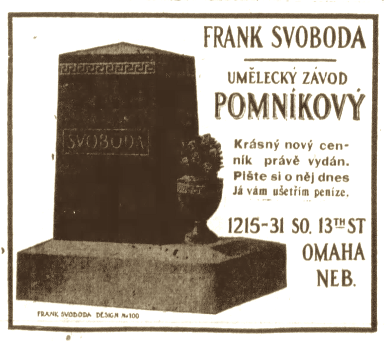
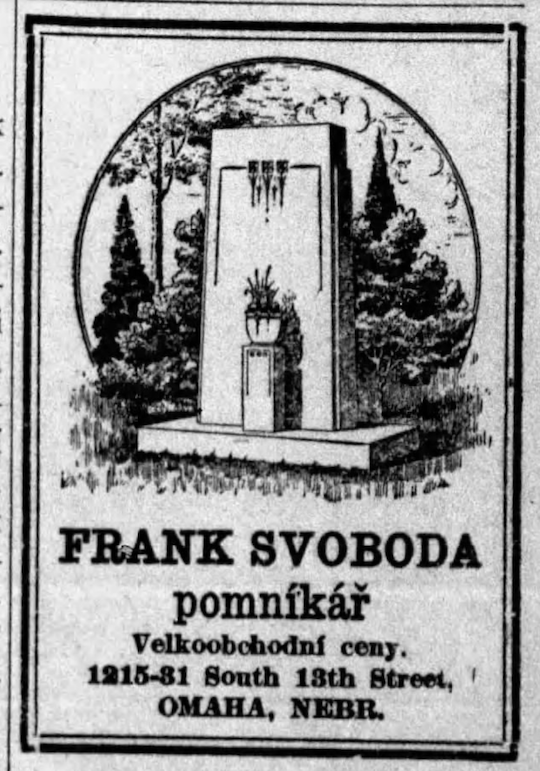
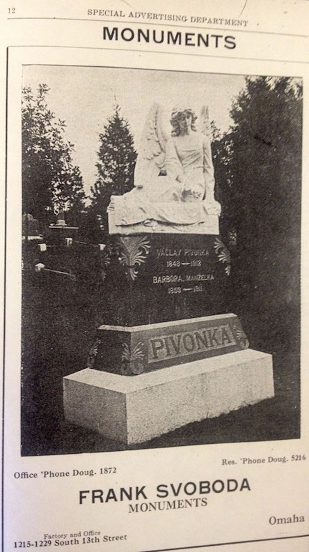

I had mentioned the well-known, early Omaha Czech, Jan “John” Rosicky, editor and owner of several Czech papers through his National Printing Company of Omaha. His death in 1910 was stunning to the Czech community. “His greatest fame rested on his founding of the Western Bohemian Fraternal Association,” known as the Z. C. B. J. This organization’s annual convention in Omaha brought thousands of Bohemians to Omaha for ten days. It was during the press parade due to the unveiling of the John Rosicky monument in the National Bohemian Cemetery “near Omaha” at Fifty-fourth and Center that I learned more of Mr. Frank Svoboda’s history. Svoboda’s monument to John Rosicky was a grand sixteen feet high, Flemish bar granite incorporating a bronze bust of Rosicky on top.
The Tel Jed Sokol Hall at Thirteenth and Martha Street. Looking north on Thirteenth Street. Bostwick, Louis (1868-1943) and Frohardt, Homer (1885-1972). The Durham Museum. 1956.
Svoboda’s carving is magnified. “Sokol Emblem is Placed” in September of 1926. “In view of hundreds of interested spectators, a huge stone falcon was hoisted to the top of the Tel Jed Sokol Hall, under construction at Thirteenth and Martha. “The bird was carved from a seven-ton solid rock of Bedford stone and presented to the lodge by Frank Svoboda of the Svoboda Monument works.”
1932. Omaha World-Herald.
In 1932 the Central High School Booster Club envisioned a monument marker to the Oregon Trail set on West Military Avenue–a granite marker, inlaid with bronze tablets. Shown here are students George Payne and Virginia Lee Long with Center High Principal J. G. Masters. “The monument was a gift to the Booster Club by Frank Svoboda of the Svoboda Monument Works.” (Where and is it still there? According to Adam Fletcher Sasse, North Omaha History writer, the marker stands at 9308 Military Road.)
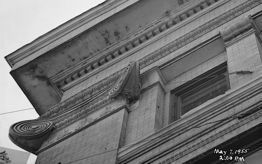
Corner of the roof of the S.S. Kresge’s Building at Sixteenth and Harney St. as seen from the street. Bostwick, Louis (1868-1943) and Frohardt, Homer (1885-1972). The Durham Museum. 1955.
The more I looked around I could see eagles and other brilliant carvings on buildings all over old Omaha. Details carved just for beauty’s sake. Was Frank Svoboda involved in the execution of these carvings, either as the sole creator or as part of a larger team? If we continue to pursue this investigation, I bet we can find the truth. We just need a Czech translator. I certainly would be grateful to hear from family members who may know of other Svoboda contributions to our Omaha landscape. The Bohemian National Cemetery and other regional cemeteries hold many impressive examples of Mr. Svoboda’s creations.
1503 Park Wild Avenue
It was evident that the Frank Svoboda business and his family were flourishing during this time. I found it particularly intriguing, now given our greater cultural awareness of this whole portion of Old Omaha, that Frank Svoboda did not build his family’s marble home within the confines of Little Bohemia, despite his established reputation there. However, the more I obsessively walked and drove the area, it became clear why he would desire to place his most significant monument atop the highest hill available. The parcels comprising what would eventually become 1503 Park Wild Avenue precisely provided that.
1503 Park Wild Avenue, as we have reviewed numerous times, is made up of lot 48 of the Kountze Addition and lots 16 and 17 of the Park Wild Addition. I am going on record to say the home was not constructed in December 1917, as the building permit had only JUST been submitted. Another brief press piece from January 1918 indicated that 1503 Park Wild Avenue was “being built.”
The 1918 Baists Real Estate Atlas features the residence located at 1503 Park Wild Avenue on its map. Consequently, we might infer that the home was constructed by 1918. Let us go with that hunch until later notice.
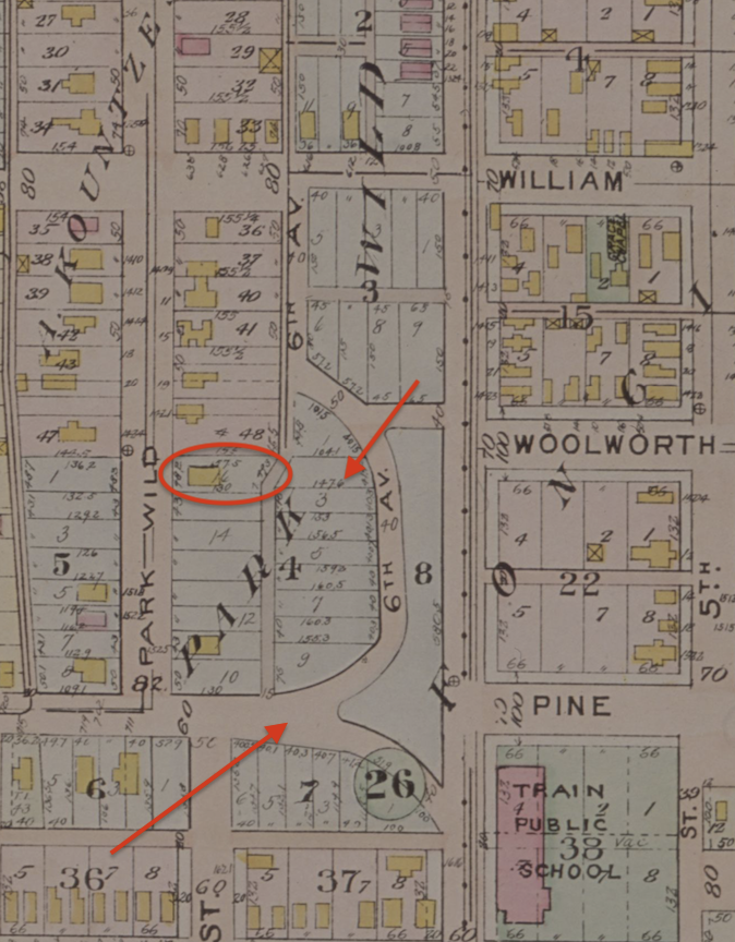
Homesite of 1503 Park Wild Avenue circled in hot orange. #48 signifies the portion of the Lot 48 of Kountze Addition. The #16 is the lot of the Park Wild Addition. Image borrowed from 1918 Baist’s Real Estate Atlas of Surveys of Omaha, Nebraska, Complete in One Volume, Compiled From Official Records, Private Plans and Actual Surveys. Title page gives credit to G. Wm. Baist, Wm. E. & H. V. Baist Surveyors. Borrowed from the Omaha Public Library.
I placed hot orange arrows on the dramatic parceling efforts of the original Park Wild Addition only exposed due to this great old map. Sixth Street, which ran in front of the Train School and the large, wooded hill to the west, considered too elevated for a city park, was strangely cut into a number of lots (19 total?) with access from a newly proposed 6th Avenue. These lots never appeared to be developed into homes, except to be delineated on this map (and other maps to follow, I would learn.) I would love to hear from anyone who know more about this. Shortly we will examine how these empty parcels were made into Dahlman Park.
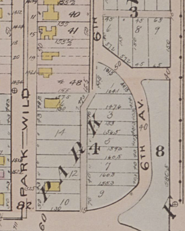
These mystery lots of Park Wild Addition would have abutted the lots lining Park Wild Avenue. Examine, if you will. 1918 Baist’s Real Estate Atlas of Surveys of Omaha, Nebraska, Complete in One Volume, Compiled from Official Records, Private Plans and Actual Surveys. Title page gives credit to G. Wm. Baist, Wm. E. & H. V. Baist Surveyors.
Another conclusion drawn from this map is that 1503 Park Wild was definitively not the master’s manor with an extensive surrounding estate. Further confirmation that several the smaller homes surrounding 1503 predated it.
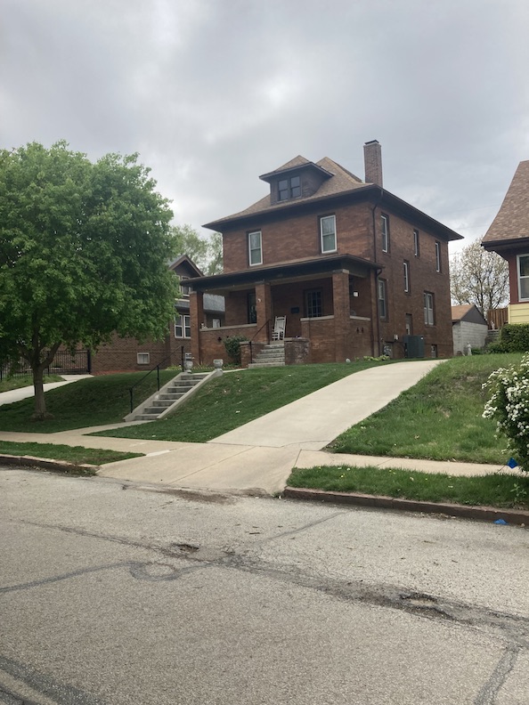
**SIDENOTE** Of interest and warranting further research is the Charles Pavlik brick American Foursquare at 1522 Park Wild Avenue, situated across from the Svoboda home. As per the city’s History Properties and Surveys website, this residence was designed by its owner, Charles Pavlik. According to city records, 1522 Park Wild was constructed in 1914, consistent with archive newspapers; nevertheless, I discovered additional evidence indicating it was erected in 1909. The point being that 1522 Park Wild long held court on the high end of this block, previous to 1503 Park Wild’s arrival. What captivated me, aside from this being an elevated, dark, striking home, is that Charles Pavlik was a fellow Bohemian, suggesting a possible connection with Svoboda or signaling the opportunity for a cultural shift as Czechs departed the once enclave. Supplementary evidence indicates that Charles Pavlik Sr. was a soap maker, a profession that lacked clear association with architecture.
Back to Business. What we know: 1503 Park Wild Avenue was completed sometime in 1918. Solid evidence indicates that the Svobodas were in the home by February 1919, if not 1918.
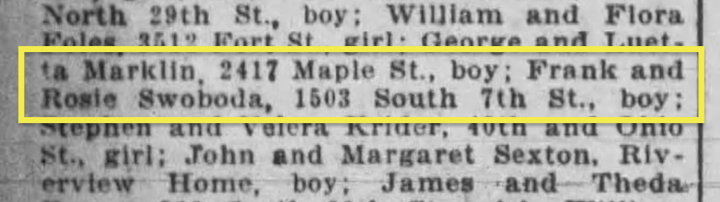
Our proof of the Svoboda family have relocated to their new home by February 11, 1919, although called South Seventh Street, instead of Park Wild Avenue. The announcement of a baby boy born to Frank and Rosie “Swoboda.” The dates line up with their son Roy Svoboda (1919). Omaha Daily Bee.
There were six rooms with an additional sunroom on the first floor, oak trim and floors. French doors. According to historic interviews with locals in the Omaha Awareness Tours The Near South Side (1979), the Svoboda home was known to have six bedrooms plus a third floor. Did the third floor serve as servants’ quarters? A ballroom? Those home features didn’t seem to align with the Svobodas’ ethos, given the clues of their industriousness. Were they guest rooms or an in-law suite? That seems more plausible.
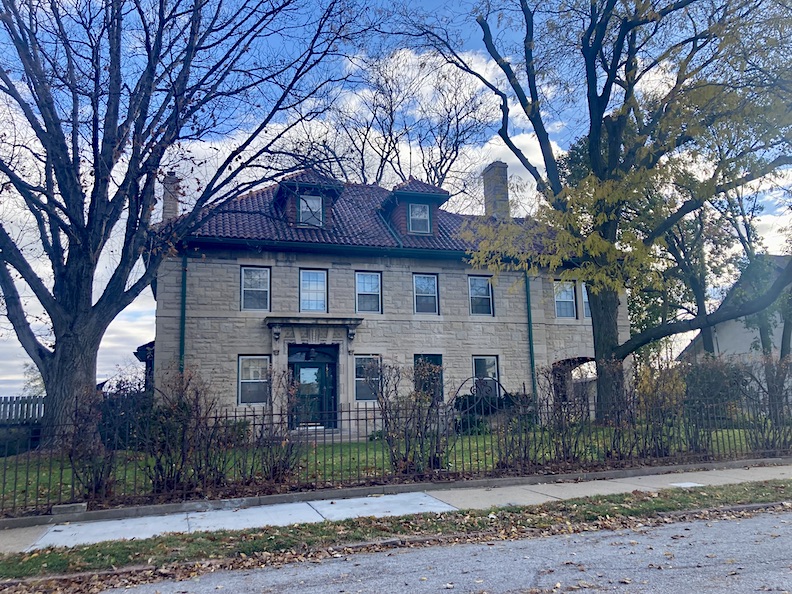
1503 Park Wild Avenue in fall of 2024.
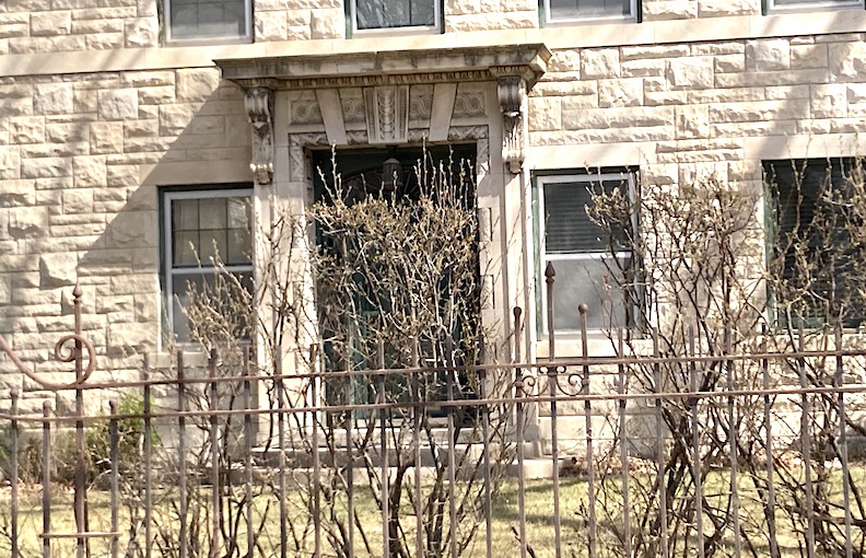
The beauty of the stone door surround, particularly the natural patina, highlights the very Art Deco forms—it seems influenced by Native American art. A pair of charming, not too large lanterns would heighten the whole effect, but I do love the original modest, country lantern hidden at the subtle arched door. The glorious entry carvings of 1503 (please enlarge) are the scaled down, residential version of what we saw at the YMCA and the Brandeis Theatre building. The window surrounds remain simple, yet dignified and strong. I would like to see what the original casements looked like.
If we skip ahead in time of the 1934 Sanborn Map, we can compare architectural footprint of the house from the above 1918 Baist’s Real Estate Atlas and what we see before us today.
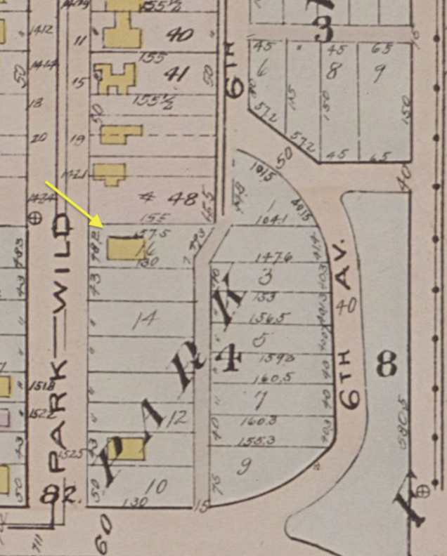
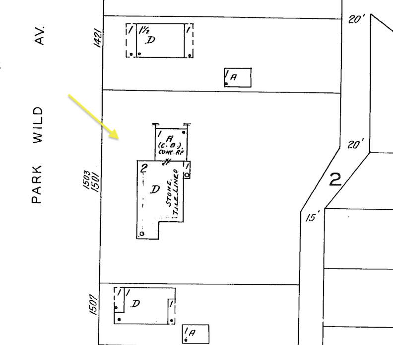
Yellow arrows point to 1503 Park Wild Avenue. Not only do we observe the property line alterations over time but there were some architectural additions as well. This would mean the addition of the arched sunporch/room on the southern-most end of the home. Another argument might be that the 1918 map was either not drawn in a very detailed manner or that the 1503 Park Wild was being built at the time of the survey and did not have the southern wing added yet. There was also a basement double garage addition to the north end. 1918 Baist’s Real Estate Atlas of Surveys of Omaha, Nebraska, Complete in One Volume. Borrowed from the Omaha Public Library. 1934 Sanborn Map lent by Trina Westman and Shelley McCafferty of the City Planning Department.
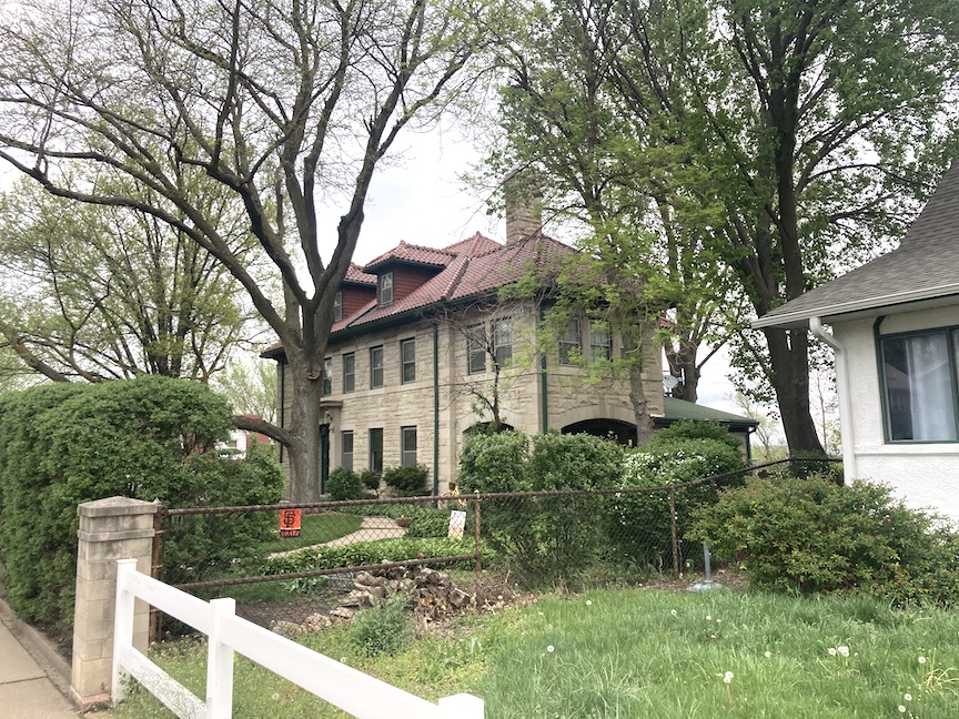
Spring of 2024. Camera facing a northeast angle. One could argue that the sunporch addition came later and that might explain the chimney rising through the middle of the house. In that scenario the chimney would have been a somewhat symmetrical bookend to the chimney of the northeast side. However, I believe this southern end might have been original or came very shortly after due to the seamless nature of the stone. Not the green roofed addition to the arch windowed sunroom.
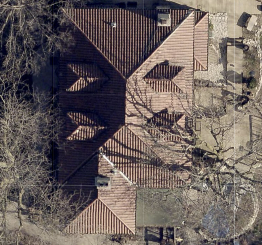
This roof aerial may or may not display what I am questioning. The top of the photo is north. The front of 1503 Park Wild is the left side of the photo. The sunroom addition is at the bottom of the photo. The southern chimney protrudes (at a photographic distortion) from that wing’s ridge line. The chimney does seem to line up with the southern edge of the home’s main rectangle box, minus the sunroom addition. The sunroom wing deceivingly appears to be as large and wide as the home, from the sidewalk. Note the green roofed addition abutting the sunroom addition. All very tidy and symmetrical, from the sky except for that sunroom and a northeastern porch’s roof. This means nothing of course. Image from the DOGIS site.
Another obsessive view.
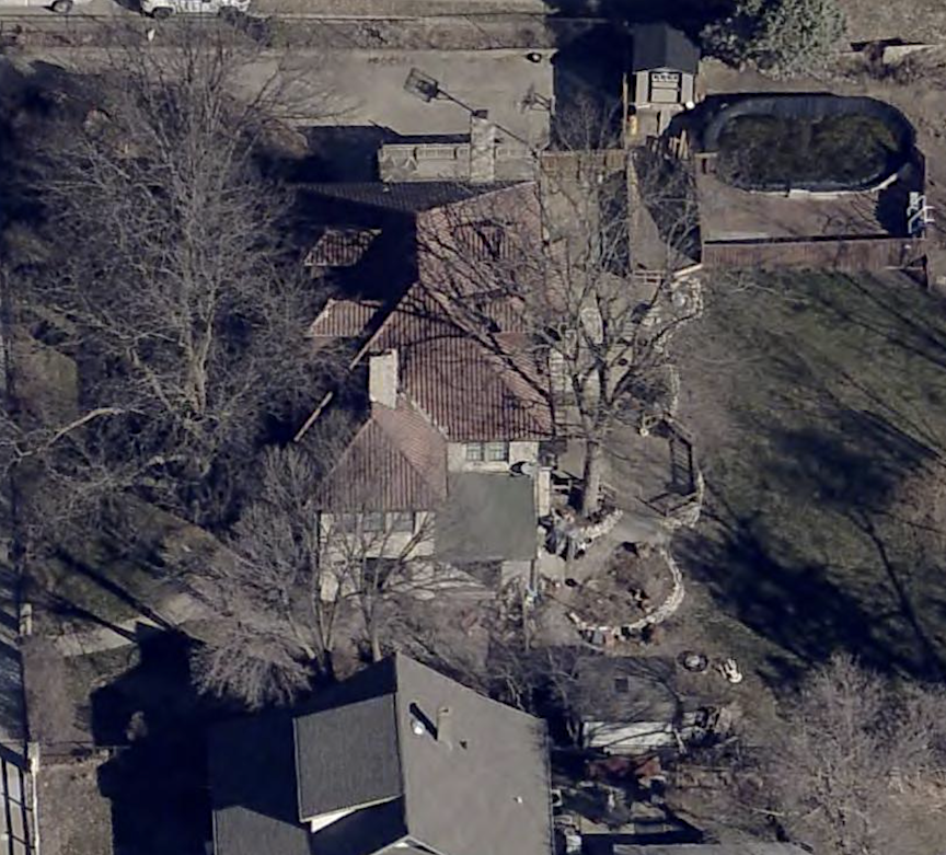
Eastern elevation from the sky. Image borrowed from DOGIS.
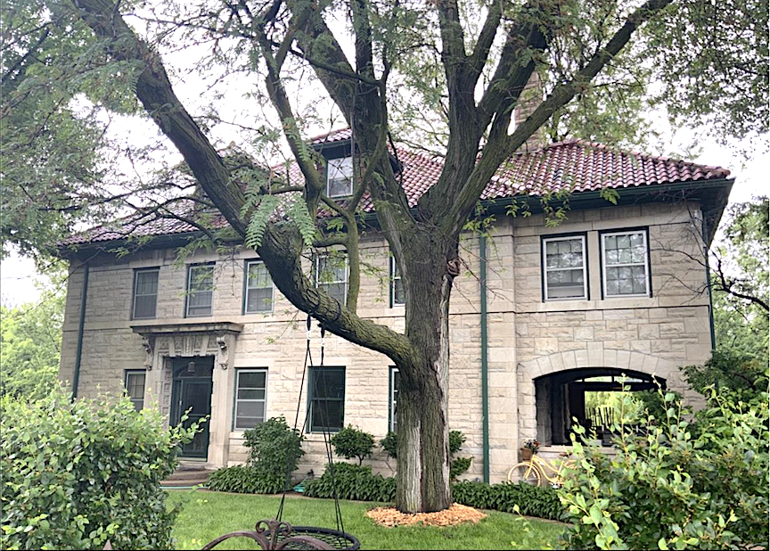
June of 2023.
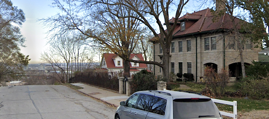
November of 2024.
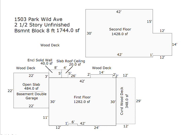
The Douglas County Assessor’s floor plans are typically a generic outline. They do not appear to provide the supplementary information that I can understand but I include it here in case someone more well versed in these measurements is seeing something.
What do you think?

August of 2022.
1503 Park Wild Avenue and My Walk with the Late Virginia Savage McAlester
As always, our deep, obsessive approach is indirect, in the hope that some piece of evidence could fall into place, without knocking on doors and being obnoxious. I would consult our special lady friend, Virginia Savage McAlester and her bible, A Field Guide to American Homes regarding my observations of the Frank Svoboda house.
Upon extensive examination, I have concluded that 1503 Park Wild Avenue is an elegant home. An atypical building. Distinguished, artistic, while simple and effective. The building materials are the primary highlights, complemented by several stylish and classical architectural details, rendering this structure unusual for its location in Omaha and its time period. Simplicity and modesty come to mind only due to numerous attributes where the original owner and architect exhibited Midwestern Restraint. The residence seems a textbook Midwestern interpretation of an eclectic Renaissance Revival style. A touch of Italian, a hint of Georgian, subtle elements of French Eclectic, and a slight Italianate influence. We have seen characteristics of this house in movies or in historic architectural photos although they were consistently far more reaching and opulent. This is the reason I hint at conservative containment, potentially driven by financial considerations, societal or geographical factors.
The Near South Side book did state: “The marble was imported from Italy.” As we now know, Mr. Svoboda possessed extensive connections to procure any stone necessary for the construction of this home. The glory of this “stately mansion,” as 1503 was called decades ago, is the rarity and the wonder of the stone-cut presentation. A “stone cut residence” speaks to a home constructed from stone, where the stone blocks are cut precisely, shaped, and sized. This can be accomplished by employing chisels, hammers, and saws. The phrase “stone cut” may also suggest that the stone serves as a decorative feature, such as a veneer or cladding, rather than functioning as the principal load-bearing material of the structure.
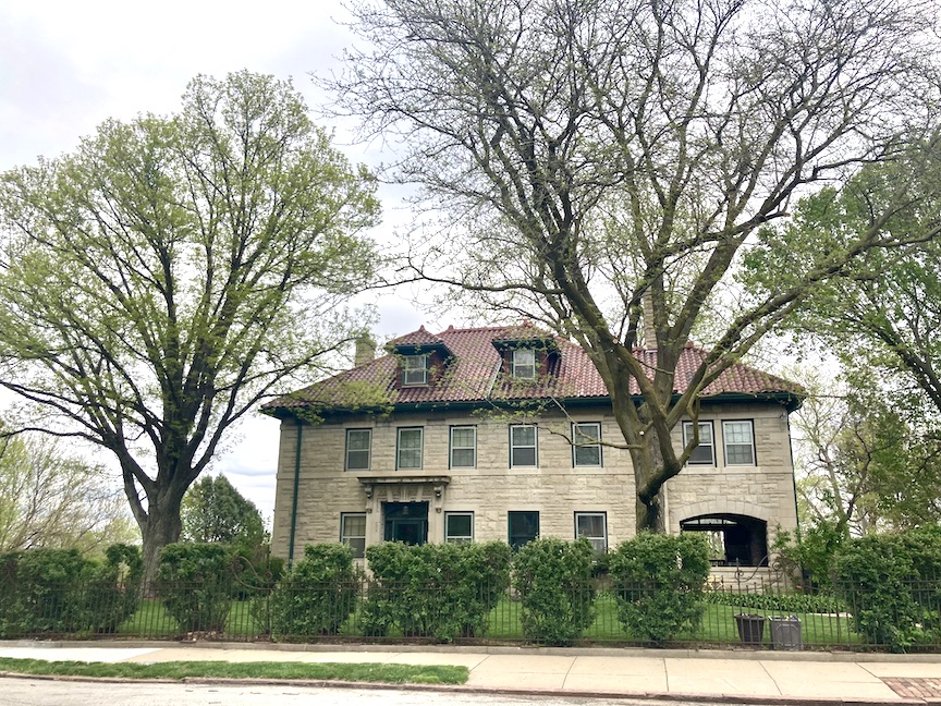
1503 Park Wild Avenue features a hipped roof composed of deep red Spanish clay tile or terra cotta, (or a contemporary imitation?), with hipped edges on the northern and southern elevations. The Italian Renaissance characteristically included a low-pitched, hipped roof, typically adorned with tiles. A flat roof is located on the north, providing access to the basement double garage. The ridge of the hip roof is visually prominent, paralleling the front facade of the house. I find this roof to be one of the most exciting features of the home. Ornate and stylized, the tile roof and its ridge also lend a clean look. The southern wing, which we have been calling the sunroom wing, together with the lower hip roof cross gable, seems to be an extension of the main block of the house. The entire roofline is intriguing, with two hipped dormers on the east elevation and two dormers on the west elevation, featuring smaller sash windows than those observed below.
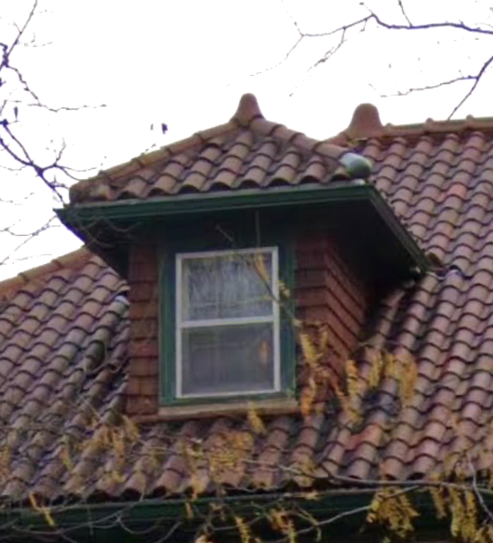
These clay roof trim styles that come to a peak, are called hip ridge bumps but I think we should rename them Ridge Nubbies. I also enjoy Ridge Nubuals. Give it a whirl. These decorative finials make a unique roof statement.
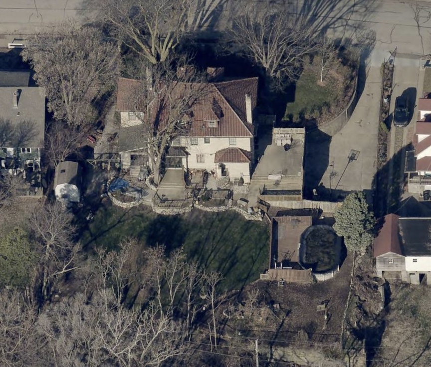
East elevation or rear. Note distortion of the aerial lens. Photo borrowed from DOGIS. Raised deck with an above ground pool on the northern side of the property line.
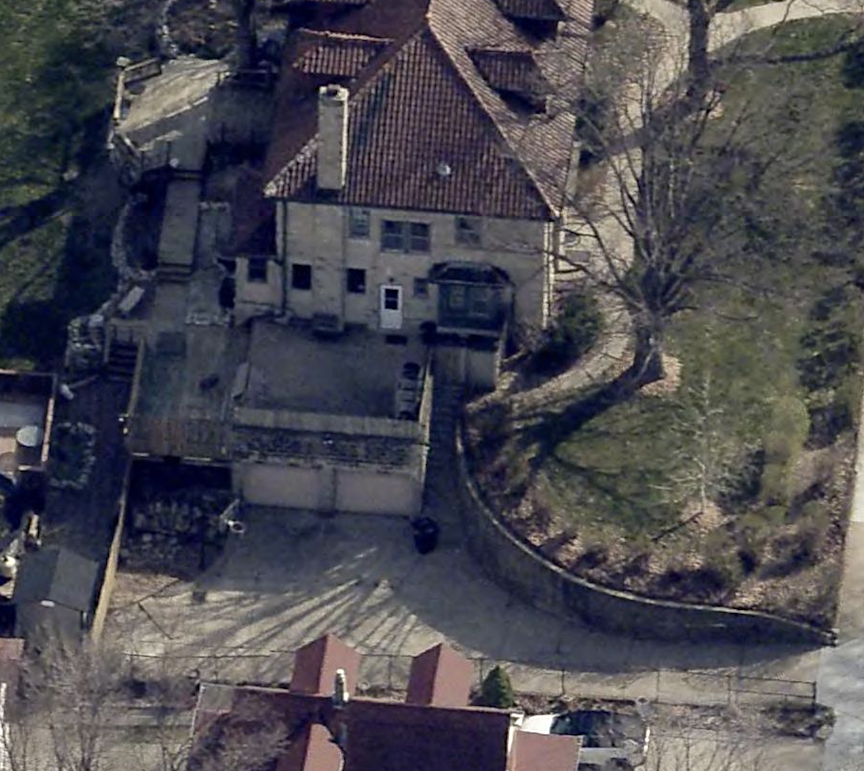
North elevation and a peak at how the garages function at basement level. Note the north chimney and the dormer windows that line up on the third floor. Aerial photograph borrowed from the DOGIS site.
A subtle beltline established an identity to a very shallow projecting facade, complemented by strong, uncomplicated moldings encircling the windows. Intricate window surrounds are absent, and the window sashes are small. Typically, the main floor windows might be more elaborate, occasionally arched, while the upper story displays smaller windows. Not so here. There is a flat, unassuming quality, to all the windows. The windows are framed in hunter green paint, coordinating with the front door, the downspouts, the under-eaves, and the roof of a rear extension.
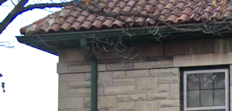
I could not see any ornamental brackets beneath the wide eaves. There are no fancies present.
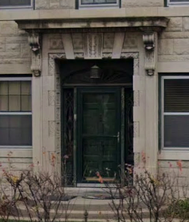
The yellowish beige masonry is “stone cut” into curious brick-like forms of diverse sizes, textures, and relief depths. Despite the presence of a gorgeous, classical, carved entrance surround, it maintained an intimate scale that is not at all intimidating. This entry is the magic of 1503 Park Wild Avenue. The hallmark carved Art Deco shapes feel very sleek while Native American. It features the characteristic Renaissance arch, however obscured by the dark green paint of the recessed doorway. The small entry porch is characteristic of this Revival style, as is the unpretentious singular door. The antique lantern is wonderful. It felt Art Deco was unable to discern whether there was iron grillwork encircling the door, in front of the glass panes. Magnificent.

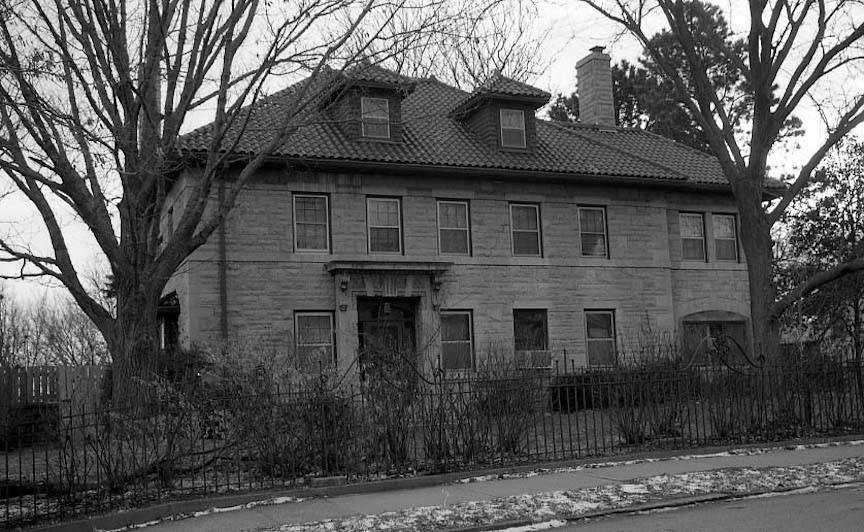
These two photos are borrowed from city’s History Properties and Surveys site. Images were captured in the 2006 Reconnaissance Survey. July 2006. They give a stark view of the home
The windows and screens of the sunroom in the southern wing have been smartly removed, resulting in a year-round open sunporch. (The 2006 photos show the closed porch look.) The original, broad, arched windows of the sunroom are striking, while welcoming. The residence is elongated with a wide elevation; this expansive footprint embodies the essence of noble Georgian or Italian Renaissance architecture. Conversely, this design was not preoccupied with balance and symmetrical reflections. The substantial stone, providing her curb appeal and perception of “good bones,” is a crucial aspect of Renaissance Revival architecture. The Italianate aesthetic, which is really an English style despite its name, features a less formal design shown in the rusticated exterior and asymmetrical appearance. It is the natural patina of the stones that I am in love with. Although this home on first walk by initially appears balanced and symmetrical, every element is subtly off-center, which I find appealing. It captivates the eye.
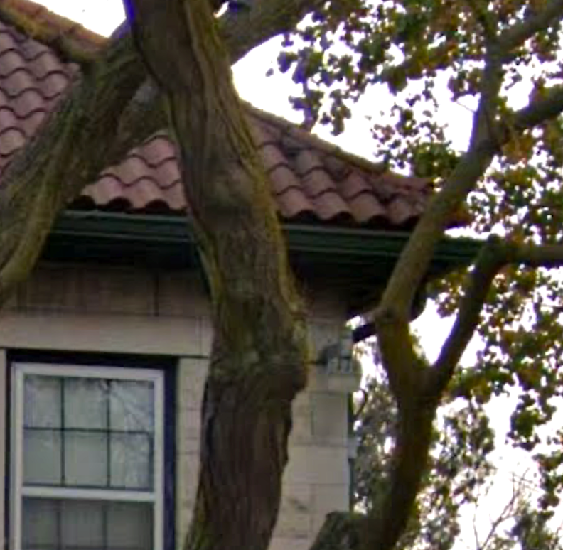
Of interest…far southern corner of the home, under the eave…is this a gargoyle? Is this a carved owl? Previous photos show a large spotlight type fixture on this corner. Also…fourth option: am I losing my mind?
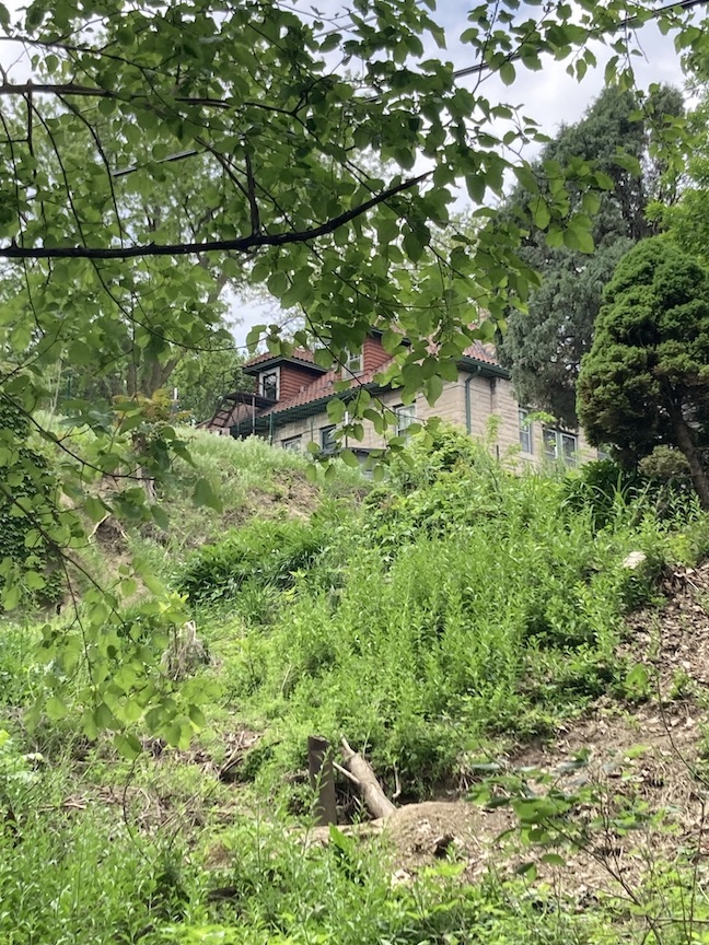
I am enamored by wrought and cast-iron fire escapes from bygone eras. Possibly because these were a great place to puff on a cigarette in my younger years, I am curious about the construction date of the one attached to the southernmost rear dormer. (Studying its design and its bolting from afar, I was reminded of circus ladders I have seen precariously placed on the most unpredictable objects, as aerial performers execute their physical feats from these slender bars.) Such a feature is uncommon today, however joyously found on houses of a specific height and historical period, particularly if the owners were renting to tenants during the 1940s to 1960s era. Of course, fire escapes on apartment buildings and other structures were established much earlier; however, I have rarely observed them on single family homes unless the home had a lofty third-story bedroom, a history of room rentals or group living where regulation likely influenced the decision. Fire escapes became obsolete in new buildings of the late 1960s and, in certain instances, were prohibited as safety rules evolved. I recorded a reminder on this exquisite fire escape and its potential as a clue in black ink.
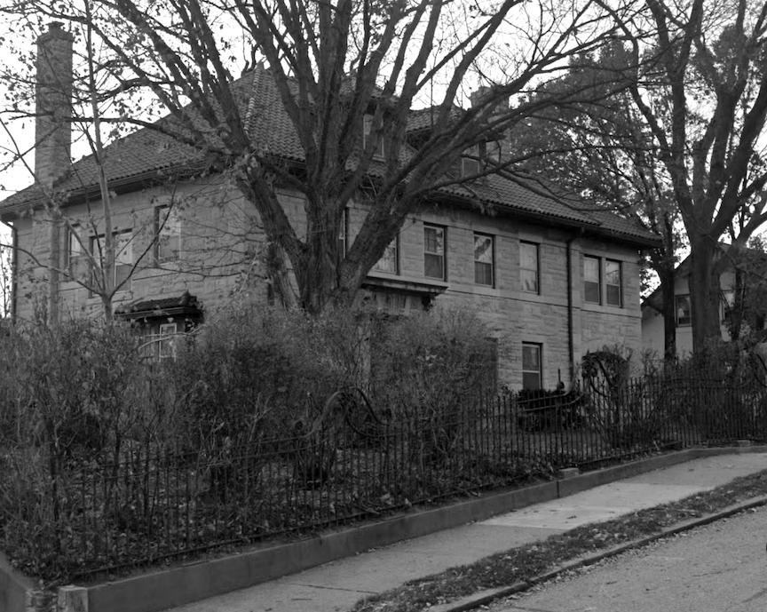
Another crush of mine is the scrolling, delightful, iron fence appears to be original (or of the first two owners) and runs the full length of the home, apparently found nowhere else on the property.
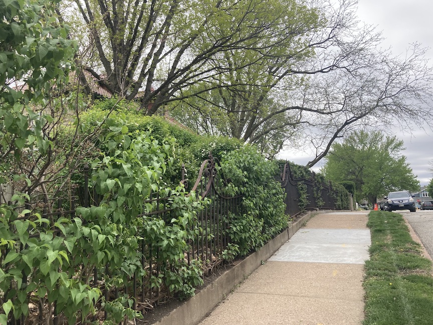
A charming hedge grows along it now. As you can see the fence rises to seven arches of curly-q, lyre-like shapes. This ironwork is important and beautiful. I love to see when people preserve their gates, grills, panel and railings for their cultural and artistic value.
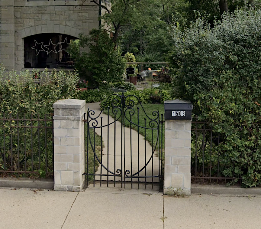
These pillars are most likely original but this gate is not. Replaced during the years, I think I found the mysterious storyline that might explain that.
The stone pillar on the southern corner of the property, neighbor’s home seen in the background, is original as well. Sadly the northern post of the property is missing.
Somethings were evident but I certainly would love to know more of the detail of original construction. I believe 1503 Park Wild Avenue is a diminutive masterwork of design and craftsmanship by Omaha’s once famous marble cutter. But there was also an architect, although locating him would require some time.
The Architect
As stated earlier, An Inventory of Historic Omaha Buildings from 1980 had reported that our 1503 Park Wild Avenue obsession was designed by Architect “Ballard, D.” The city’s History Properties and Surveys site repeated this information. The Nebraska State Historic Preservation Office offered very limited inform about the D. Ballard architect. In fact the listing “Frank Swoboda Residence (1917), 1503 Park Wild Ave, Omaha, Nebraska. (DO09:0064-006)” was his only catalogued claim to fame. The construction year and the owner’s name were both incorrect, which aroused my suspicion. Furthermore, the two sources appeared to have reiterated the inaccuracies.
I was able to find a Dunn Ballard in the Omaha Evening Bee of 1917, who was involved in the Omaha Western Association of Railroads. This gentleman gathered statistics for the Union Pacific and other western railways. There was also a Fanny D. Ballard present in Omaha. I became most enchanted with the following rabbit hole. Are you aware of the I AM cult established by Guy Ballard? Apparently, he received guidance from an individual he happened to encounter at Mount Shasta. (Miss Cassette is obsessed with the strange, magnetic phenomenon at Mount Shasta.) Guy, his wife Edna, and their son, Donald C. Ballard, became “accredited messengers” of the ascended masters, later establishing the I AM at the masters’ direction. This Donald C. Ballard was most definitely not our Omaha architect.
It was the 1910 United States Census that disclosed a Donald C. Bollard. Twenty-four years old. Born in Nebraska. Resided in Washington, D.C. where he worked as a draftsman in an architectural firm. Secured a rental property with his spouse, 22-year-old Lucile Brooks Bollard, originally from Tennessee. I experienced a breakthrough—what if the census spelling was accurate and all of Omaha’s architectural records on 1503 Park Wild Avenue were erroneous? Simple misspelling. That was it. Or, I should say, I went off that hunch. Donald Chamberlin (middle name spelling fluctuated) Bollard was born in September 1885 in Omaha, Nebraska. He. became an architect. His parents were Herbert Henry Bollard and Jennie Olive Chamberlin Bollard, also of Omaha.
Donald Chamberlin Bollard
The 1905 Omaha Daily Bee announced D. C. Bollard had been appointed to draftsman in the forest service and by 1908, an Evening World-Herald article described our man Bollard having moved to Washington D. C. “He is employed in the office of the supervising architect of the (U. S.) Treasury at Washington. He is at present in charge of one of the government buildings at the Seattle Exposition. Mr. Bollard had recently returned from a year of travel and architectural study in Europe and expects to return for further work in Paris next spring.” An earlier article let on Mr. Bollard had graduated from Omaha High School (now called Central High) in 1903. Although it is said Mr. Bollard obtained his degree from the University of Nebraska-Lincoln, subsequently attended the Massachusetts Institute of Technology, formally studied at the Sorbonne in Paris and was a draftsman in the forest service, it was hard to fathom the rapid timeline of these achievements.
In October 1909, Donald wed Lucille Brooks Bollard in Washington, D.C. In 1910, while residing in Washington, DC, they welcomed their son, Donald Chamberlin Bollard Jr. Discovery of the proposed architect and the accurate spelling of his name significantly helped in all areas. Omaha City Directory of 1915 indicated the Donald Bollards had relocated to Omaha and Mr. Bollard was employed as a draftsman for G. B. Prinz– as in, Omaha Famous Architect, George Bernhard Prinz. We have met George Prinz in our past investigations. Architect Prinz is claimed to have earned his education at the Massachusetts Institute of Technology and pursued studies in Europe. These coincidences may explain the initial Bollard-Prinz connection.
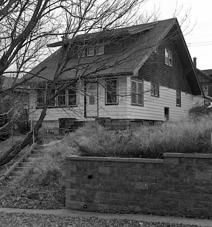
Current appearance of 4802 Underwood Avenue.
Upon arrival to Omaha, the Bollard family purchased 4802 Underwood Avenue, an appealing bungalow in Dundee that is presently for sale. It includes its original beamed ceilings, a fireplace, and exquisite built-ins such as bookcases, a buffet, and a China cabinet.
North entrance to Technical High School at 3215 Cuming Street. Bostwick, Louis (1868-1943) and Frohardt, Homer (1885-1972). The Durham Museum. 1924.
This is how I remember it. I always marveled at this massive school when I was a little girl. I liked to count how many students were smoking out front on the sidewalk…
Donald C. Bollard remained a draftsman at the Prinz office until a City Directory listing logged him as “architect” in the Fred W. and Edwin B. Clarke firm in 1917. (*Note: Although there are differences between draftsmen and architects, in those days these designations seemed interchangeable; in addition, I have come to not always rely on the discrimination of the Omaha City Directories.) Brothers Edwin B. Clarke and Frederick Woodruff Clarke were architects who occasionally resided and practiced in different places. In 1915, the two siblings commenced a collaborative practice in Omaha that remained until approximately 1926, resulting in the construction of numerous significant buildings, the most notable, in my eyes, being Omaha’s Technical High School in 1921, located at 3215 Cuming Street.
During this year (1917) Donald and Lucille had son, Philip Brooks Bollard.
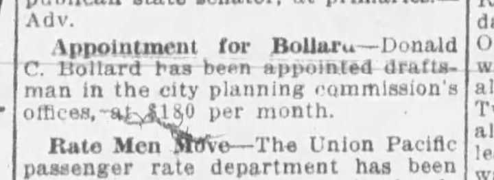
The Omaha Evening Bee. August of 1918.
In August 1918, the Omaha Evening News reported Mr. Bollard had been appointed as a draftsman at the City Planning Commission’s offices, with a salary of $180 per month. The Omaha City Directory of 1918 also revealed he was employed simultaneously as a draftsman with Bankers Realty Investment Company.
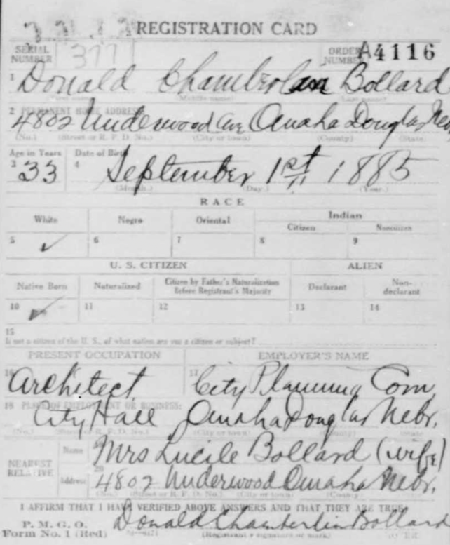
United States World War I Draft Registration Card 1917-1918. Thirty-three year old Donald Bollard obviously registered after his appointment to the City Planning Commission’s office.
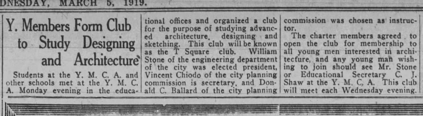
Omaha Daily Bee. March 5, 1919.
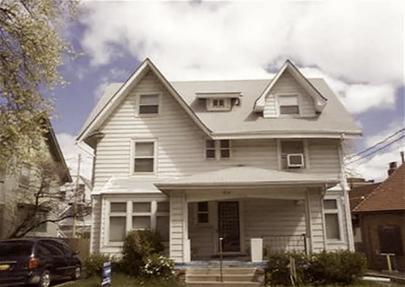
I was pleased to find the Bollard family moved into the large, historic David A. Baum residence at 3808 Harney Street—one of my longtime favorites. Baum was founder and president of Baum Iron Company. The large home featured oak finishes with built-ins throughout, fireplaces, maids’ quarters–plural. 3808 Harney was never a showplace but a large, attractive home. Mrs. Louise Metz Funk, daughter of wealthy brewer, Fred Metz, made this home famous at a time when Ms. Metz, newly returned to Omaha, needed to establish a local residence, while waiting two years to charge cruelty and file for divorce from her estranged husband, Arthur C. Funk, real estate and livestock dealer of Bloomington, Illinois. Regrettably, The Omaha Daily Bee of April 15, 1920, revealed that the Bollard couple’s eight-month-old baby (some clues say thirteen months old), Bruce, died in their 3808 Harney Street residence. Additionally, 3808 Harney would host the baby’s funeral. Afterward the house became the M. A. Nagel residence for decades with the Mrs. renting to tenants as she continued to live there.
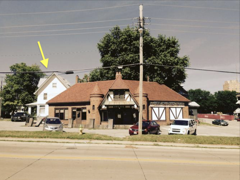
2015.
When the neighboring business, McFoster’s Natural Kind Café, at 302 South Thirty-eighth Street, closed their doors in 2014, the Dundee Bank bought the restaurant building. Needing room for their drive-thru, Dundee Bank tore down the large 3808 Harney and three homes on the Farnam Street side, for surface parking in the 2015-2016 time period. For a related article, check out: New Omaha: Three Grande Old Dames Torn Down.
Omaha Loan and Building Association building on the northwest corner of 15th and Dodge Street, formerly the McCague Building. How it stacked up in 1950. Bostwick, Louis (1868-1943) and Frohardt, Homer (1885-1972). The Durham Museum. 1950.
The 1920 Omaha City Directory listed “Bollard, Donald C. archt 303 McCague bldg.” Additional inform was garnered in the American Architect and the Architectural Review, Volume 117, June 30, 1920: “Donald C. Bollard and James R. Webster have opened an office at 303 McCague Building, Omaha.” I would monitor the McCague building as it was being erected in 1890, a large stone structure on the northwest corner of Fifteenth and Dodge Streets. As we like to do around these parts, the McCague Building was renamed the Omaha Loan and Building Association Building in the 1920s, only to be repeatedly called “the old McCague building” for the next fifty years and then torn down for no good reason in 1970.
Omaha World-Herald. April of 1921. All the heavy hitters–many that we have investigated together. Donald C. Bollard is listed under Associates on the far right.
Omaha City Directory of 1921…Frustratingly listed under the name Ballard.
Mr. Bollard, either independently or in collaboration, worked in Omaha until the 1923 Omaha City Directory indicated, “Bollard Donald C. moved to Lincoln Neb.” An unusual notation in the directory except for certain years, as a sleuth, I greatly valued the tip! By 1925 the Bollards had returned to Omaha and in 1930 they made a significant relocation to Kansas City, Missouri. Mr. Bollard retired in 1960 and passed away in April 1962 in Kansas City, Missouri, as stated in his obituary. Lucille Brooks Bollard, wife, passed away in Shawnee Mission, Kansas, in 1981.
The Nebraska State Historic Preservation Office website offered a page for architect Donald C. Bollard, although, dismally, there were no buildings or projects from Omaha recorded.
In the end, aside from Donald Chamberlin Bollard’s career as a practicing architect in Omaha and elsewhere, I was disappointed by the lack of articles detailing the projects or structures he designed. Furthermore, I found no publications linking him absolutely to our Frank Svoboda residence, save from a resemblance to the misspelled, illusory architect, D. Ballard. I am of the believe that our man, Donald Chamberlin Bollard did design the 1503 Park Wild Avenue home with Frank Svoboda. Mr. Bollard was working in the Fred W. and Edwin B. Clarke firm when the project was initiated, was appointed to the City Planning Commission’s offices for the duration and had possibly hung his own shingle during the build. This requires further investigation and rectification in the official record by someone more well connected than I.
The Little Italy Spotlight
During the construction of 1503 Park Wild Avenue, Little Italy was receiving increased attention in the community. The news pieces frequently appeared replete with unfavorable stereotypes. Interwoven within the iron fencing, train lines, and trestle, these constituted some of the narratives.
1919. Omaha World-Herald.
1919. Omaha Evening Bee.
Endless shootings occurred in Little Italy in the 1920s for various motivations. The moral squad apprehended three individuals and seized equipment used for booze production. In 1922 moonshine whisky was being transported to soft drink parlors in Little Italy. Numerous allegations of betrayal, double-crossings, deceit had been asserted, with bullets expected to fly. 1923: “It is a known fact that a woman bootlegger, many times convicted is ‘in the wrong’ with certain residents of the district. Many stories have been current in the neighborhood, some of them hinting that the woman was too close to certain federal informants.” In late summer 1923, the residents of Little Italy submitted a petition to City Council, asserting that two city patrolmen on the Little Italy beat should be prohibited from conducting warrantless stops and searches on the streets of Little Italy. Officers were said to board streetcars without warrant or justification, searching both men and women, even girls.
By the time beautiful, young Mrs. Louise Pirrucello Salerno shot and killed her uncle by marriage, Peter D. Sferas, reports indicated that the unrest in Little Italy had resulted in every other man on the street carrying a revolver, however “none would discuss yesterday’s shooting with outsiders.” Trust and believe, I followed the storyline, and the young lady had her reasons. (We will meet Louis Pirrucello Salerno again later in our investigation.) The family feuds, embezzlement, prohibition killings, the arson plots, Little Italy was dished up for all to read.
The Secret of Chimneys
Let us revisit the Svobodas and their gorgeous home. The 1920 United States Census indicated Frank and Rose lived at 1503 Park Wilde Avenue with their children: Sylvia, aged 12; George, aged 10; Helen, aged 8; Irvin, aged 6; and Roy, aged 1, along with their 18-year-old niece, Violet, who was employed as a “servant.” During this period, the Svobodas frequently employed a live-in servant, not necessarily a family member. Side digging revealed their son, Stanley, was born in 1920, and that Rose’s mother, Petronila “Nellie” Bilak Svoboda, passed away on March 1, 1920. In 1920, Frantisek and Nellie Svoboda resided on South Eleventh Street; however, after Nellie’s death, Frantisek relocated to 1503 Park Wild. It is quite probable that Frank’s mother, Mrs. Mary Svoboda, had also moved in. ‘Twas a vibrant and bustling household, we can infer.
Three lifechanging events occurred in 1921.
In May of 1921, Frank Svoboda obtained the largest wholesale granite manufacturing facility in the United States, located in Mountain Park, Oklahoma, along with its quarries. According to Oklahoma state geologist, Mr. Svoboda’s new acquisition was the “most ideal pink granite formation in the world.” The wonder of it all was that Mountain Rock rose 700 feet above ground, extended miles below the surface and measured around one and a half miles in breadth. A volcanic formation known as Mount Radzminski was also present in the shape of a dome. Native Americans had long called this entire region, “The Dome of the Great Spirit.” Mr. Svoboda intended to divest the retail monument works segment of his Omaha business to dedicate his whole attention to the granite plant. In November 1921, Frank Svoboda established the Svoboda Granite Corporation with a capital stock of five hundred thousand dollars. The Board of Directors comprised Frank, Rose, Frank’s brothers, and an individual named E. W. Capps.
Omaha-Posten. May 11, 1921.
The Svoboda residence was struck by lightning in the middle of a June day. The bolt struck the roof, causing a hole as it descended through a radiator and, in a blue flame, traversed the front room where Frank’s mother, Mrs. Mary Svoboda, and Rose’s father, Mr. Frantisek Svoboda, were seated. Following Mrs. Mary Svoboda’s fainting and collapse onto the floor, the bolt continued its trajectory towards the kitchen, instilling fear in the maid, Mrs. Mary Soukala, who then collapsed and fell to the floor as well. The youngest, Roy and Stanley were present in the residence but unscathed. Frank and Rose were at the monument works.
The Omaha Evening Bee. June 9, 1921.
Frantisek Svoboda, distinguished father-in-law, passed away on December 31, 1921, at the age of 76 in the 1503 Park Wild Avenue house. I convey this information only in the event that a specter walks the corridors at night in search of a warm glass of milk or paces in slippers in the library yet unidentified.
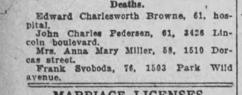
Omaha Daily Bee. January 1, 1922. Death occurred December 31, 1921.
In 1922, Rose Svoboda gave birth to her youngest and last child, Morris Svoboda. However, I was unable to locate any information regarding Morris beyond the age of eight at the time of the 1930 United States Census. I questioned whether he died in childhood?
House Without a Key
It all began to deteriorate, at least in the tracking of archival documents, with a Legal Notice for Indebtedness in 1923: “Notice hereby given that the amount of all existing debts of the Svoboda Granite Corporation, a corporation on the first day of January 1923 was $39,288.28.” Three Svobodas were designated as the Majority of the Board of Directors. Frank was the president, Rose as secretary, and Adolph was involved. It would appear they were operating at a deficit. The 1925 notice of indebtedness totaled $89,472.78. Frank Riha was appointed as a board member at that time. I would discover numerous legal cases initiated against Frank Svoboda.
Regrettably in November of 1927 Mr. Svoboda, by then considered a veteran monument manufacturer in the U.S., filed for bankruptcy in federal court. The personal property, stone and monument works, the numerous granite manufacturing plants and related lands had gotten away from him somehow. Ultimately there may exist a multitude of explanations to which I do not have access. The Svoboda vehicles were offered up at public auction, “belonging to bankrupt estate of Frank Swoboda [sic].” The event was highly visible, featuring a Studebaker touring car, an Avery two-ton truck; Indiana two-ton truck; a Ford sedan. By 1929 Frank Svoboda was remodeling the frame house at 1215 South Thirteenth Street and shortly thereafter I knew his family would again move in.
Late one night I wondered if this fall from grace happened because the Svoboda firm excavated from The Dome of the Great Spirit?
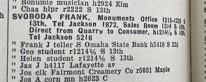
The 1929 City Directory showed Frank’s business location remained at 1215-1229 South Thirteenth Street. Salesroom: 1214 South Thirteenth Street. Dwelling located at 1214 ½ South Thirteenth. The census also notated that son George, aged 20, was becoming a draftsman in the monument company. This all gave me hope that the family business continued and that they had gotten out from under. The Daily Record, in part proved that, with their January of 1929 announcement that the Svobodas had paid off the mortgage on 1503 Park Wild Avenue to the Union State Bank… But the Svobodas continued to reside in their smaller house on the commercial lot until 1930, as indicated by the United States Census of that year.
The curious thing was, who resided at the residence at 1503 Park Wild Avenue? I had come to believe the Svobodas were renting it out although I had no real proof of this agreement. It appeared most cost-effective for them to rent the stone mansion while residing in a smaller property they already possessed. The 1929 City Directory showed a couple, Anton and Louise Hoffman living in the Park Wild house. It seems I had heard of an Anton Hoffman. Tuck that away for now.
Shortly thereafter Frank Svoboda and the family regained stability and relocated to the gorgeous 2051 Deer Park residence. 2051 Deer Park Blvd was a beautiful corner lot. Eight rooms, four bedrooms. The Vasak family listed it for sale in 1929. By the latter half of 1930, the Svobodas had moved in.
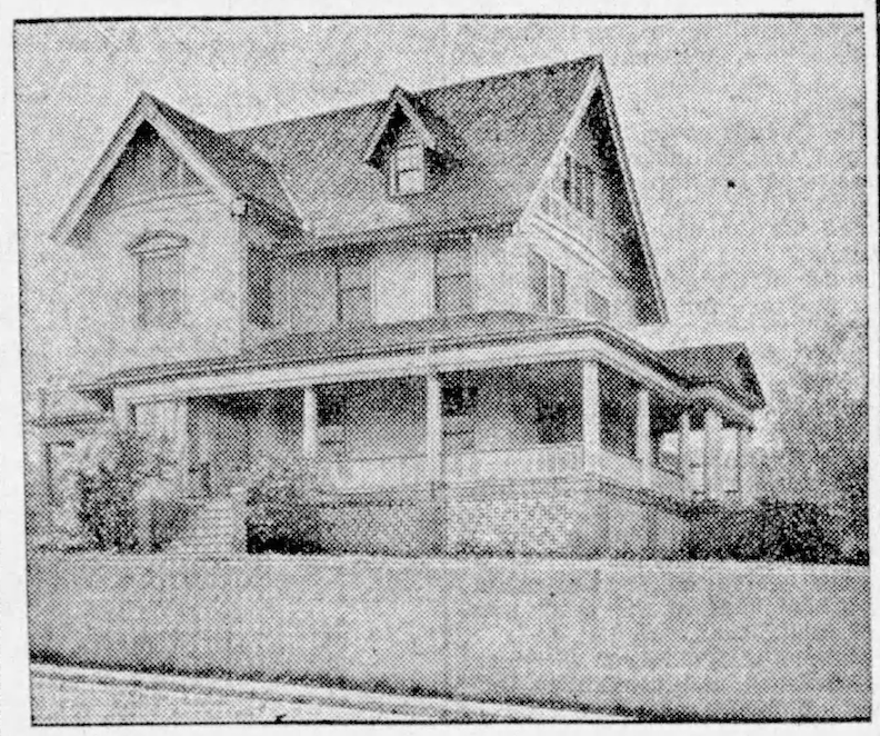
Omaha World-Herald. September of 1929. “An unheard of value $16,000 Home for $8,750 It must be sold!” The Stock Market Crash occurred one month after this advertising, marking the onset of the Great Depression.
I had a wonderful time surveying and walking this neighborhood throughout the summer of 2024.
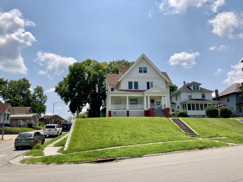
2051 Deer Park Boulevard front elevation. She is, indeed, a substantial house, and her elevated position on a corner lot enhances this dramatic presence. She significantly overshadows the Foursquare to the west, which is likewise a sizable residence. Now broken up into apartments, 2051 Deer Park Blvd appears to maintain her dignity.
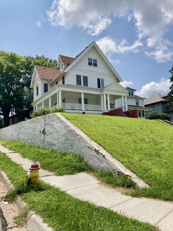
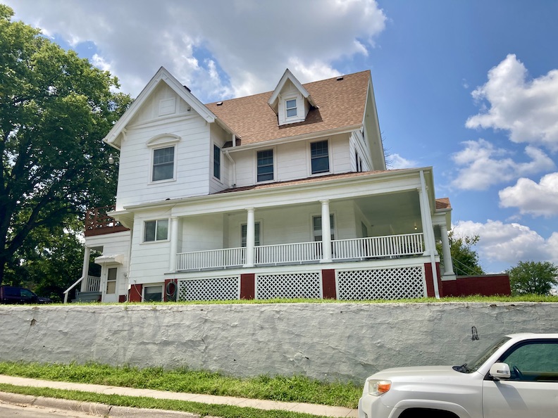
I love the intricacies of the eastern elevation—the care the architect devoted to ensure a pleasing perspective for onlookers who turned the curve.
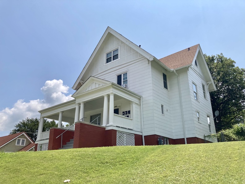
Although tidy and crisp looking, if this was my girl, I would want to make all of these yummy architectural features pop–at the very least, bringing the timbering back to life. Remarkable house and uplifting to find her in such good condition.
End of the Series
I think we can all agree that we should proceed and investigate the clues at 1503 Park Wild Avenue; but, certain inquisitive individuals, like myself, might be interested in learning about the fate of the Svobodas. I had gotten fixated, and the footprints beckoned to me… I will try to move quickly through these indications.
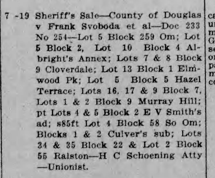
This regrettable story from June 1932 in The Daily Record indicated that Douglas County had confiscated Frank Svoboda’s multiple properties around town and conducted a Sheriff’s Sale. While we have acknowledged that Mr. Svoboda may have occasionally overextended himself in expanding his firm, it is important to remember that this most recent shocking news occurred during the Great Depression, a period when many individuals lost their dreams. Thankfully the monument works business for which he was most known, continued strong for many years to come.
I was saddened to read Mrs. Rose Mary Svoboda passed away in the hospital in May 1939 at the age of 49 following a seven-week illness. Mr. Frank Svoboda died just months later in August 1939 at the age of 61. Both are interred in the Bohemian Cemetery, an incredible family monument honoring their lives. When he died, Mr. Svoboda had been in the monument business for 35 years. Oddly the mystery son, Morris Svoboda, was absent from both obituaries.
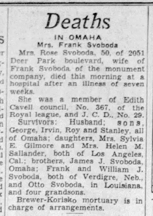
May of 1939. Evening World-Herald.
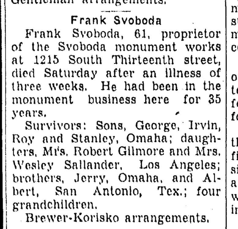
August 27, 1939. Evening World-Herald.
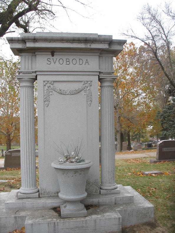
The Svoboda family plot with stately monument at the Omaha Bohemian Cemetery, 5201 Center Street.
At the end of that year, the Evening World-Herald reported the Frank Svoboda children paid a substantial payment to satisfy their parents taxes dating back to 1923. The item was titled “Back Taxes Collections Set Record.” The sheriff’s office apparently collected $14,848 in a single day during their delinquent tax initiative.
Son Irvin would take over the reins of the monument business and in 1940 the formal estate transitioned into Irvin Svoboda’s name. He was just 25 years old. At the time of the 1940 U.S. Census, Irvin lived with brothers Stanley age 20, Roy age 21, Inelda Svoboda age 20 and Leona Gleeson at 48. I assumed Inelda was one of the brothers’ wives. Leona Gleeson might have been Inelda’s mother or a live-in servant. Previously, I conducted an investigation about a French Normandy house in Omaha and some of you astute sleuths might remember the Irvin Svoboda name from that inquiry, as Irvin would go on to acquire other to-die-for-houses in Omaha. I’ve got to assume growing up in 1503 Park Wild shaped his tastes. That story here: The Curious Case of the French Fairytale Cottage Part One.
Back then, I wrote: “Something tells me Irvin could have his very own My Omaha Obsession book.” Maybe some day!
During the 1960s, there were sporadic legal issues involving the Svoboda Monument works. By 1966, the name had been altered to Omaha-Svoboda Monument Company, and they relocated to Thirty-second and Q Street (3213-15 Q Street) under the designation of Frank Renna, “Builders and Designers of Fine Memorials Since 1932.” The date was incorrect, but I deduced that it was when Frank Renna joined the ranks and I was still thinking of the Svoboda days.
Sylvia Elinor Svoboda Gilmore 1907-1998
George Joseph Svoboda. R 1909-1981
Helen Mae Svoboda Sallander 1912-1996
Irvin Svoboda 1914-1972 married Rose Wagner Svoboda 1917-2007
Roy Svoboda 1919-1962
Stanley Svoboda 1920-1993
Morris Svoboda 1922-
Please take up the Morris Svoboda cause, if you are able. And with that, dear Svobodas, loučíme se s vámi.
The Glass Key
The 1929 City Directory had shown a couple, Anton and Louise Hoffman, living in the Park Wild house. I was able to go back and retrace for 1929 Warranty Deeds of our 1503 Park Wild Avenue. The Hoffmans bought the house under Mrs. Louise Hoffman’s name, a recurring practice within this family. During the period when the Hoffmans acquired 1503 Park Wild from the Svobodas, they were also buying and selling other properties.
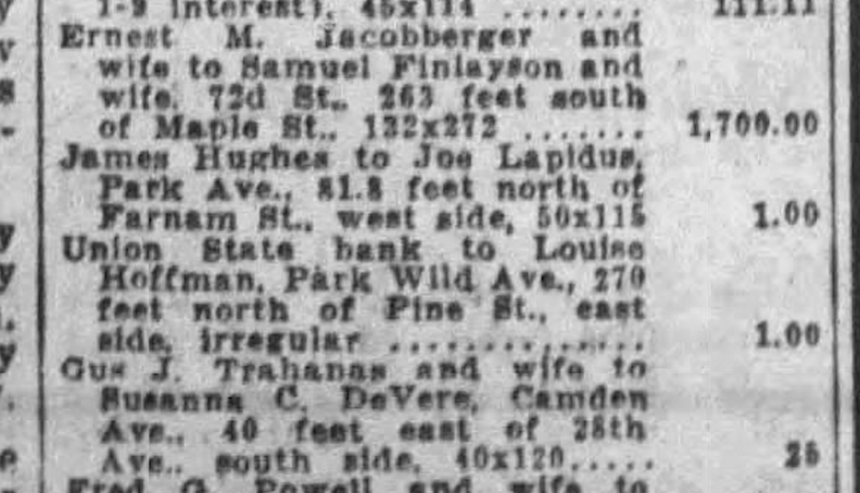
The Svoboda house moved from the Union State Bank into Louise Hoffman’s name. Lest you fear this house was seized by the bank or the sheriff, The Daily Record, showed that the Svobodas had paid off the mortgage on 1503 Park Wild Avenue to the Union State Bank. January 14, 1929. The Omaha Evening Bee.
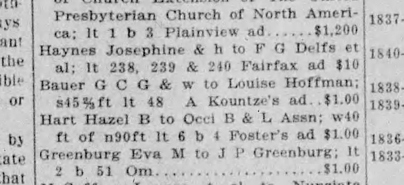
Louise Hoffman also secured the additional adjacent parcel, previously discussed, from George C. G. Bauer and his wife. January 29, 1929. The Daily Record.
Shortly into my cursory dig of the Hoffman family, I stumbled across something of a local scandal happening exactly in the timeframe the Hoffmans moved into the Svoboda residence. Charles McConnell, an accountant, was accused of aiding and advising in the preparation in the 1928 false income tax return for Anton Hoffman, former partner-operator in the Friars Club, a gambling establishment. McConnell’s prepared tax statement split Hoffman’s income between him and his wife Louise so that the resulting tax was lessened by about two thousand dollars. This case ended up going to federal court in May of 1931.
But it went deeper than that. I would find that Anton “Tony” Hoffman was an Omaha Underworld Character. This sent thrills.
The Hoffman Introduction
Anton Hoffman (b. 1882) married Miss Louise Rasmussen (b. 1883) on September 14, 1904.
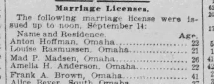
The Omaha Evening Bee. 1904.
State of Nebraska Marriage License. 1904.
George Hoffman (1851-1889) wed Anna Cipra (sometimes written Cippera) Hoffman (1852-1915) in 1872. Both were natives of Czechia. George Hoffman was the inaugural mail carrier for the “Bohemian District” in Omaha until a postal regime change in 1887 rendered him shockingly unemployed. Several months after losing his postal position, Mr. Hoffman launched a grocery store in his name on South Thirteenth Street. His brother was equally well-known, John Hoffman, manager of the Bohemian National Hall located at Thirteenth and Williams. The Hoffmans had several children; my investigation would find the infant child of the couple died in their home in January 1887 and possibly another five-year-old son later that year in October of 1887. Following the closure of the Hoffman store by creditors, (in January of 1889 the Joseph Garneau Cracker Company waged a suit against George to recover $63.70 on crackers sold in district court), which rendered Mr. Hoffman penniless, he perished under unspecified circumstances on Valentine’s Day at his residence located at the intersection of Twelfth and Williams Street. Mother Anna would remarry John Dohnal in 1898.
Louise’s parents were Henry Rasmussen and Anna Christinsen Rasmussen. Both originated from Denmark.
The newlywed’s residence after marriage was 1450 South Thirteenth Street, a home no longer extant. The location is within the enclosed premises where Kehm Contractors, 1446 South Thirteenth Street, store their masonry supplies.
Shortly after their nuptials, I was interested to find young Louise Rasmussen Hoffman began buying property around town under her new name in October of 1904.
The young Hoffmans resided at various locations along South Thirteenth Street and in nearby neighborhoods throughout their marriage. Evidence suggests that a cousin, John Hoffman, resided with them as well. Anton and Louise had two children: Gladys Ann Hoffman, born in 1905, and Anton W. Hoffman, Jr., born in 1908. Son Anton Hoffman passed away in 1911 at the age of three in one of the residences on South Thirteenth Street.
January 1911. Evening World-Herald.
Boss of the Fifth Ward
Mr. Hoffman registered for the World War I draft in September 1918, as evidenced by the draft card. The same card let on he was engaged in the oil business with Wick Petroleum Company, located in the Omaha National Bank Building. I would also find positions as a mail clerk at the National Printing Company, City License Inspector, and affiliations with the Omaha Athletic Club and the Friars Club. All honorable pursuits, or so I presumed.
A local pharmacist named Anton Hoffman was simultaneously practicing in Omaha, but he was not the same individual.
I was still a novice on the trail, merrily gathering clues as revelations against Mr. Anton “Tony” Hoffman began to emerge. In June of 1912, with local bootlegging limited to a few transient “resorts,” the vice authorities focused on gambling in Omaha, conducting raids on two locations. The Anton Hoffman Poolhall located at 1424 South Thirteenth Street, on that night was occupied by fourteen boys and men playing cards. All individuals, including Mr. Hoffman, were apprehended, and taken to the station. Then in 1915 Mayor Dahlman mysteriously appointed Anton Hoffman as City License Inspector, succeeding Dave Berkowitz. Mr. Hoffman took the position June 1 and quickly became unpopular with local peddlers not accustomed to paying licenses. That August, Tony brought a raid on twelve pawnshops for operating without a city license. Surprising to me, Tony was well entrenched in both the political world and the sporting realm.
Omaha, Nebraska, like many wide open, developing cities of a certain age, exhibited a deficiency in significant early law police presence or protective supervision. These vulnerabilities, coupled with the country’s geographical position, likely established a ripe foundation for a history of organized crime, especially prevalent in the early 20th century. The city was dominated by a formidable political figure, Tom Dennison, who many of you are familiar with. It seems to me that anyone could have intervened, wielded immense influence, and assumed control over the criminal governance in the city, because Omahans have consistently exhibited a modest, and seemingly accommodating demeanor.
Tom Dennison, as seen in later years, referred to as Pickhandle or Old Grey Wolf, oversaw Omaha’s extensive criminal enterprises, encompassing prostitution, gaming, and bootlegging.
In the early 1890s, Tom Dennison (1858 –1934), a gambler and saloon proprietor from Colorado and Montana, arrived in Omaha and quickly built up his political stronghold. He assumed dominance over the majority of the illicit activities in the city by forming a “gang” that governed the city’s administration, commerce, and criminal activities. Dennison’s authority encompassed law enforcement, with the police reporting directly to him and a mayor acquiescing to his demands. Dennison is recognized for facilitating the election of “Cowboy” James Dahlman as mayor of Omaha on eight occasions, and upon losing an election, instigating the Omaha Race Riot of 1919 as retaliation against the victorious candidate.

Omaha Mayor, “Cowboy” James Dahlman and his horse near a Native American encampment. Bostwick, Louis (1868-1943) and Frohardt, Homer (1885-1972). The Durham. 1916.
James “Jim” Dahlman or “Cowboy Jim” was elected mayor of Omaha in 1906, marking the first of three consecutive electoral victories. Ultimately, he served eight terms, 1906 – 1918 and 1921 – 1930, winning the name the Perpetual Mayor. Dahlman formed a close, corrupt alliance with Tom Dennison, who allegedly endorsed his initial campaign due to Dahlman’s “tolerance” of Dennison’s Sporting District. In 1908, the Nebraska Legislature enacted a statute mandating that saloons operate just during daylight hours. Mayor Dahlman spearheaded the opposition in Omaha, where he overtly exhibited his defiance in numerous drinking holes across the city.
It was within Old Grey Wolf’s outfit that Tony Hoffman operated, serving under the Dahlman regime, and was unabashedly referred to as “the representative of the gang in the city hall.” Hoffman was also called a Dennison gang lieutenant, a Dennison ward worker and the Boss of the Fifth Ward. Based on my study, on the legitimate face of things, this was a political title for a district. (There is also significant evidence that Tony Hoffman introduced his younger cousin, Milton Hoffman, to “the Old Man, who hired him when he learned the youth, a recent business school graduate, knew shorthand.” Milton would become involved in some exceptionally crooked dealings. Cousin Milton Hoffman has been accused of inciting and luring the mob from South Omaha to the Douglas County Courthouse Omaha Race Riot of 1919, which culminated in the lynching of Will Brown, a Black civilian.) From this distance, I would guess Tony Hoffman was executing the orders of Tom Dennison and his right-hand man, key lieutenant, William E. “Billy” Nesselhous, rather than acting as a mafia-style Boss who is Head or top decision maker. I may be mistaken. You see, despite my extensive research in the reputable press, survey of all books on this topic, review of legitimate ancestral archives, I discovered far more missing pieces regarding the Tony Hoffman history. No photographs whatsoever. He was a ghost. On that note, if anyone has photographs or familial information on Tony and the Hoffmans that they’d be willing to contribute to this article, please get in touch.
Tony Hoffman’s domain was the Fifth Ward: Pacific Street, the Missouri River, Deer Park to Twenty-fourth Street. We know the area well by now. The Ward Map of Omaha, Nebraska; Office of City Engineer. 1918. Map of the ward system in 1918, including the boundaries of the twelve wards or electoral subdivisions and the precincts therein. Borrowed from the Omaha Public Library’s City of Omaha Public Works Collection.
As Boss of the Fifth Ward, the literary dreamer in me began to understand why the Hoffmans would want to buy our 1503 Park Wild residence when it went on the market in 1929 and rule from the stone cut mansion atop the hill.
The Sticky Wickets
In the summer of 1918, Tony Hoffman was brought up on connection to drug dealing. Shortly after he was nabbed for vagrancy charges. The excuse being a “Dr. Tarry had been treating” Hoffman regularly and advised him “not to do any work.”
July of 1918. The Omaha Daily News.
The dates seemed off. Tony Hoffman was again made City License Inspector in May of 1918.
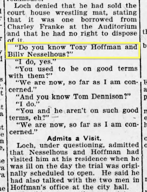
In 1918 Pete Loch, the wrestler, was in a real pickle. His legitimate business was at 1415 Harney Street under the name of Orpheum Gardens with associates Johnny Ford and John Leonard. The three, along with a Mr. Johnny Lynch, took interest in the Lakeside Roadhouse. Tony Hoffman and Billy Nesselhous testified that during a conversation between them and Pete Loch the latter said he, Loch, was “the best little jury fixer in town and had fixed many juries for Johnny (Lynch).” Apparently, Pete Loch had sought intervention through Tom Dennison when Loch is alleged to have stated he was “through with Johnny.” It was a tangled web submerged Omaha dealings and the newspapers could barely track.
1918. William E. “Billy” Nesselhous whom I have written of often. Tom Dennison’s right-hand man was a former jockey, son of a harness maker, a sportsman and savvy investor. Unbeknownst to the public, when Nesselhous died he was calculated to be the wealthiest man in Nebraska, having planfully invested his underworld earnings for decades. Nesselhous was buried in a substantial copper bronze casket weighing almost a quarter of a ton. Soon after Ruth Beavers of Kansas City asserted her claim for a one-million-dollar portion of the inheritance following Billy’s demise, identifying herself as Ruth Nesselhous, the common law spouse.
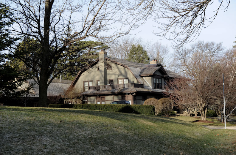
Of serendipitous interest, Nesslehous lived in 5505 Farnam Street, currently the Warren Buffet residence. Nesselhous originally purchased 5505 Farnam for his mother for seventy-five thousand dollars. Following her death, Nesselhous moved in. He converted the unfinished third story into a “lodge,” adorned with logs, functioning as a party room. He loved to socialize and threw frequent gatherings, said to have been flocked with pretty girls.
June of 1919. Evening World-Herald. Comically, Mr. Hoffman said he thought a man had the right to protect himself by giving a different name to the police.
October of 1920, forty-two men were caught in a Sunday gambling house raid. Judge Charles Foster was charged with protecting the patrons and house, particularly the Denby Smokehouse (cigar store) at 109 South Fifteenth Street. Because of the sweep, the illicit sportsmen were trapped in the cigar shot basement; some rushed through the coal hole under the sidewalk but were apprehended by the raiding party. Tony Hoffman of 1415 South Twenty-first Street was sentenced to fifteen days in jail. When brought up in court, Hoffman offered that he “is an old man, that he has been working for 15 years and has a daughter, 15 years old.” (Three fifteens in a row…odd). Apparently “a volume of condemnation against Hoffman” came down, accusing him of being an immoral character and declaring that Hoffman had not worked in over twenty years. Meanwhile I smiled to later find the United States Census of 1920 which logged Hoffman as a “manager in the oil industry.”
September 1924. The Mediator. Amid true scandals, it was easy to find silly pokes and nudges within the media.
In 1925, Charles Edward Stenicka Jr., the son of the city’s comptroller, wed Gladys Hoffman (1905-1994). Gladys, as you will recall, was the sole daughter of Tony and Louise Hoffman. Charles Jr. later ascended to the presidency of Stenicka Manufacturing Company and Sterling Electric Company. At the time of the marriage, Junior’s father was Charles Edward Stenicka, Sr., who served as the City Comptroller for an extended period. This appeared to be a beneficial union for numerous reasons.
A preferred dirty book of mine, River City Empire: Tom Dennison’s Omaha by Orville D. Menard (1989) implied that Charles Stenicka, Jr.’s relationship with his father-in-law, Tony Hoffman, extended beyond mere familial ties. In describing the underground network of backscratching, “Similarly, friendly and cooperative paving contractors took care of city streets, and a favored electric company did considerable work for the city and county perhaps not coincidentally a firm official was a son-in-law of machine old timer, Tony Hoffman.”
Why here is Gladys now… October of 1922. Omaha Daily News. For what it was worth, seventeen year old Gladys Hoffman, was chosen most popular girl at the Catholic Sokol Bazaar.
The Stenicka couple would continue to live with the Hoffmans for years to follow. In June of 1926 the couple had son Anthony Charles Stenicka (1926-1946) and later still, another son, Charles E. Stenicka III.
The Friars’ Club Tale
As introduced earlier in our Hoffman narrative, the Hoffmans became embroiled in a local scandal shortly after relocating to 1503 Park Wild Avenue in 1929. But as most scandals do, the underlying story extended further back in time.
The Friars’ Club was widely exposed in the winter of 1926 when local grocer, Otto J. Smith gained notoriety after testifying following his public bankruptcy, having incurred a loss of $19,000 in a single year at the club. Smith provided testimony that he lost money when he shot craps in the Friars’ Club. Few Omaha officials professed any knowledge of the place, which purportedly opened in the fall of 1924. Tom Dennison said, “I don’t know anything about it.” When pressured, Dennison explained Friars’ was not a gambling club but a political club. Later he let on his office was one floor below the Friars’ Club in the “old Elks’ Club building.” This building was at 315 South Fifteenth Street, renamed the Bankers Savings building. Within Jon L. Blecha’s amazing Cigars and Wires: The Omaha Underworld’s Early Years I learned that Billy Nesslehous’ real estate office was, coincidentally, in the same building. It is widely known that during his tenure, Dennison operated an office in the Budweiser Saloon in the Sporting District (the vicinity of Sixteenth and Harney), where he oversaw his assets. This “sporting” term was a prevalent and kindlier designation for all forms of gambling and prostitution. Brothels, gambling venues, clandestine bars during prohibition to include clubs, and cigar shops were referred to as sporting houses. Sportsmen were those partaking in gambling, alcohol consumption, prostitution, and even racketeers or a city or crime boss could be classified as sportsman. Was the Budweiser Saloon underneath the Friars? Did Dennison have two offices? Or was this Elks Club office a Dennison ruse?
February 1926. Evening World-Herald.
Regardless Dennison finally confessed to going to the Friars’ Club “once” to see Tony Hoffman “at the door.” Hoffman was acknowledged as “night management.” Tony Hoffman was sleeping at noon in his residence at 3164 South Thirteenth Street when the newsmen came to call. Like the well-trained Boss’s Daughter, Gladys answered the door and gave word that “an appointment with him would be very difficult.”
As the story of the Friars’ Club came to light, anyone in Omaha out of the know, quickly came into the know. Friars’ Club was Omaha’s most notorious gambling place, taking in about $20,000 a week. The Friars ran high rolling dice games, poker games, blackjack games. “The play was tremendous because the Friars was the only dice game in town, Nesselhous and Dennison saw to that.” If an independent operator wanted to open up a game, he was immediately raided by the police. Nesselhous and Dennison controlled the police department. They were also friendly with the city’s most prominent bankers.
Site of the original Elks Lodge at 313 South 15th Street in the Withnell Building. This was where Tom Dennison political boss was headquartered, purportedly. Bostwick, Louis and Frohardt, Homer. The Durham Museum. 1916.
The Friars’ Club was at Fifteenth and Harney. My investigation revealed the Dennison gang began leasing the third floor of the building sometime in 1924. This location was known as the old Elks’ Club Lodge building, turned Bankers Savings building. (I discovered the Elks’ Club Lodge built a new building at the northwest corner of Eighteenth and Dodge in 1923). As for the operation of the Friars’ Club: “An elevator takes one up as long as the club is running. An operator is on duty most nights until 3 or 4 am or until the play runs out. The place opens for business at 2 pm each day. A customer was frisked immediately leaving the elevator by an outer guard. He is frisked for a firearm. If unknown to the inside man, the visitor is given the exhaustive once over by viewing of a tiny peep hole. This inside man then gives the final assent to the outer guard. The door to the Friars’ club opens. 30 by 50 ft. Couple of billiard tables, converted for crap games. Blackjack tables. Blue haze of smoke. Little conversation. The proprietors circle about. Tony Hoffman is an affable, pleasant appearing, young fellow of 35. He looks like the ordinary bank clerk. Frank Housky is a big jovial fellow—he’ll laugh with you until you want to borrow money. Harry Pullman is a little dandified fellow, older than his partners, gray haired.” Sidenote: What Hoffman, Housky, Pullman and Friars were to games, Eddie Barrick and Whitey Petty were to the horse race betting arm of the Dennison faction.
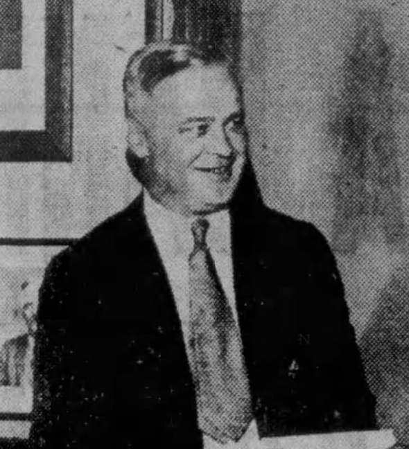
Frank Housky, “well-known figure of Omaha’s submerged life.” Part of the dope gang of 1917. Also called “Dennison’s main card and dice man.” Housky wisely left Omaha for Los Angeles then settled comfortably into the Las Vegas scene with his gambling club safely within the walls of the Apache Hotel in 1936.
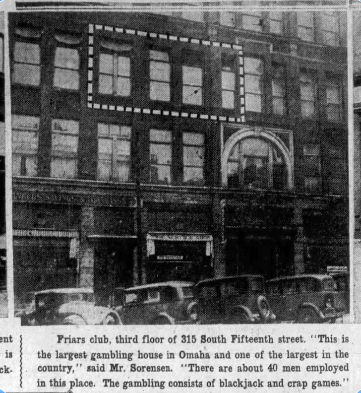
February of 1929. Evening Bee News.
Strangely several civil cases were inexplicably started by those poor souls seeking the recovery of substantial sums lost at cards to Tony Hoffman and Frank Housky at the Friars’ Club. When a third gambling lawsuit emerged, a further startling detail was revealed: Tony Hoffman was proprietor of a basement gambling den beneath a pool hall at 1308 Douglas Street. An investigation conducted by City Commissioner Dan B. Butler revealed additional clandestine evidence. The Friars’ Club on the third floor was connected to two other rooms on separate floors within the same structure, as well as rooms in the basement at 203 South Nineteenth and in the basement of the Dodge Hotel at Thirteenth and Dodge Streets. This was the lair beneath the billiard hall. Butler, when pressed, would divulge: “The Friars’ Club was first started as a club with a membership. Recently membership cards have been disregarded and anybody who has the money can go there. I am ashamed to state that some members of our police force have been seen there.” Police Chief Dana Van Deusen initially claimed he was unfamiliar with the Friars’ Club, but subsequently remembered it, asserting that he could not conduct a raid due to its status as a secret fraternal organization. Apparently, Sheriff Endres conducted a visit but did not make any arrests. He observed several harmless games of pinochle in action. For more on Sheriff Endres, check out my earlier investigation: Omaha Crime Files: The River Girl.
In 1929, Christian Abraham Sorensen, the newly appointed Attorney General of Nebraska, declared his intention to “personally stop gambling in Omaha.” The Friars’ Club as a timely, well publicized target was shuttered. The relocation of The Ladies’ Auxiliary of the American Legion to their new premises, formerly the third floor of the Friars’ Club, that October, conveyed a powerful message of renewal. Sorensen would complicate matters for Dennison and his associates from that declaration forth. Due to lack of trust in local law enforcement, Sorensen ultimately convinced the U.S. Justice Department in 1932 to commence a federal case against Dennison’s entire enterprise. The remainder is well-documented history.
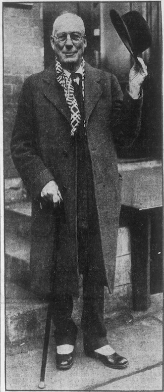
1930. Omaha Evening-Bee.
But we’ve got another matter to square up. When the Hoffman family moved into 1503 Park Wild, I mentioned they were in some hot water over taxes. This dual-income case ended up going to federal court in May of 1931. The government initiated a prosecution against the Hoffmans’ tax accountant, Charles S. McConnell. McConnell was indicted for income tax fraud related to the drafting of the 1928 tax returns for Tony and Louise Hoffman. McConnell divided Mr. Hoffman’s 1928 income with his spouse to circumvent income tax obligations. The Hoffmans asserted that they were simply adhering to professional tax counsel. Partners Frank Housky and I. R. Pullman from the Friars’ Club were summoned to provide testimony. Mr. Hoffman remitted the outstanding amount to the authorities, and it appears there were no active charges against him. Tony Hoffman, “ill at home” having “suffered a relapse and unable to testify at the hearing,” left Mrs. Hoffman to confront the defense’s allegation that her tax return was “based on profits in brokerage deals transacted for her by her husband in her name.” Simultaneously, accountant McConnell refuted any allegations of misconduct. This lawsuit dragged on until 1934, resulting in all parties walking away without blame.
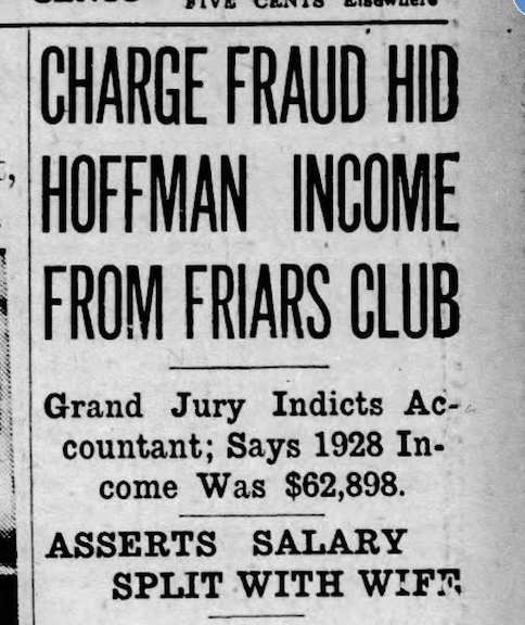
April 1931. Omaha World-Herald archive.
The Notorious of 1503 Park Wild Avenue
Tony and Louise Hoffman resided at the glorious 1503 Park Wild Avenue for several decades. Despite its previous Svoboda history, the Hoffman family made this stately mansion their home. We can only imagine who was invited into the 1503 Park Wild Avenue home in the Hoffman era. The property reportedly featured a formal entry hall, a spacious living room, an expansive dining room, a kitchen with a breakfast room, five bedrooms, color-tiled bathrooms and powder rooms, a sizable third floor with a half bath, and a generous leisure room in the basement.
A study of the 1930 U. S. Census revealed a residence appraised at $18,000. Tony, at 47, stated he was a “speculator in the stock industry.” Regardless of its veracity, Hoffman was regarded as a personal friend and political aide with various arms of local politics. At 47, Louise was a housewife, likely occupied with her daughter and grandchildren. Charles Stenicka, aged 32, his wife Gladys, 25, their son Anthony, 3, and their infant Charles, 11 months, resided with the Hoffmans. According to the 1940 Census, Tony and Louise were the sole occupants of the residence. Of note Hoffman completed the seventh grade, while Louise completed the fourth grade.
Psssst….Little Italy Check-in
All the while Dennison was the political crime boss of Omaha and the Hoffmans lived on the hill within Tony’s assigned Fifth Ward, Little Italy had become the epicenter of criminal activities related to the production, distribution, and rivalry over earnings from illicit booze during Prohibition (1920-1933). Anthony “Tony” Joseph Biase a native of Omaha’s Little Italy, was the preeminent Mafioso in Omaha from the Prohibition through the 1970s. Tony Biase was an American mobster with an extensive career in gambling and narcotics, serving as a caporegime in the Omaha faction of the Civella Crime Family or the Kansas City Mafia started by the DiGiovanni Brothers. I will condense this very important storyline but only because our tale is weaving ever longer into the night. Through his connections in the mob-controlled casinos of Las Vegas, Biase’s activities became intertwined with Vito Genovese, the Boss of the New York Genovese crime family. Tony Biase later was appointed Boss of the Omaha organization. I certainly would like to learn more about how these two Tonys commingled and oversaw this Fifth Ward. A neighborhood man to the end, Mr. Biase passed away in his 80s in Little Italy.
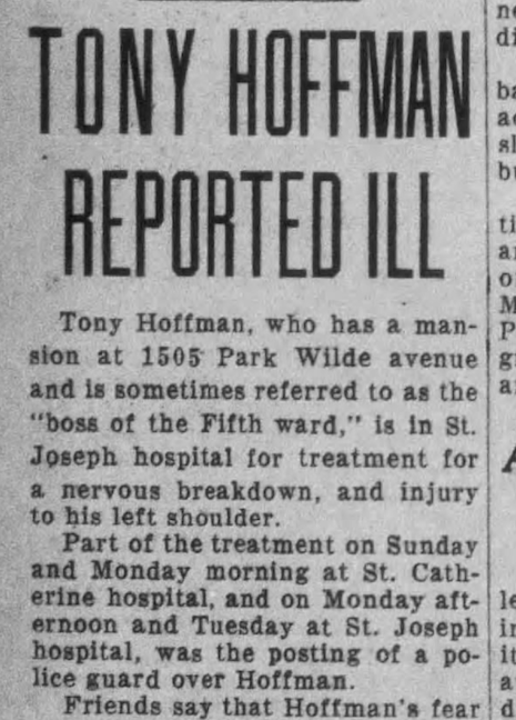
1931. The Omaha Evening-Bee News. Was this a plant? Why would this story be released to the public?
In September 1931, Tony Hoffman had a “nervous breakdown” and received treatment at St. Catherine and then St. Joseph Hospital, with a police officer stationed outside his room throughout his various stays. Friends asserted Hoffman feared being kidnapped and held for ransom, as had occurred with other prominent gamblers in Detroit, Chicago, and Des Moines. Four physicians were supervising Hoffman. To alleviate his concerns, Hoffman reportedly played 18 holes of golf daily, according to family. The intense heat was specifically cited as a factor in Hoffman’s eventual hospitalization. At the same time, pal Frank Housky was caught up in a public divorce case in which his wife sought $100,000 in alimony, while his vehicle was “accidentally” removed from a garage by the morals squad. This resulted in the suspension of the Police Sergeant. Both Tom Dennison and Billy Nesselhous were known to have feared being kidnapped or assassinated. Nesselhous narrowly escaped “the snatch,” underworld term for kidnapping three times.
Concurrently in December of 1931, whether connected or not, Louise Hoffman’s half-brother, fifty-five-year-old laborer Andrew Rasmussen, was discovered lying poisoned to death out on Pacific Street. The story given publicly suggested that Mr. Rasmussen was “despondent since the death of his wife” that same month. Some things we can never know.
This simultaneous Tony Biase underworld narrative and Tony Hoffman’s fears of kidnapping led me to contemplate whether the Hoffman estate was secured and exclusive, rather than the social center I had envisioned. Perhaps due to the stress Hoffman continually experienced, financial problems, the Great Depression or other unidentified factors, in May of 1932 the Omaha Sunday Bee News announced 1503 Park Wild Avenue was for sale. “$4,500 cash. Six rooms with additional sunroom on 1st floor, oak trim and floors. French doors.” Mysteriously the Hoffmans did not sell their grand home, instead staying on an additional twenty years.
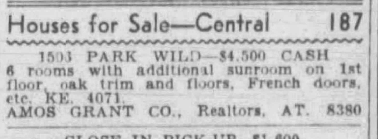
May 22, 1932. Omaha Sunday Bee News.
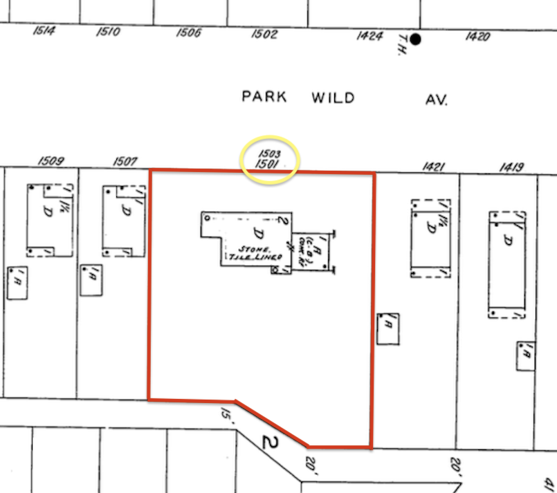
I observed a possible clue derived from the 1934 Sanborn Map, which we shall examine shortly. Yes, yes. I realize we’ve seen this one before. I highlighted our 1503 Park Wild Avenue in red. The upper portion of the image is oriented westward, positioned laterally to facilitate the evaluation of the postal addresses inscribed over the property boundary, also highlighted in yellow. “1501” and “1503” are included. Do these two home addresses represent the remnants of the Hoffman-Stenicka shared residence? The Great Depression and the 1930s posed significant challenges for most families, and as our previous investigations let on, families with large residences sometimes took in renters to alleviate financial strain. Do the two addresses labeled on this 1934 map suggest that the Hoffmans rented a section of their expansive home? 1934 Sanborn Map lent by Trina Westman and Shelley McCafferty of the City Planning Department.
I was captivated by the idea of the Hoffmans having created a concealed corridor located behind a built-in bookshelf. Alternatively, I fantasized and fixated that it may have sprung from their basement through a doorway in the hillside behind the home. When I took into account Mr. Hoffman’s mental bearing and his predisposition for, seemingly, anxiety related illness, his very concern for his safety may have prompted this extreme measure. The more I learned about The Gang, my daydream appeared to be within acceptable limits. Was there a subterranean vault? Could there be a tunnel beneath this residence? Oh dear…Oh, I do hope the current owners make contact.
Deadline at Dawn
Mayor James Dahlman served for an unparalleled twenty-one years. He passed away on January 20, 1930, in Excelsior Springs, Missouri (story forthcoming) while mayor of the city. Tom Dennison passed away on February 14, 1934, in San Diego, allegedly due to injuries sustained in a vehicle accident. The Dennison political machine, at least nominally, terminated with his death. Billy Nesselhous died on January 2, 1937 in a Rochester, Minnesota hospital after a sudden stroke. I could find not even a peep from Tony Hoffman after these deaths. Anton “Tony” Hoffman died at the age of 71 in the 1503 Park Wild residence on July 23 of 1953.
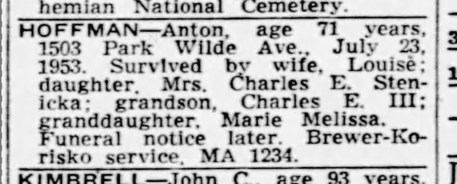
July 23, 1953. Evening World-Herald. (Grandchildren listed as Charles Edward Stenicka III and Mystery Miss Marie Melissa, whom I could not track. Grandson Anthony Charles Stenicka, previously mentioned, had died at the age of twenty in 1946.)
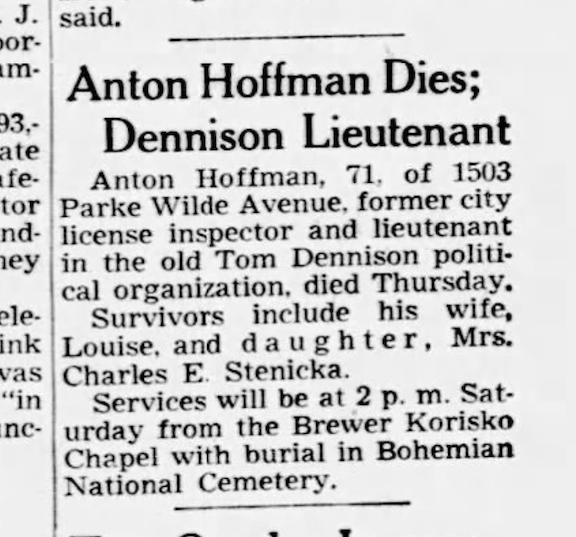
July 24, 1953. Evening World-Herald. It was more of an obituary than most of us will received and yet divulged nothing new. Oh Tony Hoffman, we hardly knew ye.
Whispering Footsteps
Mrs. Louise Hoffman continued to live in the large stone carved home until selling to a fraternity (!) in June of 1956. That July she relocated to another of the Hoffmans’ longstanding properties, 3465 South 13th Street, which has subsequently been incorporated into Omaha’s Henry Doorly Zoo land. She lived out the rest of her days until passing away in that home in December of 1958.
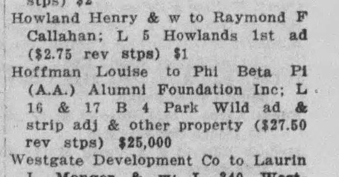
June 27, 1956. The Daily Record. Mrs. Louise Hoffman sold to the Phi Beta Pi Alumni Foundation Inc.
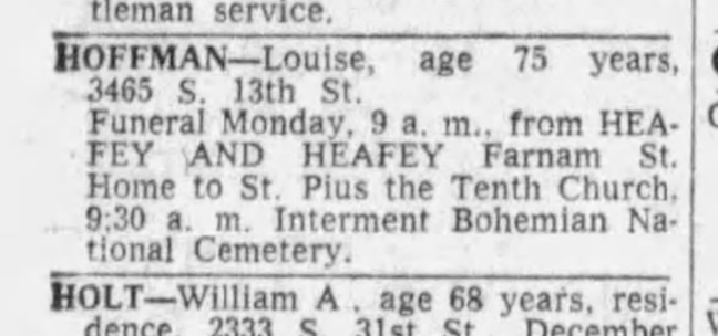
December 16, 1958. Omaha World-Herald.
Headstone photo by Warren Cupples. January 1959.
The Daily Record stated administration of Louise Hoffman’s estate to Charles E. Stenicka, Jr. It was the end of an era and one that I had barely scratched the surface on. I’ve got to think that is how the Hoffmans preferred things. If anyone possesses photographs or personal information regarding the Hoffman family, kindly share them.
House of Strangers
In June of 1956, the Phi Beta Pi Alumni Foundation Inc. purchased our lovely 1503 Park Wild Avenue residence for the Creighton medical fraternity, Phi Beta Pi. The fraternity was moving from their 115 South Thirty-fourth Street house, also located within a proper neighborhood.
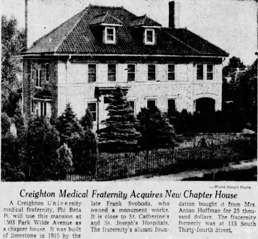
Here we see our first photographic coverage of the 1503 Park Wild Avenue home. “It was built of limestone in 1915.” Mrs. Anton Hoffman sold it for 25 thousand dollars. I was beside myself. Those evergreens!! Was Mr. Hoffman trying to wall himself off? It was headed that way, had future owners left them to grow. Fascinating. July 1956. Omaha World-Herald.
Exterior view of the Phi Beta Pi fraternity house, located at 115 South Thirty-fourth Street. The fraternity moved from 115 South Thirty-fourth Street to the Park Wild Avenue home. Bostwick, Louis (1868-1943) and Frohardt, Homer (1885-1972). 1954.
When a fraternity house is not located on a college campus, fraternities frequently acquire big residences, occasionally mansions, for chapter housing. We have found this practice in our previous investigations. This tactic was prevalent nationwide, although I have specifically observed similar acquisitions in Omaha starting in the 1920s. These once private residences, bought for fraternal housing, are called chapter houses or lodges. They are usually held in the fraternity’s name, an alumni association, or the university/college. Fraternities may also rent residences, including substantial ones. Sometimes fraternities move into other large buildings that were not constructed as residences, leading to strange and wonderful conversions…and sometimes muddlement long into the future.
104 South Thirty-ninth Street is a favorite of mine…most recently the Pi Kappa Alpha Delta Chi chapter, or UNO Pikes house.
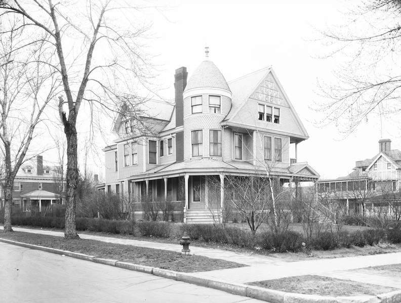
A gorgeous fraternity house for the University of Nebraska Medical College at Thirty-sixth and Dewey Avenue. Bostwick, Louis (1868-1943) and Frohardt, Homer (1885-1972). The Durham Museum. 1926.
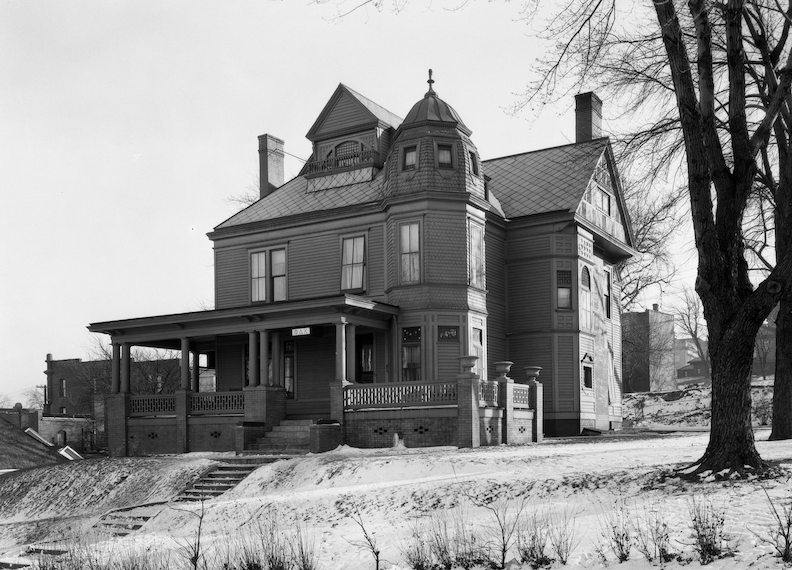
Stunning Creighton University fraternity house at 2123 Cass Street. Bostwick, Louis (1868-1943) and Frohardt, Homer (1885-1972). The Durham Museum. 1922. This was back when Creighton University was lovingly called “Hilltop” and sometimes, in referring to the Bluejays, the team was called the Hilltop Birdmen or the Hilltoppers.
The stately University of Nebraska Medical Center Phi Chi Medical Fraternity at 3708 Dewey Avenue was once the Charles E. Metz Mansion. For a brief intro, check out: The Cudahy Mansion Casebook.
The gorgeous E. K. Buck house at 3920 Dewey Avenue is now the Creighton Phi Chi Upsilon chapter house.
The once Sigma Phi Epsilon house at 3301 Harney Street has also received my attention. It began life as the old Northwestern Bell Telephone Exchange building. A brief mention here: Circo’s Bar Memories.
The mysterious 3618 Farnam Street, unfortunately razed, was one of the more interesting fraternity houses reconfigurations as it had previously served as a funeral home. That story here: A Passing Glimpse: 3618 Farnam Street.
And please, let is never, ever forget our shake shingle dream girl, 2226 Howard Street. Now razed. She was once a fraternity, as well. Article here: Mysteries of Omaha: 2226 Howard Street.
The Creighton Frat House
The presence of a fraternity in a neighborhood can significantly alter the local dynamic, especially if the surrounding buildings are single family dwellings. No matter how kind, how well behaved, how studious the students are, a neighborhood is affected, just as neighborhood effect can touch individuals. Although I do not know the exact impact that Phi Beta Pi had on the Park Wild block, it is interesting to consider. The Phi Beta Pi fraternity encountered an issue prior to selecting 1503 Park Wild, as they sought to acquire a sixteen-room residence at the northwest intersection of Turner Boulevard and Woolworth Avenue in May of 1956. This would have necessitated rezoning. Fifteen neighbors from Field Club, their attorney, and the Westminster Presbyterian Church appeared before the Omaha Planning Commission with a petition containing 281 signatures and a strategy to oppose the fraternity. The Field Club neighborhood was strong and organized, and this did not end well for the boys. Months later, Phi Beta acquired the Park Wild Avenue house with no hitch.
The Omaha City Directories recorded 1503 Park Wild under the Phi Beta Pi Fraternity and the name Lawrence Abbruzzina, occasionally, from 1956 to 1960. I was unable to locate this mystery individual in the typical historical sources until I searched Ancestry, where I discovered him simply labeled as “manager Phi Beta Pi Fraternity.” I assume the iron fire escape was installed at the rear of the home as a safety precaution. I possess no definitive evidence other than, the multitude of member-residents living in the house and the prevailing popularity of fire escapes at that time. The frat also raised a Phi Beta Pi mascot dog named “Hiper” in their time as stewards of 1503 Park Wild. In October 1956, the spouses of the Phi Beta Pi organized an open house and buffet meal, leading me to believe this was not an Animal House situation. Mrs. Bena, the Chi housemother, was present “to oversee the dinner’s progression.” Following the supper, the visitors occupied the remainder of the evening dancing in the adorned recreation room.The Creightonian reported that rush had concluded in November, followed by the pledge party with more dancing in the “rec room” where refreshments were served.
The dining room of a once grand mansion, turned into a fraternity’s Mid-century Modern dining hall, complete with diner-esque chrome-plated chairs of faux leather and big, sturdy tables. An eclectic mix of times and styles. (Not from our 1503 Park Wild house but you get what I am trying to show here.) Savage, John (1903-1989). The Durham Museum. 1950.
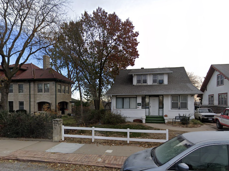
1505 Park Wild Avenue, the craftsman style home to the south was rented in the 1958-1960 school years.
Because of crowded conditions, in the 1958 school year, the fraternity rented another neighboring house as an annex. 1505 Park Wild, one house to the south, served as bedroom overspill. Hiper, the dog supposedly commuted between the two houses. Marie Jensen was fraternity housemother in those days, taking care of the boys in both homes. She said that Hiper hid when there were large parties.
1958. The Creightonian. This sad illustration of Hiper depicted an event when the dog went after a neighbor’s car. Living with medical students meant that Hiper received all of his care in the stone cut mansion.
Little Italy Neighbors
During the fraternity’s residence atop the Park Wild hill, the restaurants and businesses of Little Italy flourished in this era. Omaha, along with the nation, began to recognize and embrace the contributions of Italian Americans. Although I found Italian restaurants sprinkled throughout Omaha from the teens on, by the 1950s these Little Italy restaurants were thriving, attracting not only local patrons but also visitors from across the city. In my assessment, industry also continued to flourish along the river, albeit at a cost.
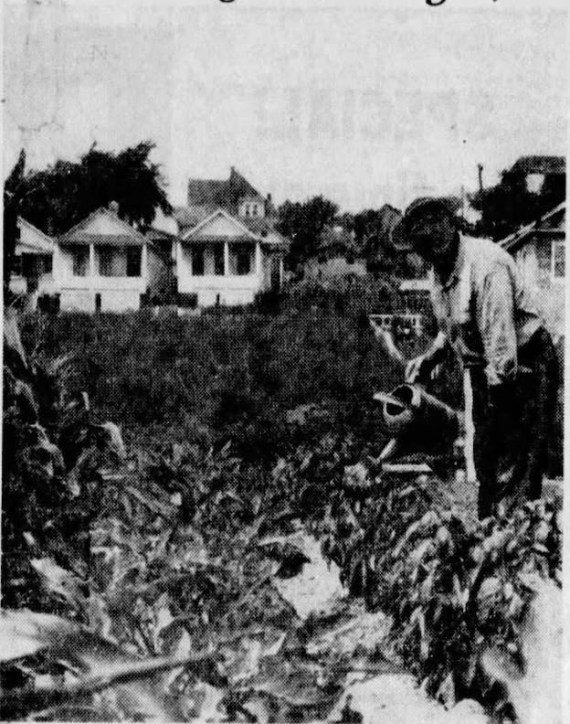
July 1956. Omaha World-Herald. “Alfio DiMauro, 1904 South Seventh Street, owns the lot next to his house and has a larger garden than most.” Perfect cottages seen in the background.
1957. The North Omaha Sun. 2020 South Eighth Street.
Little Frank’s Steakhouse (match cover) at 1102 South Seventh Street was a 1950’s favorite.
There were also homes like these still standing in Little Italy, amidst the activity in 1946. Durham Museum.
1950. The Jewish Press. THE Nisi family classic. 1211 South Fifth Street.
The Nisis.
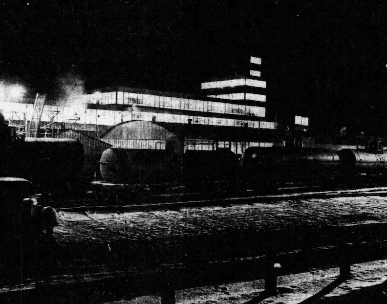
Night photo of the Quaker Oats chemical plant, 302 Pierce Street, from 1952. Omaha World-Herald.
The Chicago food and cereal company, Quaker Oats, announced their intention to locate a Quaker Oats furfural chemical facility in Little Italy in 1950. They would locate at 302 Pierce, both next to train lines and the river. In 1951, Charles M. Holmes, the manager of the chemical facility, refuted allegations that the plant’s waste materials would endanger the wildlife of the Missouri River, although admitting that they were dumping into the river. The facility at 302 Pierce Street utilized substantial amounts of previously discarded Quaker Oats corncobs, converting them into liquid furfural, which was then transported in tank cars to nylon production facilities. The processed husks, stalks, and cobs constituted the byproducts of the breakfast cereal industry, which were transformed into a chemical for synthetic product manufacturing. However, this process possessed the potential for significant fire hazard. There was a silo explosion of 1974, which couldn’t have been clean and a fire in 1976; it was the explosion and fire of 1994 that I noticed the company had astutely rebranded itself as QO Chemicals, no doubt to dissociate from the perception of a wholesome American cereal company releasing volatile compounds from their ingredients. An additional industrial output of this operation was cob hull ash, a fine, powdery material, which was hauled off to out of sight, Ponca Hills into the late 1980s. The Great Lakes Chemical Corp later bought the factory followed by more explosions and fires in the 1990s. They sold to Penn Specialty Chemicals who sold quickly in 1999. The factory complex was torn down and now the Leavenworth Lift Station Facility (sewer) has been refashioned at 302 Pierce Street.
The growing popularity of the Santa Lucia Festival also promoted good will within the community. Look at how beautifully people used to dress! A crowd of people around the shrine during the Italian Santa Lucia Festival. The Christ Child Center, the once Drexel Mansion, is seen in the yard behind. John Savage, photographer. Durham Museum. 1954.
1946. Omaha World-Herald. Caniglia’s World Famous Pizzaria. 1114 South Seventh Street.
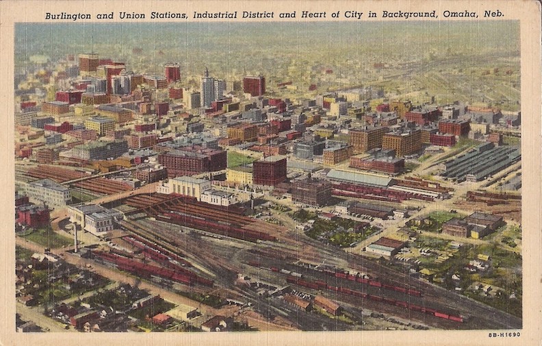
This wonderful painted postcard from 1948 provides a brief sight of the historic Little Italy, located immediately south of the Burlington and Union Stations. The camera is oriented at a northwest angle. The Missouri River is obscured from sight but would be located on the extreme right. The bottom left corner displays a glimpse of Little Italy. Locate your glasses and focus on Pacific Street. Observe the numerous residences and enterprises that have now vanished.
“You know what nice homes line the streets. Convenient to the railroads, the industrial and downtown districts.”
Behind the Wrought Iron Fence
Suddenly the fraternity’s inevitable plans to relocate were suggested Mid-Winter semester in a real estate announcement.
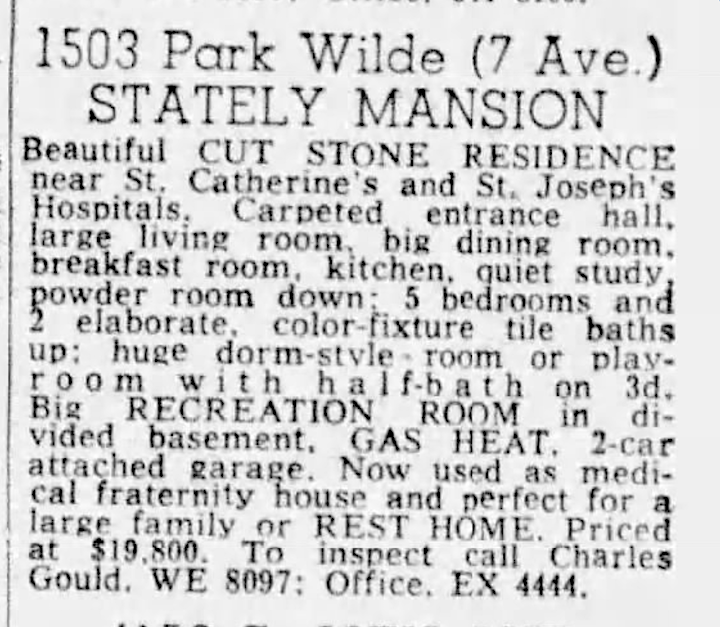
March 6, 1960. Omaha World-Herald. “Now used as a medical fraternity house and perfect for a large family or REST HOME.” *These enormous residences and mansions were occasionally repurposed as hospitals or rest homes. As we shall see later in our investigation tonight.
Whether related or not, there had been accidents at the home, predating the lawsuits, potentially catalyzing the sudden sale.
On March 19, 1960, the fraternity was confronted with a lawsuit initiated by neighbor Roger Vipond of 1409 Park Wilde Avenue–fifty-five thousand dollars in opposition to the Phi Beta Pi Alumni Foundation, Inc. Four-year-old Brian Vipond had sustained injuries while swinging on the iron gate of the 1503 Park Wild residence.
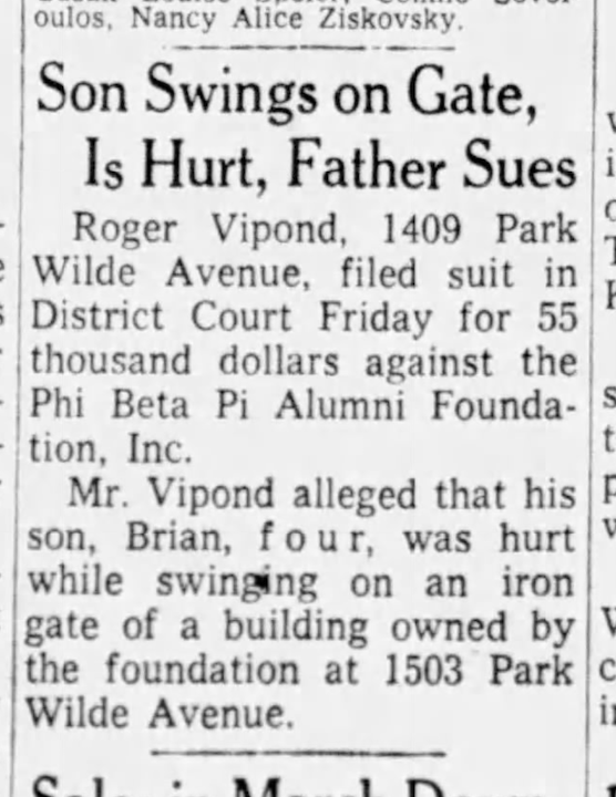
March 19, 1960. Evening World-Herald.
Lois “Sue” Harder and Roger Vipond were married in 1948 and resided a few doors away at 1409 Park Wild in the fraternity years. The Viponds had ten children. Roger Vipond was a World War II reservist and a graduate of Creighton University. The family would relocate to 3429 Webster shortly after this litigation. In October 1960, the Vipond case was dismissed with prejudice at the plaintiff’s expense; complete record waived; all in accordance with the motion for dismissal filed. I was pleased to find little Brian showed significant recovery, went on to become a Cathedral student, an athlete, he married and moved to a life in Arizona.
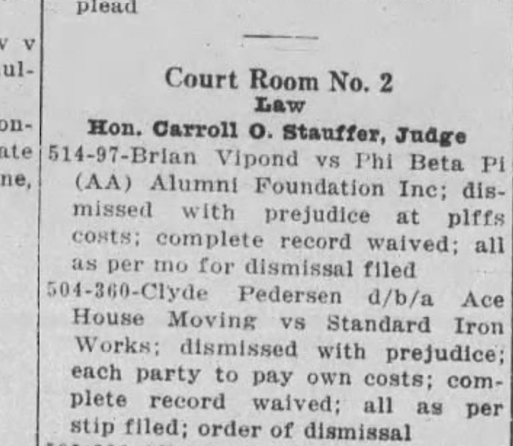
October 12, 1960. The Daily Record.
That could have concluded the dangerous fence narrative; however, as Omaha Fate would have it, years later, young Ricky Rexroat, aged seven, was struck by a vehicle and pinned against a fence near the intersection of Forty-ninth and Chicago Streets. The youngster was struck by a vehicle operated by Linda M. Brakey after colliding with a car driven by Roger B. Vipond. Levern Rexroat subsequently initiated legal proceedings against Roger Vipond, seeking $85,000 in damages. (Likewise little Ricky Rexroat would go on to have a full life.) To further my fence hobbyhorse, in 1976, Roger Vipond obtained a building permit and constructed a new fence at their 3429 Webster home.
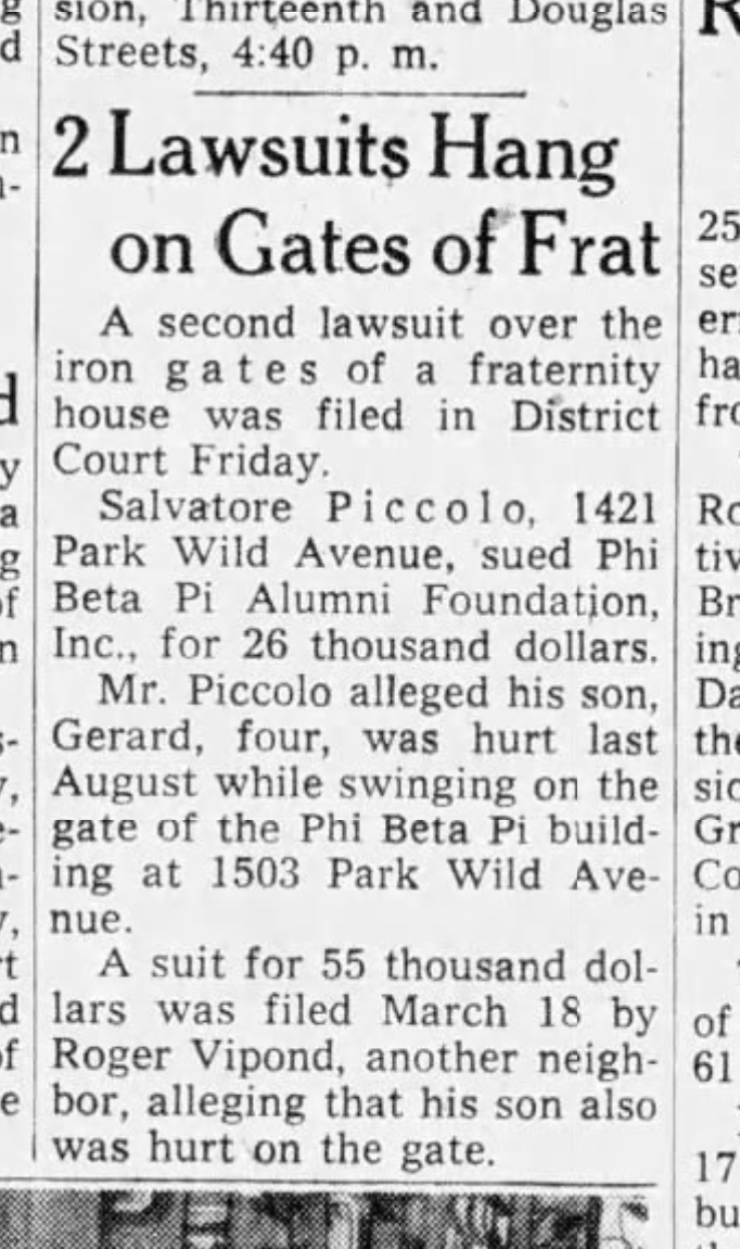
April 9, 1960. Omaha World-Herald.
One month after the Vipond claim, an additional lawsuit was filed over the fraternity’s iron gate. Mr. Salvatore Piccolo of 1421 Park Wild Avenue initiated legal action against the Phi Beta Pi Alumni Foundation for twenty-six thousand dollars following an incident in August 1959, in which his four-year-old son, Gerard Piccolo, sustained injuries while swinging on the same wrought iron gate.
Salvatore Piccolo was born in Carlentini, Sicily. He wed Maria Antonia Napolitano from Floridia, Sicily. The couple resided with their three daughters and little son directly north of the fraternity, in my favorite 1893 front-gabled, white frame house, which was held in the Piccolo name well into the 1990s. I suspect little Gerard Piccolo may have grown up to become the retired long-serving public defender of Grand Island, Gerry Piccolo, which pleased me greatly. Salvatore’s sibling, Joe Piccolo, fathered numerous children, including Anthony Piccolo, proprietor of Omaha Famous Piccolo Pete’s restaurant. The Piccolos were a well known family in Little Italy.
May 1960. The Daily Record. “demur to pet.” After trying to get to the bottom of these abbreviated legal terms, I have come think this is saying that the defense was contesting the legal validity of the Piccolo petition, rather than the truthfulness of the petitioner’s assertions. Based on the other case, the Piccolo v. Phi Beta Pi case seemed progressing towards dismissal, but I am not sure of how it all turned out. We do have some My Omaha Obsession attorney friends who could probably ring in on this. And of course, no one would know better than Attorney Gerry Piccolo.
The mesmerizing 1503 Park Wild Avenue wrought iron fence… I contemplated whether the children’s magnetic draw was riding the fence horseback style or standing in the gate’s bars as it swung back and forth. The substantial wrought iron gate may have provided a risk of hands and fingers becoming ensnared in the latch mechanism or sustaining cuts from the old ironwork design, or even being thrown off, dependent on how hard the gate slammed shut. I was uncertain. I had speculated earlier in our pictorial examination of the fence, if these accidents may have prompted the owners of 1503 to acquire a dissimilar, but “safer,” gate compared to the original wrought iron fence.
**Addendum of June 14, 2025. After heavy scrutiny of the 2006 Reconnaissance Survey photograph, I discovered the original gate of the fence was still present at that time. These findings contradict my initial hypothesis. I was wrong. Photo below shows white arrow pointing to what looks to be the original gate.
Photograph borrowed from the 2006 City Planning Reconnaissance Survey.
.
How the enigmatic residence, with it mysterious gate and fence appeared in that time period.
The Harder They Fall
In June 1960, the Phi Beta Pi Alumni Foundation Inc. sold the 1503 Park Wild Avenue property to Mr. Richard H. Hays and his wife. Potentially influenced by the legal issues, the maintenance of this home, the complexities from living in a neighborhood filled with little children or other unknown factors, the Phi Beta Pi acquired a new fraternity house, “located near St. Catherine’s and St. Joseph’s Hospitals,” which I tracked to 809 Pine Street. This address was situated in the previously mentioned Forest Hill neighborhood.
The 809 Pine Street home was described as a scenic site with historical significance—”the Val J. Peter residence,” where all family members were alumni of Creighton University. Mr. Peter had been the publisher of the Omaha Daily Tribune, a German language newspaper, and a former U. S. Marshal. The large 809 Pine Street turned frat house was razed in 1997. In fact many large homes had disappeared from this particular neighborhood in that timeframe. This all came to light when I began researching the 802 Worthington Street, formerly the William B. Meikle and W. R. Matthews’ house for tonight’s investigation. Oddly the Meikle-Matthews property had been renamed 1424 South Eighth Street, before being demolished.
The 802 Worthington Street home, formerly the William B. Meikle and W. R. Matthews’ house was renamed 1424 South Eighth Street, before being demolished. Perhaps it had it been broken up into apartments, leading to an additional address. Once I walked the land and saw this incredible historic photo, I could understand by its positioning on the northwest corner of Worthington and South Eighth Street that its porch and entrance could lend to either postal direction. Strange situation. A wonderful, proud home, it was torn down between 2014 and 2016.
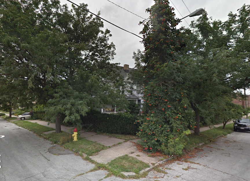
Here is the last time that 802 Worthington Street/1424 South Eighth Street was seen alive on public record. Mysterious and hidden.
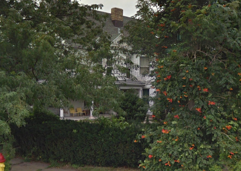
And there she is, magnified beyond the Trumpet Vines. Perfect, lasting memories.
This area was obviously Top Drawer at one time. I needed to know more about Forest Hill. In 1886, the Worthington Street was designated in honor of Bishop George Worthington, the Bishop of the Episcopal Diocese of Nebraska. The Worthington family constructed an opulent residence at 1240 South Tenth Street (photograph to follow), situated north of the intersection of Tenth and William. Contracts to pave Worthington Street, also known as Worthington Place, were initiated in 1889.
In the fall of 1886, Mr. Herman Kountze, or possibly all of The Posh Omaha Set, articulated that “Omaha’s greatest deficiency” was the absence of a uniquely residential district. The magnificent residences were reportedly dispersed “from Dan to Beersheba, so to speak We have no street which can be called our best residence street and no quarter which can be fairly denominated our best residence section.” Mr. Kountze’s “South Omaha property,” situated next to his picturesque residence, Forest Hill, with a river view, was previously noted in this investigation as a local gem. Kountze had subdivided his property near Brownell Hall and Bishop Worthington’s new residence into huge lots, called the Forest Hill addition, which he began selling exclusively to individuals personally known to him, who committed to constructing residences of stone or brick, with a minimum cost of $7,000. The mansion of Bishop Worthington was already constructed.
I know I set a boundary not to cross Tenth Street, yet I found myself crossing it.
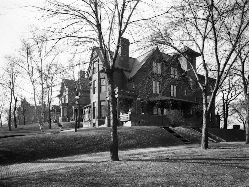
Still Standing! Go and give her some praise. The Cornish Mansion is seen to the south. The Presbyterian Hospital at 1240 South Tenth Street. A very large three-story brick building, formerly the Worthington mansion. Bostwick, Louis (1868-1943) and Frohardt, Homer (1885-1972). The Durham Museum. 1922.
After the sudden death of Bishop George Worthington in France, his residence at 1240 South Tenth Street (shown above) and its surrounding acre were acquired by the Presbyterian Synod of Nebraska and functioned as a hospital for several years. By the early teens, it was no longer affiliated with the Presbyterian denomination in Omaha and was regarded as a prestigious private hospital with a capacity of fifty beds. Mr. Robert McClelland, a Civil War veteran, together with his wife and daughter, twelve nurses, and twelve doctors, established their own hospital. McClelland sold the mansion to Dr. Karl Connell, who subsequently expanded and renovated it. The McClellands repurchased it and implemented more enhancements. Subsequently, the Lutheran Association assumed control of the ever-expanding mansion facility, establishing their own hospital. The mansion has been apartments for as long as I can remember.
William Street to the north, Eighth Street to the east, Pine Street to the south, with Worthington situated in between, and Tenth Street to the west. When I commenced my reconnaissance mission over a year ago, walking this beautiful neighborhood, where the Grace Bible College had, curiously, always been speckled throughout in my growing up, I discovered large swaths of green space within the blocks. (It should be noted that many vacant lots existed in the adjacent blocks of my childhood stomping ground, which like any 1970s kids, we utilized effectively for bike ramps, extensive ball games, after school fighting rings and clandestine hideouts. But children, by and large, do not play outside in kiddie-gangs anymore, so these Forest Hill fields were standouts in my survey.) By the looks of the magnificent homes that remained, I got the hint that the absent structures were likely mansions—certainly something quite glorious was missing. The holes were obvious, but it was exciting to conjure. I would find that these blocks and the remaining homes were the very remnants of the Forest Hill area. The deeper I dug, it appeared that the mid-1990s was last time that this neighborhood was chock-full of continuous original houses. Had the large homes been cut up into apartments? Had they fallen into disrepair? Was their presence deemed seedy for some reason? All of them? I was just weaving….It was inconceivable. Demolishing houses deemed “old” was a misguided Omaha trend prevalent from the 1950s to the 1970s. What prompted the razing of these homes in the mid-1990s?
Many empty parcels, well maintained along South Eighth Street. The wondrous 1425 South Eighth Street, who we met earlier, in the distance, to the north.
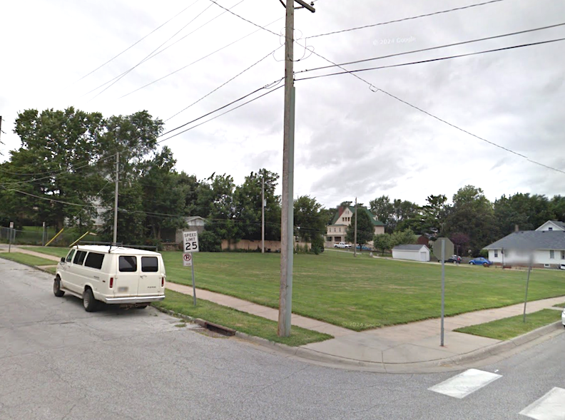
A number of flat, vacant parcels on the southwest corner of Eighth and William Street would have made a great impromptu neighborhood ball field in the 1970s. Not a child in sight.
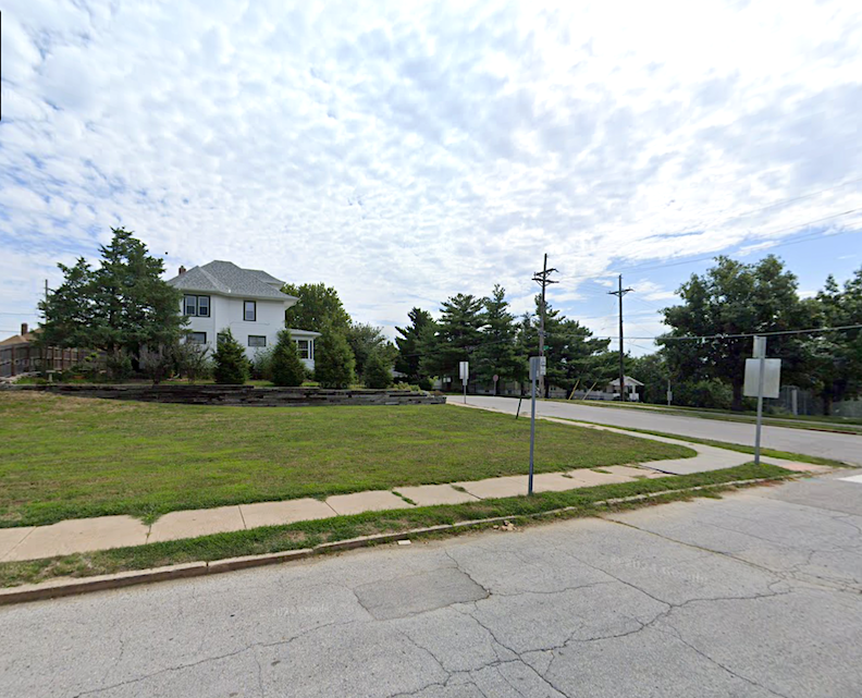
Northeast corner of Eighth and Pine Streets. Among these images, I did not include various empty lots between houses or vacant lots converted to surface parking. I think you get the idea.
While I could not find a photograph of 809 Pine Street, the Val J. Peter residence, I am including some great photographic images of homes in this close-knit area, which have since been demolished, in order to convey the ambiance and character of the long-ago tree-lined streets of Forest Hill. Unbeknownst to me, there was a current long-game project afoot involving Bluestone Development. Clearly, I had succumbed to a recently identified condition: Omaha Development and Construction Fatigue. This had been in progress for some time, although buildings were undoubtedly vanishing during the composition of this never-ending probe. Before we drool over the historic photos and the newest missing buildings to this area, let’s have an overview of what exactly happened to the elegant hilltop neighborhood.
Grace Bible College
In 1886, the Episcopalian Church established the new Brownell Hall, a boarding and day school for girls. This was previously mentioned, as the institution established on land provided by Mr. Herman Kountze.
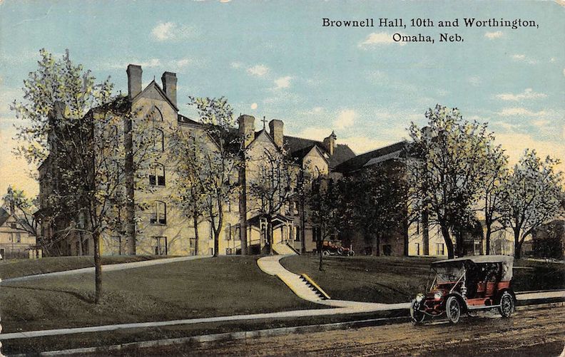
Brownell Hall. 1910 postcard. Lovely. The camera is looking across Tenth Street to the east.
Omaha Evening Bee, June 1886—”The laying of the corner stone of the new Brownell Hall, Forest Hill, in the immediate vicinity of Herman Kountze and Bishop Worthington’s residences, will take place tomorrow evening at seven o’clock.” I only leave this clue here as we will find an Omaha Famous Scavenger, of the best kind, rescuing this Brownell corner stone many years later.
Upon Brownell Hall’s relocation to the Happy Hollow neighborhood within the former Patrick Mansion, which subsequently evolved into the unparalleled Brownell-Talbot School, the United Methodist Church acquired the original Brownell Hall structure in 1922, repurposing it as a dormitory for young working women, designating it Willard Hall, later renaming it Stuntz Hall. At one time, the Presbyterian Theological Seminary acquired the keys to the expansive hall; nearby, the Presbyterian Hospital operated from the former Worthington family estate located at 1240 South Tenth Street, which is the origin of the nearby street name Worthington Street/Worthington Place. Owing to World War II and financial constraints, the Presbyterian Theological Seminary ceased their operation on Tenth Street. In 1943, ten Mennonite pastors and laymen established Grace Bible Institute by fundraising within their churches to acquire the former seminary building and inaugurate their educational institution. All Grace Bible classes took place in the former Brownell Hall-Presbyterian Theological Seminary facility, which provided dormitories as well. Fascinating to consider how many Christian denominations were involved with this building.
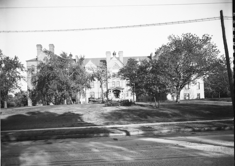
Opened June 1, 1923, Willard Hall was founded for the purpose of providing a homelike retreat for self-supporting young women, either attending school or working in Omaha. An exterior view of Willard Hall with a car parked on the lawn. 1509 South Tenth Street Willard Hall. Bostwick, Louis (1868-1943) and Frohardt, Homer (1885-1972). Durham Museum. 1924.
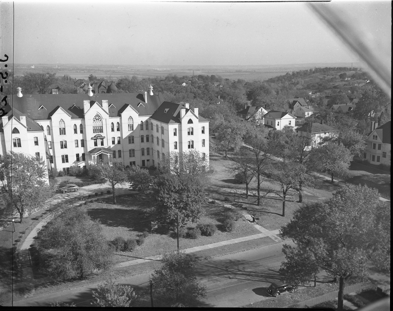
An aerial view of the Grace Bible Institute. This angle allows us to see how large the building truly was. The address by this time is 1515 South Tenth street. Savage, John (1903-1989). The Durham Museum. 1948. Study the massive houses lining Pine Street, to the south. Now all demolished.
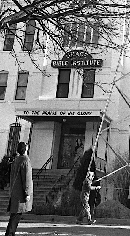
Years later the awning ’twas not as glorious.
Grace Bible Institute changed their name to Grace College of the Bible in 1976 but an even more significant event occurred in that year: the expansion of the college campus, which resulted in substantial alterations to the integrity of the Forest Hill neighborhood. This singular event, in hindsight, resulted in the neighborhood’s loss of a great deal of their community power. St. Catherine’s Hospital, to the north, site of the original Kountze family home, announced its intentions to move out west. Their 2.6-acre property at Eighth and Forest Avenue was sold to Grace. The college seized possession of the complex to the north in the autumn of 1977.
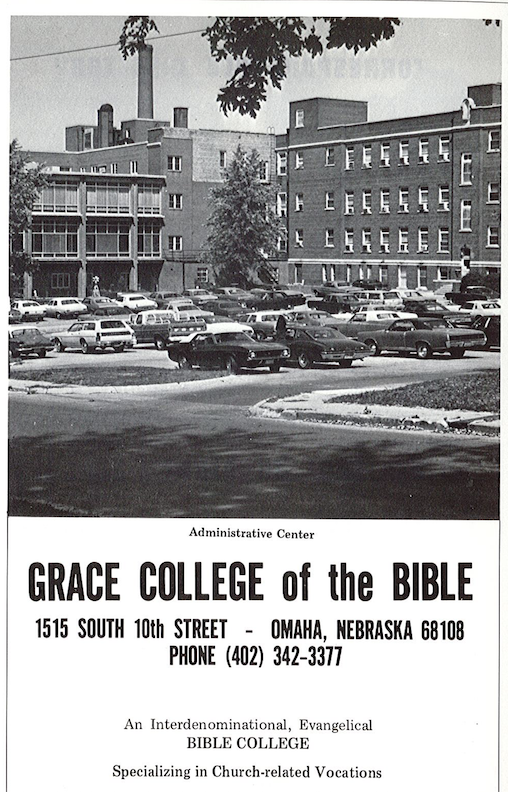
Grace University 1975-1976 Academic Bulletins.
As we have previously discussed, St. Catherine’s Hospital first functioned from the grand Kountze home, with later expansions to the property. Although the original residence was a part of the hospital deep into the 1930s, when Grace College of the Bible acquired the property in 1976, the Kountze residence had been entirely dismantled.
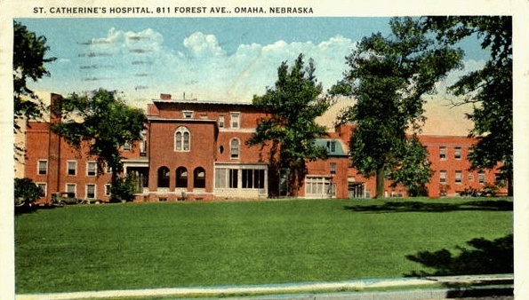
Wonderful little St. Catherine’s Hospital postcard with incorporation of the Herman Kountze mansion.

A more detailed view of St. Catherine’s Hospital at Eighth and Forest Ave exterior. The old Herman Kountze mansion is still attached to the new building. Bostwick, Louis (1868-1943) and Frohardt, Homer (1885-1972). The Durham Museum. 1925.
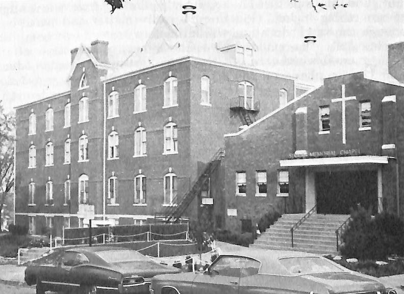
Grace University 1975-1976 Academic Bulletins. This photograph taken on Pine Street shows the southern elevation of “Old Main” and the Suckau Memorial Chapel entrance, completed in 1957.
At this point the Grace College of the Bible campus covered a three-block area from Forest Avenue on the north to Pine Street on the south and spread two blocks east to west from Eighth to Tenth Streets. My research indicated that the institution had begun acquiring the houses within that vicinity by the 1960s. They slowly bought up and rezoned some of the surrounding large houses. I couldn’t help but wonder where their money was coming from. I found hints that the college had dreamed of creating a more unified, modern campus, meaning surface parking, walking paths and green space. Through a lens of presentism, we now can see this might have signaled to anyone paying attention, that Grace sought the removal of the neighborhood homes.
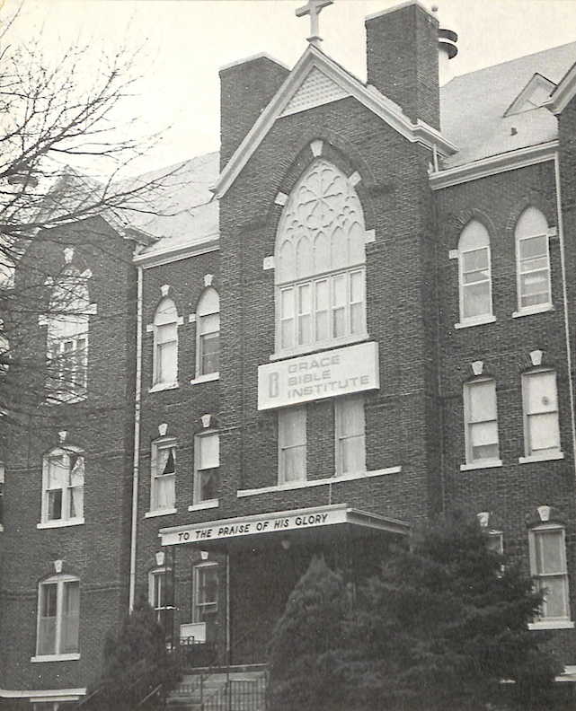
Old Main as captured in The 1975-1976 Grace Academic Bulletins.
The 1975-1976 Grace Academic Bulletins booklet revealed, “The institute now owns twenty-three buildings on or surrounding the original site.” New buildings constructed were the Suckau Memorial Chapel basement 1949 and first floor chapel by 1957. Dr. C. H. Suckau was a former missionary in India and served as president of Grace Bible Institute from 1943 to 1950. Schmidt Memorial Hall for Men 1962. Grace University Gymnasium, (renamed the Classen Gym) and Student Center (renamed the Burkholder Center) was built in 1967, housing the Grace Book Store and Grace Counseling Center by the 2000s.
Grace University Gymnasium renamed the Classen Gym at Eighth and Worthington Streets. Despite my advocacy for reuse, the integration of this aesthetically challenging structure into the new Pine Elementary School has not yielded favorable results.
The strange thing is the Grace school consistently lacked a substantial student body. By the 1980s, enrollment had decreased to 208 pupils. My examination led me to the college’s 52nd year when the Grace College of the Bible transitioned to adoption of the Grace University name in July of 1995. With a number of tracks of study within their programming, although still a Christian school, Grace University sought to legitimize their offerings, moving toward a traditional university system with bachelor’s and master’s degrees. Supported by twenty evangelical denominations and recent accreditations, Grace’s enrollment rose to approximately 468 students in the fall of 1996. They had to have assumed they would continue to grow their enrollment, bolstered by the rising popularity of the evangelical movement in the 1990s.
Grace University President Neal McBride announced in May of 1997 the school would tear down the historic Brownell Hall, renamed Old Main, as they had allowed the 122-year-old administrative building to “fall apart” on their watch. McBride also announced fourteen surrounding houses of the properties the college had assembled would also be razed. “We own a big piece of real estate in this area, but it is mostly houses.” (Yes, that is what happens when you move a college into a neighborhood. I am looking at you as well, UNO and UNMC. And Creighton, we see what you are doing down on Cuming Street. ) The demolition began shortly after. Much of that land would become green space I found when I began this case. Months later, McBride resigned.
Friends, I want you to steel yourself, because the story does not get much any prettier going forward.
Let’s just stop here and breathe a bit.
A Walk Among the Tombstones
Prior to the demolition revelation in 1997, I discovered Grace Bible had razed several substantial, doomed houses. For example, upon the death of Mary K. Cecha in 1970, Grace Bible snatched up her residence at 830 Worthington Street, which had been the home of the Albin and Mary Cecha family for more than fifty years.
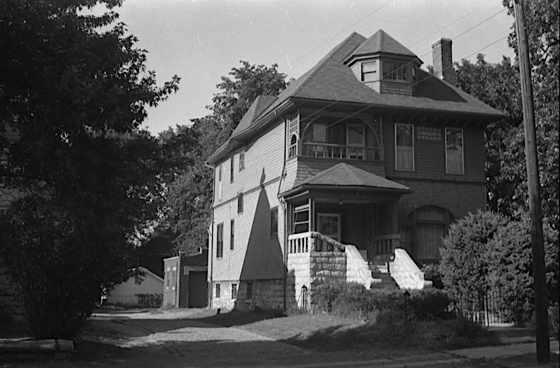
830 Worthington Street. Photograph by Martin Weil. The Durham Museum. 1964.
In 1979 the Grace College went before City Planning to have 1427 South Eighth Street and 830 Worthington Street houses leveled for surface parking.
In the 1970s, one hundred Mennonite Church volunteers from Kansas, Missouri, Iowa, and Minnesota congregated and commenced the dismantling of three wood and stone structures in the Forest Hill neighborhood. The Bruce mansion located at 1427 South Eighth Street was a turreted Queen Ann structure, constructed in 1881 (some archival material says 1891). It had been recognized as one of Omaha’s architecturally noteworthy structures by Landmarks Inc. 810 Worthington Street and 820 Worthington were also coming down, by volunteers’ hands; the homes were bought to make room for a new dormitory, but the purchase of the Old St. Catherine’s solved that. The two houses were occupied by students and faculty. Grace Bible only had 465 students at that time.
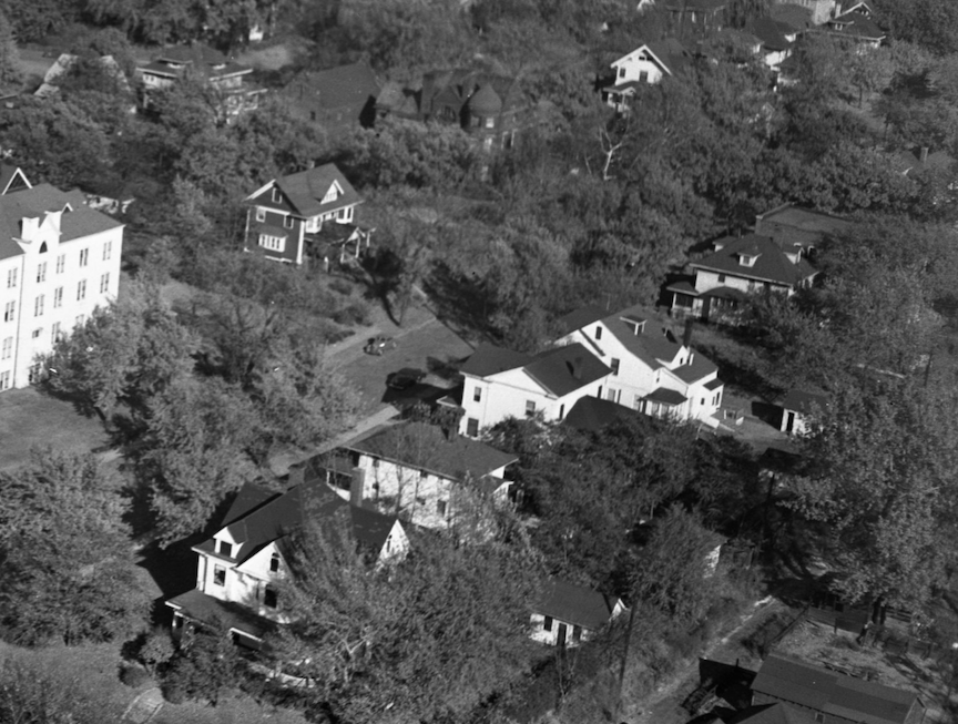
The southern elevation of Grace Bible Institute is seen on the left side of the photograph. Camera angles to the east. Pine Street extends eastward between Grace Bible and the substantial residences on its southern side, with one charming dark house on the northern side. All of these were dismantled by Grace Bible over time. One of these glories must have been the 821 Pine Street rabbit hole I fell into one night. The McPherron family possessed the extensive estate situated at 821 Pine Street. After Perry McPherron’s death in 1956, Mrs. Ella Kathryne McPherron remained in the residence and continued to lease rooms to tenants, a practice the couple had taken up in the 1940s. Following Mrs. McPherron’s demise in 1964, the home seemingly disappeared from records until it was announced it would be torn down in 1997. It appeared that as homeowners died, Grace sought to acquire the properties or perhaps the relatives reached out to the institution to commence the transaction. Savage, John (1903-1989). Durham Museum, 1948.
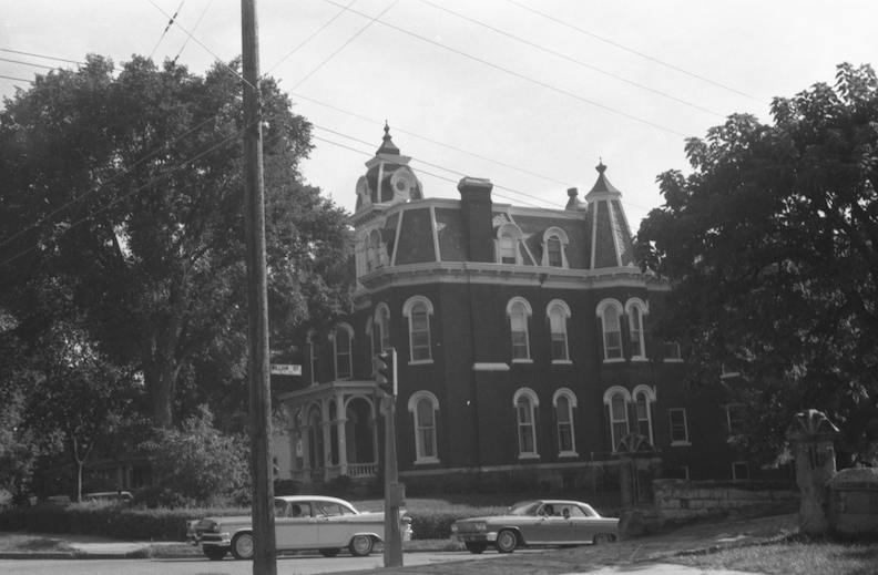
Cornish Apartments, 1404 South Tenth Street. Multiple stories, with large windows. Martin Weil. The Durham Museum. 1964.
Of note, Grace Bible College also possessed the historic Joel Cornish mansion located at 1404 South Tenth Street. Fortunately, the good people at Landmarks Inc successfully found a new owner for the three-story brick residence constructed in 1886 in the French Second Empire style, so relieving Grace of its ownership. The Cornish mansion stands today.
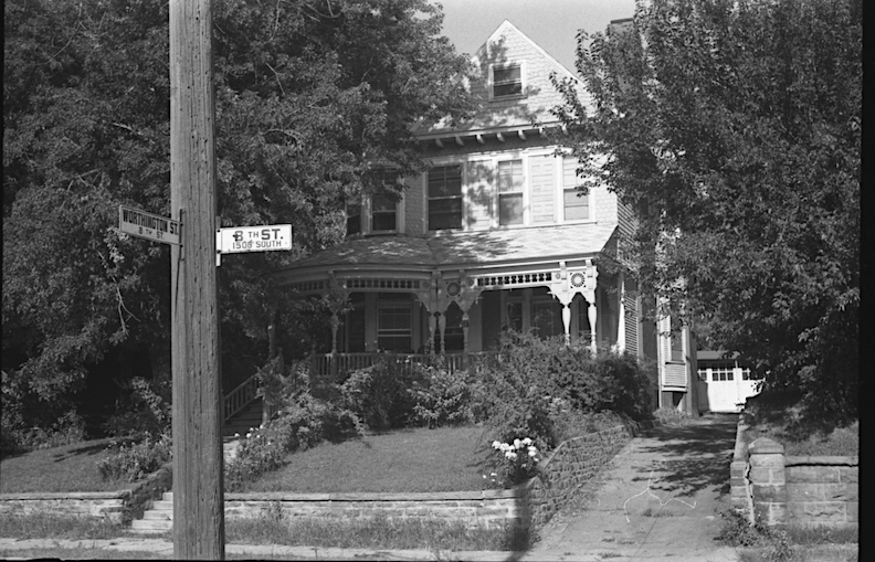
Edward E. Bruce, originally from New England, relocated to Omaha, where he operated a wholesale drug company. His mansion at 1427 South Eighth Street, constructed in 1891, was among the final exemplars of the Queen Anne architectural style in the region. Exterior was of geometric shingling and carved wood. Grace Bible acquired it in the 1960s and utilized it as a dormitory till 1977, when they declared they needed the lot but not the wonderful house. 1427 SouthEighth Street. Martin Weil photographer. The Durham Museum. 1964.
The official tear down list from 1997.
Old Main
1505 South Eighth Street
807 William Street built in 1910. Strangely in February 1995, the 807 William home burned down, or a portion of it, deliberately set ablaze. Grace possessed it. I am not implying that they ignited the fire.
805 William Street
811 William Street
809 Worthington
811 Worthington
813 Worthington
814 Worthington
816 Worthington
1517 South Eighth Street
809 Pine Street
817 Pine Street
821 Pine Street
1506 South Tenth Street
Grace Bible College stopped using the original Brownell Hall building, by then nicknamed, “Old Main,” in 1984. They said it was falling apart. This photograph shows the last time the building was seen standing. Thankfully Omaha native and preservationist, Frank Horejsi, was able to get inside the Brownell Hall cornerstone and save the treasures within, placed by the Episcopalian founders.
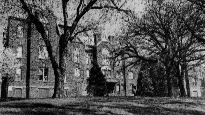
May of 1997.
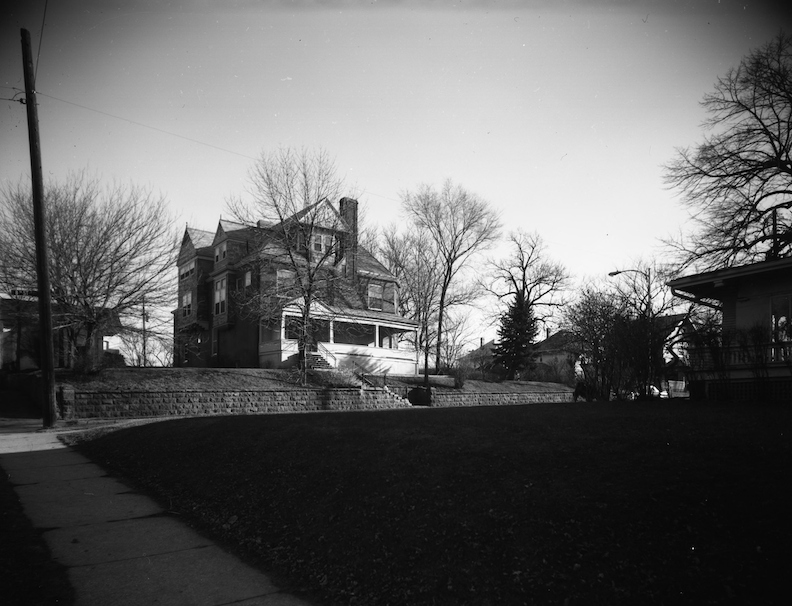
The Joseph Barker house at 1505 South Eighth Street was razed with the large group of demos in 1997. Built in 1901, patterning his dining and living rooms after the 17th Century Buddileigh House at Betley, Stafforshire, England, the Barker house had a long reign. Apparently, this large home was used by the nurses of St. Catherine Hospital, as the convent of the Sisters of Mercy. Bostwick, Louis (1868-1943) and Frohardt, Homer (1885-1972). Durham Museum. 1967.
Grace University President David Barnes resigned in April of 2016. Downward slide to closing after that. I would guess that the dwindling enrollment is why I found Grace University began selling land that same year. In spring of 2016 Grace already “sold land near Ninth and William Streets as part of its recent offloading.” Later still Grace put 831 Pine up for sale, 2.04 acres listed for $1.244 million and 815 Worthington (see below) up for sale, 1.3 acres listed for $840,000.
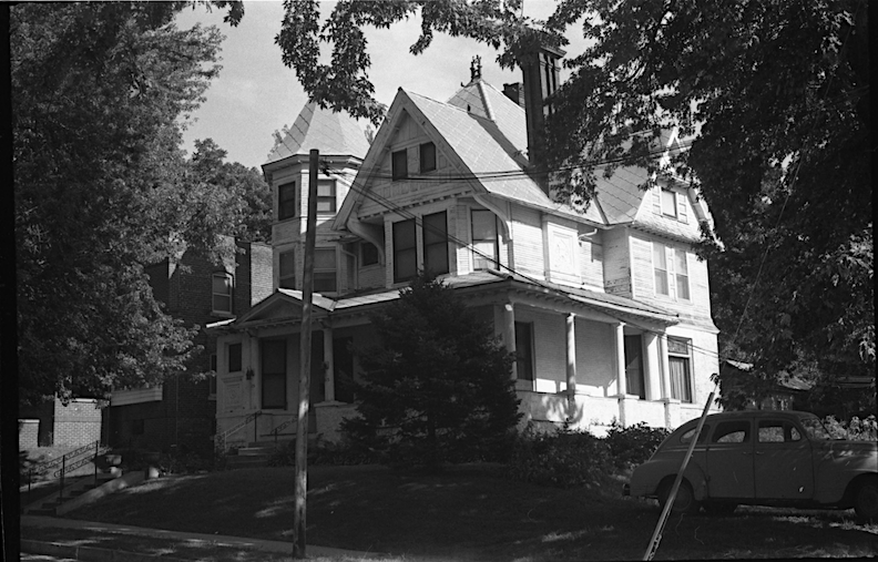
815 Worthington Street. Photographer: Martin Weil. The Durham Museum. 1964. 815 Worthington, a three-story glory featuring ten rooms and oak finishes, originally constructed at a cost above $8,000. After failing to sell, when the original owners moved on, the huge and costly residence was converted into a nurses’ home in the early 1910s and thereafter, dismally, offered room and board for rent. Until the McKaber B. and Minnie B. Koory family moved in the teens, it regained its status as a single-family residence. Mr. Koory operated a wholesale business specializing in dry goods and novelties. The couple had one son and eight daughters until Mr. Koory was fatally struck by an automobile outside of his shop, twice. This remarkable residence remained within the Koory family until at least the early 1970s, and potentially for a longer duration.
Last known map of Grace University depicting pathways and existing structures from the 2010s.
In 2017, Omaha Public Schools finalized a $4.25 million agreement to acquire a portion of the Grace University property, encompassing the site where Brownell Hall once stood, extending from Tenth Street to Eighth Street, and from Worthington to Pine. Their objective was to construct a new elementary school in Little Italy. The Train Elementary School had closed decades ago as part of a strange OPS plan, but I suppose I’m being an Annoying Abigail. I would assume that these previously mentioned straggler properties were absorbed into this large school plan. In May of 2018, Omaha Public School announced they would construct a new elementary school–later named Pine Elementary. This abhorrent design for an elementary school defies adequate description, and I will not be featuring a photograph. I am disheartened that we as a community see fit to confine children and teachers within this and other similar oppressive, soul killing warehouses throughout the day. An investigation regarding recent developments in elementary school architecture is forthcoming.
Subsequently, Grace University declared its closure in May 2018. The school’s initial aim was to move to Blair, Nebraska, but ultimately discontinued operations entirely after 75 years. With enrollment declining to 300 students in the 2017-2018 academic year, the writing was on the wall.
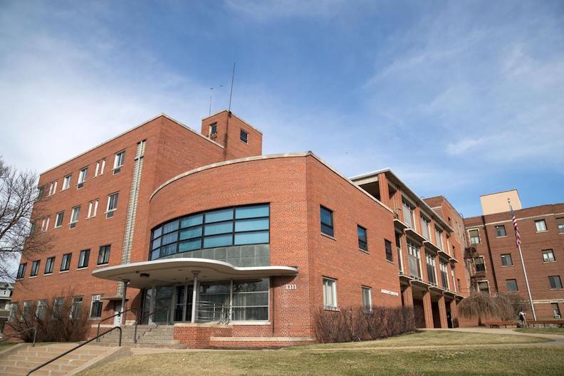
Urban Village Development acquired the former St. Catherine Hospital at 1311 South Ninth Street, which had three dormitory structures and a substantial administration building, encompassing almost three acres and totaling 142,000 square feet. The property was sold for approximately $1.25 million. It was previously listed for $3.5 million following Grace University’s announcement to vacate its 75-year campus. Urban Village projected a $16 million apartment development, transforming the complex into 167 one-bedroom and studio units. This was widely advertised in the summer of 2018, and it appeared Urban Village finished the first wave of apartments in 2019. I understand that they did have a leasing and management period, then divested and transferred ownership to another developer, whose name I have pledged never to disclose again. Urban Village quietly left the building.
Having sold portions of their campus to Omaha Public School and Urban Village, “financially embattled” Grace University struck yet another deal for their remaining land with Bluestone Development. I have heard the city and the Mayor Jean Stothert were heavily involved in these negotiations.
The Come On
Bluestone Developers, Christian and Debra Christensen, under the Worthington 10 LLC designation, purchased vacant lots and residential properties in the neighborhood, demolishing several to facilitate their prospective apartment project. Forty-six prior postal addresses/parcels were absorbed into this project. For the record, Bluestone did not demolish all these structures. Aerial maps of this area indicate that the most recent photograph depicting all historic homes intact was dated 1993.
October 2024, Omaha World-Herald. Building permits filed. Nine additional permits filed on that day, as well.
Nook Site Plan.
With those homes and parcel boundaries reconfigured, the Bluestone Development group created a new subdivision, Nook. Coyly, Nook is also the name of their new apartment project. Now we have already taken many swings at these new apartment buildings around town and Their Thin Little Names having become increasingly ambiguous and abstract. The team possibly think Nook is catchy or evokes a lifestyle of a trendy hideaway with plants, wicker, and crochet chunky blankets. As opposed to all the other empty, new apartment buildings and townhouses in town, the Nook developers have told the neighborhood, the future tenants of Nook will be vetted and presumably are begging for leases. Ten three-story buildings and two hundred fifty apartments along the narrow streets of this older part of town presents parking challenges in addition to architectural and cultural continuity; the objective of these plans is to accommodate as many tenants as feasible within limited areas.
Alley Poyner Macchietto Architecture design.
Rather than designing the now standard, yet widely criticized Industrial Box in the Box, national architects are wising up and endeavoring to incorporate gabled roofs onto these box structures, emphasis on street side, particularly in older neighborhoods where residents justifiably express discontent—paying homage to the historic grandeur that their gabled-boxes have encroached upon. These are my perceptions when examining the Nook computer-aided design.
There would be a few more structures taken down in recent times.
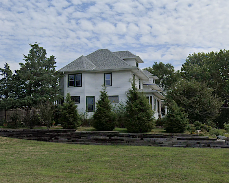
Here we see a western view of the lovely Foursquares at 722 and 720 Pine Street, now razed, made vulnerable by proximity to a large, empty field.
Foursquares front elevation at 722 and 720 Pine Street.
As seen on Eighth Street in an eastern portion of a blank field was what looked to be an incredible outbuilding, quarters of the past or a carriage house. Next to it, on the south was the blue workshop described below.
Grace Bible built 1509 South Eighth as their maintenance shop in 1975. By 2006 it had become home to Yankee Construction.
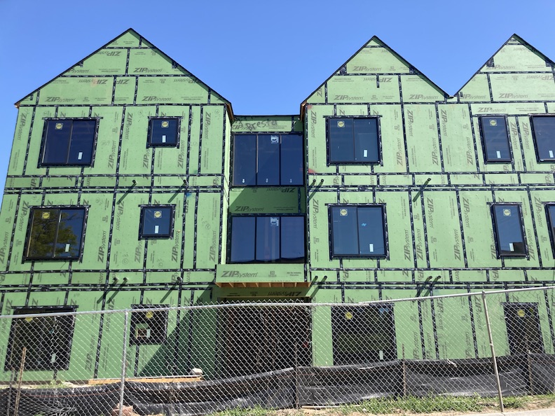
I had to survey and size up Nook for myself.
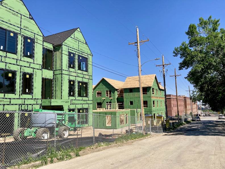
Eighth Street facing northwest angle. The red brick buildings in the distance are the Dahlman Flats at 1311 South Ninth Street. These buildings were a part of the Grace University, previously the St. Catherine’s Hospital, previously the Herman Kountze mansion site.
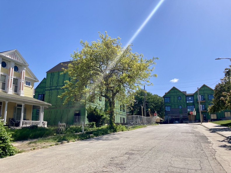
Current Worthington Street view. 810 Worthington seen in yellow, previously discussed. 802 Worthington, the William B. Meikle and W. R. Matthews’ house renamed 1424 South Eighth Street, which was razed a few years back, is now site of a portion of the new Nook project. Nook buildings also seen bordering Eighth Street.
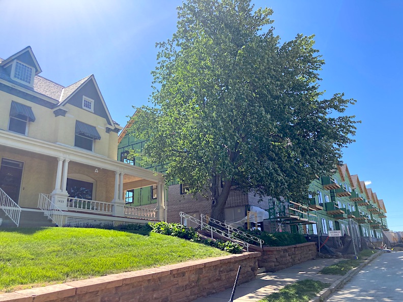
1425 South Eighth Street next door to its new neighbors, Nook. Camera faces southeast angle.
How the beautiful 901 and 905 William Street houses are getting along with their new Nook neighbors. Camera faces south across William. I find the scale overwhelming, but they say City Planners Want Density. Bluestone also wants the Forest Hill neighbors to know that they are invited into the seven projected minuscule “Pocket Parks” that they are squeezing in between these buildings.
My goodness gracious…that certainly was a deep hole I took us down. Where were we? Oh yes, here we were. In June 1960, the Phi Beta Pi Alumni Foundation Inc. sold the 1503 Park Wild Avenue property to Mr. Richard H. Hayes and his wife.
The next owners’ chapters, while equally significant as its predecessors, will be intentionally concise due to the privacy of family members. In accordance with my practice about current homeowners, I shall refrain from disclosing their identities or backgrounds to ensure their privacy.
The Hays Family
In June 1960, Richard Hoyt Hays and his wife, Catherine Ann Appel Hays, purchased 1503 Park Wild Avenue from the Phi Beta Pi fraternity. While the Phi Beta Pi fraternity did not vacate until October 1960, the Hays family seemingly did not occupy the house until 1961 or 1962, possibly due to the labor-intensive period required for rehabilitation after its usage as a fraternity house or other unforeseen disruptions.
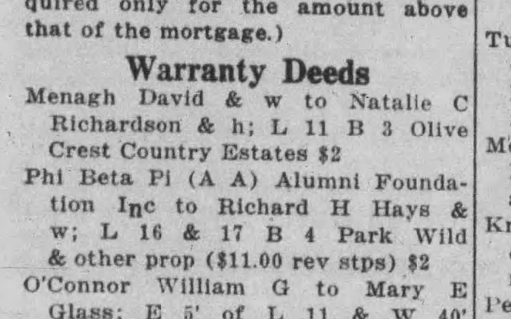
June 8, 1960. The Daily Record.
Of note it wasn’t until 1962 December The Daily Record reported R. H. Hays was moving from 1005 Atlas Street to 1503 Park Wild Avenue.
“Dick” Hays graduated from Tech High and later from Iowa State in the summer of 1949 with a degree in landscape architecture. “Cathy” Appel was a Council Bluffs girl; the Hays couple wed in Council Bluffs, Iowa in 1958.
Miss Catherine Appel featured in the news in 1957.
I was delighted to discover that prior to moving to 1005 Atlas Street, the Hays family resided in 7826 Military Avenue, my Childhood Dream Home. Likely most kids who grew up in Benson or spent time in Keystone tried to get a peek at this unique home–a True Dollhouse. I questioned whether they rented that home or if it was one of their many properties. Throughout the decades of his residence at 1503 Park Wild Avenue, Richard H. Hays’ name repeatedly appeared in the real estate transfer records. I have prepared my 7826 Military Avenue Dream for another case but have not yet published it. Upcoming investigation!
In those early years living at 1503 Park Wild, Mr. Hays worked as a landscape architect. I was intrigued by the potential for remarkable landscaping ideas at 1503 Park Wild, specifically what Mr. Hays envisioned for the expansive property and an innovative descent to Dahlman Park below. I also contemplated whether some of his horticultural designs persist today.
Richard “Dick” H. Hays, J. Frederic “Fred” Schlott, and Willis G. “Bill” Farrington, were landscape architects, practicing as a firm at 3715 Dodge Street. Farrington and Fred Schlott founded Schott, Farrington and Associates in 1958. The firm designed the Gerald Ford Birthplace, landscaped the Witherspoon Mansion as well as many formal gardens in town. They appeared to have met at Marshall Nurseries, a long time Omaha tree nursery established in 1916, a spin-off of the Marshall Brothers founded in 1887. Bill Farrington would go on to found Indian Creek Nursery, 303 North Saddle Creek Road, a beloved midtown institution. Dick Hays also worked as a landscape architect with the Omaha Planning Department. I had mentioned the Hays’ regular purchasing and selling of properties. One such investment involved Schlott and Farrington when the three collaborated to construct a strip mall. Unfortunately, when the county sought to widen the Little Papio Creek, running near their project, the matter culminated in litigation.
During his years living in our 1503 Park Wild focus, Mr. Hays would attain a Master of Social Work degree, later assuming the role of supervisor at Douglas County Welfare and Catholic Charities. He rose to Director of the Douglas County Child Protective Services, the Director of the Omaha Home for Girls, ultimately concluding his professional journey as the Executive Director of Uta Halee Girls Village.
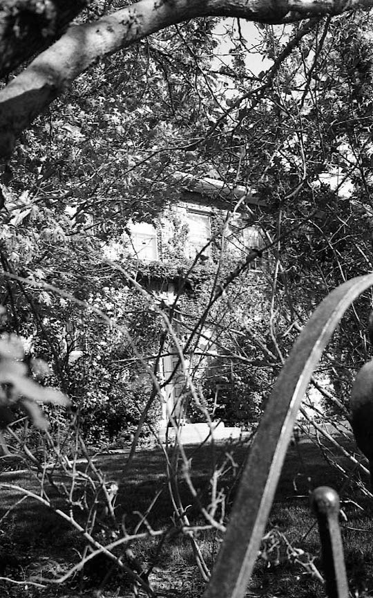
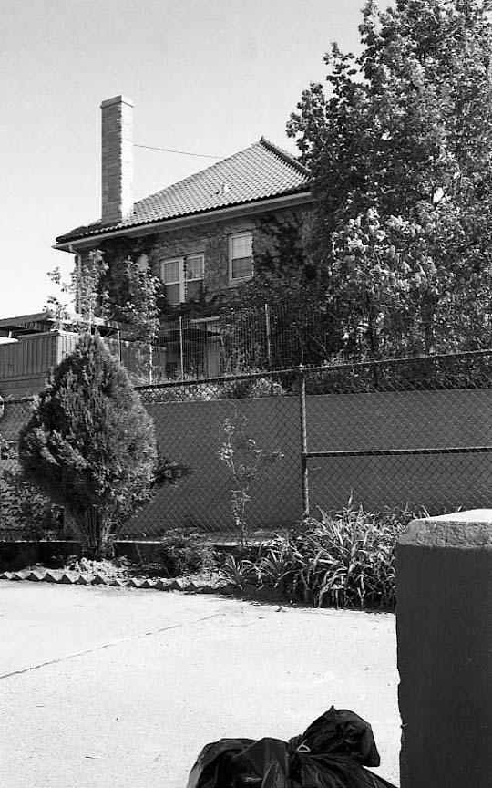
These great photographs originate from the 1980 Reconnaissance Survey. They were shared by Shelley McCafferty of the City Planning Department. 1503 Park Wild was overgrown with ivy and appeared to be integrated into the landscape. I appreciate that the photographer took such enigmatic and artistic images. Not your usual survey photos.
The large Hays family would live in the 1503 Park Wild house until about the 1988 time period.
1965. South Omaha Sun. Our Mr. Dick Hays.
Given that the Hays family resided adjacent to the park, and considering the Mister’s proficiency in these particular matters, I was interested to find his pivotal role in the community’s fight for the neighborhood, the aesthetics of the park and the very land itself. It was during Dick Hays’ landscaping career, an unforeseen intersection of expertise, community-led initiatives, safety, and functional challenges arising from topography of the area, inadequate city planning, and detrimental land use practices, culminated in Mr. Hays’ involvement and underscored the broader dilemma regarding the Dahlman Park issue–a persistent issue that endures to the present day. Let us proceed to the findings from the Dahlman Park timeframe, incorporating Mr. Hays’ contributions from the mid-1960s.
It is now time to return to the pin I requested you to push into your field notes map.
The Quest for Dahlman Park
Getting to the bottom of Dahlman Park has been a pleasurable yet hairpulling endeavor, likely due to its enigmatic natural state that resisted and continues to resist domestication. This is merely the perception of someone who is a bluff-whisperer. This land seemingly will not be tamed. It is a true mystery. It is wooly, unbroken, mired in difficulty and utterly captivating. I was pleased to find indication that the vacant, steep land had functioned as a leisure and meeting area for decades prior to being officially named Dahlman Park by the city. These natural meeting spots are significant, historical subjects overlooked by the newsmen of the past and even now. If anyone has additionally clues to share with us, please comment or make contact.
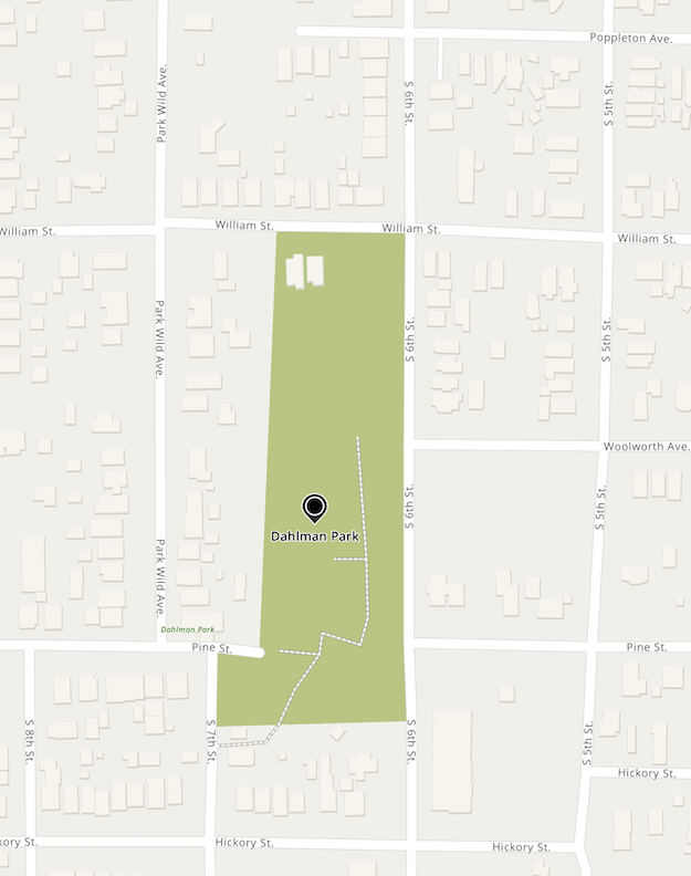
Dahlman Park map courtesy of Google Map.
Dahlman Park, as it is now known, spans from William Street on the north, its eastern border stretches alongside Sixth Street, the southernmost extremity extends about halfway between Pine and Hickory, and its western perimeter borders the rear lands of the Park Wild Avenue residences. The highest elevation is located on the southern side. Strangely yet beautifully, the east and west are flanked by dense trees. The northern approach, or seemingly designated entry point, is situated directly on William Street, at its lowest level. Access to the park is also available via an unconventional rear entrance located at Seventh Street and Pine.
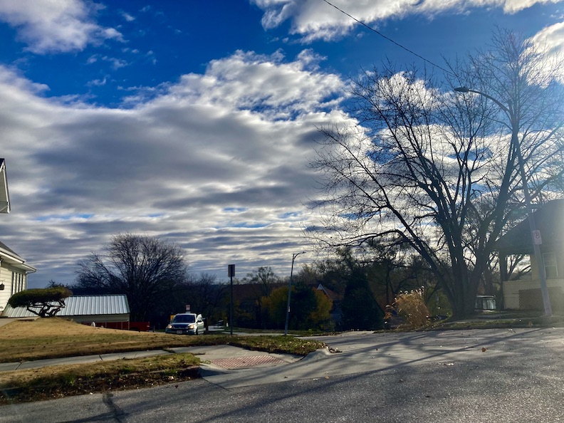
Access to the park’s “back entrance” can be found after a slight jog in the road from the highest point of Park Wild Avenue and Pine, to Seventh, where you will surely see the ends of the Earth in the distance.
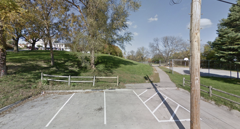
Off of Seventh and Pine, there exists a discreet, secondary access road leading to four parking places. The entire experience warns of a challenging configuration and “enter at your own risk”–conditions that I love. It is all very hidden. Concerning the restricted parking availability, there is literally insufficient space for more vehicles. Given the steep ascent, topography, and the park’s secluded location within a residential area, it seems plausible that the park, in its current state, is intended for local pedestrians.
There is a mysterious additional, angled road off Sixth Street, just a wee bit south of Pine leading to the playground area of the park. The pavement is significantly deteriorated and fragmented. Was this once the formal entrance to the park, long ago abandoned? Was this the entrance for groundskeepers?
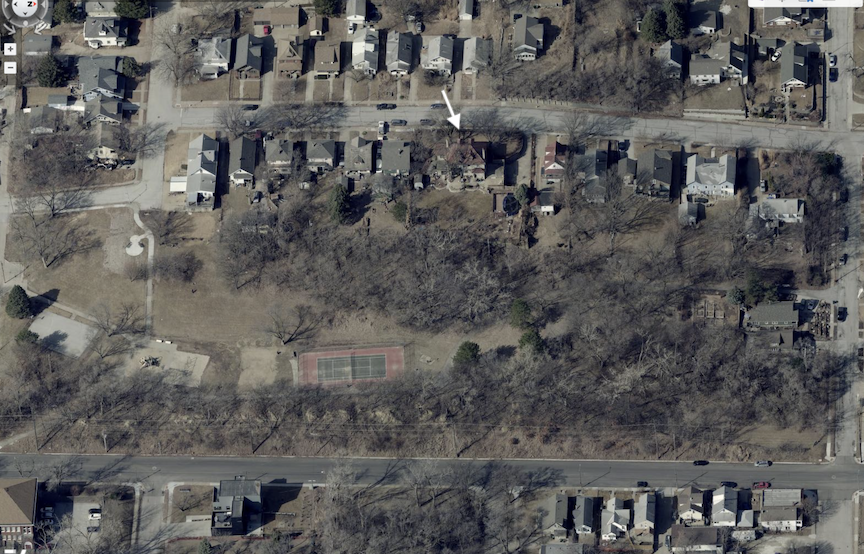
This aerial photograph gives a good idea of the park area. Camera faces west. Sixth Street is found a the bottom of the image. William Street runs along the righthand side of the photo. I’ve placed a white arrow pointing at 1503 Park Wild Avenue. Photo borrowed from the DOGIS site.
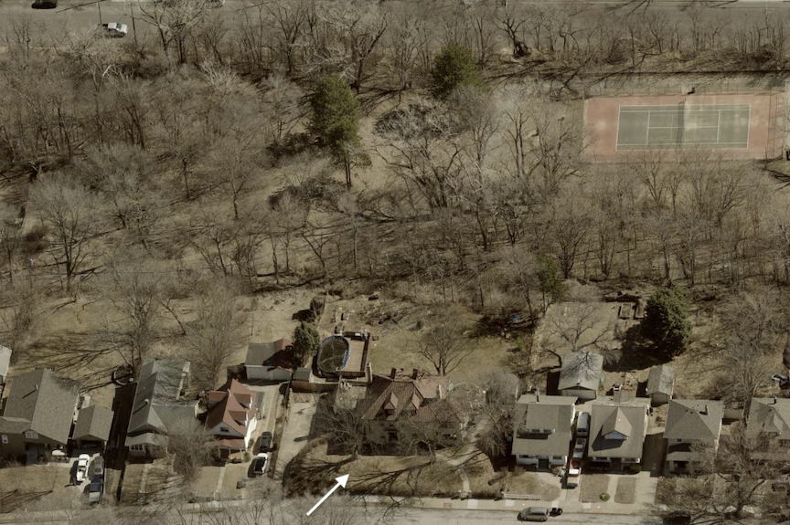
The camera faces east with Park Wild Avenue in the foreground along the bottom of the photo. White arrow pointing at 1503 Park Wild’s front elevation. Perhaps a better understanding of the woods and how Sixth Street drops below the park in this image. Photo borrowed from the DOGIS site.
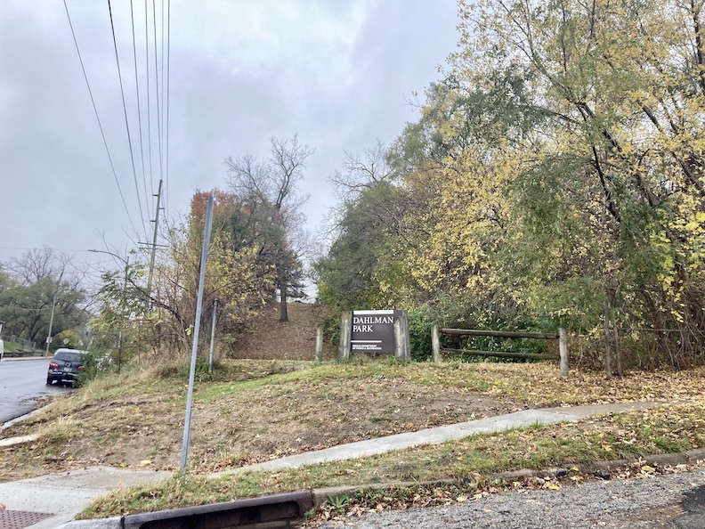
The Dahlman Park entrance at Sixth and William Streets is notably unusual due to its elevation and a literal point of entry created by the sign and fencing. These park aesthetics could be attributed to the two residences occupying the area immediately to the west on William Street or potential safety issues. A curious park visitor stands in the wedge, gazing up the slope, contemplating future sledding opportunities or potential hiding spots for a game of hide & seek or worse.
According to Little Italy lore, the northern entrance to the vacant ground at Sixth and William Streets functioned as both a recreational center and a meeting place for the early inhabitants and the Little Italy community. This expanse of property has remained largely undisturbed, owned by the city, positioned between mansions and smaller residences, who enjoy some of the highest elevations offering exceptional views of the city and the river.
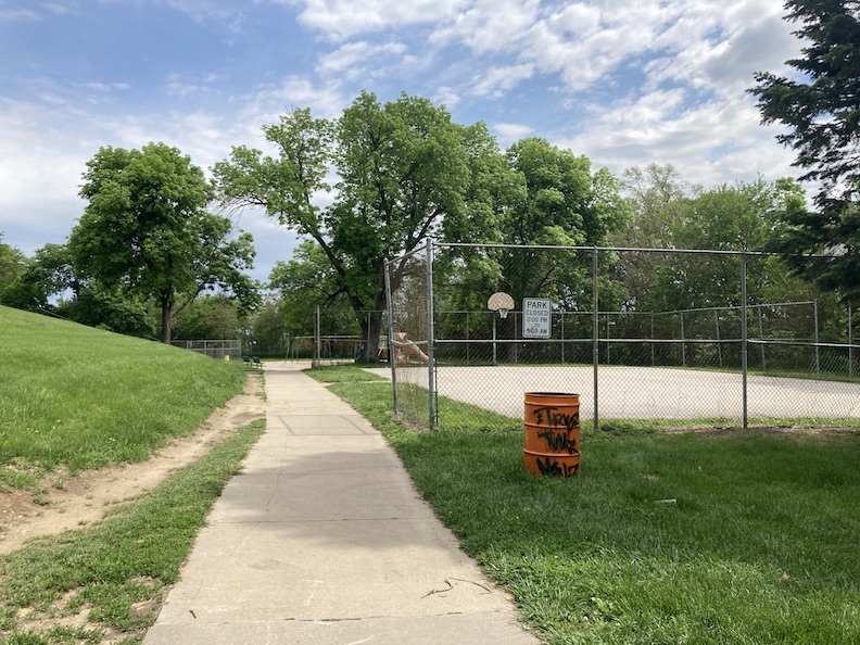
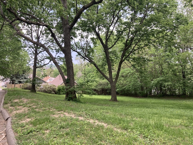
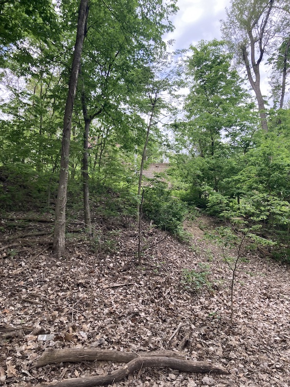
Once inside the park, it is a nicely maintained, special green space. There is a basketball court, a tennis court, playground area and walking paths.
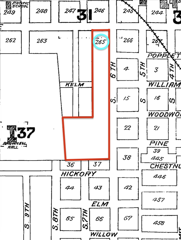
I traversed as far back on the continuum to its furthest extent. I acknowledge that some locals may possess familial information that potentially extends further back, which I am eager to learn. The above 1887 Sanborn Map illustrates a substantial parcel at the Dahlman Park site. This map exclusively illustrates city blocks, omitting any depiction of buildings. (Some of the street names to the south changed over time.) I circled the block number (265). An examination of the 265 block indicates a massive parcel owned by City Lands, reaching to Pierce Street on the north. I apologize for my cropping skills; I cut out the street name. This land would later be developed into the Park Wild addition. The detailed view of the 265 block, that I did not include, revealed four residences along Pierce Street and a drugstore at the corner; however, I could locate no additional maps of the southern region, which would have shown the specific park area. Thanks to Trina Westman and Shelley McCafferty for sharing the historic Sanborn Maps.
In 1866, Anton Cajori purchased Lot 1. By 1899, there existed a handful of lots in Block 265, presumably all located in the northern portion of this map. In the 1940s, Donald Miloni operated his tavern at 1202 South Sixth Street, located in Lot One. 607 Pierce Lot 2 Block 265, was an old theatrical structure, foreclosed in 1940. The theatre was owned by Filodelfo Cormaci throughout the 1930s. These were the parcels owned by Paola Milone, Joe and Angela Bruno, Josephine Cappellano, and Tony and Millie Pistone from the 1950s to the 1970s. These lots have no bearing on our Dahlman Park land, I simply wished to offer up these beautiful Italian names.
I tried my best to align these two separate Sanborn maps from 1901. At this point in 1901, we can see the Lot 3 land ended at William Street on the north. One of the two existing homes within the park bounds, on William Street has been constructed by the time of this map. The factory building in the southwest corner, previously discussed, remains. As a reminder, when the new Park Wild Addition was being platted in 1914, the developers’ design allocated park space on the west side of Sixth Street. Furthermore, the proposed park area was situated sixty feet above the graded Sixth Street and, in the city council’s view, was not suitable for park functions and was rejected. Thanks to Trina Westman and Shelley McCafferty of the City Planning Department for sharing the historic Sanborn Maps.
Before it was named, the steep park had always been a good but dangerous sled run. Many a child in this hilly area experienced a sled ride gone wild. In 1918 Little Harvey Appleby of Park Wild Avenue’s sled ran beneath the wheels of a streetcar at Sixth and William. He survived, but his foot was crushed.
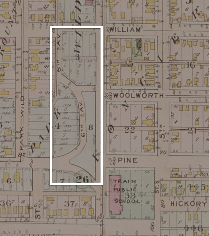
An examination of the previously shared 1918 Baists Real Estate Atlas illustrates subdivided parcels within the area that would eventually transform into the park–all part of the Park Wild addition. I counted nine lots to the north and nine more to the south. At the time this map was created, no houses (within the park lands) had been constructed. I outlined the current boundaries of the park in white. 1918 Baist’s Real Estate Atlas of Surveys of Omaha, Nebraska, Complete in One Volume, Compiled From Official Records, Private Plans and Actual Surveys. Title page gives credit to G. Wm. Baist, Wm. E. & H. V. Baist Surveyors. Borrowed from the Omaha Public Library.
The Mystery Park is Built
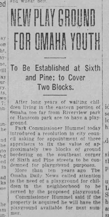
July 1923. The Omaha Daily News. The Omaha Daily News apparently indicated in 1913 that the children of the Park Wild–Little Italy area required a park. These neighborhood kiddies in the eastern section of Omaha, distant from Riverview Park (subsequently transformed into Henry Doorly Zoo) or Hanscom Park, would finally possess a playground to claim as their own. Park Commissioner Hummel requested the city council to appoint three appraisers to evaluate the worth of roughly two blocks of land “bordering the southeast corner of Sixth and Pine street” to be “condemned” for playground purposes. It may be a journalist’s mistake, but the park is located on the southwest side.
The following day, the council agreed to approve the ordinance for “seventeen lots near Sixth and Pine streets” to be designated for public use as a playground and park. Those must have been the Park Wild lots we assessed previously. The ground was said to be “located on a height that affords a view of the Missouri River.” I should say. Although the park was desperately needed, the area had become, what we might consider, unsettled in those Prohibition years. Suspicious. Hinky Hills. A nephew shot his uncle late night, right out on Sixth and William due to a financial disagreement. Two Black men were discovered deceased from gunshot wounds in the middle of Sixth and Pine, believed to be engaged in the illicit alcohol trade. A mysterious note was found indicating that a girl had been abducted and was being held in a bootlegger’s cottage located in the hills. It was rumored a number of bootleggers resided in those hills, along with a sprinkling of older women living independently in the cottages, some of them were “street peddlers,” while others were known as “crazy” or gypsies. 2, 900 pounds of sugar were stolen from the Haarmann Vinegar and Pickle Company down on Fourth and Pacific streets. One of the company’s sugar-hauling trucks, from which sugar was stolen, was lifted by bootleggers, and found parked at Sixth and Pine. Chief Samardick and Officers Edwards and Lynch conducted a stakeout at Sixth and Pine at 4 A.M. on a hunt for bootleggers. Shortly after dawn, they intercepted a touring car carrying 20 gallons, coming from the hills. I only share these stories because they coincided with the locals’ determination to construct this special park for their children.
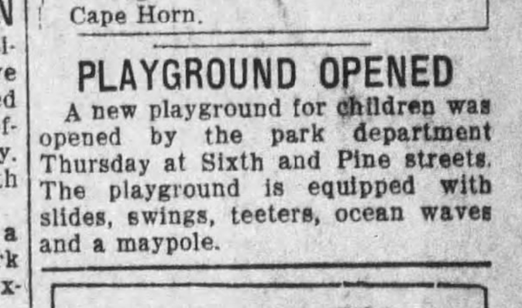
June of 1925. The Omaha Daily News. With playground equipment installed two full years later, Omaha was introduced to a new park. They continued to describe this Sixth and Pine street park, leading me to believe it had an entrance in that area. This description would change over time.
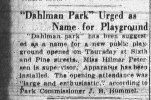
June 1925. The Omaha Evening Bee. “A large and enthusiastic” group attended the opening of the new park. “Miss Hillman Petersen is supervisor.” I am not sure what “apparatus has been installed” meant. Also interesting that Dahlman Park was being urged as an early name; however the park would not be named this for a long while. This mysterious land would continue to present obstacles all the way.
Oddly it wasn’t until July of 1925 that “property (was) deeded for park purposes at Sixth and Pine.”
1926. Omaha World-Herald. Starting in 1925, Omaha city commissioners proposed naming a new woodland park, situated north of Florence along the river drive, Dahlman Park, while favoring the naming of what we now call Dahlman Park, Buckingham Park. By 1926, officials were still engaged in deliberations. Why didn’t they just name it Park Wild, Miss Cassette wondered. I mean, that would have been perfect, as it was naturally in Omaha’s first settlement. Park Wild, I can see it on a city sign. The term “Park” is included in the designation. It is indeed Wild. Concepts from the detective’s office. Later in 1926 they would settle on the Dahlman Park idea for this Park Wild park. James Dahlman, who was known as Omaha’s Cowboy Mayor, served from 1906-1918 and from 1921-1930. He was still mayor during this park christening.
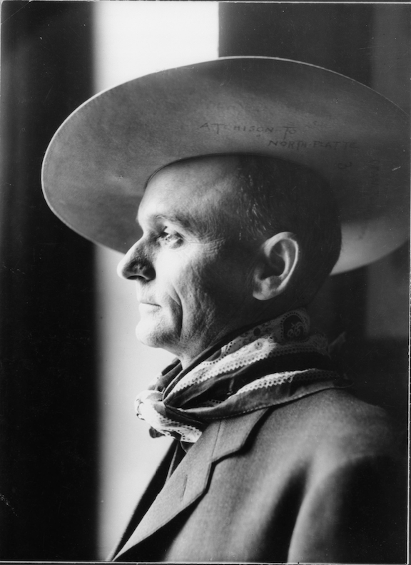
Omaha Mayor, James Dahlman wearing a cowboy hat and bandanna. 1906-1907. Bostwick, Louis (1868-1943) and Frohardt, Homer (1885-1972). The Durham Museum.
My first clue that Dahlman Park was formally designated as such was by the Santa Lucia Festival of 1926. The Santa Lucia Festival commenced at St. Philomena Church, presently known as St. Frances Cabrini, located at Tenth and William. A high mass was held at the church, after which the statue of Santa Lucia was removed, mounted on a float, and transported to the Grand Arch of Triumph, constructed at the intersection of Sixth and Pierce streets for the event. The huge parade traversed the streets of Little Italy at 3 PM. At midnight in Dahlman Park, a fireworks display occurred. The subsequent day, a Monday, was a repeat performance. The Sons of Italy band, under the direction of Pietro Cosentino, and the Union Pacific band performed over the weekend in commemoration of the Santa Lucia event. I only wished I could find a photo of this early park land.
In 1927, Mr. W. H. Wallweber was appointed as the watchman of Dahlman Park. I would come to wonder if he was self-appointed due to his many questionable, yet enjoyable, duties. Mr. Wallweber was assigned the responsibility of distributing melons and adjudicating the melon-eating contests in the park. In the summer of 1930, the city parks hosted regular band concerts. The publication enumerated the several parks along with their corresponding dates and musical ensembles. The “Italian Band,” led by Pietro Cosentino, performed in Dahlman Park on August 2, 1930.
During the 1930s, Dahlman Park experienced problems as it ceased to function as a children’s playground and instead transformed into a substantial mud washout onto Sixth Street. Given that Park Wild’s “steep hills could not entice industry,” it appears that Dahlman Park was either utilized by the city for some purpose or poised for real estate development again, though I was not fully certain. Future newsmen would address the city’s land misuse. It appears quite likely that the parkland was mismanaged, exemplified by vegetation removal and further grading problems. The inadequate, though interesting, grading and other intrusions to the land may have caused significant erosion on the diverse and steeply elevated terrain.
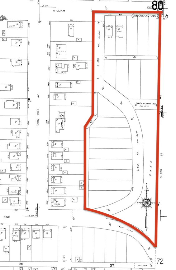
The 1934 Sanborn Map illustrates a distinct division of lots within the Dahlman Park area. I delineated the park land parcels with a coarse red boundary. Aside from the two residences situated on the William Street boundary, I counted around 14 to 16 lots, contingent upon their designation as green or park space. This alternative arrangement included a narrow “park” situated between the current Sixth Street and a projected semicircular Sixth Avenue. Woolworth Avenue and Pine Street were both marked as “Not Open.” Thanks to Trina Westman and Shelley McCafferty of the City Planning Department for sharing the historic Sanborn Maps.
Had the developers or the city overzealously proceeded with grading this land, stripping away the ground coverings and trees that stabilized the soil, I could see a mudslide flooding Sixth Street or William, dependent.
However, the lots remained unsold, and the houses were not constructed. In 1940, it was announced that a grading crew commenced work on a new softball diamond at Dahlman Park. Did this scheme materialize? In 1947, Dahlman Park was identified as a “priority by the Park and Recreation Commission.” It appears they only express that sentiment when circumstances have become critical. Forty-seven thousand dollars in City Wide Plan bond funds was initially designated for two troubled parks: Dahlman Park ($15,000) and Packers Park (Twenty-seventh and S Streets, $32,000). Yet again, they deserted Dahlman Park. In 1948, the rationale against investing in Dahlman was that “the fifty-foot bluff makes the proposed site of Dahlman Park impractical.”
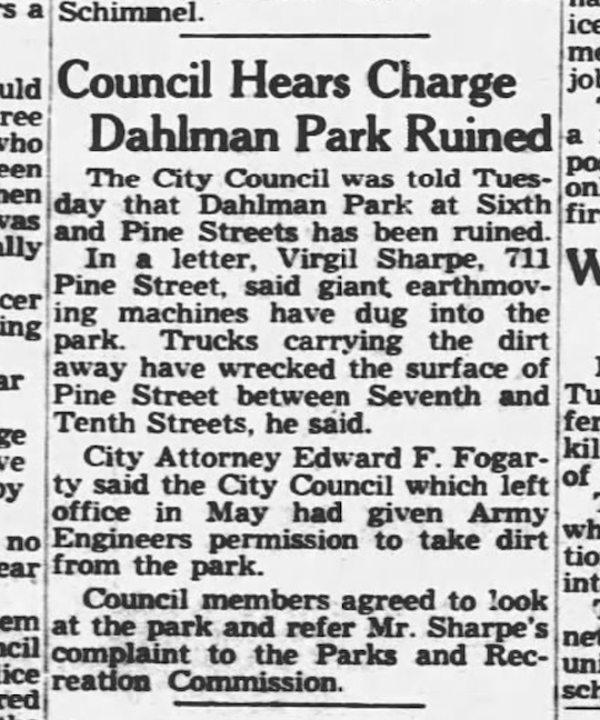
October of 1948. The Evening World-Herald.
Then to make matters much worse, Omaha’s City Council granted the Army Engineers authorization to extract soil from the park without notifying the public. Dahlman Park at Sixth and Pine Streets had essentially been “ruined.” The large earth-moving machinery excavated the park, and upon departure, the trucks damaged the surface of Pine Street between Seventh and Tenth Streets. Virgil Sharpe would write in a letter of protest. A month later, Thomas C. Caniglia articulated the sentiments of the Little Italy neighborhood, expressing displeasure and possibly other emotions, regarding the citizens’ lack of opportunity to contest the removal of dirt.
I was beginning to understand the odd shape, grade and complexity of the park.
November of 1948. Evening World-Herald.
By 1952, Dahlman Park was in worse shape, no thanks to Ralph McClintock, Omaha Park superintendent. The damage to Dahlman Park became a blame game after the decisions around the April 1952 flood emergency. The Army Engineers continued to use the park as a “borrow pit” which caused serious erosion, including hole of 16 feet deep. The engineers had cut much of the bank down to use in controlling the floor of that year. The Little Italy neighborhood rose up to call the park hole hazardous. Engineers said they were not to blame; the contractors said they were not to blame.
It wasn’t until 1954 that the City Planning Commission “closed off Pine Street, Sixth Avenue and Woolworth Avenue within Dahlman Park.” The park covered approximately four and a half acres at that time. I had not realized those were park thoroughfares until reading this clue.
April 1955. Omaha World-Herald.
The Evening World-Herald of April 1955 reported that the City Council was requested to address the half-block drop-off at Sixth and William. Residents stated that the bank, measuring 10 to 15 feet in height, posed a danger to youngsters. Neighbors were apprehensive about allowing their children outside due to concerns of them falling over the precipice. The unfortunate bank was established three years ago when soil was excavated from the location to construct a levee to mitigate flooding from the Missouri River. The “cliff” extended from William Street southward into Dahlman Park.
July 1955. Omaha World-Herald.
“Once Dahlman Park, Sixth and William Streets, was both recreational center and meeting place for the colony. Today it is only a steeply sloping vacant lot, overgrown with weeds. Neighborhood youngsters have made repeated attempts to have it leveled so they can switch baseball games from the narrow alleys. Last week after fruitless pleadings with the Park and Recreation Department, the youngers took matters on themselves. Descending on the eyesore with sickles, rakes, and eager hands the pulled weeds, directed by Pat Venditte, 10, of 1213 ½ South Sixth Street.” Pat Venditte had evidently been a neighborhood advocate since his childhood. It was impressive! He remains a local champion of Little Italy.
The South Omaha Sun reported in 1964 that ol’ Dahlman Park had been colloquially referred to the area residents as “Mosquito Park” or “Mosquito Hill.” Once more, assurances were made to assist the Sixth Street area from Pine to William; nevertheless, “the scope of the improvements is limited due to the terrain of the park.” Following the Army Corps of Engineers debacle, trees were planted on the slope and ground cover was established to prevent further erosion; however, the city failed to maintain it. They were unable to grade due to the steepness of the slope. It was the same story over and over again.
I was delighted to discover Mr. Dick Hays, the owner of 1503 Park Wild, held the position of President of the Dahlman Park Improvement Club in 1967. He was deeply engaged in the community, participating in city planning meetings and communicating with the media regarding Little Italy and Park Wild’s aspirations for transformation in Dahlman Park. The neighborhood just wanted the park to be right– what it could have been from the beginning. I am honestly not sure if he or the club made any impact.
1965. South Omaha Sun.
Mr. Hays: “Dahlman Park must be developed into an adequate recreation area is necessary due to population density and little open space other than this park.” The Park and Recreation department was supposed to prepare a topographical map of Dahlman Park to determine what was necessary for its development as a playground, picnic area and general recreation area. Hays said, “The area encompasses a beautiful view of Iowa, the hills and bridges” and he would “put it against anything in Omaha.” The neighborhood committee “came into existence following the defeat of urban renewal. A good deal of new construction has taken hold in the Little Italy area and the neighbors united, realizing it was incumbent on them to preserve the residential quality of the neighborhood.” Said Hays, “This is a fine old section that is really quite stable. People of three and four generations are living here and staying here.”
Mrs. Louise Salerno, proprietor of the now-defunct Omaha establishments Trentino’s at Tenth and Pacific and Italian Gardens (located at 1228 South Sixth, subsequently Café De Paris), advocated for the establishment of Dahlman Park in the 1960s. A lifelong inhabitant of the neighborhood with her husband, Anthony. There was strong neighborhood involvement and advocacy that I could find since the 1960s.
Side Note on Federally Funded Operation Pride
It was in this 1960s period that a portion of the Park Wild-Little Italy area was cordoned off and renamed by an unknown source. “The Dahlman Park neighborhood” was bounded by Eleventh, Pierce, Hickory and the railroad tracks. Also in this period, there was a push for older parts of Omaha to be prettied up. In 1966, the 40-block area adjacent to the Dahlman Park “project” was valued at $326,000, enabling government loans to assist the Little Italy neighborhood in restoring their properties. The Dahlman Park/Little Italy area was recommended for some “clearance of residential and commercial building.” Joe DiGiacomo, 30-year tavern operator of the Omaha Famous, Depot Bar at Tenth and Mason (closed in 1973), also a former welterweight boxer during the 1930s, told a reporter that he “is a leader of a group of about one thousand persons from the neighborhood in opposition to the program.” Furthermore Mr. DiGiacomo said “the older folks don’t want to lose their homes, lose everything.” DiGiacomo said there would be “the biggest demonstration that the city had ever seen if residents were forced out of their homes.” DiGiacomo, president of the neighborhood Grandview Organization wanted to meet with the Omaha Planning Director in a vacant café at Fifth and Pierce, which made me smile.
The 1972 city summary reported that 66 Omaha homes had been renovated with federal funds and 54 others were repaired by the owners. The Operation Pride project of 1967-1970 federal funding was unanimously called a flop.
1970. Omaha World-Herald.
In 1977, the City of Omaha extended an invitation to submit bids for the “development” of Dahlman Park. In 1978, playground equipment, a horseshoe pit, and a baseball backstop were erected using a federal community development block grant. A tennis court, located slightly south of the playground, was erected to Dahlman Park in the summer of 1979.
2018. Omaha World-Herald. RDG Planning and Design computer generated layout of a Dahlman Park Plan.
I was surprised to find that in 2018 Marty Shukert, the former Omaha City Planning Director, collaborated with neighbors and served as a consultant for RDG Planning and Design, where he held the position of partner. Three Dahlman Park “options” were developed and presented. The most significant development entailed the construction of approximately 15 additional residences, with some situated within the park and others oriented towards Sixth Street. Pedestrian pathways, a tiered amphitheater, a field, and a water fountain. There was concern that public parkland cannot be converted for private use, such as residential development, without specific legislative intervention.
My conclusion was that the Dahlman Park property could be graded and prepared for residential development, but that it would be too expensive and impossible to grade and prepare it for use as a public park.
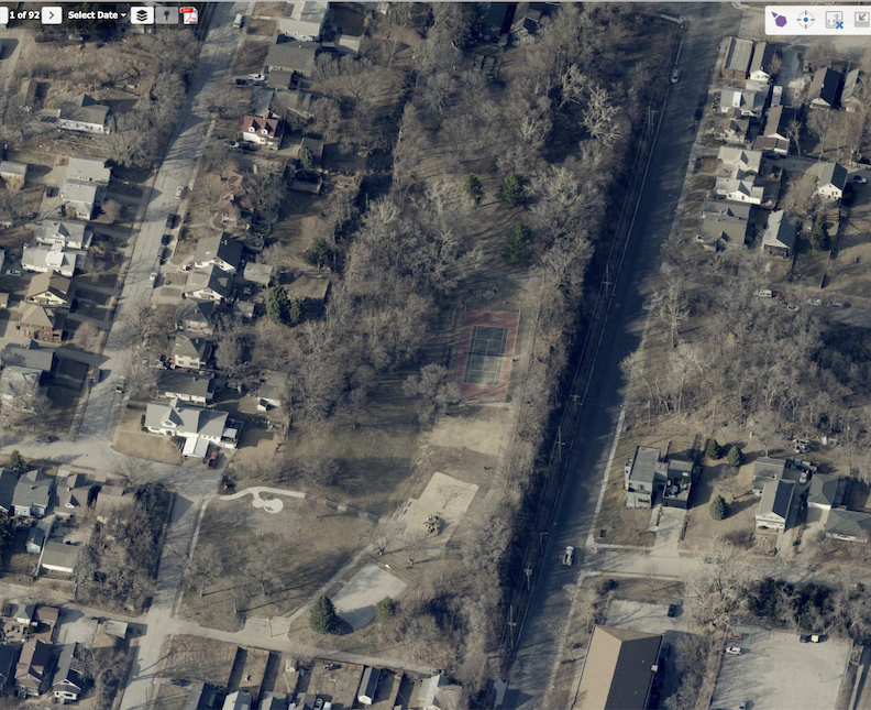
The news coverage of 2022 was hopeful, once again. The article signaled the neighbors were “hoping to re-energize the park in Omaha’s Little Italy.” Marie Sedlacek, of the “Historic South Tenth Street Neighbors and Advocates,” stated, “It’s a really large piece of land. And we just want it to be an asset for the neighborhood.” From the article, Sedlacek said the park often gets trashed, and people want to see more activities available. Now, several years after neighbors drafted their vision, Omaha’s Parks Department is moving forward with plans to reimagine Dahlman Park.” City Council member Danny Begley, who represented the area, stated that the city would next evaluate the feedback, formulate a strategy, and investigate costs and funding. I have found nothing else about Dahlman Park since that date.
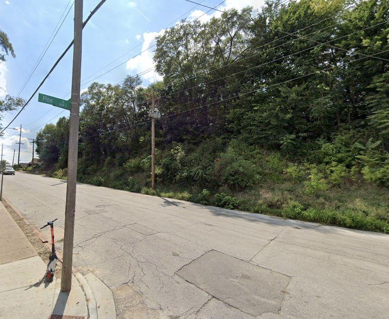
The very special land, as viewed from Sixth and Pine.
The End
Dick Hays and his family would sell our 1503 Park Wild Avenue dream home to the current owners around the 1988 period. Mr. and Mrs. 1503 Park Wild have made this their forever home. They have demonstrated exemplary stewardship, and it is evident to every passerby that this residence is cherished. In deference to their family’s privacy, I shall refrain from disclosing any further information.
Let it be known, we all love your house.
Thank you,
Miss Cassette
I will conclude this issue for the night, my esteemed detectives and longtime friends. As you pass 1503 Park Wild Avenue, I hope you recall her entrancing narrative. Whisper to her that Miss Cassette sent you.
This investigation is dedicated to Sarah Rowe, Frank Svoboda and the beautiful families of Little Italy. The research and writing were conducted alongside and inspired by the music of Gordon MacRae, Frank Sinatra, Judy Garland, and Alexandre Desplat’s Birth.
I welcome your feedback and comments on 1503 Park Wild Avenue and the surrounding properties. Let’s hear it for the Park Wild, Little Italy, Little Bohemia, Tenth Street and the Cottages in the Hills. Please share your additional clues to the story in the “Comments,” as we know more together. Everyone would love to read what you have to say and it makes the sharing of Omaha history more fun. You can use an anonymous smokescreen name if need be. We want to hear from you.
You can keep up with my latest investigations by joining my email group. Click on “Contact” then look for “Sign me up for the Newsletter!” Enter your email address. You will get sent email updates every time I have written a new article. Also feel free to join My Omaha Obsession on Facebook.
Thank you, Omaha friends.
Miss Cassette
© Miss Cassette and myomahaobsession, 2025. Unauthorized use and/or duplication of this material without express and written permission from this site’s author and/or owner is strictly prohibited. Excerpts and links may be used, provided that full and clear credit is given to Miss Cassette and myomahaobsession with appropriate and specific direction to the original content.
If you are looking for more architectural and Omaha history sleuthing fun, ask your local or bigbox bookseller for my book: My Omaha Obsession: Searching for the City. Also available everywhere online. Thank you.
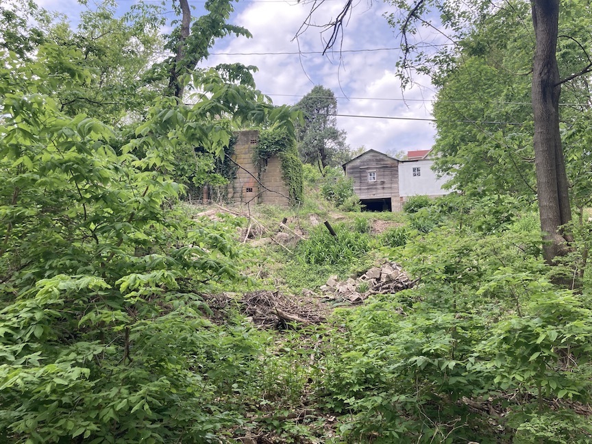
Carmelo Carlentini in 1970, at his home at 115 South Ninth Street, with a batch of what the 92-year-old Sicilian liked to call, “Good Old Dago Red Wine.”
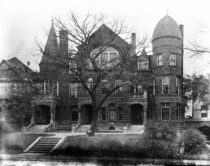

Wow! That is probably my favorite house in all of Omaha. I used to wonder if it would ever come up for sale. I first discovered it exploring in my college years. That’s some great detective work.
It’s hard to see all the photographs; the reminders of the senseless loss of history and for the practical: the loss of economic resources, much of it intangible in nature. I could go on but I won’t. It’s just sad.
Hello, I thank you for spending time with this long one even though some of it is sad. I always hope that my investigations will find their way to you as you seem to have the tenacity to dig through it all. I would very much like to know the timeframe that you were spying on 1503 in your college days. I wonder what it was like or what you saw! Thank you for taking these journeys with me. You always have such great insight and historical knowledge. Miss Cassette
Bro this is whack. Obvious you don’t live in little Italy. I’d teach her right over this Nonsense. Author, I’m gonna fake all this knowledge Pretending I k ow what a Niebhorhood is
Like so I can make Money. That’s your hero, if u can make it this
Far, cuz holy moly. Fairy tales,, I live here, author is trash. I’ve been here for 30years she
Never Asked me Anything., u put my shit as servant houses cuz
You’re Ignorant, but You Can’t talk to Me. I k ow people that have been here longer than me but you don’t talk to them either. Cuz your fake, your just internet research BS to get money. This is a holy moly trash site. It isn’t made to tell the truth. I hope
U figure it out. She isn’t soon g anything special. My hood
Is special, she’s trying to
Klingon so she doesn’t have to get a real job, but if
All them
bs word make me feel
Like
Ur
Learning something’s mg good
For
You. Website doesn’t
Make
It easy
To respond at all. Imagine that I prolly sound stupid on purpose. This
Lady is a clown. and to boot, the text is so large get it’s hard to. She even
Wants you to put
Your
Email in thento sell your
Information, wow good
On you. I’d punch you
In the face
In real life
Because that’s what you really deserved. see if you’ran actual neiborhood where people love
Each other. Never something you could
Understand. . The. Theirs all that trash cuz your
Website is trash. 2025 and your trash, a little weird but here we are. Blame it on me for your trash. Not like anyone cares anyways. You’re a fake person. Think about it, cuz that would d what u are.
Hello,
I thank you for writing in. You have given me a lot to think about. I want to acknowledge that I am not from Little Italy and Never could or would claim to be. I grew up in Benson. I am truly sorry to have offended you. That was not my intention at all. In fact, I thought of this article as a big love letter to the area. I only write about what interests me. I do not write for money and I do not make any money from my website. I certainly do not sell anyone’s emails and I do not have anyone’s emails on file. It is purely a function of my website to make sure that the comment section is not continually spammed.
I wish you the best.
Miss Cassette
Thank you , Miss Cassette, for your amazing and dedicated work on behalf of your readers. I always think it is a gift when I see your name in my mail.
You give your readers such interesting details about
places we all want to know about.
With much gratitude-Victoria
Thank you, Victoria! I may have gone a bit overboard with this one but I just wanted to know more and more… and more kept being revealed to me. Thank you so much for following my narratives and for always cheering me on. I do appreciate you. Have a beautiful end of spring week!
I’m always excited to see your posts! Thank you! Still waiting to visit the 93rd and Dodge mysterious house. 😉
Thank you, Pam! I just drove by 93rd Street mansion today. It is driving me nuts!! I know I am not alone in that. Someday, I dream I can get in there.
Took me a few days to read… great stuff as always. I can be very long winded so this may be the longest comment in history…
Didn’t take long for me to tell where things were going towards the end, as I saw the address of Herman Kountze’s estate.
I came to Omaha in 2000 to attend Grace University, as it was then known. At the time we were the largest incoming class in their history, which seemed very promising. They had all these brochures about the plans for the future, artist drawings of how the campus would look in the future. In retrospect it’s of course clear it was part of that upswing you mentioned in the 90s/early 2000s evangelical movement with kids of boomers wanting to go to a Christian college, many of whom had parents who went there. Of course when you’re a college student in a new city you don’t know anything of what things were like before you got there, especially in the more nascent days of the internet and availability of information, etc. I believe First National Tower was in the middle of being built and all the NoDo area along Abbott Drive etc was demolished awaiting the development that was to come with the Quest Center, etc. As far as the Little Italy neighborhood, as a student you didn’t quite get a sense of the history, many of the houses around there had become rentals for students, faculty were even land lords. As I lived there longer and did some exploring of all the areas you mentioned, driving the odd streets near the river, playing basketball at Mosquito Hill park, going to concerts at the Sokol, hanging out late at night at Donut Stop, walking the larger neighborhood and down to Old Market, you tend to appreciate it more (you know, when you’re a seasoned 21 year old instead of youthful 18).
I’m not commenting to defend Grace or anything, or judge them necessarily either, it was a moment in time, and unfortunately sometimes decisions in moments that seem right have permanent consequences, as we have seen time and time again.
I have in the years between moved away from Omaha and moved back again, I love the history, and I read every one of your posts, it’s all very exciting to me.
Hello Patrick, thank you so much for writing in and for taking the time (this one was loooong) to read the latest. I dreamed someone from Grace would write in and shed light. I think you captured perfectly the experience of moving to a new town, starting school, and not knowing what had been. This is something I had not even thought about in regard to the incoming Grace students. What a cool place to have walked daily and gotten an intimate feel for. Also I like hearing your take on who was attending the school in that time period and the University’s upbeat vibe of expansion. I do appreciate your descriptions and enlightenment! Please write in as much as you want and as you think of things. Take care, Miss Cassette
Thanks for the long read. It had been a while since your last in-depth story. This was very much appreciated. My wife’s employer owns 1415 Harney St. She knows some of the buildings history but was unaware of the Orpheum Gardens or even what it was.
Thank you for writing in, Byron and for your appreciation of the longer story. I worked on it so long that it felt like a piece of my life. Glad to release it in many ways. How interesting to hear about your wife’s connection to 1415 Harney. I would like to know more about Orpheum Gardens! Thank you for your generosity in reaching out. Miss Cassette
This. Was. FABULOUS!!! You truly outdid yourself on this one (and I LOVE it when you do that!!). Question: I note that the retaining walls of 1424 Park Wild Avenue—right across the street plus a few steps north from the Frank Swoboda House—seem to echo the stonework at 1503. Is there any connection beyond their age? The Douglas County Assessor’s Office says that 1424 Park Wild was built in 1883, meaning it was already 35 years old by the time 1503 Park Wild was being built, so it’s the granddaddy on the block! Its current iteration looks nondescript and in but fair condition, so I have no idea what it looked like back in 1883, when it was newly built, and how much of that design or character remains. In your research for this piece, did you by any chance come across any photographic evidence of what the 1883 version of 1424 Park Wild Avenue may have looked like? Or did you come across ANY thing about that house, by any chance?? Are you as fascinated by those old concrete stairs rising off of Park Wild Avenue as I am?? Thank you so much in advance for your reply!
Hello Chris, Thank you for such enthusiasm and your kind words. I really appreciate it. I am obsessed with 1424 Park Wild Avenue. I did not find any historic photos of it. The person that owns this owns many many properties around the block and I did work on that for a while but ultimately did not include it. If you can imagine, so much gets left on the cutting room floor. I do know that 1424 has quite the view! It is fascinating. The stairs! I have way too many photos of this house and didn’t want them to think I was a stalker. Well, a nice stalker.
Yes!! 1424’s stairs!!! I’m so glad someone else “gets” my utter fascination with 1424!
I wonder how much Mr. Ziebarth himself knows about the history of 1424. He owns 22 parcels in the Forest Hill/Little Italy areas. One can tell he’s got good taste and knows what he’s doing, because among his 22 parcels are many of the very places in these neighborhoods that fascinate me the most (though none quite as alluring as the gravitational force luring me again and again to the mysteries of 1424!).
Oh … and I had been thinking (for years, actually), that the Frank Swoboda of the Swoboda Bakery was the same Frank as the owner of 1503. Thank you so much for finally clearing this up for me. I’d often ruminated on how many loaves of bread Frank would have to have sold in order to afford to build such a glorious abode as 1503. So there was the thought that 1503 could not have been built on bread alone. Additionally, there was the consideration that his commute back and forth between work and home would have been such a suspiciously long trek at 1.4 miles, roundtrip, assuming he would likely have been hoofing it. But when you wrote that in Omaha’s “Praha” neighborhood (as Little Bohemia was known back then), it was possible that if one had yelled out, “Hey! Frank Svoboda! [Swoboda]!!,” half of the male population would likely have turned around in response, it was then that I finally succumbed to the realization—after all these years of thinking otherwise—that this was indeed A Tale of Two Franks.
I am a descendant of the Salernos who started the Bank of Sicily. My son lived in the big white house next to McFosters for awhile. I read the whole story and really enjoyed it. I am about halfway through your book. I have been trying to learn more about my Sicilian ancestors and Little Italy.
Hello Diane, this is so exciting! I am really glad to hear from a Salerno family member. Your family contributed so much to Omaha. If I find more, I will try to send it your way, if I can remember. What a funny coincidence about your son living next to McFosters. I LOVED that house. Sad to see it gone. (I believe I heard from him on FB.) So good to hear from you both and if you think of anything else, please write again. Miss Cassette
AMAZING work as always!! Thank you Miss Cassette!! 💓✨️
Thank You, J Boogie! It is really kind of you to take the time to cheer me on. I am having so much fun with this current story and I hope that you like it too. Have a good weekend.
Absolutely a fantastic read! Thank you so much for your work. I can’t believe I walked by the house on Tuesday and wondered about the history and now 3 days later am completely informed about it. Also you writing style is wonderful.
Thank you, Kevin. That is so nice of you. I do fall in love with every house that I am working on but this 1503 Park Wild Avenue keeps calling me back.